Jersey County
![Jersey County Courthouse in Jerseyville, listed on NRHP No. 86001008 [1]](https://upload.wikimedia.org/wikipedia/commons/thumb/6/60/Jerseycourt.png/298px-Jerseycourt.png) Jersey County Courthouse in Jerseyville, listed on NRHP No. 86001008 |
|
| administration | |
|---|---|
| US state : | Illinois |
| Administrative headquarters : | Jerseyville |
| Address of the administrative headquarters: |
Government Administration Building 200 N. Lafayette Street Jerseyville, IL 62052 |
| Foundation : | February 28, 1839 |
| Made up from: | Greene County |
| Area code : | 001 618 |
| Demographics | |
| Residents : | 22,985 (2010) |
| Population density : | 24 inhabitants / km 2 |
| geography | |
| Total area : | 976 km² |
| Water surface : | 20 km² |
| map | |
| Website : www.jerseycounty-il.us | |
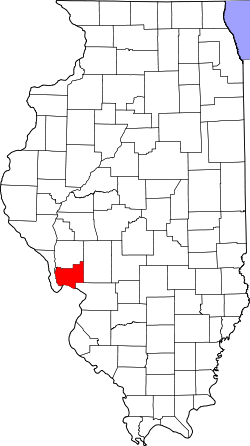
The Jersey County is a county in the US -amerikanischen State Illinois . In 2010 , the county had 22,985 residents and a population density of 24 people per square kilometer. The county seat is in Jerseyville .
Jersey County is located in the eastern part of the Greater St. Louis metropolitan area, known as Metro-East , around the city of St. Louis in neighboring Missouri .
geography
The county is located in southwest Illinois where the Illinois River flows into the Mississippi and has an area of 976 square kilometers, of which 20 square kilometers are water. The southern border of the county is formed by the Mississippi and is also the state border with Missouri . The following counties border Jersey County:
| Greene County | ||
| Calhoun County |

|
Macoupin County |
|
St. Charles County, Missouri |
Madison County |
Rivers in the county
In addition to the Mississippi and Illinois Rivers , which border the county , there are a number of smaller rivers in Jersey County:
history
What is now Jersey County was once the home of the Kickapoo, Menomini, Potawatomi, and Illinois Indians. In 1832 the village of Hickory Grove was renamed Jerseyville and the first post office was opened. In 1835, Illinois' first public school was established here.
Jersey County was formed on February 28, 1839 from the southern part of Greene County and was named after the origin of most of the settlers - New Jersey .
Due to the favorable location and the fertile soil, the region quickly developed into a well-known agricultural area. In 1844 the Mississippi overflowed its banks and destroyed the village of Grafton. In 1849 the area was hit by the Asian flu, which left many people dead. The courthouse, which is still in use today, was built in 1894.
Demographic data
| Population development | |||
|---|---|---|---|
| Census | Residents | ± in% | |
| 1840 | 4535 | - | |
| 1850 | 7354 | 62.2% | |
| 1860 | 12,051 | 63.9% | |
| 1870 | 15,054 | 24.9% | |
| 1880 | 15,542 | 3.2% | |
| 1890 | 14,810 | -4.7% | |
| 1900 | 14,612 | -1.3% | |
| 1910 | 13,954 | -4.5% | |
| 1920 | 12,682 | -9.1% | |
| 1930 | 12,556 | -1 % | |
| 1940 | 13,636 | 8.6% | |
| 1950 | 15,264 | 11.9% | |
| 1960 | 17,023 | 11.5% | |
| 1970 | 18,492 | 8.6% | |
| 1980 | 20,538 | 11.1% | |
| 1990 | 20,539 | 0% | |
| 2000 | 21,668 | 5.5% | |
| 2010 | 22,985 | 6.1% | |
| Before 1900 1900–1990 2000 2010 | |||
As of the 2010 census , Jersey County had 22,985 people in 8,642 households. The population density was 24 inhabitants per square kilometer. Statistically, 2.5 people lived in each of the 8,642 households.
The racial the population was composed of 97.6 percent white, 0.4 percent African American, 0.3 percent Native American, 0.3 percent Asian and other ethnic groups; 1.2 percent were descended from two or more races. Hispanic or Latino of any race was 1.0 percent of the population.
22.8 percent of the population were under 18 years old, 61.6 percent were between 18 and 64 and 15.6 percent were 65 years or older. 50.7 percent of the population was female.
The median income for a household was 48,573 USD . The per capita income was $ 24,144. 10.0 percent of the population lived below the poverty line.
Jersey County localities
1 - predominantly in Macoupin County
structure
Jersey County is divided into eleven townships :
|
|
See also
Individual evidence
- ^ Extract from the National Register of Historic Places . Retrieved March 13, 2011
- ↑ GNIS-ID: 424243. Retrieved on February 22, 2011 (English).
- ↑ a b c U.S. Census Bureau, State & County QuickFacts - Jersey County, IL ( Memento of the original from July 12, 2011 on WebCite ) Info: The archive link was automatically inserted and has not yet been checked. Please check the original and archive link according to the instructions and then remove this notice. Retrieved December 11, 2012
- ↑ a b National Association of Counties. Retrieved December 11, 2012
- ^ US Census Bureau - Census of Population and Housing.Retrieved March 15, 2011
- ^ Extract from Census.gov.Retrieved February 15, 2011
- ↑ Missouri Census Data Center - Illinois ( page no longer available , search in web archives ) Info: The link was automatically marked as defective. Please check the link according to the instructions and then remove this notice. Retrieved December 11, 2012
Web links
Coordinates: 39 ° 5 ′ N , 90 ° 22 ′ W

