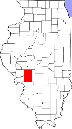
Macoupin County
 Macoupin County Courthouse |
|
| administration | |
|---|---|
| US state : | Illinois |
| Administrative headquarters : | Carlinville |
| Address of the administrative headquarters: |
Macoupin County Office 215 S. East Street Carlinville, IL 62626 |
| Foundation : | January 17, 1829 |
| Area code : | 001 217 |
| Demographics | |
| Residents : | 47,765 (2010) |
| Population density : | 21.4 inhabitants / km 2 |
| geography | |
| Total area : | 2247 km² |
| Water surface : | 10 km² |
| map | |
| Website : www.macoupincountyonline.net | |
The Macoupin County is a county in the US -amerikanischen State Illinois . In 2010 , the county had 47,765 people and a population density of 21.4 people per square kilometer. The county seat is Carlinville .
Parts of Macoupin County are part of the eastern part of the Greater St. Louis metropolitan area called Metro-East around the city of St. Louis in neighboring Missouri .
geography
The county is located in central southwest Illinois in the eastern suburb of St. Louis . It has an area of 2247 square kilometers, of which ten square kilometers are water. The following neighboring counties border Macoupin County:
| Morgan County | Sangamon County | |
|
Greene County , Jersey County |

|
Montgomery County |
| Madison County |
In the north of Macoupim County is the Otter Lake , a 3 km² reservoir created by damming the Otter Creek . It was built for flood protection reasons and is now also used as a recreation and leisure facility.
history
Macoupin County was formed on January 17, 1829 from parts of Greene County and Madison County. It was named after the Indian word Macaupiana. The Indians used this word for the American lotus growing along rivers and streams .
The first verifiable whites to set foot on this land were around 350 soldiers from Fort Russell in 1812, led by Territorial Governor Ninian Edwards . The first courthouse was built in 1820 and was a typical log cabin. The cost was $ 128. The second courthouse was built of stone from 1867 to 1870 and cost around a million dollars. It was the largest county courthouse of its time in the United States and is still used as such today.
Demographic data
| Population development | |||
|---|---|---|---|
| Census | Residents | ± in% | |
| 1830 | 1990 | - | |
| 1840 | 7826 | 293.3% | |
| 1850 | 12,355 | 57.9% | |
| 1860 | 24,602 | 99.1% | |
| 1870 | 32,726 | 33% | |
| 1880 | 37,692 | 15.2% | |
| 1890 | 40,352 | 7.1% | |
| 1900 | 42,256 | 4.7% | |
| 1910 | 50,685 | 19.9% | |
| 1920 | 57,274 | 13% | |
| 1930 | 48,703 | -15% | |
| 1940 | 46,304 | -4.9% | |
| 1950 | 44.210 | -4.5% | |
| 1960 | 43,524 | -1.6% | |
| 1970 | 44,557 | 2.4% | |
| 1980 | 49,384 | 10.8% | |
| 1990 | 47,679 | -3.5% | |
| 2000 | 49.019 | 2.8% | |
| 2010 | 47,765 | -2.6% | |
| 1830-1890 1900-1990 2000 2010 | |||
As of the 2010 census , Macoupin County had 47,765 people in 19,612 households. The population density was 21.4 inhabitants per square kilometer. Statistically, 2.35 people lived in each of the 19,612 households.
The racial the population was composed of 97.6 percent white, 0.8 percent African American, 0.3 percent Native American, 0.3 percent Asian and other ethnic groups; 0.9 percent were descended from two or more races. Hispanic or Latino of any race was 0.9 percent of the population.
22.2 percent of the population were under 18 years old, 60.7 percent were between 18 and 64 and 17.1 percent were 65 years or older. 50.8 percent of the population was female.
The median income for a household was 44,673 USD . The per capita income was $ 22,993. 12.1 percent of the population lived below the poverty line.
Macoupin County localities
1 - partly in Sangamon County
2 - partly in Jersey County
structure
Macoupin County is divided into 26 townships :
|
|
|
See also
Individual evidence
- ↑ GNIS-ID: 424257. Retrieved on February 22, 2011 (English).
- ↑ a b c U.S. Census Bureau, State & County QuickFacts - Macoupin County, IL ( Memento of the original from July 14, 2011 on WebCite ) Info: The archive link was automatically inserted and not yet checked. Please check the original and archive link according to the instructions and then remove this notice. Retrieved December 18, 2012
- ^ A b National Association of Counties.Retrieved December 18, 2012
- ^ US Census Bureau _ Census of Population and Housing.Retrieved February 17, 2011
- ^ Extract from Census.gov.Retrieved February 15, 2011
- ↑ Missouri Census Data Center - Illinois ( page no longer available , search in web archives ) Info: The link was automatically marked as defective. Please check the link according to the instructions and then remove this notice. Retrieved December 18, 2012
Web links
Coordinates: 39 ° 16 ' N , 89 ° 55' W

