
Ogle County
![The Ogle County Courthouse in Oregon, listed on NRHP No. 81000222 [1]](https://de.wikipedia.org/wiki/Datei:Oregon,_IL_Ogle_County_Courthouse_01.JPG) The Ogle County Courthouse in Oregon, listed on NRHP No. 81000222 |
|
| administration | |
|---|---|
| US state : | Illinois |
| Administrative headquarters : | Oregon |
| Address of the administrative headquarters: |
Ogle County Courthouse P.O. Box 357 Oregon, IL 61061 |
| Foundation : | January 16, 1836 |
| Made up from: | Jo Daviess County |
| Area code : | 001 815 |
| Demographics | |
| Residents : | 53,497 (2010) |
| Population density : | 27.2 inhabitants / km 2 |
| geography | |
| Total area : | 1977 km² |
| Water surface : | 11 km² |
| map | |
 |
|
| Website : www.oglecounty.org | |
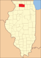
The Ogle County is a county in the US -amerikanischen State Illinois . In 2010 , the county had 53,497 residents and a population density of 26 people per square kilometer. The county seat is Oregon .
geography

The county is located in northern Illinois, about 60 kilometers from Wisconsin . It has an area of 1977 square kilometers, of which eleven square kilometers are water. Ogle County is traversed from north to south by the Rock River from Wisconsin . The following neighboring counties border Ogle County:
| Stephenson County | Winnebago County | Boone County |
| Carroll County |
.svg)
|
DeKalb County |
| Whiteside County | Lee County |
Recreational areas
There are several recreational areas in Ogle County:
- White Pines State Park between Polo and Oregon
- Lowden Memorial Park, about two kilometers north of Oregon on the east bank of the Rock River with the Blackhawk statue about 20 meters high
- Castle Rock State Park on Illinois Route 2 in southern Oregon
- Lowden-Miller State Forest, about five miles south of Oregon
history
| Population development | |||
|---|---|---|---|
| Census | Residents | ± in% | |
| 1840 | 3479 | - | |
| 1850 | 10,020 | 188% | |
| 1860 | 22,888 | 128.4% | |
| 1870 | 27,492 | 20.1% | |
| 1880 | 29,937 | 8.9% | |
| 1890 | 28,710 | -4.1% | |
| 1900 | 29,129 | 1.5% | |
| 1910 | 27,864 | -4.3% | |
| 1920 | 26,830 | -3.7% | |
| 1930 | 28,118 | 4.8% | |
| 1940 | 29,869 | 6.2% | |
| 1950 | 33,429 | 11.9% | |
| 1960 | 38.106 | 14% | |
| 1970 | 42,867 | 12.5% | |
| 1980 | 46,338 | 8.1% | |
| 1990 | 45,957 | -0.8% | |
| 2000 | 51.032 | 11% | |
| 2010 | 53,497 | 4.8% | |
| Before 1900 1900–1990 2000 2010 | |||
Ogle County was formed on January 16, 1836 from parts of Jo Daviess County . It was named after Joseph Ogle (1737-1821), a pioneer, politician and captain of the territorial militia.
On January 3, 1837, the county government's first official meeting was held and Oregon was chosen as the administrative seat. Because of violent differences with the south of the county this split off on February 27, 1839 and became Lee County with Dixon as the seat of the county administration. In the same year Oregon was renamed Florence, but in 1843 renamed Oregon again. The courthouse, still in use today, was built in 1891 for around $ 107,000 for buildings and furnishings. In 1984 it was renovated for $ 1.5 million.
Territorial development

Ogle County from its founding in 1836 to 1839
1839 until today


Demographic data
According to the 2010 census , Ogle County had 53,497 people in 20,669 households. The population density was 26 inhabitants per square kilometer. Statistically, 2.55 people lived in each of the 20,669 households.
The racial the population was composed of 93.2 percent white, 0.9 percent African American, 0.2 percent Native American, 0.5 percent Asian and other ethnic groups; 1.4 percent were descended from two or more races. Hispanic or Latino of any race was 8.9 percent of the population.
24.8 percent of the population were under 18 years old, 60.0 percent were between 18 and 64 and 15.2 percent were 65 years or older. 50.4 percent of the population was female.
The median income for a household was 55,733 USD . The per capita income was $ 24,959. 8.9 percent of the population lived below the poverty line.
Places in Ogle County
other unincorporated communities
1 - partially in Carroll County
structure
Ogle County is divided into 24 townships :
|
|
|

See also
Individual evidence
- ^ Extract from the National Register of Historic Places.Retrieved March 13, 2011
- ^ Ogle County ( English ) In: Geographic Names Information System . United States Geological Survey . Retrieved February 22, 2011.
- ↑ a b c U.S. Census Bureau, State & County QuickFacts - Ogle County, IL ( Memento of the original from July 15, 2011 on WebCite ) Info: The archive link was automatically inserted and not yet checked. Please check the original and archive link according to the instructions and then remove this notice. Retrieved December 26, 2012
- ^ A b National Association of Counties. Retrieved December 25, 2012
- ^ US Census Bureau - Census of Population and Housing.Retrieved March 15, 2011
- ^ Extract from Census.gov.Retrieved February 15, 2011
- ↑ Missouri Census Data Center - Illinois ( page no longer available , search in web archives ) Info: The link was automatically marked as defective. Please check the link according to the instructions and then remove this notice. Retrieved March 3, 2014
Web links
List of counties in Illinois
Adams |
Alexander |
Bond |
Boone |
Brown |
Bureau |
Calhoun |
Carroll |
Cass |
Champaign |
Christian |
Clark |
Clay |
Clinton |
Coles |
Cook |
Crawford |
Cumberland |
DeKalb |
DeWitt |
Douglas |
DuPage |
Edgar |
Edwards |
Effingham |
Fayette |
Ford |
Franklin |
Fulton |
Gallatin |
Greene |
Grundy |
Hamilton |
Hancock |
Hardin |
Henderson |
Henry |
Iroquois |
Jackson |
Jasper |
Jefferson |
Jersey |
Jo Daviess |
Johnson |
Kane |
Kankakee |
Kendall |
Knox |
LaSalle |
Lake |
Lawrence |
Lee |
Livingston |
Logan |
Macon |
Macoupin |
Madison |
Marion |
Marshall |
Mason |
Massac |
McDonough |
McHenry |
McLean |
Menard |
Mercer |
Monroe |
Montgomery |
Morgan |
Moultrie |
Ogle |
Peoria |
Perry |
Piatt |
Pike |
Pope |
Pulaski |
Putnam |
Randolph |
Richland |
Rock Island |
Saline |
Sangamon |
Schuyler |
Scott |
Shelby |
St. Clair |
Strong |
Stephenson |
Tazewell |
Union |
Vermilion |
Wabash |
Warren |
Washington |
Wayne |
White |
Whiteside |
Will |
Williamson |
Winnebago |
Woodford
Coordinates: 42 ° 2 ′ N , 89 ° 19 ′ W