Coles County
![The Coles County Courthouse in Charleston, listed on the NRHP since 1978 [1]](https://upload.wikimedia.org/wikipedia/commons/thumb/c/c9/Coles_County_Courthouse_2012-10-31_12-22-11.jpg/298px-Coles_County_Courthouse_2012-10-31_12-22-11.jpg) The Coles County Courthouse in Charleston, listed on the NRHP since 1978 |
|
| administration | |
|---|---|
| US state : | Illinois |
| Administrative headquarters : | Charleston |
| Address of the administrative headquarters: |
Coles County, Illinois 651 Jackson Ave. Charleston, IL 61920 |
| Foundation : | 1830 |
| Made up from: | Clark County |
| Area code : | 001 217 |
| Demographics | |
| Residents : | 53,873 (2010) |
| Population density : | 40.9 inhabitants / km 2 |
| geography | |
| Total area : | 1321 km² |
| Water surface : | 5 km² |
| map | |
| Website : www.co.coles.il.us | |
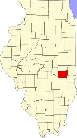
The Coles County is a county in the US -amerikanischen State Illinois . In 2010 , the county had 53,873 residents and a population density of 40.9 people per square kilometer. The county seat is Charleston .
geography
The county is east of central Illinois and is traversed by the Embarras River and the Little Wabash River . It has an area of 1316 square kilometers, of which five square kilometers are water. The following neighboring counties border Coles County:
| Douglas County | Edgar County | |
| Moultrie County |

|
|
| Shelby County | Cumberland County | Clark County |
history
In 1824 what would become the county was still a wilderness when the first settlers arrived. It was John Parker and his Tennessee sons and Samuel Kellog and his family, 14 people in all.
Coles County was formed in 1830 from parts of Clark County. The county was much larger then, since the Cumberland and Douglas counties that were also formed from it did not yet exist. It was named after Edward Coles (1786–1868), the second governor of Illinois (1822–1826).
The first courthouse was built in 1831 and the city of Charleston developed around it. This building served in its function until 1835 when the first stone building was erected.
Demographic data
| Population development | |||
|---|---|---|---|
| Census | Residents | ± in% | |
| 1840 | 9616 | - | |
| 1850 | 9335 | -2.9% | |
| 1860 | 14,203 | 52.1% | |
| 1870 | 25,235 | 77.7% | |
| 1880 | 27,042 | 7.2% | |
| 1890 | 30.093 | 11.3% | |
| 1900 | 34,146 | 13.5% | |
| 1910 | 34,517 | 1.1% | |
| 1920 | 35,108 | 1.7% | |
| 1930 | 37,315 | 6.3% | |
| 1940 | 38,470 | 3.1% | |
| 1950 | 40,328 | 4.8% | |
| 1960 | 42,860 | 6.3% | |
| 1970 | 47,815 | 11.6% | |
| 1980 | 52,260 | 9.3% | |
| 1990 | 51,644 | -1.2% | |
| 2000 | 53,196 | 3% | |
| 2010 | 53,873 | 1.3% | |
| Before 1900 1900–1990 2000 2010 | |||

As of the 2010 census , Coles County had 53,873 people in 21,076 households. The population density was 40.9 inhabitants per square kilometer. Statistically, 2.05 people lived in each of the 21,076 households.
The racial the population was composed of 92.9 percent white, 3.8 percent African American, 0.2 percent Native American, 1.0 percent Asian and other ethnic groups; 1.5 percent were descended from two or more races. Hispanic or Latino of any race was 2.1 percent of the population.
18.5 percent of the population were under 18 years old, 67.7 percent were between 18 and 64 and 13.8 percent were 65 years or older. 51.8 percent of the population was female.
The median income for a household was 37,790 USD . The per capita income was $ 19,798. 19.1 percent of the population lived below the poverty line.
Localities in Coles County
1 - partly in Moultrie County
2 - partly in Cumberland County
structure
Coles County is divided into twelve townships :
|
|
|
See also
Individual evidence
- ↑ Extract from the National Register of Historic Places - No. 78001118.Retrieved November 22, 2012
- ↑ GNIS-ID: 424216. Retrieved on February 22, 2011 (English).
- ↑ a b c U.S. Census Bureau, State & County QuickFacts - Coles County, IL Retrieved November 22, 2012
- ^ A b National Association of Counties. Retrieved November 22, 2012
- ^ US Census Bureau - Census of Population and Housing.Retrieved March 15, 2011
- ↑ Extract from Census.gov.Retrieved on February 14, 2011
- ↑ Coles County - Townships ( Memento of the original from October 11, 2006 in the Internet Archive ) Info: The archive link was automatically inserted and not yet checked. Please check the original and archive link according to the instructions and then remove this notice. Retrieved November 22, 2012
Web links
Coordinates: 39 ° 31 ' N , 88 ° 13' W


