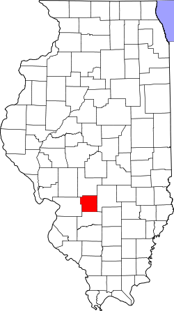
Bond County
 Bond County Courthouse |
|
| administration | |
|---|---|
| US state : | Illinois |
| Administrative headquarters : | Greenville |
| Address of the administrative headquarters: |
Bond County Clerk 200 W. College Avenue Greenville, IL 62246-1088 |
| Foundation : | January 4, 1817 |
| Made up from: | Madison County |
| Area code : | 001 217 |
| Demographics | |
| Residents : | 17,768 (2010) |
| Population density : | 18 inhabitants / km 2 |
| geography | |
| Total area : | 991 km² |
| Water surface : | 6 km² |
| map | |
| Website : bondcountyil.com | |
The Bond County is a county in the US -amerikanischen State Illinois . In 2010 , the county had 17,768 residents and a population density of 18 people per square kilometer. The county seat is Greenville .
Bond County is located in the eastern part of the Greater St. Louis metropolitan area called Metro-East around the city of St. Louis in neighboring Missouri .
geography
The county is located in central southwest Illinois and has an area of 991 square kilometers, of which six square kilometers are water. The following neighboring counties border Bond County:
| Montgomery County | ||
| Madison County |

|
Fayette County |
| Clinton County |
history
In 1807 the first settlers from the south came to this area and built Fort Hill and Fort Jones to protect against the indigenous people. Settlement was slow and in 1816 there were just 25 log cabins. The first log cabins were built in 1815 on the site of what would later become Greenville.
Bond County was formed from parts of Madison County on January 4, 1817, before the new state of Illinois was founded. It was named after Shadrach Bond (1773-1832), the first governor of Illinois (1818-1822).
The seat of the county administration was first in Hills Station and from 1817 to 1821 in Perryville . He was then relocated to Greenville, where the first courthouse was built in 1822. In 1873 the first students were able to leave Greenville High School .
Demographic data
| Population development | |||
|---|---|---|---|
| Census | Residents | ± in% | |
| 1820 | 2931 | - | |
| 1830 | 3124 | 6.6% | |
| 1840 | 5060 | 62% | |
| 1850 | 6144 | 21.4% | |
| 1860 | 9815 | 59.7% | |
| 1870 | 13,152 | 34% | |
| 1880 | 14,866 | 13% | |
| 1890 | 14,550 | -2.1% | |
| 1900 | 16,078 | 10.5% | |
| 1910 | 17,075 | 6.2% | |
| 1920 | 16,045 | -6% | |
| 1930 | 14,406 | -10.2% | |
| 1940 | 14,540 | 0.9% | |
| 1950 | 14,157 | -2.6% | |
| 1960 | 14,060 | -0.7% | |
| 1970 | 14,012 | -0.3% | |
| 1980 | 16,224 | 15.8% | |
| 1990 | 14,991 | -7.6% | |
| 2000 | 17,633 | 17.6% | |
| 2010 | 17,768 | 0.8% | |
| Before 1900 1900–1990 2000 2010 | |||
As of the 2010 census , Bond County had 17,768 people in 6,310 households. The population density was 18 people per square kilometer.
The racial the population was composed of 90.9 percent white, 6.1 percent African American, 0.5 percent Native American, 0.4 percent Asian and other ethnic groups; 1.8 percent were descended from two or more races. Hispanic or Latino of any race was 3.1 percent of the population.
Statistically, 2.79 people lived in each of the 6,310 households.
20.3 percent of the population were under 18 years old, 65.0 percent were between 18 and 64 and 14.7 percent were 65 years or older. 46.2 percent of the population was female.
The median income for a household was 45,520 USD . The per capita income was $ 22,225. 13.7 percent of the population lived below the poverty line.
Bond County localities
|
1 - partly in Montgomery County
2 - partly in Clinton County
3 - partly in Madison County
structure
Bond County is divided into 9 townships :
| Township | Population (2010) |
FIPS |
|---|---|---|
| Burgess Township | 2439 | 17-09694 |
| Central Township | 8013 | 17-12112 |
| Lagrange Township | 1169 | 17-40741 |
| Mills Township | 552 | 17-49321 |
| Mulberry Grove Township | 1361 | 17-51297 |
| Old Ripley Township | 867 | 17-55730 |
| Pleasant Mound Township | 1018 | 17-60586 |
| Shoal Creek Township | 1783 | 17-69641 |
| Tamalco Township | 566 | 17-74418 |
See also
Individual evidence
- ↑ GNIS-ID: 424204. Retrieved on February 22, 2011 (English).
- ↑ a b c U.S. Census Bureau, State & County QuickFacts - Bond County, IL Retrieved November 19, 2012
- ^ A b National Association of Counties.Retrieved November 19, 2012
- ^ US Census Bureau - Census of Population and Housing.Retrieved March 15, 2011
- ↑ Extract from Census.gov.Retrieved on February 14, 2011
- ↑ Missouri Census Data Center - Illinois ( page no longer available , search in web archives ) Info: The link was automatically marked as defective. Please check the link according to the instructions and then remove this notice. Retrieved March 3, 2014
Web links
Coordinates: 38 ° 53 ′ N , 89 ° 26 ′ W

