
Pope County, Illinois
 Pope County Courthouse |
|
| administration | |
|---|---|
| US state : | Illinois |
| Administrative headquarters : | Golconda |
| Address of the administrative headquarters: |
Pope County Courthouse Golconda, IL 62938 |
| Foundation : | January 10, 1816 |
| Made up from: |
Gallatin County Johnson County |
| Area code : | 001 618 |
| Demographics | |
| Residents : | 4470 (2010) |
| Population density : | 4.7 inhabitants / km 2 |
| geography | |
| Total area : | 970 km² |
| Water surface : | 10 km² |
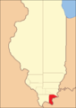
| map | |
 |
|
The Pope County is a county in the US -amerikanischen State Illinois . In 2010 the county had 4,470 residents and a population density of 4.7 people per square kilometer. The county seat is Golconda .
geography
The county is located in southern Illinois on the Ohio River , which forms the border with Kentucky . It has an area of 970 square kilometers, of which ten square kilometers are water. The following neighboring counties border Pope County:
| Williamson County | Saline County | |
| Johnson County |
.svg)
|
Hardin County |
| Massac County |
Livingston County, Kentucky |
history

| Population development | |||
|---|---|---|---|
| Census | Residents | ± in% | |
| 1820 | 2610 | - | |
| 1830 | 3316 | 27% | |
| 1840 | 4094 | 23.5% | |
| 1850 | 3975 | -2.9% | |
| 1860 | 6742 | 69.6% | |
| 1870 | 11,437 | 69.6% | |
| 1880 | 13,256 | 15.9% | |
| 1890 | 14,016 | 5.7% | |
| 1900 | 13,585 | -3.1% | |
| 1910 | 11,215 | -17.4% | |
| 1920 | 9625 | -14.2% | |
| 1930 | 7996 | -16.9% | |
| 1940 | 7999 | 0% | |
| 1950 | 5779 | -27.8% | |
| 1960 | 4061 | -29.7% | |
| 1970 | 3857 | -5% | |
| 1980 | 4404 | 14.2% | |
| 1990 | 4373 | -0.7% | |
| 2000 | 4413 | 0.9% | |
| 2010 | 4470 | 1.3% | |
| Before 1900 1900–1990 2000 2010 | |||
Pope County was formed on January 10, 1816 from Gallatin Counties and Johnson Counties. It was named after Nathaniel Pope (1784-1850), the first secretary of the Illinois Territory (1809 to 1816) and the last Illinois Territory delegate in Congress.
The first settlers were Scots and Irish, after which mainly German immigrants came to this area. In 1839, the eastern portion of Pope County was separated, from which Hardin County was formed. Golconda, the seat of the county administration, was founded in 1797, albeit under the name Sahrahsville, after Sarah Lusk, daughter of a Virginia senator and widow of Major Lusk, who built and operated the first ferry there in 1797. Sarah Lusk got the license to continue operating the ferry in 1804 and was the first woman in America to receive such a license. The first courthouse was completed in 1820 and the one still in use today in 1873.
Territorial development
Pope County from its founding in 1816 to 1839

1839 to 1843

1843 to 1847

1847 until today


Demographic data
According to the 2010 census , Pope County had 4,470 people in 1,751 households. The population density was 4.7 people per square kilometer. Statistically, 2.19 people lived in 1751 households.
The racial the population was composed of 91.7 percent white, 6.0 percent African American, 0.6 percent Native American, 0.2 percent Asian and other ethnic groups; 0.9 percent were descended from two or more races. Hispanic or Latino of any race was 1.4 percent of the population.
18.2 percent of the population were under 18 years old, 60.2 percent were between 18 and 64 and 21.6 percent were 65 years or older. 47.3 percent of the population was female.
The median income for a household was 37,177 USD . The per capita income was $ 19,681. 18.0 percent of the population lived below the poverty line.
Pope County localities
structure
Pope County is divided into six precincts :
| district | Population (2010) | FIPS |
|---|---|---|
| Eddyville No. 6 precinct | 792 | 17-91116 |
| Golconda No. 1 precinct | 707 | 17-91386 |
| Golconda No. 2 precinct | 952 | 17-91404 |
| Golconda No. 3 precinct | 668 | 17-91422 |
| Jefferson No. 4 precinct | 485 | 17-91746 |
| Webster No. 5 precinct | 866 | 17-93654 |
See also
Individual evidence
- ↑ GNIS-ID: 424277. Retrieved on February 22, 2011 (English).
- ↑ a b c U.S. Census Bureau, State & County QuickFacts - Pope County, IL Retrieved January 2, 2013
- ↑ a b National Association of Counties. Retrieved January 2, 2013
- ^ US Census Bureau - Census of Population and Housing.Retrieved March 15, 2011
- ↑ Extract from Census.gov . Retrieved February 15, 2011
- ↑ Missouri Census Data Center - Illinois ( page no longer available , search in web archives ) Info: The link was automatically marked as defective. Please check the link according to the instructions and then remove this notice. Retrieved August 2, 2012
Web links
List of counties in Illinois
Adams |
Alexander |
Bond |
Boone |
Brown |
Bureau |
Calhoun |
Carroll |
Cass |
Champaign |
Christian |
Clark |
Clay |
Clinton |
Coles |
Cook |
Crawford |
Cumberland |
DeKalb |
DeWitt |
Douglas |
DuPage |
Edgar |
Edwards |
Effingham |
Fayette |
Ford |
Franklin |
Fulton |
Gallatin |
Greene |
Grundy |
Hamilton |
Hancock |
Hardin |
Henderson |
Henry |
Iroquois |
Jackson |
Jasper |
Jefferson |
Jersey |
Jo Daviess |
Johnson |
Kane |
Kankakee |
Kendall |
Knox |
LaSalle |
Lake |
Lawrence |
Lee |
Livingston |
Logan |
Macon |
Macoupin |
Madison |
Marion |
Marshall |
Mason |
Massac |
McDonough |
McHenry |
McLean |
Menard |
Mercer |
Monroe |
Montgomery |
Morgan |
Moultrie |
Ogle |
Peoria |
Perry |
Piatt |
Pike |
Pope |
Pulaski |
Putnam |
Randolph |
Richland |
Rock Island |
Saline |
Sangamon |
Schuyler |
Scott |
Shelby |
St. Clair |
Strong |
Stephenson |
Tazewell |
Union |
Vermilion |
Wabash |
Warren |
Washington |
Wayne |
White |
Whiteside |
Will |
Williamson |
Winnebago |
Woodford
Coordinates: 37 ° 25 ′ N , 88 ° 34 ′ W