
Clark County (Illinois)
 Clark County Courthouse |
|
| administration | |
|---|---|
| US state : | Illinois |
| Administrative headquarters : | Marshall |
| Address of the administrative headquarters: |
County Courthouse 501 Archer Avenue Marshall, IL 62441 |
| Foundation : | 1819 |
| Made up from: | Crawford County |
| Area code : | 001 217 |
| Demographics | |
| Residents : | 16,335 (2010) |
| Population density : | 12.6 inhabitants / km 2 |
| geography | |
| Total area : | 1308 km² |
| Water surface : | 9 km² |
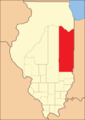
| map | |
 |
|
| Website : www.clarkcountyil.org | |
The Clark County is a county in the US -amerikanischen State Illinois . In 2010 , the county had 16,335 residents and a population density of 12.6 people per square kilometer. The county seat is in Marshall .
geography
The county is located in eastern Illinois on the west bank of the Wabash River , which forms the border with Indiana . It has an area of 1,308 square kilometers, of which nine square kilometers are water. The following neighboring counties border Clark County:
| Coles County | Edgar County |
Vigo County, Indiana |
| Cumberland County |
.svg)
|
|
| Jasper County | Crawford County |
Sullivan County, Indiana |
history

Clark County was formed in 1819 from parts of Crawford County. It was named after George Rogers Clark (1752-1818), a border guard at the time of the American War of Independence and Indian expert.
The first county administrative seat was in Aurora on the Wabash River. In 1823 the seat was moved to Darwin and in 1839 to Marshall.

Clark County from its inception through 1821
Clark County between 1821 and 1823

Clark County between 1823 and 1830

Clark County since 1830 when Coles County was split off


Demographic data
| Population development | |||
|---|---|---|---|
| Census | Residents | ± in% | |
| 1820 | 931 | - | |
| 1830 | 3940 | 323.2% | |
| 1840 | 7453 | 89.2% | |
| 1850 | 9532 | 27.9% | |
| 1860 | 14,987 | 57.2% | |
| 1870 | 18,710 | 24.8% | |
| 1880 | 21,894 | 17% | |
| 1890 | 21,899 | 0% | |
| 1900 | 24,033 | 9.7% | |
| 1910 | 23,517 | -2.1% | |
| 1920 | 21,165 | -10% | |
| 1930 | 17,872 | -15.6% | |
| 1940 | 18,842 | 5.4% | |
| 1950 | 17,362 | -7.9% | |
| 1960 | 16,546 | -4.7% | |
| 1970 | 16,216 | -2% | |
| 1980 | 16,913 | 4.3% | |
| 1990 | 15,921 | -5.9% | |
| 2000 | 17.008 | 6.8% | |
| 2010 | 16,335 | -4% | |
| Before 1900 1900–1990 2000 2010 | |||
As of the 2010 census , Clark County had 16,335 people in 7,032 households. The population density was 12.6 inhabitants per square kilometer.
The racial the population was composed of 98.1 percent white, 0.3 percent African American, 0.2 percent Native American, 0.3 percent Asian and other ethnic groups; 0.7 percent were descended from two or more races. Hispanic or Latino of any race was 1.1 percent of the population.
Statistically, 2.31 people lived in the 7,032 households.
22.8 percent of the population were under 18 years old, 59.2 percent were between 18 and 64 and 18.0 percent were 65 years or older. 51.3 percent of the population was female.
The median income for a household was 43,003 USD . The per capita income was $ 23,083. 13.4 percent of the population lived below the poverty line.
Clark County localities

1 - partly in Cumberland County
2 - partly in Edgar County
structure
Clark County is divided into 15 townships :
|
|
See also
Individual evidence
- ↑ GNIS-ID: 424213. Retrieved on February 22, 2011 (English).
- ↑ a b c U.S. Census Bureau, State & County QuickFacts - Clark County, IL Retrieved November 22, 2012
- ^ A b National Association of Counties. Retrieved November 22, 2012
- ^ US Census Bureau - Census of Population and Housing.Retrieved March 15, 2011
- ↑ Extract from Census.gov.Retrieved on February 14, 2011
- ↑ Missouri Census Data Center - Illinois ( page no longer available , search in web archives ) Info: The link was automatically marked as defective. Please check the link according to the instructions and then remove this notice. Retrieved November 22, 2012
Web links
List of counties in Illinois
Adams |
Alexander |
Bond |
Boone |
Brown |
Bureau |
Calhoun |
Carroll |
Cass |
Champaign |
Christian |
Clark |
Clay |
Clinton |
Coles |
Cook |
Crawford |
Cumberland |
DeKalb |
DeWitt |
Douglas |
DuPage |
Edgar |
Edwards |
Effingham |
Fayette |
Ford |
Franklin |
Fulton |
Gallatin |
Greene |
Grundy |
Hamilton |
Hancock |
Hardin |
Henderson |
Henry |
Iroquois |
Jackson |
Jasper |
Jefferson |
Jersey |
Jo Daviess |
Johnson |
Kane |
Kankakee |
Kendall |
Knox |
LaSalle |
Lake |
Lawrence |
Lee |
Livingston |
Logan |
Macon |
Macoupin |
Madison |
Marion |
Marshall |
Mason |
Massac |
McDonough |
McHenry |
McLean |
Menard |
Mercer |
Monroe |
Montgomery |
Morgan |
Moultrie |
Ogle |
Peoria |
Perry |
Piatt |
Pike |
Pope |
Pulaski |
Putnam |
Randolph |
Richland |
Rock Island |
Saline |
Sangamon |
Schuyler |
Scott |
Shelby |
St. Clair |
Strong |
Stephenson |
Tazewell |
Union |
Vermilion |
Wabash |
Warren |
Washington |
Wayne |
White |
Whiteside |
Will |
Williamson |
Winnebago |
Woodford
Coordinates: 39 ° 20 ′ N , 87 ° 47 ′ W