
Iroquois County
 Iroquois County Courthouse |
|
| administration | |
|---|---|
| US state : | Illinois |
| Administrative headquarters : | Watseka |
| Address of the administrative headquarters: |
Iroquois County Government 1001 E. Grant Street Watseka, IL 60970 |
| Foundation : | February 26, 1833 |
| Made up from: | Vermilion County |
| Area code : | 001 815 |
| Demographics | |
| Residents : | 29,718 (2010) |
| Population density : | 10.3 inhabitants / km 2 |
| geography | |
| Total area : | 2896 km² |
| Water surface : | 4 km² |
| map | |
 |
|
| Website : www.co.iroquois.il.us | |
The Iroquois County is a county in the US -amerikanischen State Illinois . In 2010 , the county had 29,718 residents and a population density of 10.3 people per square kilometer. The county seat is Watseka .
geography
The county is located in northeast Illinois on the Indiana border and is the third largest in Illinois by area. It has an area of 2896 square kilometers, of which four square kilometers are water.
The Iroquois River flows through the county . North of the county this flows into the Kankakee River , one of the two headwaters of the Illinois River .
The following neighboring counties border Iroquois County:
| Kankakee County | ||
| Ford County |
.svg)
|
Newton County, Indiana Benton County, Indiana |
| Vermilion County |
history
| Population development | |||
|---|---|---|---|
| Census | Residents | ± in% | |
| 1840 | 1695 | - | |
| 1850 | 4149 | 144.8% | |
| 1860 | 12,325 | 197.1% | |
| 1870 | 25,782 | 109.2% | |
| 1880 | 35,451 | 37.5% | |
| 1890 | 35,167 | -0.8% | |
| 1900 | 38.014 | 8.1% | |
| 1910 | 35,543 | -6.5% | |
| 1920 | 34,841 | -2% | |
| 1930 | 32,913 | -5.5% | |
| 1940 | 32,496 | -1.3% | |
| 1950 | 32,348 | -0.5% | |
| 1960 | 33,562 | 3.8% | |
| 1970 | 33,532 | -0.1% | |
| 1980 | 32,976 | -1.7% | |
| 1990 | 30,787 | -6.6% | |
| 2000 | 31,334 | 1.8% | |
| 2010 | 29,718 | -5.2% | |
| Before 1900 1900–1990 2000 2010 | |||
In 1830 two different, independent settlements were founded by a total of 12 families.
The county was formed on February 26, 1833 from parts of Vermilion County and named after the Indian tribe of the Iroquois or the Iroquois River . Exact information about this can no longer be determined today.
The first administrative seat was in Montgomery, then in Middleport and finally Watseka.
Territorial development

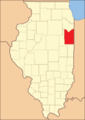
Iroquois County from its inception to 1836
1836 to 1853

1853 until today


Demographic data
As of the 2010 census , Iroquois County had 29,718 people in 11,884 households. The population density was 10.3 inhabitants per square kilometer. Statistically, 2.45 people lived in each of the 11,884 households.
The racial the population was composed of 97.2 percent white, 1.0 percent African American, 0.3 percent Native American, 0.5 percent Asian and other ethnic groups; 1.1 percent were descended from two or more races. Hispanic or Latino of any race was 5.7 percent of the population.
23.3 percent of the population were under 18 years old, 57.6 percent were between 18 and 64 and 19.1 percent were 65 years or older. 51.1 percent of the population was female.
The median income for a household was 48,248 USD . The per capita income was $ 24,563. 11.5 percent of the population lived below the poverty line.
Localities in Iroquois County
1 - partially in Kankakee County
structure
Iroquois County is divided into 26 townships :
|
|
|

See also
Individual evidence
- ↑ GNIS-ID: 424239. Retrieved on February 22, 2011 (English).
- ↑ a b c U.S. Census Bureau, State & County QuickFacts - Iroquois County, IL ( Memento of the original from July 12, 2011 on WebCite ) Info: The archive link was automatically inserted and not yet checked. Please check the original and archive link according to the instructions and then remove this notice. Retrieved December 7, 2012
- ↑ a b National Association of Counties. Retrieved December 7, 2012
- ^ US Census Bureau - Census of Population and Housing.Retrieved March 15, 2011
- ^ Extract from Census.gov.Retrieved February 15, 2011
- ↑ Missouri Census Data Center - Illinois ( page no longer available , search in web archives ) Info: The link was automatically marked as defective. Please check the link according to the instructions and then remove this notice. Retrieved December 7, 2012
Web links
List of counties in Illinois
Adams |
Alexander |
Bond |
Boone |
Brown |
Bureau |
Calhoun |
Carroll |
Cass |
Champaign |
Christian |
Clark |
Clay |
Clinton |
Coles |
Cook |
Crawford |
Cumberland |
DeKalb |
DeWitt |
Douglas |
DuPage |
Edgar |
Edwards |
Effingham |
Fayette |
Ford |
Franklin |
Fulton |
Gallatin |
Greene |
Grundy |
Hamilton |
Hancock |
Hardin |
Henderson |
Henry |
Iroquois |
Jackson |
Jasper |
Jefferson |
Jersey |
Jo Daviess |
Johnson |
Kane |
Kankakee |
Kendall |
Knox |
LaSalle |
Lake |
Lawrence |
Lee |
Livingston |
Logan |
Macon |
Macoupin |
Madison |
Marion |
Marshall |
Mason |
Massac |
McDonough |
McHenry |
McLean |
Menard |
Mercer |
Monroe |
Montgomery |
Morgan |
Moultrie |
Ogle |
Peoria |
Perry |
Piatt |
Pike |
Pope |
Pulaski |
Putnam |
Randolph |
Richland |
Rock Island |
Saline |
Sangamon |
Schuyler |
Scott |
Shelby |
St. Clair |
Strong |
Stephenson |
Tazewell |
Union |
Vermilion |
Wabash |
Warren |
Washington |
Wayne |
White |
Whiteside |
Will |
Williamson |
Winnebago |
Woodford
Coordinates: 40 ° 44 ′ N , 87 ° 49 ′ W