
Benton County, Indiana
 The Benton County Courthouse in Fowler, listed on the NRHP |
|
| administration | |
|---|---|
| US state : | Indiana |
| Administrative headquarters : | Fowler |
| Address of the administrative headquarters: |
County Courthouse 706 East 5th Street Fowler, IN 47944-1556 |
| Foundation : | February 18, 1840 |
| Made up from: | Jasper County |
| Area code : | 001 765 |
| Demographics | |
| Residents : | 8854 (2010) |
| Population density : | 8.4 inhabitants / km 2 |
| geography | |
| Total area : | 1053 km² |
| Water surface : | 0.2 km² |
| map | |
 |
|
| Website : www.bentoncounty.in.gov | |
The Benton County is a county in the US -amerikanischen State Indiana . In 2010 , the county had 8,854 residents and a population density of 8.4 people per square kilometer. The county seat is Fowler .
Benton County is part of the metropolitan area around the city of Lafayette in the southeastern neighboring Tippecanoe County .
geography
The county is located in northwest Indiana and borders Illinois to the west . It has an area of 1053 square kilometers without any significant water surface. The following neighboring counties border Benton County:
| Newton County | Jasper County | |
|
Iroquois County, Illinois |
.svg)
|
White County |
|
Vermilion County (Illinois) |
Warren County | Tippecanoe County |
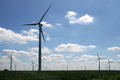
Wind turbine

Freeland Park
Indiana Park


history
.jpg)
Benton County was formed on February 18, 1840 from parts of Jasper County. It was named after Thomas H. Benton (1782-1858), an American politician and US senator .
economy
Demographic data
| Population development | |||
|---|---|---|---|
| Census | Residents | ± in% | |
| 1850 | 1144 | - | |
| 1860 | 2809 | 145.5% | |
| 1870 | 5615 | 99.9% | |
| 1880 | 11,108 | 97.8% | |
| 1890 | 11,903 | 7.2% | |
| 1900 | 13,123 | 10.2% | |
| 1910 | 12,688 | -3.3% | |
| 1920 | 12.206 | -3.8% | |
| 1930 | 11,886 | -2.6% | |
| 1940 | 11,117 | -6.5% | |
| 1950 | 11,462 | 3.1% | |
| 1960 | 11,912 | 3.9% | |
| 1970 | 11,262 | -5.5% | |
| 1980 | 10,218 | -9.3% | |
| 1990 | 9441 | -7.6% | |
| 2000 | 9421 | -0.2% | |
| 2010 | 8854 | -6% | |
| Before 1900 1900–1990 2000 2010 | |||
According to the 2010 census , Benton County had 8,854 people in 3,581 households. The population density was 8.4 people per square kilometer. Statistically, 2.42 people lived in each of the 3581 households.
The racial the population was composed of 97.9 percent white, 0.8 percent African American, 0.2 percent Native American, 0.2 percent Asian and other ethnic groups; 0.8 percent were descended from two or more races. Hispanic or Latino of any race was 4.9 percent of the population.
25.2 percent of the population were under 18 years old, 59.2 percent were between 18 and 64 and 15.6 percent were 65 years or older. 50.4 percent of the population was female.
The median income for a household was 47,240 USD . The per capita income was $ 22,461. 12.0 percent of the population lived below the poverty line.
Benton County localities
1 - partly in Tippecanoe County
structure

Benton County is divided into eleven townships :
|
|
See also
Individual evidence
- ↑ GNIS-ID: 450403. Retrieved on February 22, 2011 (English).
- ↑ a b c U.S. Census Bureau, State & County QuickFacts - Benton County, IN Retrieved December 10, 2012
- ^ A b National Association of Counties.Retrieved December 10, 2012
- ^ US Census Bureau - Census of Population and Housing.Retrieved March 15, 2011
- ^ Extract from Census.gov.Retrieved February 15, 2011
- ↑ Missouri Census Data Center - Indiana ( page no longer available , search in web archives ) Info: The link was automatically marked as defective. Please check the link according to the instructions and then remove this notice. Retrieved December 10, 2012
Web links
List of counties in Indiana
Adams |
Allen |
Bartholomew |
Benton |
Blackford |
Boone |
Brown |
Carroll |
Cass |
Clark |
Clay |
Clinton |
Crawford |
Daviess |
DeKalb |
Dearborn |
Decatur |
Delaware |
Dubois |
Elkhart |
Fayette |
Floyd |
Fountain |
Franklin |
Fulton |
Gibson |
Grant |
Greene |
Hamilton |
Hancock |
Harrison |
Hendricks |
Henry |
Howard |
Huntington's |
Jackson |
Jasper |
Jay |
Jefferson |
Jennings |
Johnson |
Knox |
Kosciusko |
LaGrange |
Lake |
LaPorte |
Lawrence |
Madison |
Marion |
Marshall |
Martin |
Miami |
Monroe |
Montgomery |
Morgan |
Newton |
Noble |
Ohio |
Orange |
Owen |
Park |
Perry |
Pike |
Porter |
Posey |
Pulaski |
Putnam |
Randolph |
Ripley |
Rush |
St. Joseph |
Scott |
Shelby |
Spencer |
Strong |
Steuben |
Sullivan |
Switzerland |
Tippecanoe |
Tipton |
Union |
Vanderburgh |
Vermillion |
Vigo |
Wabash |
Warren |
Warrick |
Washington |
Wayne |
Wells |
White |
Whitley
Coordinates: 40 ° 36 ′ N , 87 ° 19 ′ W