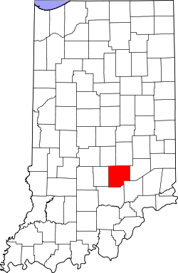
Bartholomew County
![Bartholomew County Courthouse in Columbus, listed in NRHP No. 79000031 [1]](https://upload.wikimedia.org/wikipedia/commons/thumb/c/c4/Bartholomew_County_Courhouse_1874_and_Vetrans_Memorial_Columus_IN.jpg/298px-Bartholomew_County_Courhouse_1874_and_Vetrans_Memorial_Columus_IN.jpg) Bartholomew County Courthouse in Columbus, listed on NRHP No. 79000031 |
|
| administration | |
|---|---|
| US state : | Indiana |
| Administrative headquarters : | Columbus |
| Foundation : | February 12, 1821 |
| Area code : | 001 812 |
| Demographics | |
| Residents : | 76,794 (2010) |
| Population density : | 72.9 inhabitants / km 2 |
| geography | |
| Total area : | 1060 km² |
| Water surface : | 7 km² |
| map | |
| Website : www.bartholomewco.com | |
Bartholomew County is a county in the US state of Indiana . The county seat is Columbus .
geography
Bartholomew County has a size of 1060 square kilometers. It is bordered in a clockwise direction by the following counties: Shelby County , Decatur County , Jennings County , Jackson County , Brown County, and Johnson Counties .
history
Bartholomew County was formed on February 12, 1821. It was named after Joseph Bartholomew , a general in the Indiana militia who played an important role in the settlement of the country and who was involved in the 1811 Battle of Tippecanoe .
There are six National Historic Landmarks in Bartholomew County . A total of 21 buildings and sites in the county are listed on the National Register of Historic Places (as of August 31, 2017).
| growth of population | |||
|---|---|---|---|
| Census | Residents | ± in% | |
| 1830 | 5476 | - | |
| 1840 | 10,042 | 83.4% | |
| 1850 | 12,428 | 23.8% | |
| 1860 | 17,865 | 43.7% | |
| 1870 | 21,133 | 18.3% | |
| 1880 | 22,777 | 7.8% | |
| 1890 | 23,867 | 4.8% | |
| 1900 | 24,594 | 3% | |
| 1910 | 24,813 | 0.9% | |
| 1920 | 23,887 | -3.7% | |
| 1930 | 24,864 | 4.1% | |
| 1940 | 28,276 | 13.7% | |
| 1950 | 36,108 | 27.7% | |
| 1960 | 48.198 | 33.5% | |
| 1970 | 57.022 | 18.3% | |
| 1980 | 65,088 | 14.1% | |
| 1990 | 63,657 | -2.2% | |
| 2000 | 71,435 | 12.2% | |
| 2010 | 76,794 | 7.5% | |
| Before 1900
1900–1990 2000 + 2010 |
|||
Individual evidence
- ^ Extract from the National Register of Historic Places . Retrieved March 13, 2011
- ↑ GNIS-ID: 451683. Retrieved on February 22, 2011 (English).
- ↑ Listing of National Historic Landmarks by State: Indiana . National Park Service , accessed August 31, 2017.
- ↑ Search mask database in the National Register Information System. National Park Service , accessed August 31, 2017.
- ↑ US Census Bureau - Census of Population and Housing . Retrieved March 15, 2011
- ↑ Extract from Census.gov . Retrieved February 15, 2011
- ↑ Extract from census.gov (2000 + 2010). Accessed April 2, 2012
Web links
Coordinates: 39 ° 13 ′ N , 85 ° 54 ′ W
