
Monroe County, Illinois
 The Monroe County Courthouse in Waterloo |
|
| administration | |
|---|---|
| US state : | Illinois |
| Administrative headquarters : | Waterloo |
| Address of the administrative headquarters: |
Monroe County Courthouse 100 S. Main Street Waterloo, IL 62298-1399 |
| Foundation : | January 6, 1816 |
| Made up from: |
St. Clair County Randolph County |
| Area code : | 001 618 |
| Demographics | |
| Residents : | 32,957 (2010 estimate) |
| Population density : | 32.8 inhabitants / km 2 |
| geography | |
| Total area : | 1030 km² |
| Water surface : | 24 km² |
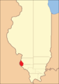
| map | |
 |
|
| Website : www.monroecountyil.org | |
The Monroe County is a county in the US -amerikanischen State Illinois . In 2010 , the county had 32,957 residents and a population density of 32.8 people per square kilometer. The county seat is Waterloo .
Monroe County is located in the eastern part of the Greater St. Louis metropolitan area called Metro-East around the city of St. Louis in neighboring Missouri .
geography
The county is located in southwest Illinois and is bounded to the west by Mississippi , which also forms the border with the neighboring state of Missouri . It has an area of 1030 square kilometers, of which 24 square kilometers are water. The following neighboring counties border Monroe County:
|
St. Louis County, Missouri |
St. Clair County | |
|
Jefferson County, Missouri |
.svg)
|
|
|
Ste. Genevieve County, Missouri |
Randolph County |
history

| Population development | |||
|---|---|---|---|
| Census | Residents | ± in% | |
| 1820 | 1516 | - | |
| 1830 | 2000 | 31.9% | |
| 1840 | 4481 | 124.1% | |
| 1850 | 7679 | 71.4% | |
| 1860 | 12,832 | 67.1% | |
| 1870 | 12,982 | 1.2% | |
| 1880 | 13,682 | 5.4% | |
| 1890 | 12,948 | -5.4% | |
| 1900 | 13,847 | 6.9% | |
| 1910 | 13,508 | -2.4% | |
| 1920 | 12,839 | -5% | |
| 1930 | 12,369 | -3.7% | |
| 1940 | 12,754 | 3.1% | |
| 1950 | 13,282 | 4.1% | |
| 1960 | 15,507 | 16.8% | |
| 1970 | 18,831 | 21.4% | |
| 1980 | 20,117 | 6.8% | |
| 1990 | 22,422 | 11.5% | |
| 2000 | 27,619 | 23.2% | |
| 2010 | 32,957 | 19.3% | |
| Before 1900 1900–1990 2000 2010 | |||
Monroe County was formed on January 6, 1816 from parts of St. Clair County and Randolph County. It was named after James Monroe (1758–1831), the fifth President (1817–1825) of the United States.
The first settlers were probably the French in the 17th century, who took the land from the English. After the peace of Paris it fell back to the English. During the American Revolutionary War , George Rogers Clark and his "long knives" conquered Fort Cahokia and Fort Kaskaskia . Since these came from Virginia , Illinois became a county of Virginia after the revolution. The new Continental Congress urged Virginia to release the county and Illinois became a member of the new government and also got parts from the Northwest Territory. Illinois received its state status in 1818. Germans and Irish also began to settle in Monroe County in the mid-19th century.
Territorial development
Monroe County from its founding in 1816 to 1825

1825 to 1827

1827 until today


Demographic data
According to the 2010 census , Monroe County had 32,957 people in 11,968 households. The population density was 32.8 inhabitants per square kilometer. Statistically, there were 2.68 people each in the 11,968 households.
The racial the population was composed of 98.0 percent white, 0.2 percent African American, 0.2 percent Native American, 0.4 percent Asian and other ethnic groups; 0.8 percent were descended from two or more races. Hispanic or Latino of any race was 1.4 percent of the population.
24.5 percent of the population were under 18 years old, 62.2 percent were between 18 and 64 and 13.3 percent were 65 years or older. 50.3 percent of the population was female.
The median income for a household was 71,342 USD . The per capita income was $ 28,745. 5.0 percent of the population lived below the poverty line.
Localities in Monroe County
1 - partially in St. Clair County
structure
Monroe County is divided into 37 precincts :
|
|
|
See also
Individual evidence
- ↑ GNIS-ID: 1784865. Accessed on February 22, 2011 (English).
- ↑ a b c U.S. Census Bureau, State & County QuickFacts - Monroe County, IL ( Memento of the original from July 15, 2011 on WebCite ) Info: The archive link was automatically inserted and not yet checked. Please check the original and archive link according to the instructions and then remove this notice. Retrieved June 28, 2012
- ^ A b National Association of Counties.Retrieved December 23, 2012
- ^ US Census Bureau - Census of Population and Housing.Retrieved March 15, 2011
- ^ Extract from Census.gov.Retrieved February 15, 2011
- ↑ Missouri Census Data Center - Illinois ( page no longer available , search in web archives ) Info: The link was automatically marked as defective. Please check the link according to the instructions and then remove this notice. Retrieved June 28, 2012
Web links
List of counties in Illinois
Adams |
Alexander |
Bond |
Boone |
Brown |
Bureau |
Calhoun |
Carroll |
Cass |
Champaign |
Christian |
Clark |
Clay |
Clinton |
Coles |
Cook |
Crawford |
Cumberland |
DeKalb |
DeWitt |
Douglas |
DuPage |
Edgar |
Edwards |
Effingham |
Fayette |
Ford |
Franklin |
Fulton |
Gallatin |
Greene |
Grundy |
Hamilton |
Hancock |
Hardin |
Henderson |
Henry |
Iroquois |
Jackson |
Jasper |
Jefferson |
Jersey |
Jo Daviess |
Johnson |
Kane |
Kankakee |
Kendall |
Knox |
LaSalle |
Lake |
Lawrence |
Lee |
Livingston |
Logan |
Macon |
Macoupin |
Madison |
Marion |
Marshall |
Mason |
Massac |
McDonough |
McHenry |
McLean |
Menard |
Mercer |
Monroe |
Montgomery |
Morgan |
Moultrie |
Ogle |
Peoria |
Perry |
Piatt |
Pike |
Pope |
Pulaski |
Putnam |
Randolph |
Richland |
Rock Island |
Saline |
Sangamon |
Schuyler |
Scott |
Shelby |
St. Clair |
Strong |
Stephenson |
Tazewell |
Union |
Vermilion |
Wabash |
Warren |
Washington |
Wayne |
White |
Whiteside |
Will |
Williamson |
Winnebago |
Woodford
Coordinates: 38 ° 17 ′ N , 90 ° 11 ′ W