
Jo Daviess County
 Jo Daviess County Courthouse |
|
| administration | |
|---|---|
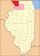
| US state : | Illinois |
| Administrative headquarters : | Galena |
| Address of the administrative headquarters: |
Jo Daviess County Courthouse 330 North Bench Street Galena, IL 61036 |
| Foundation : | February 27, 1827 |
| Made up from: |
Putnam County Mercer County Henry County |
| Area code : | 001 815 |
| Demographics | |
| Residents : | 22,678 (2010) |
| Population density : | 14.6 inhabitants / km 2 |
| geography | |
| Total area : | 1602 km² |
| Water surface : | 46 km² |
| map | |
 |
|
| Website : www.jodaviess.org | |
The Jo Daviess County is a county in the US -amerikanischen State Illinois . In 2010 , the county had 22,678 residents and a population density of 14.6 people per square kilometer. The county seat is Galena .
geography
The county in the extreme northwest of Illinois and borders to the west - separated by the Mississippi - on Iowa ; to the north is bordered by Wisconsin . It has an area of 1602 square kilometers, of which 46 square kilometers are water.
Jo Daviess County is located in the Ice Age-shaped region called the Driftless Area , which stretches across southeastern Minnesota , southwestern Wisconsin, northeastern Iowa, and far northwestern Illinois. During the last ice age, the so-called Wisconsin Glaciation , the region remained ice-free, so that the river valleys of the Galena River and the Apple River could cut deeper into the plateau during this time.
The following neighboring counties border Jo Daviess County:
|
Grant County, Wisconsin |
Lafayette County, Wisconsin |
|
|
Dubuque County, Iowa |
.svg)
|
Stephenson County |
|
Jackson County, Iowa |
Carroll County |
history


Jo Daviess County was formed on February 27, 1827 from parts of Putnam , Mercer and Henry Counties . The county was named after Joseph Hamilton Daviess (1774-1811), a lawyer and military officer from Kentucky , who was killed at the Battle of Tippecanoe .
As early as 1690, the French Nicholas Perrot built a trading post on the east bank of the Mississippi and traded with the Indians along the Fever River , now the Galena River , by buying the lead extracted from the mines and selling it on to the French. It was not until 1816 that the captain of the US Army, John Shaw , reported again on the lead-mining Indians on the Fever River. In 1818, JohnTyler Armstrong built a log cabin on the east bank of the Fever River. In 1819 Francis Bouthillier took over this log cabin and set up a ferry connection across the river. Over the next few months, over 100 men came to work in the lead mines along the river. In 1822 the government sold the first mine to Colonel James Johnson , who arrived with about 20 whites and 50 slaves.
In 1826 the first post office was opened in Galena and in 1827 the first steamers began their regular trips between Galena and St. Louis ; in addition, the Miners Journal appeared , the first newspaper in the region. The first Presbyterian church was built in 1838 and in 1841 the city of Galena alone had 650 houses and 2,225 inhabitants. In 1844 the courthouse, which had been started in 1839, was completed and put into operation, and in 1847 the sale of land to private individuals began. In 1854 the county got its first railroad connection through the Illinois Central Railroad , and a big fire destroyed all wooden buildings along the main road.
In 1860 the future US President Ulysses S. Grant came to Galena, rented a house and worked with his father and brothers in his leather goods shop. After the end of the Civil War, Grant came back and set up his campaign office here.
Territorial development
| Population development | |||
|---|---|---|---|
| Census | Residents | ± in% | |
| 1830 | 2111 | - | |
| 1840 | 6180 | 192.8% | |
| 1850 | 18.604 | 201% | |
| 1860 | 27,325 | 46.9% | |
| 1870 | 27,820 | 1.8% | |
| 1880 | 27,528 | -1 % | |
| 1890 | 25.101 | -8.8% | |
| 1900 | 24,533 | -2.3% | |
| 1910 | 22,657 | -7.6% | |
| 1920 | 21,917 | -3.3% | |
| 1930 | 20,235 | -7.7% | |
| 1940 | 19,989 | -1.2% | |
| 1950 | 21,459 | 7.4% | |
| 1960 | 21,821 | 1.7% | |
| 1970 | 21,766 | -0.3% | |
| 1980 | 23,520 | 8.1% | |
| 1990 | 21,821 | -7.2% | |
| 2000 | 22,289 | 2.1% | |
| 2010 | 22,678 | 1.7% | |
| Before 1900 1900–1990 2000 2010 | |||

The Jo Daviess County from its inception in 1827 to 1831

1831 to 1836
1836 to 1837

1837 to 1839

1839 until today


Demographic data
According to the 2010 census , Jo Daviess County had 22,678 people in 10,083 households. The population density was 14.6 inhabitants per square kilometer. Statistically, 2.17 people lived in each of the 10,083 households.
The racial the population was composed of 97.2 percent white, 0.5 percent African American, 0.2 percent Native American, 0.3 percent Asian and other ethnic groups; 0.9 percent were descended from two or more races. Hispanic or Latino of any race was 2.7 percent of the population.
20.8 percent of the population were under 18 years old, 57.9 percent were between 18 and 64 and 21.3 percent were 65 years or older. 49.8 percent of the population was female.
The median income for a household was 47,103 USD . The per capita income was $ 27,494. 10.5 percent of the population lived below the poverty line.
Localities in Jo Daviess County
structure
Jo Daviess County is divided into 23 townships :
|
|
|

See also
Individual evidence
- ↑ 2011-02-22 ( English ) In: Geographic Names Information System . United States Geological Survey . Retrieved July 15, 2012.
- ↑ a b c U.S. Census Bureau, State & County QuickFacts - Jo Daviess County, IL ( Memento of the original from July 12, 2011 on WebCite ) Info: The archive link was automatically inserted and not yet checked. Please check the original and archive link according to the instructions and then remove this notice. Retrieved December 18, 2012
- ^ A b National Association of Counties.Retrieved December 18, 2012
- ↑ Extract from the National Register of Historic Places - No. 66000322.Retrieved November 20, 2011
- ↑ Extract from the National Register of Historic Places - No. 69000056. Retrieved November 20, 2011
- ^ US Census Bureau - Census of Population and Housing.Retrieved March 15, 2011
- ^ Extract from Census.gov.Retrieved February 15, 2011
- ↑ Missouri Census Data Center - Illinois ( page no longer available , search in web archives ) Info: The link was automatically marked as defective. Please check the link according to the instructions and then remove this notice. Retrieved March 3, 2014
Web links
List of counties in Illinois
Adams |
Alexander |
Bond |
Boone |
Brown |
Bureau |
Calhoun |
Carroll |
Cass |
Champaign |
Christian |
Clark |
Clay |
Clinton |
Coles |
Cook |
Crawford |
Cumberland |
DeKalb |
DeWitt |
Douglas |
DuPage |
Edgar |
Edwards |
Effingham |
Fayette |
Ford |
Franklin |
Fulton |
Gallatin |
Greene |
Grundy |
Hamilton |
Hancock |
Hardin |
Henderson |
Henry |
Iroquois |
Jackson |
Jasper |
Jefferson |
Jersey |
Jo Daviess |
Johnson |
Kane |
Kankakee |
Kendall |
Knox |
LaSalle |
Lake |
Lawrence |
Lee |
Livingston |
Logan |
Macon |
Macoupin |
Madison |
Marion |
Marshall |
Mason |
Massac |
McDonough |
McHenry |
McLean |
Menard |
Mercer |
Monroe |
Montgomery |
Morgan |
Moultrie |
Ogle |
Peoria |
Perry |
Piatt |
Pike |
Pope |
Pulaski |
Putnam |
Randolph |
Richland |
Rock Island |
Saline |
Sangamon |
Schuyler |
Scott |
Shelby |
St. Clair |
Strong |
Stephenson |
Tazewell |
Union |
Vermilion |
Wabash |
Warren |
Washington |
Wayne |
White |
Whiteside |
Will |
Williamson |
Winnebago |
Woodford
Coordinates: 42 ° 22 ′ N , 90 ° 13 ′ W