
McHenry County (Illinois)
 McHenry County Courthouse |
|
| administration | |
|---|---|
| US state : | Illinois |
| Administrative headquarters : | Woodstock |
| Address of the administrative headquarters: |
McHenry County Government Center 2200 North Seminary Ave Woodstock, IL 60098 |
| Foundation : | January 16, 1836 |
| Made up from: |
Cook County LaSalle County |
| Area code : | 001 815 |
| Demographics | |
| Residents : | 308,760 (2010) |
| Population density : | 200.1 inhabitants / km 2 |
| geography | |
| Total area : | 1563 km² |
| Water surface : | 20 km² |
| map | |
 |
|
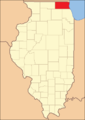
The McHenry County is a county in the US -amerikanischen State Illinois . In 2010 , the county had 308,760 people and a population density of 200.1 people per square kilometer. The county seat is Woodstock .
McHenry County is part of the Chicago metropolitan area .
geography
The county is located in the far north of Illinois in the northwest suburb of Chicago on the border with Wisconsin . It has an area of 1563 square kilometers, of which 20 square kilometers are water. The following neighboring counties border McHenry County (Illinois):
|
Walworth County, Wisconsin |
Kenosha County, Wisconsin |
|
| Boone County |
.svg)
|
Lake County |
| DeKalb County | Kane County | Cook County |
history
| Population development | |||
|---|---|---|---|
| Census | Residents | ± in% | |
| 1840 | 2578 | - | |
| 1850 | 14,978 | 481% | |
| 1860 | 22,089 | 47.5% | |
| 1870 | 23,762 | 7.6% | |
| 1880 | 24,908 | 4.8% | |
| 1890 | 26,114 | 4.8% | |
| 1900 | 29,759 | 14% | |
| 1910 | 32,509 | 9.2% | |
| 1920 | 33.164 | 2% | |
| 1930 | 35,079 | 5.8% | |
| 1940 | 37,311 | 6.4% | |
| 1950 | 50,656 | 35.8% | |
| 1960 | 84.210 | 66.2% | |
| 1970 | 111,555 | 32.5% | |
| 1980 | 147,897 | 32.6% | |
| 1990 | 183.241 | 23.9% | |
| 2000 | 260.077 | 41.9% | |
| 2010 | 308.760 | 18.7% | |
| Before 1900 1900–1990 2000 2010 | |||
McHenry County was formed on January 16, 1836 from parts of Cook County and LaSalle County . It was named after William McHenry , a White County pioneer and US Senator.
Territorial development
The county used to extend as far east as Lake Michigan .
McHenry County when it was founded in 1836

1839 until today


Demographic data
According to the 2010 census , McHenry Counties had 308,760 people in 108,361 households. The population density was 200.1 inhabitants per square kilometer. Statistically, 2.83 people lived in each of the 108,361 households.
The racial the population was composed of 94.3 percent white, 1.3 percent African American, 0.5 percent Native American, 2.6 percent Asian and other ethnic groups; 1.3 percent were descended from two or more races. Hispanic or Latino of any race was 11.7 percent of the population regardless of ethnicity.
26.7 percent of the population were under 18 years old, 53.7 percent were between 18 and 64 and 19.6 percent were 65 years or older. 50.2 percent of the population was female.
The median income for a household was 76,909 USD . The per capita income was $ 32,318. 6.9 percent of the population lived below the poverty line.
Localities in McHenry County
Census-designated places (CDP)
Other Unincorporated Communities
1 - partly in Kane County
2 - partly in Cook , Kane and Lake County
3 - partly in Lake County
structure
McHenry County is divided into 17 townships :
|
|
See also
Web links
Individual evidence
- ↑ GNIS-ID: 1784815. Retrieved on February 22, 2011 (English).
- ↑ a b c U.S. Census Bureau, State & County QuickFacts - McHenry County, IL ( Memento of the original from July 14, 2011 on WebCite ) Info: The archive link was automatically inserted and not yet checked. Please check the original and archive link according to the instructions and then remove this notice. Retrieved December 21, 2012
- ↑ a b National Association of Counties.Retrieved December 21, 2012
- ^ US Census Bureau - Census of Population and Housing.Retrieved March 15, 2011
- ^ Extract from Census.gov.Retrieved February 15, 2011
- ↑ Missouri Census Data Center - Illinois ( page no longer available , search in web archives ) Info: The link was automatically marked as defective. Please check the link according to the instructions and then remove this notice. Retrieved December 21, 2012
List of counties in Illinois
Adams |
Alexander |
Bond |
Boone |
Brown |
Bureau |
Calhoun |
Carroll |
Cass |
Champaign |
Christian |
Clark |
Clay |
Clinton |
Coles |
Cook |
Crawford |
Cumberland |
DeKalb |
DeWitt |
Douglas |
DuPage |
Edgar |
Edwards |
Effingham |
Fayette |
Ford |
Franklin |
Fulton |
Gallatin |
Greene |
Grundy |
Hamilton |
Hancock |
Hardin |
Henderson |
Henry |
Iroquois |
Jackson |
Jasper |
Jefferson |
Jersey |
Jo Daviess |
Johnson |
Kane |
Kankakee |
Kendall |
Knox |
LaSalle |
Lake |
Lawrence |
Lee |
Livingston |
Logan |
Macon |
Macoupin |
Madison |
Marion |
Marshall |
Mason |
Massac |
McDonough |
McHenry |
McLean |
Menard |
Mercer |
Monroe |
Montgomery |
Morgan |
Moultrie |
Ogle |
Peoria |
Perry |
Piatt |
Pike |
Pope |
Pulaski |
Putnam |
Randolph |
Richland |
Rock Island |
Saline |
Sangamon |
Schuyler |
Scott |
Shelby |
St. Clair |
Strong |
Stephenson |
Tazewell |
Union |
Vermilion |
Wabash |
Warren |
Washington |
Wayne |
White |
Whiteside |
Will |
Williamson |
Winnebago |
Woodford
Coordinates: 42 ° 19 ′ N , 88 ° 27 ′ W