
Kaohsiung
|
Kaohsiung 高雄市 |
|||
 From top to bottom, left to right: Skyline at night, “Red Line” of the Kaohsiung Metro, Kaohsiung Stadium, southern summit of the “Jade Mountain” Yushan , Kaohsiung History Museum , pagodas at Lotus Lake |
|||
|
|||
| State : |
|
||
| Coordinates : | 22 ° 37 ′ N , 120 ° 18 ′ E | ||
| Height : | 9 m | ||
| Area : | 2,951.8524 km² | ||
| Residents : | 2,776,912 (Dec 2017) | ||
| Population density : | 941 inhabitants per km² | ||
| Time zone : | UTC + 8 (Chungyuan time) | ||
| Telephone code : | (+886) (0) 7 | ||
| Postal code : | 800-813 | ||
| ISO 3166-2 : | TW-KHH | ||
| Community type : | Government immediate city | ||
| Structure : | 38 districts ( 區 , Qū ) | ||
| Mayor : | Yang Ming-chou ( 楊明 州 , executive) ( independent ) | ||
| Website : | |||
| City flower: | Chinese rose marshmallow | ||

|
|||


Kaohsiung ( Chinese 高雄市 , Pinyin Gāoxióng Shì , Tongyong Pinyin Gaosyóng Shìh , W.-G. Kao-hsiung Shih , Zhuyin ㄍ ㄠ ㄒ ㄩ ㄥ ˊ ㄕ ˋ , Pe̍h-ōe-jī Ko-hiông-chhī , , Japanese : Takao ) is the second largest city in Taiwan . It is one of six sub -government cities in Taiwan and is divided into 38 districts .
Kaohsiung is located in the southwest of the island of Taiwan on the South China Sea and has the country's most important port. Most of Taiwan’s oil imports, which are processed by the surrounding industry, are handled here.
geography
Kaohsiung is located in the southwest of the island of Taiwan. The actual core city lies on the coast of the Taiwan Strait and includes the island of Qijin in the west; Kaohsiung is bordered by Tainan City to the north, and Pingtung County to the south and southeast . In the east and northeast, the urban area expanded in 2010 in the districts of Namasia , Taoyuan and Maolin extends into the Taiwanese central mountains , where it borders on the districts of Chiayi , Nantou , Hualien and Taitung .
Due to the large extent from southwest to northeast, the area of the city of Kaohsiung has very different landscapes. While the west is relatively flat and merges into the Pingdong Plain in the southeast , the terrain rises steeply in the east and northeast and reaches a height of 3844 m in the Taoyuan district on the southern summit of Yushan . The area between the industrial core city in the west and the mostly forested mountains is used intensively for agriculture.
The area of Kaohsiung is traversed by numerous watercourses coming from the mountains, the largest of which is the Gaoping River (Chinese: 高屏溪Gāopíngxī ), which also forms the border with Pingtung County. Best known is the Love River (Chinese: Kern Aìhé ) flowing through the city center thanks to its tourist importance
history
Kaohsiung developed from a village that was called Táⁿ-káu in the 17th century, which in the language of the local Taiwanese indigenous people meant something like bamboo forest . This name became the name Tá-káu (written with the characters 打狗) in the Minnan dialect of the Chinese immigrants . In 1624 the Dutch, defeated by the Chinese troops in Penghu, built a fortress near the village. In 1630, the first organized Chinese immigration from Fujian Province to Taiwan began. Kaohsiung was one of the main settlement targets. In 1661 the Dutch were driven out by the Chinese under the leadership of General Zheng Chenggong . The place was then named 萬年 , Wàn Nián - "ten thousand years / eternity" and thus belonged to the two municipal districts. After the name was changed again to Takao in the 1670s, the place finally began to grow steadily, brought about by the constant immigration of Chinese settlers from the mainland. In 1684 the name was again changed to 鳳山 , Fèngshān - "Mountain of the Phoenix", and the place became part of the Taiwan Prefecture. During this time, the city's port also became important for the first time.

In 1895 Taiwan was ceded to Japan with the Treaty of Shimonoseki . In Japanese , the name changed from 打狗 ( Tá-káu in Taiwanese) to 高雄 ( Takao in Japanese ) and, although both words were pronounced the same, the meaning of the characters used changed from the dog beat to High Hero , which in turn pronounced in standard Chinese as Gāoxióng (= Kaohsiung), which is how today's name arose. The Japanese encouraged the expansion of the city, especially the port.
On July 13, 1913, the Roman Catholic Diocese of Kaohsiung was established as the Apostolic Prefecture of Formosa and renamed the Apostolic Prefecture of Kaohsiung in 1949 . In 1961 the Apostolic Prefecture was elevated to a diocese. Episcopal Church is the Cathedral of Our Lady of the Holy Rosary .
During World War II, Takao (especially the port and airfield) was the target of several American bombing raids from June 1944 to August 1945.
After 1945, the island of Taiwan came under the rule of the Republic of China again and Kaohsiung became an independent city within the province of Taiwan . The remainder of the former Japanese prefecture of Takao was reorganized as Kaohsiung County . On July 1, 1979, Kaohsiung was removed from Taiwan Province and promoted to a city under the government. In December 1979 the Kaohsiung incident occurred here , in which pro-democratic tendencies in the population broke away.

From July 16 to 29, 2009, Kaohsiung hosted the 8th World Games .
On December 25, 2010, Kaohsiung County was incorporated into the city as part of a ROC government reform process . The urban area increased from 154 to 2946 km², the population from around 1.5 to 2.7 million.
On July 31, 2014, a series of severe gas explosions rocked the city, tearing up entire streets. Gas leaks in underground pipelines in the petrochemical industry have been identified as the cause .
The 3rd Ecomobility World Festival took place here from October 1st to 31st, 2017 with a corresponding congress from October 2nd to 4th.
climate
The climate of Kaohsiung is tropical, humid and hot and characterized by the monsoons . In the mountainous hinterland, the climate is significantly cooler and more moderate. The rainiest months are June to August. With an average of more than 6 hours of sunshine per day, Kaohsiung is one of the sunniest cities in Taiwan.
|
Climate data from the years 1981–2010
Source: Taiwan Central Weather Bureau
|
||||||||||||||||||||||||||||||||||||||||||||||||||||||||||||||||||||||||||||||||||||||||||||||||||||||||||||||||||||||||||||||||||||||||||||||||||||||
Districts


Before 2010, the urban area only included the actual "core city" with the eleven core districts Qijin ( 旗津 區 ), Gushan ( 鼓山 區 ), Yancheng ( 鹽 埕 區 ), Zuoying ( 左 營 區 ), Xinxing ( 新興 區 ), Qianjin ( 前 金 區 ), Lingya ( 苓雅 區 ), Sanmin ( 三民 區 ), Nanzi ( 楠梓 區 ), Qianzhen ( 前 鎮區 ), Xiaogang ( 小 港區 ).
Through the incorporation of the 27 cities and municipalities of the adjoining previous Kaohsiung district in the form of districts in 2010, the city has now comprised 38 districts. The three rural districts of Namaxia , Tauyuan and Maolin , which are located deep in the mountains and are mostly inhabited by members of the indigenous peoples of Taiwan , have had a special self-governing status since 2014 as “ high country urban districts of the indigenous people” ( 直轄市 山地 原住民 區 ).
The following table lists the districts with their population and area. The original districts of the core city are marked with a gray background.
| district | chin. | Hanyu Pinyin | Taiwanese (POJ) | Area (km²) |
Residents | Ew./km² |
|---|---|---|---|---|---|---|
| Nanzi | 楠梓 區 | Nánzǐ Qū | Lâm-chu | 25.8276 | 184.410 | 7.136 |
| Zuoying | 左 營 區 | Zuǒyíng Qū | Chó-iâⁿ | 19.3888 | 196,839 | 10.158 |
| Gushan | 鼓山 區 | Gǔshān Qū | Kó͘-san | 14.7458 | 139,619 | 9,468 |
| Sanmin | 三民 區 | Sānmín Qū | Sam-bîn | 19.7866 | 342.176 | 17.308 |
| Yancheng | 鹽 埕 區 | Yánchéng Qū | Iâm-tiâⁿ | 1.4161 | 24,212 | 17,086 |
| Qianjin | 前 金 區 | Qiánjīn Qū | Chiân-kim | 1.8573 | 26,888 | 14,492 |
| Xinxing | 新興 區 | Xīnxīng Qū | Sin-heng | 1.9764 | 51.020 | 25,849 |
| Lingya | 苓雅 區 | Língyǎ Qū | Lêng-ngá | 8.1522 | 170.457 | 20,936 |
| Qianzhen | 前 鎮區 | Qiánzhèn Qū | Chiân-tìn | 19.1207 | 189,115 | 9,898 |
| Qijin | 旗津 區 | Qíjīn Qū | Kî-tin | 1.4639 | 28,665 | 19,595 |
| Xiaogang | 小 港區 | Xiǎogǎng Qū | Sió-káng | 45.4426 | 157.508 | 3,467 |
| Fengshan | 鳳山 區 | Fèngshān Qū | Hōng-soaⁿ | 26.7590 | 359.071 | 13,418 |
| Daliao | 大寮 區 | Dàliáo Qū | Toā-liâu | 71.0437 | 112,395 | 1,582 |
| Niaosong | 鳥 松 區 | Niǎosōng Qū | Chiáu-chhêng | 24.5927 | 44,262 | 1,800 |
| Linyuan | 林 園區 | Línyuán Qū | Lîm-hn̂g | 32.2860 | 69.995 | 2,170 |
| Renwu | 仁武 區 | Rénwǔ Qū | Jîn-bú | 36.0808 | 86,582 | 2,396 |
| Dashu | 大樹 區 | Dàshu Qu | Toā-chhiū | 66.9811 | 42,650 | 637 |
| Dashe | 大 社區 | Dàshè Qū | Toā-siā | 26.5848 | 34,644 | 1,304 |
| Gangshan | 岡山 區 | Gāngshān Qū | Kong-san | 47.9421 | 97.168 | 2,028 |
| Luzhu | 路竹 區 | Lùzhú Qū | Lō͘-tek | 48.4348 | 52,603 | 1,087 |
| Qiaotou | 橋頭 區 | Qiáotóu Qū | Kiô-thâu | 25.9379 | 37,619 | 1,451 |
| Ziguan | 梓官 區 | Zǐguān Qū | Chu-koaⁿ | 11.5967 | 35,919 | 3,103 |
| Mituo | 彌陀 區 | Mítuó Qū | Mî-tô | 14.7772 | 19,315 | 1,307 |
| Yong'an | 永安 區 | Yǒng'ān Qū | Éng-an | 22.6141 | 13,910 | 615 |
| Yanchao | 燕巢 區 | Yàncháo Qū | Iàn-châu | 65.3950 | 29,823 | 456 |
| Tianliao | 田寮 區 | Tiánliáo Qū | Chhân-liâu | 92.6802 | 7.205 | 78 |
| Alian | 阿蓮 區 | Ālián Qū | A-lian | 34.6164 | 28,746 | 831 |
| Qieding | 茄萣 區 | Qiédìng Qū | Ka-tiāⁿ | 15.7624 | 30,081 | 1,908 |
| Hunei | 湖 內 區 | Húnèi Qū | Ô͘-lāi | 20.1615 | 29,861 | 1,480 |
| Qishan | 旗山 區 | Qíshān Qū | Kî-san | 94.6122 | 36,816 | 389 |
| Meinong | 美濃 區 | Měinóng Qū | Bi-long | 120.0316 | 39,811 | 332 |
| Neimen | 內 門 區 | Nèimén Qū | Lāi-mn̂g | 95.6224 | 14,526 | 152 |
| Shanlin | 杉林 區 | Shānlin Qū | Sam-nâ | 104.0036 | 11,918 | 115 |
| Jiaxian | 甲仙 區 | Jiǎxiān Qū | Kah-sian | 124.0340 | 6,073 | 49 |
| Liugui | 六 龜 區 | Liùguī Qū | La̍k-ku | 194.1584 | 12,971 | 67 |
| Maolin | 茂林 區 | Màolín Qū | Bō͘-lîm | 194.0000 | 1,987 | 10 |
| Tauyuan | 桃源 區 | Táoyuán Qū | Thô-goân | 928.9800 | 4,326 | 5 |
| Namaxia | 那 瑪夏 區 | Nàmǎxià Qū | Namasia | 252.9895 | 3.137 | 12 |
| Kaohsiung as a whole | 2951.8524 | 2,774,323 | 939 | |||
| Source: Statistics Department of the Ministry of the Interior (May 2018) | ||||||
| Core city of Kaohsiung |

| Map of Kaohsiung wards |
|---|
|
Economy and Infrastructure
.jpg)
In the past, aluminum, wood and paper products, fertilizers, cement and various metals were produced in Kaohsiung, most of which were intended for export. Today you will find mainly mechanical engineering and shipbuilding industries.
The city 's subway system, the Kaohsiung Mass Rapid Transit (KMRT), began operations in 2008. The first line, the “Red Line” running in north-south direction, was opened on March 9, the second line, the “Orange Line” running in east-west direction, followed on September 14th.
A ring-shaped tram (light rail) is also planned around the city center. Since the end of 2012, this route has been tendered as a catenary-free project. In January 2013, the Spanish rail vehicle manufacturer CAF and consortium partner Evergreen Construction secured the first phase of the tram project, with CAF low-floor trams from the Urbos vehicle family contributing.
The new high-speed rail ( Taiwan High Speed Rail ), which shortens the travel time to the capital Taipei to 90 minutes, has been running from the provisional terminus at Zuoying in the north of the city since January 2007 .
The Takao Railway Museum opened in Gushan District in 2010 .
Kaohsiung International Airport in the southern Xiaogang district is Taiwan's second largest airport. Both the train station and the airport are connected to the KMRT network.
CityBike Kaohsiung is a public bike rental system.
port

The administrative authority for the port is not subordinate to the city, but to the Ministry of Transport. In the port there is a special economic zone for trade with the People's Republic of China , which started in April 1997 with certain restrictions. For political reasons, a direct movement of goods and goods between the two countries is not possible. The existing offshore transshipment center in Kaohsiung is responsible for shipping traffic to the two ports of Xiamen and Fuzhou in mainland China . Freight traffic to Taiwan or vice versa from Taiwan to the special economic zone is prohibited as intended. After around 48 years of stagnation in trade relations across the Taiwan Strait , the Sheng Da container ship, which had started the day before in Xiamen, arrived in Kaohsiung on April 20, 1997 to unload and pick up cargo for third countries.
In 2016, the port had handled around 10.5 million TEU , making it 13th among the largest container ports in the world .
Rail transport
The ten tallest skyscrapers

- Tuntex Sky Tower ( 東 帝 士 八五 大樓 , Dōngdì shì bāwǔ dàlóu ) 347 m + Spire = 380 m
- Grand 50 Tower
- Far Eastern Ding Ding Hotel
- Grand Hi-Lai Hotel
- Asia-Pacific Financial Plaza
- Linden Hotel
- Xin-Fu-Hwa
- Bao-Cheng Enterprise Tower ( 寶 成 企業 大樓 , Bǎochéng qǐyè dàlóu )
- Shr-Hwa Financial Center ( 世華 商業 中心 , Shìhuá shāngyè zhōngxīn )
- Kaohsiung Twin Towers
tourism

While Kaohsiung gained importance in the period after the Second World War because of its port and heavy industry, it has recently become a tourist destination, especially for visitors from China and Japan . Popular destinations in the core city area include the Love River , Lotus Lake , Chengcing Lake , Shoushan (at 356 m the highest point in the core city), Xiziwan Bay, Qijin Island, and the Liuhe night market , the Ruifeng night market and the tallest building in the city, the Tuntex Sky Tower . In the Fo Guang Shan Buddha Museum , where a tooth relic of the Buddha is kept, you can get an insight into the Buddhist worldview and art. In the extended urban area, the mountains are a popular destination for hiking and bathing in thermal springs. Meinong District is famous for its traditional Hakka people culture. The Asia New Bay Area at the port is an industrial, trade fair and cultural site. The Ciaotou sugar factory is now a museum and technical monument.
Colleges and universities
Kaohsiung is home to a number of government and private colleges and universities offering a variety of courses and specializations:
| Name (German / English) | Chinese |
|---|---|
|
Cheng Shiu University Cheng Shiu University |
正 修 科技 大學 |
|
Kaohsiung National University of Science and Technology (NKUST) National Kaohsiung University of Science and Technology |
國立 高雄 科技 大學 |
|
Fooyin University Fooyin University |
輔 英 科技 大學 |
|
I-Shou University I-Shou University |
義 守 大學 |
|
Kao Yuan University Kao Yuan University |
高苑 科技 大學 |
|
Medical University of Kaohsiung Kaohsiung Medical University |
高雄 醫學 大學 |
|
National Education University Kaohsiung National Kaohsiung Normal University |
國立 高雄 師範大學 |
|
Shih Chien University (Campus Kaohsiung) Shih Chien University (Kaohsiung Campus) |
實踐 大學 (高雄 校區) |
|
Shu-Te University Shu-Te University |
樹德 科技 大學 |
|
Sun Yat-sen National University National Sun Yat-sen University |
國立 中山大學 |
|
National University of Hospitality and Tourism Kaohsiung National Kaohsiung University of Hospitality and Tourism |
國立 高雄 餐旅 大學 |
|
National University of Kaohsiung National University of Kaohsiung |
國立 高雄 大學 |
|
Wenzao Ursuline University of Foreign Languages Wenzao Ursuline University of Languages |
文藻 外語 大學 |
Twin cities
Kaohsiung has international partnerships with the following cities:
|
|
|
Personalities
- Shih Ming-teh (* 1941), civil rights activist and politician
- Fan Chung (* 1949), mathematician
- Lung Ying-tai (* 1952), writer and Minister of Culture of the Republic of China
- Lu Chen (* 1976), magician
- Chuang Chia-jung (* 1985), tennis player
- Kuei Ya Chen (* 1990), badminton player
- Tai Tzu-ying (* 1994), badminton player
- Peter Liu Cheng-chung (* 1951), clergyman, archbishop
- Belle Chen (* 1988), pianist
See also
gallery


Kaohsiung skyline

Love flow
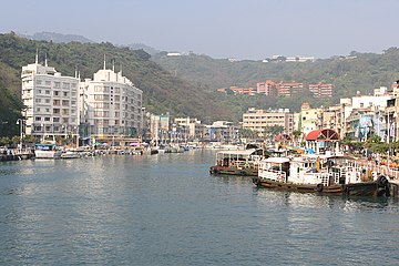
Gushan fishing port

Cathedral of Our Lady of the Holy Rosary

Formosa-Boulevard Metro Station

World Game Stadium

South Summit of Yushan


Web links
- Kaohsiung City Government Website (Chinese / English)
Individual evidence
- ↑ a b Kaohsiung Handbook 高雄 手冊 - Part I: Living in Kaohsiung 生活 篇. (pdf) Retrieved March 23, 2019 (English).
- ↑ American missions against Takao, Takao Airfield, Takao Harbor June 29, 1944 - August 12, 1945. pacificwrecks.com, accessed on July 14, 2018 (English).
- ↑ vks / dpa / AFP: Violent detonations: Dozens of dead after gas explosions in Taiwan. Spiegel Online, August 1, 2014, accessed August 2, 2014 .
- ↑ Taiwan gas blasts in Kaohsiung kill at least 25. BBC News, August 1, 2014, accessed August 2, 2014 .
- ↑ ecomobilityfestival.org (August 24, 2017)
- ^ Administrative Districts. Kaohsiung City Council website, accessed February 9, 2018 .
- ↑ THE LOCAL GOVERNMENT ACT (LAST AMENDMENT: JANUARY 29, 2014). Council of Indigenous Peoples, accessed February 10, 2018 .
- ↑ with Dongsha Islands , Nansha Islands , Taiping Dao
- ↑ 戶數 、 人口 數 及 遷徙 06 鄉鎮 土地 面積 及 人口 密度 (97) (“Number of households, population and migration: land area and population density of the municipalities”). Ministry of Interior Statistics Department, accessed February 3, 2018 (Chinese).
- ↑ Kaohsiung MRT predicts 11% rise in passenger traffic. Taipei Times, January 4, 2011, accessed July 26, 2018 .
- ^ Kaohsiung picks CAF to build catenary-free trams. Railwy Gazette, January 7, 2013, accessed July 26, 2018 .
- ↑ "Three Links" across the Taiwan Strait ( Memento from February 27, 2003 in the web archive archive.today ) (English)
- ^ Taiwan-China Trade Link. The New York Times, April 20, 1997, accessed July 26, 2018 .
- ^ Kaohsiung - Sister & Friendly Cities (English), accessed March 1, 2018
Core city: Nanzi | Zuoying | Gushan | Sanmin | Yancheng | Qianjin | Xinxing | Lingya | Qianzhen | Qijin | Xiaogang
Outer city: Fengshan | Daliao | Niaosong | Linyuan | Renwu | Dashu | Dashe | Gangshan | Luzhu | Qiaotou | Ziguan | Mituo | Yong'an | Yanchao | Tianliao | Alian | Qieding | Hunei | Qishan | Meinong | Neimen | Shanlin | Jiaxian | Liugui

Government Immediate Cities: Kaohsiung | Tainan | Taipei | New Taipei | Taichung | Taoyuan
Counties in Taiwan Province: Changhua | Chiayi | Hsinchu | Hualien | Miaoli | Nantou | Penghu | Pinging | Taitung | Yilan | Yunlin
Independent cities in Taiwan Province: Chiayi | Keelung | Hsinchu
Counties in Fujian Province: Kinmen | Lienchiang ( Matsu Islands )