
Konrad-Adenauer-Ufer (Cologne)
The Konrad-Adenauer-Ufer is a northern section of the Rheinuferstraße in Cologne on the left bank of the Rhine. It is a multi-lane avenue street, which was equipped with a median , sidewalk and a promenade with a bike path. Under its current name, the street runs between the inner-city Hohenzollern Bridge in the north of the old town and the western part of the Zoobrücke located further northeast at the end of the Neustadt-Nord district , where it turns into the street Niederländer Ufer. The street section is also part of the federal highway 51 .


History of origin
Roman and Franconian times

To the north-east of a settlement that later became a Roman colony , the course of the Rhine had created a bay whose elongated bank area was inhabited by boaters and fishermen from ancient times . A village is said to have formed on the northern area of this strip of shore, which was named "vicus deae Lucretiae" after a deity. For this purpose, the ancient historian Hermann Schmitz explicitly referred to a Celtic origin of the name of this patron goddess and cited two inscriptions found in this context. According to this, the texts contain the name of a mother goddess (dea Lucretia) and thus refer to local contexts, since this name does not occur in the Roman cult. He explained that since pre-Christian times deities venerated as matrons mostly also coined the place names and in this case the origin lies in the ubian period. One of the inscriptions was found north of the Roman wall, the other in the corner of the north and east walls of the ancient city.

Even in Roman times, the sickle-shaped course of the Rhine gave no reason to build a northern riverside road, as starting from the core of the Roman city - apart from unpaved roads to individual homes - the direct route is the “Eigelstein” - “Neusser Straße” - “Niehler” road Street ”chose and maintained.
In the post-Roman times, Archbishop Kunibert of Cologne is said to have built a small church on the Rhine in front of the northern Roman wall , possibly on the area of an early Franconian cult site . (A similar thing happened in Minden around 803 ). Traces of the possible pagan sanctuary , the so-called "Kunibertspütz", can still be found today below the east apse in the crypt of the Church of St. Kunibert . Thus salvaged archaeological finds and remains of a possible predecessor of the Kunibert Church are the oldest traces of this section of the bank.
Location and place names of the shrine books

There were no medieval names for the entire Uferstraße in the records of the Cologne shrine books, which began as early as the 12th century . The properties registered in these, located on the bank , were mostly named after their owner, a conspicuousness in nature or were given an indication of the location. There are only designations for Rheinuferstraße, such as the addition “in littore” around 1135, then “Litus Reni”, opposite “der Reyn mueren”, “versus Renum” and in 1596 “uff der stat mauren” on the Rhine. The address formulations used in this way for entries in the shrine books of medieval city districts did not change in the course of the following centuries. This is confirmed in the representations of the cartographer Arnold Mercator , in whose Cologne cityscape from 1570 only the streets that mostly flow vertically into the Uferstraße were given names, but not the Uferstraße itself. The northernmost city fortifications were also expanded during Mercator's time . It was “a stone building” which “makes a point into the Rhine” in front of the outer tower ( Weckschnapp ) of the city wall. The map also illustrates the sparse development of this period and shows in the far north only a row of houses behind the fortifications, which were mostly followed by vineyards . Only after the Kunibert Church did the buildings condense into several rows of houses.
After almost 2000 years, in which the course of the river bed and corrections of the bank area occurred, archaeological finds from Roman times and subsequent epochs as well as the traditional collegiate church, remnants of the early city fortifications and the street "Am Alten Ufer", which still exists today, even if only rudimentary. .
Medieval banks of the Rhine

House building in the Middle Ages was simple and unadorned. The buildings were often erected on a base reinforced by stone or pebbles or on some other massive substructure. The houses built near the shore mostly used piles driven into the ground as foundations in order to create a secure building site. The material of the superstructure consisted of roughly hewn bars and beams , the compartments of which had been given wooden cladding or were filled with brushwood and clay . From around the 15th century, bricks were used to reduce the risk of fire. The years 1376, 1462 and 1502 are given for the particularly devastating fires in the then suburb of Niederich .
Gates and gates on the "old bank"
With the completion of the fortifications on the Rhine side, which were also equipped with towers and gates to a lesser extent than the large curtain wall, a number of the small alleys now only led through gates or gates to the bank of the Rhine, referred to here as Am Alten Ufer . These towers and passages included the Trankgassentor (1293), the Waldemanns- or Kostgassenpforte and the Servatiusturm; this was connected from the bank via a bridge to the opposite town courtyard of the Eberbach monastery (1214) on Servasgasse. In 1525 the council called for the tower to be demolished; However, a compromise was agreed in which the city was granted the concession to manned the tower with a guard if necessary. North of the Kostgassenpforte and the Servatiusturm was around 1292 as “s. Cervaysporte “called (1600 already walled up) later Servas or Mü (ö) nchspforte. It was followed in the course of the wall by a so-called Wichhaus with the designation "Everstein", which was also mentioned by Hermann von Weinsberg in 1595 and presented itself as a rectangular projection from the fortification. The last gate before the Kunibertsturm was the Blomengassenpforte (1373 porta Blomingasse) located before the end of Machabäerstraße, which was also called the slaughterhouse gate in the 19th century because of the slaughterhouse built on this street .
Collegiate Church of St. Kunibert
The collegiate church has been part of Cologne's northern shore panorama since time immemorial and since its inauguration in 1247, apart from the fire damage to the west tower in 1376, it experienced only a few external changes until the beginning of modern times . As early as 1388, Bishop “Wicbold von Kuhn” ([sic]) had the southern of the two choir towers equipped with a new high helmet from his own resources , and in 1400 the western bell tower was rebuilt at the Chapter's expense . As early as 1403, the high helm of the south tower was again considered dilapidated and was adjusted to the lower north tower. This gave the building an appearance that was still shown in 1531 by Woensam's woodcut . Lightning strike in 1666 caused another fire, which destroyed the east towers and the roof of the sacristy . The reconstruction only took two years, but the towers were initially not given helmets due to lack of money. A restoration of the choir towers in their old form was decided in 1683 and carried out by the master carpenter Albert Burscheidt. A lack of maintenance in the 18th century resulted in a poor state of construction, which, in conjunction with the floods and the washing of the foundations by the flood of 1784, deteriorated further.
With the abolition of the monastery in 1802 and the collection of the church building fund, the church council was deprived of the opportunity to carry out a planned renovation of the church. They made do with provisional measures , such as the erection of supporting buttresses , the reduction of the height of the helmets (1817) and other measures. After an improvement in the financial situation was finally achieved in 1829 and a comprehensive renovation could be decided, the main tower collapsed in the spring of 1830. The collapse shattered the western transept , a yoke of the nave and the vestibule in front of the tower.
The reconstruction progressed only very slowly, so that the city decided in 1835 to support the parish financially in order to accelerate the reconstruction. In a conference under City Secretary Fuchs in 1843 the construction of the main tower was decided, the cost of which was estimated at 13,917 thalers and which the city council approved in December 1843. The city master builder Johann Peter Weyer was initially entrusted with the management of the construction project . After lengthy preliminary technical investigations, the tower was finally completed in 1860 according to plans by Heinrich Nagelschmidt . Nagelschmidt carried out restorations on the church until 1901 and was replaced by the builder Eduard Endler .
Kunibert weir system

In addition to the old collegiate church of St. Kunibert and its provost , the city wall with its half-towers and the Kunibert gate castle was one of the most striking structures on the northern bank of the Rhine.
The Rhine wall connected at the southeast corner with the crenellated main tower of the northernmost city fortification . The originally four-storey tower was rebuilt in 1633 by the city stonemason Peter Schäffer. He had received the order to shorten the tower by one storey and to prepare a stable platform on this stump, which should be used for the installation of heavy artillery . For this purpose, the walls of the substructure were optimized to a thickness of six feet and the central chamber received a ceiling vault , which was now able to withstand the load of the heavy equipment. A battlement connected the tower towards the Rhine via an archway spanning the towpath and further wall arches resting on pillars with a massive rectangular tower (ark) built around 40 feet in the river bed. Ark and parts of the entire complex were destroyed by the ice drift in 1784 .
In the course of the 17th century the main tower was a two-story, with a stepped gable ornate brick building added that had not yet received the Prussian time and as at this time Morgue was used. To the west of the city wall there had been a bastion since 1632 , similar to the one that had been built towards the field in front of the Bayenturm . Here in the north the bulwark was reinforced around 1670 by a bezel placed in front , so that with these structures one of the pentagonal earth bastions was created at the end of the 17th century, the shape of which was to become typical for the later fortifications of Cologne. Documents from the Cologne pension chambers from the years 1682 and 1689 were found on the properties confiscated for this purpose , whereby costs of 18,062 florins were recorded for 1682 .
Beyond these changes, there were hardly any differences in the bank design between Mercator's and Hollar's drawing. Only 220 years later does a clear change become visible in Manskirsch's painting in the southern development of the bank. The forerunner of the Uferstraße, the towpath, remained unchanged during this period and only became dispensable with the advent of steam shipping .
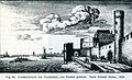
Kunibert Tower and Vorwerk from the north (1635)

St. Petrus, sculpture formerly standing in front of Kunibertstor, restored in 1835. Today at the bastion

Kunibertstorburg around 1840

Remains of the Kunibertstorburg around 1881


In front of the Kunibert Gate there was a statue of a saint on the shipyard side (like a statue of St. Nicholas on the Bayenturm). It depicts St. Peter and was reworked in 1838 by a restorer "Stephan". Today it is attached to the base of the bastion facing the Rhine.
Rhine bank flood zone

The city suffered the most severe flood damage, and with it in particular the areas of the banks of the Rhine in 1784. At that time, the highest water level ever recorded on the Rhine in Cologne was reached at 13.55 m . In this catastrophe, also known as the flood of the century, the "Ark", the watch tower protruding into the Rhine at the north corner of the city wall, was also destroyed. These catastrophes were repeated frequently, including in 1926, 1930 and 1948. Only then were relatively effective water protection measures implemented as part of a comprehensive redesign of the Rheinuferstraße.
Bank of the Rhine and the French period

Nothing is known about an early expansion of the Uferstraße beyond Cologne's northern Rhine fortifications . Mercator's plan from the early modern period shows only a towpath running in front of the fortification, as it was later designed by Wenzel Hollar and then at the turn of the 19th century by the painter Franz Joseph Manskirsch (1770–1827) with his Rhine panorama in 1795 was shown. However, the picture also shows the remains of the Ark, which was destroyed 11 years earlier.
The road between Lennep and Cologne coming from the Bergisches Land was completed as Wermelskirchener Chaussee as early as 1775 and designated as Cöln-Berliner Staatsstraße in 1865 . Their traffic inevitably had to be crossed by ferry boats near Mülheim am Rhein until 1872, the operation of which was replaced by a ship bridge in 1885 . The provisional connection to a north-eastern Rhine crossing was the traditional street name Mülheimer Weg or Mülheimer Chaussee , today's Riehler Straße.

The type of improvement in the urban infrastructure planned, started or carried out by the French administration is partially documented. One of the larger construction projects, for example, was the construction of a municipal security port on the site of today's Theodor-Heuss-Ring, which began in the spring of 1811. Files from the years 1806–1813 have been preserved and can be viewed under the inventory number 2979 in the Cologne archive . The key words on "financing, size, tendering of the work and compensation for expropriations" are cited online. In addition, measures to improve various streets of the former municipality are documented, but there is no reference to any expansion work on Rheinuferstraße. As early as 1813, Count Dejan , General Inspector of Napoleon's Imperial Pioneer Corps , had drawn up plans for the construction of two citadels , which were to be built in the south and north of the city, but were no longer implemented.
The works of the cartographer Tranchot , mainly from the French and early Prussian times, show an unspecified path on a map of Cologne, which led from the north corner of the city fortifications to a ski jump in front of today's Riehl district and ended there. The location and the ski jump are mentioned on the occasion of a storming of the same by Bergische Dragoons under Major von Boltenstern in 1814. After taking the hill (the local street name An der Schanz reminds us of it today), the latter penetrated further to the Eigelsteintorburg , but was knocked back there and tried to flee across the Rhine with his boats. While translating, he came under fire and died.
Transition to the Prussian era

The king's cabinet order issued in March 1815 determined that Cologne should be turned into a fortress. This order was followed in April of the same year by the Prussian occupation patent and created the basis for a uniformly organized administration in the Rhine Province . In connection with these changes, the Prussian treasury, as legal successor, also took over the military buildings previously owned by the state, as well as the extensive land in front of the walls of the city fortifications.
Prussian Rayon Regulations
The first rayon regulations of the Prussian state from 1790 were initially limited to a construction ban on houses, paths and ditches in a rayon. In this, starting from the outer city fortifications, at a depth of 1,200 to 1,300 paces (between 900 and 974 m), the regulations had to be observed. These conditions experienced over time multiple amendments , which followed steadily new orders in ever more sophisticated form. These were finally summarized in a regulatory act in September 1828 . According to this new legal situation, there were then three rayon zones in which, according to the rigorous regulations of 1815, from the inner zone to the outer region, the regulations were to be relaxed in sections. The New Prussian city fortifications were preceded by three rayons. They moved the reworked medieval fortifications in a semicircle, the depth of which reached here in the north, starting from the Kunibert bastion, along the Rhine and across Frohngasse to the “Mülheimer Heide”.
In the first rayon, which reached a depth of 160 rods (600 m), new massive buildings were not allowed to be erected, foundations to be laid or stone walls to be erected. Only the erection of wooden sheds or gazebos was allowed. The accumulation of materials or the planting of hedges was also prohibited.
The second, narrower rayon was 100 rods (376 m) wide. It was permissible to erect light residential and farm buildings in it, but their construction was again subject to restrictive regulations. Half-timbering was permitted, whereby the compartments were not to be filled with masonry but with clay. The height of these buildings could not exceed two storeys up to the tiled roof. Even the type of foundations of the structures was subject to regulations, they had to reach a maximum depth of 12 inches (0.38 m), and the construction of vaults was prohibited. The alignment of the building axis in the direction of the fortifications was determined by the military authorities.
The third district reached a width of 360 rods (1,360 m). It was allowed to build in it upon request and after approval by the fortress authorities. Only possible road construction projects were subject to regulations of the military authority, they had to be laid out according to lines of fire.
The regulations applicable in all fortified cities could vary in individual cases, however, as they were adapted to the different fortification systems in the respective city, their special location, equipment and strength and thus deviated from a uniform line or shape of a fortress ring in some areas. The rayon regulations were lifted after the end of the First World War .
Builder of the fortress city
Even under Prussia, Cologne did not regain the status of a Free Imperial City that had been lost with French rule , and many issues now had to be guided by the government guidelines from Berlin . This applied in particular to the special regulations applicable in fortified cities, which created a wealth of different responsibilities, so that, for example, municipal construction projects (roads, ports, rail lines) were approved by the civil authority, but failed due to the veto of the military authority. Accordingly, the military and civil authorities employed their own specialists, so that there was certainly the city government master builder, but also the “officer from the square” who, as the engineer or architect in charge, managed construction projects.
Peter Schmitz (1760–1822), who was already the master builder of the city under French rule, was followed in the New Prussian era by Johann Peter Weyer , who took over as Cologne city master builder from 1822 with the approval of the royal government . He also influenced and promoted the development of the urban transport network. In addition to all public structural and civil engineering work, he was also responsible for the work on the sections of the Cologne Rhine bank in the rayon ; a forerunner of the Rayon Law passed in 1828 had already come into force in 1815.
Weyer also had the security harbor started by the former cantonal government deepened, its bank reinforcement reinforced and a push bridge built for the access . The harbor and its green surroundings became a highlighted excursion destination in a travel guide and was a popular leisure meeting place for Cologne residents. The landscape designed in this way changed in no small measure the view of the banks of the Rhine at the height of today's bastion . Since the earth masses of the excavation were enormous - they were the excavation of a strip of land 130 m wide and 900 m long - it was partly used to create an embankment , the height of which allowed a view into the Bergisches Land. Another consequence of these embankments was that the previous Kunibert Gate on the field became obsolete and was demolished at the end of the 1840s.

The city architect Weyer, who resigned in 1844 to retire into private life, was succeeded by Bernhard Wilhelm Harperath . He designed three new gates on the banks of the Rhine, which he carried out between 1851 and 1853 together with the city's harbor builder Brunner. One of them was the Trankgassentor at the beginning of the northern Rheinuferstraße, attested to since 1293, already considered dilapidated in 1583, but not laid down until 1825. The new gate now had two arches and was decorated with two pillars on which bronze eagles had been placed. The pillars and eagles came from a gate on Friedrich-Wilhelm-Strasse that was broken off at the time (1172 platea marcmani, 1571 markmans gaß). A few decades later, the new gate was demolished in 1898, probably in connection with the construction of a continuous Rheinuferstraße.
Before that, between 1850 and 1860, large stretches of the old Rhine bank wall, which for centuries had been of vital importance for the security of the city, had been demolished.
First railway facilities on the northern bank of the Rhine

The Prussian military, in Cologne under the general inspector of the fortresses Ernst Ludwig von Aster , initially resisted vehemently against plans by the economy to approve planned passages of the railway lines into the fortress ring of the city. According to a law passed in March 1837, any approval for a railway line to be built had to be preceded by a military test. As recently as 1841, the Rheinische Eisenbahn-Gesellschaft was not allowed to run the Cologne-Aachen end line into the city center. The terminus of the line, from which the line to Müngersdorf went into operation in 1839, remained outside the city fortifications for the time being and was created “Am Thürmchen” at the level of the security port. Probably for the same reason, the terminus of the Cologne-Krefeld Railway Company , which opened in January 1856, was built at this point . In the end, after several urgent submissions from the city and the railroad, the Prussian government was granted permission to continue the route, whereby the War Ministry made military protection of the facilities a condition.
Work on the banks of the Rhine, which was intended to connect the new Rheinstation station to Trankgasse, began at the end of May 1845 with the laying of the rails, which were led through the Kunibert Gate near the security port. Due to the construction of the railway, a new Kuniberts gate (also known as Türmchens Tor) was demolished in 1848 and was replaced by a functional military-economic building that was a combination of archway, railway underpass and bastion .
The fortifications of this area (between the turret gate and the Frankenturm) were strengthened by a cavalier placed on the railroad passage , whose substructure was connected to the curtain wall by a wall with loopholes (crenellated or Carnot wall).
Changes in the Northern Rayon
The northern section of the rayon dealt with here began roughly at the bulwark of the Kunibert Tower, where the War Ministry , like the Hahnen - and Severinstor, had modifications made to install modern artillery. Furthermore, the capping of the half-towers was arranged at the level of the city wall, loopholes were created in the masonry for the infantry , and the parapets should be removed. A few meters to the north, the security harbor, which was connected to the Rhine by a narrow canal, was further expanded in 1824 at the height of the later Deutsches Ring . A narrow road should have existed up to the height of this port entrance, a road further north was probably still unpaved, so that some private buildings that were built there on the bank were still supplied via the road still called Mülheimer Chaussee.
Border area Riehl


At the northern end of the riverside path, on the border of the village of Riehl , which belongs to the Prussian mayor of Longerich , was the inn "Wattler's Fischerhaus", founded there in 1830.
Below this, on a site between today's Elsa-Brändström-Strasse, Riehler Strasse, Frohngasse and Uferstrasse, the Prussian state built a so-called detached fortress, the Riehler Schanze , in 1834/35 . This was comparable to the Rheinschanze in the south of the city and was pure earthwork . Establishing the system convicts military and civilian prisoners were used that to imprisonment were convicted. Between the years 1841 and 1847, the Riehler Schanze was expanded and converted into a fort, which was subsequently given the Roman number XI and the name Prince Heinrich of Prussia . The renovations and new buildings were based on a design by Heinrich Ferdinand Schuberth and were subsequently modified by Ernst Ludwig von Aster and Carl Ferdinand Busse and marked the end of the first rampart of the Prussian military on the left bank of the Rhine.
The development and construction of the traffic routes leading to the fortifications fell during the tenure of government master builder Weyer, who was replaced by Bernhard Wilhelm Harperath in 1844 . In an evaluation of the traffic connections of the fortress ring it was said: “There were very good connecting roads between the city gates and the individual forts. The forts were connected to one another with the old Bischofsweg . According to this, in the middle of the 19th century, when the motorization of traffic had not yet taken place, the road conditions of at least the main streets of the city were usable. However, the Rheinuferstraße in its entirety was only laid out between 1892 and 1898.
Creation of the Golden Corner
Behind the fortress of Fort XI, after “Wattler's Fischerhaus”, other bars were established. For example the Kurfürstengarten, which also opened a ballroom. Both restaurants were located just before Frohngasse on the edge of the amusement district that would later develop in Riehl, the “Golden Corner” of Cologne, first mentioned in a city guide in 1887 . At its best, the Golden Corner consisted of a collection of around 30 locations. This included inns, garden restaurants and cafés, which took care of the physical well-being and in many cases also offered their guests music and dance opportunities.
However, the first restaurants were only accessible on foot from the banks of the Rhine, but from 1860 they could also be reached by steamboat with the "Mülheimer Böötchen", which offered a fare of 10 pfennigs per person between the former town of Mülheim am Rhein, the Frohngasse pier and the old town commuted. In 1862, visitors had the opportunity to take the horse-drawn tram to reach the Golden Corner.
Due to the later issued Rayon regulations, all these facilities could not be built from solid masonry, but only from wood, so that they could be quickly demolished in the event of reinforcement.

End of the developed lower promenade at Frohngasse

In the succession of Wattler's fisherman's house: excursion restaurant at the zoo bridge

Frohngasse jetty and end of the lower promenade

A memorial for the German field artillery in Cologne stood above the flight of steps in today's sculpture park from 1936; it was destroyed in the Second World War.


Business and government interests

The market of the highly populated region and Cologne joined by 1853 such a distance with the city of Krefeld , whose businesses had specialized and dominated the market in the production of fine textiles. The line of the Cöln-Crefelder Eisenbahn-Gesellschaft that ran between these cities was merged into the Rheinische Eisenbahn-Gesellschaft in 1860 .
The industrialization made Cologne into a thriving city. The development of the regional lignite industry , that of the railroad network for freight and passenger traffic, as well as steam shipping , which had been involved in regular services since 1853, played an important role here. In addition to the investors on the quay of Kaiser-Friedrich-Ufer, important companies shaped the image of the Uferstrasse with their representative new buildings and established their directorships there.
It probably started with the building of the Royal Prussian Railway Administration on Uferstrasse and Goldgasse after the Central train station and the Rhine bridge were built.
A photo from around 1890 shows an elongated three- story building, the recessed upper structure of which was surrounded by a number of flagpoles in the manner of a penthouse . The facade, designed in white stone, had 27 window axes on the side facing the Rhine . The building, which was adjoined by a small half-timbered house with a courtyard, stood quite cramped behind a wall built directly in front of it, which bent in the direction of St. Kunibert behind the courtyard and thus enclosed the entire property.
In front of the wall, three standard-gauge tracks brought up from the south (Frankenwerft) can be seen, which were connected by a double crossing switch located in the middle track . They led to two goods sheds there, one of the tracks leading into the shed, another next to the shed and the outer track leading further north. In front of this facility you can see the confluence of the narrow, paved Goldgasse with the Uferstraße, which, also paved, arched to the north along the outer row of a promenade. At that time (around 1890) the lower extension of the quays consisted of a short ramp leading down to a concrete platform, from which the barges moored in front of it were loaded and unloaded.
Expansion of the city
Memorandum and city expansion plans
In 1864 Mathaeus Biercher (1797–1869), the city councilor , architect and building officer (from 1862 royal building manager for Cologne) , wrote a memorandum in which he submitted his urban planning ideas for a comprehensive urban expansion of Cologne. It gave the impetus which, after years of deliberation and negotiations with the state government and countless discussions in the council, led to the decision to tackle the expansion of the city. The project was advertised to the public and a winner of the competition was determined from the plans of the participating builders and architects. The jurors decided in favor of the plans of the architects Joseph Stübben and Karl Henrici , of whom the architect Stübben, who was appointed city architect, implemented the urban expansion of Cologne in the following years. In his work, Stübben was subordinate to a specially formed deputation headed by Mayor Hermann Becker .
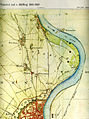
Excerpt from the Tranchot map, North Cologne 1803/20

Floor plan of the medieval city, fortifications by forts and lunettes 1880
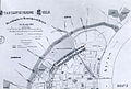
Plan for the city expansion from 1883 with the northern Rheinuferstraße

The 1888 clear design of the Rheinuferstraße


Realizations in the north city

According to the drafts drawn up by the Stübben and Henrici law firm for the expansion of the city , plans that affected the Neustadt in the north were implemented relatively late compared to the other sections. For example, between the old town of Thürmchenswall and the northern outer Wallstrasse, which was later named the Dutch Wall and is now known as Elsa-Brändström-Strasse , the Kaiser-Friedrich-Ufer street, named after the German Kaiser who died in 1888, was parceled out and designed. Following the example of the southern Neustadt, it became a further, generously laid out section of a Rheinuferstraße, which flanked the emerging Neustadt in the northeast. It was based on the example of a Parisian boulevard or at least wanted to be able to compete with other large cities in this respect. However, part of the ramparts and glacis complexes, the preservation of which had been hotly debated, fell victim to the boulevard. These areas, which are very popular with the population as excursion destinations, were planted in 1822/26 by the city gardener Berkenkamp according to plans by the garden architect Maximilian Friedrich Weyhe and have now become building land for economic reasons. Fort XI, which was built in 1841, was retained for the time being. During its construction, the “Riehler Schanze” facility, which was built in 1830, was integrated at the end of the Neustadt area. The fort only became municipal property in 1907.

Kaiser-Friedrich-Ufer
This construction phase was specified by the city council in the development plan in 1895 and 1896 , then finally determined in January 1897 and named Kaiser-Friedrich-Ufer in February 1897. As a section of Rheinuferstraße, the street formed the boundary of the villa district planned in the northern part of the city , which was realized taking into account the requirement of open development .
Street, quay and green areas
Josef Stübben, who was appointed chief engineer for the urban expansion in 1881 , was also appointed head of the urban civil engineering in 1885. In this he was subordinate to the first garden director Anton Strauss, who died in office in 1888, on whose plans the redesign of the entire " Eigelstein Glacis " was based, and to Adolf Kowallek, who succeeded him in office . He revised and completed the plans by Strauss, who had already carried out the design of the southern Rheinuferstraße at the Bayenturm and the ring promenades and prepared plans for the layout of the Kaiser-Friedrich-Ufer.


The focus of Cologne's landscape architecture at the time with regard to the Uferstraße was the planting of an avenue that would separate the laid-out Rhine promenade from the traffic. The city-side sidewalk, the road that was only expanded to four lanes at the end of the 1950s, ran along landscaped borders and other plantings, which can be traced in their planned form from detailed drawings by Kowallek from 1889.
Stübben had the construction of the Rheinuferstraße itself carried out between 1892 and 1898. The protection of the left bank of the Rhine between the corner bastions had to be carried out by four caponiers built from 1891, two of which were erected in the north of the Uferstrasse. After the loss of the First World War, all of the facilities were affected by the forced dismantling and were only preserved as stumps of their base masonry.
The lower area of the Uferstraße was tackled from the city center. This is borne out by photographs from around 1890 showing the concreting of a quay wall, which was installed meter by meter in the river bed north of the railway bridge, thus becoming the foundation of a plateau that was then built. As the postcards that appeared in the 20th century document, the further bend of the Rhine was gradually given a promenade as the lower supply route, which was accessible from above by steep stairs and later via driveways built at an angle to the embankment. The administrative building of the now Prussian Reichsbahn, which was replaced even more voluminously in 1912, was exemplary for the following generation of the other buildings on the banks of the Rhine, which - even if only partially reconstructed after the war - were preserved, structures that still offer the panorama of today's Konrad-Adenauer- Determine the banks.
A photograph from 1916 shows the upper promenade at the level of the railway headquarters in front of an already vigorously grown avenue stretching to the northeast. You can see the hustle and bustle of many visitors to the shore, a number of landing stages, and a horse cab stall with several wagons waiting for customers. There was also a landing stage for today's Cologne-Düsseldorfer .
The endeavors of the city to create additional recreational areas with fresh air and greenery for the population through horticultural design as well as by opening up and keeping the urban bank areas free, was implemented according to the ideas of this time, in which, however, sporting activities were not yet considered.
The years between the world wars
Partial demolition and description of Fort XI
A partial demolition of the military facility is said to have been carried out in 1912. The following recognizable details of the facility were named after a photograph from 1914. "Reduit with Kehltambour: Entrance to the Kehlhof, left stair tower , guard block house, entrance towards Spitzenkaponiere, entrance to Enveloppenhof, gun casemate."
A photo from 1911 shows a similar horseshoe-shaped installation. This makes it clear that the somewhat lower-lying facility at that time was in front of an amusement park that could be seen in the background , from which it was separated by a belt of trees. Further parts of the brickwork core (reduit) can be seen in the illustration, the inner courtyard of which had two- and three-storey buildings on the outside in a semicircle, which were provided with high arched windows on the courtyard side . A high round tower towered over a fortress plateau secured by surrounding balustrades . The inner wall was joined by the throat ditch with its outer wall. The plant remained until 1881 in the possession of the military treasury and went with the other fortifications on the purchase price in urban possession in 1907 after tough negotiations.
New town area of the street
On the Kaiser-Friedrich-Ufer was the Kaisergarten, which was owned by the railway administration before the city was expanded and in which a restaurant was operated. Plans by the railway administration originally provided for the passage of a further "permanent" bridge at this point, and the Kaisergarten was also under discussion at times as a building site for a church. The country houses of the Schmitt-Paffenhausen and Oppenheim families, surrounded by park-like surroundings, lay further north on the Uferstrasse . The residential area there resembled the development of the western side of the Sachsen- or Deutsches Ring, which initially only started sparsely between 1900 and 1906. It only became more concentrated in the 1920s, when, however, the approval for the construction of larger administrative buildings was already granted.
At the level of the Deutsches Ring, today's Theodor-Heuss-Ring, a monument to Emperor Friedrich was erected at the confluence with Rheinuferstraße, for whose design the sculptor Wilhelm Albermann won first prize in a competition in 1899 , but was executed between 1899 and 1899 1903 the design by the sculptor Peter Breuer , which he carried out together with the architect Bruno Schmitz . The memorial was removed in 1945/46 to make way for the construction of the ramp to the so-called Patton Bridge .

Listed railing on the northern upper promenade

Semi-villa built in 1900 with corner tower, risalit and balconies
Bastei restaurant on the stump of a former caponier

Remaining tower of the medieval fortification


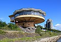
Before the confluence of the Ringstrasse , a building by Wilhelm Riphan was built in 1924 , which he designed in the expanding expressionist architectural style of the German post-war period . His design was based on the existing two-storey substructure of a former Prussian fortress and was named by him as a bastion analogous to this system (mentioned above as caponiers) . As today, the steel construction of the building on top of the building could be entered at ground level from the street side and offered a 180 ° view over the Rhine from the upper floor, which protruded far beyond the supply route to the lower quays. Riphahn's Bastei was run as an exclusive panorama restaurant and on this section of the street remained the only larger structure erected directly on the bank.
Development by Riphahn was also planned for the corner property on the inner city side of the Deutsches Ring and the Uferstraße, but his drawing from 1927 was not carried out. The property was then built on for the first time after 1945.

To the south of the ring, the development of the Uferstraße continues today in an almost closed construction, in which there are a number of buildings from the turn of the century. These include the houses with the numbers 73 ( half-timbered elements and bay windows with hood ) and 71 (slate-covered mansard roof , sandstone facade , bay windows with round arched windows and a round arched portal with integrated skylight ), which, in a four-story construction, adapt to the height of the following old tower.
The small structure called Weckschnapp (see above) escaped the fate of many of the abandoned Cologne gates. The tower had been acquired by the city in 1891 and was then repaired around 1898 according to a design from Stübben under the direction of the architect Sesterhenn at a cost of 15,000 marks.
In 1905, the architect Heinrich Band (1855–1919) designed a four-story house at Uferstrasse 67, which was equipped with an elaborate sandstone facade. After 1918 the building received a carved, massive entrance door that is still preserved today. It came from the building of the Concordia insurance company created by Gustav von Mevissen in 1853 on what was then Eintrachtstrasse.
Old town area of the street

- St. Vinzens House
With the up-and-coming lignite industry, Rheinbraun built an administration building in 1922/23 at the confluence of the Türmchenswall and Rheinuferstraße. The property, which was bought by the St. Vinzens-Haus Foundation in 1977 after war damage , then underwent extensive restoration under the direction of the architect Walter von Lom and was expanded to include new adjacent buildings. The historical main building is not only reminiscent of the representative architecture of that time, but also shows preserved or reconstructed details of a sophisticated design inside.
A little while, by pilasters of marble structured Entrée with curved shell ceiling stucco you get into the actual foyer of the house in the form of a spacious reception area with right-sided reception . The room, paneled all around with fine wood, ends on its narrow side with a stair landing, from whose balustrade railings then lead stairs on both sides to the upper floor. The glazed double doors to the garden area, which are also accessible from the platform, provide the room with daylight. The ceiling of the room is supported by rectangular columns and is one of the rare stucco ceilings in the city. It consists of a large number of transverse beams embedded in plaster. The undersides of the beams are mostly provided with floral ornamentation in the length of the beam, while the ceiling surfaces between the beams are smoothly plastered and round off at their ends. The restored complex was awarded the NRW Architecture Prize by the Association of German Architects in 1985 .
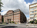
Former administration building of Rheinische Braunkohle AG on the border road from Türmchenswall to Neustadt

St. Kunibert with the pointed towers of the time
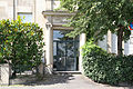
Portal of No. 37

Former building of the Reich and Federal Railway Directorate


In 1912/13 a wide, four-storey building of the Royal Railway Directorate was built on Kaiser-Friedrich-Ufer 3, based on a design by the architects Karl Biecker , Kayser and Martin Kießling , the pillars of which were porticoed in a classic column order . For the President of the Royal Prussian Railway, a representative building was built as a residential building on the adjacent property number 5 between 1906 and 1913.
On the property of the old Kgl. A three-wing building was erected near the railway line leading north to Krefeld and Neuss for the Prussian Railway Directorate. The building was badly damaged during the war and the roof was then only rebuilt in a simplified manner. After Deutsche Bahn moved out of the building, it is still waiting for a new use. In the background on the right the towers of St. Kunibert.


There is also an equestrian statue of Frederick III on the north side of the bridgehead on the left bank of the Hohenzollern Bridge. On the part of the former Kaiser-Friedrich-Ufer that began below the monument were the shunting tracks of the Cologne-Bonn Railway , which had set up its final stop Trankgasse of the Rheinuferbahn on the south side of the cathedral bridge in 1906 . With the growth of road traffic in the 1920s, the shunting operations at the bridge were criticized as being bothersome. The problem was eliminated by the extension of the line, which was put into operation on October 13, 1929 at the opening of the Mülheimer suspension bridge , which was now carried out with stops at the Deutsches Ring and Cologne Zoo up to the Mülheimer Brücke .
Change to today's Konrad-Adenauer-Ufer
Renaming
After the death of the first Federal President Theodor Heuss in 1963, it was decided to rename the German Ring, which runs between Ebertplatz and Rheinuferstraße, to Theodor-Heuss-Ring. The Kaiser-Friedrich-Ufer was named after the well-deserved Cologne native Konrad Adenauer in 1967 after the death of the latter. The former Dutch Wall was also given a new name after 1945 and became Elsa-Brändström-Straße.
Buildings and facilities
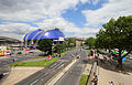
The construction of the Konrad-Adenauer-Ufer begins at its northeast end before the confluence of the Frongasse and directly next to the south side of the zoo bridge, officially inaugurated in November 1966. The foundations of the bridge are on the site on which the Kurfürstengarten garden restaurant was set up in 1887. The two northernmost properties on the Konrad-Adenauer-Ufer are between the bridge and Elsa-Brändström-Straße. Immediately next to the bridge, with the number 115, there is an excursion restaurant that follows on from the "Wattler's Fischerhaus" inn, which opened in 1830. The adjoining area of today's sculpture park has a side entrance and an entrance to the administrative headquarters of the Cologne Sculpture Park Foundation on the Elsa-Brändström-Straße that flows into it. This structure with outbuildings is said to be the remains of a bunker that served as the first youth hostel after the war .

Waterfront at the Bastei

The lower riverside path at the landing stages
Beginning of the Konrad-Adenauer-Ufer


post war period
The damage suffered by the Kunibert Church in World War II was so severe that the church could not be restored until the end of the 1970s. The architect Karl Band , who had already carried out restorations on the church in the 1930s, was mainly involved in this construction work . During this reconstruction, it lost its characteristic pointed helmets of the east towers, which now received pyramid roofs .
In addition to the destruction of the war, from which the street and promenade were not spared, there was another flood disaster in 1948, which also caused great damage in the old town. The ensuing discussions led, at the beginning of the 1950s, to considerations of expanding the existing flood protection systems. To this end, discussions were held about a proposal submitted by Theodor Nussbaum, which provided for the redesign of the entire embankment, and which has now been tackled again. Now sporting activities were planned by expanding and lengthening the promenades so that long hiking trails were created, which were supplemented by bike paths.
After the end of the war, the ship inventory of the Cologne-Düsseldorf company was destroyed. But as early as the spring of 1946 there was a new start in passenger traffic on the Rhine, approved by the English. In December 1958, the bastion was reopened in a slightly modified form after having repaired considerable war damage. However, the restaurant is currently closed for regular operation, but can be rented for events.
Monument protection
On the entire stretch of the Konrad-Adenauer-Ufer, a number of preserved buildings or systems were placed under monument protection in the 1980s.
literature
- Hermann Schmitz: City and Empire, Cologne in Roman times . Volume I, The Beginnings of the City of Cologne and the Ubier . Cologne University Press, Balduin Pick, 1948.
- Hiltrud Kier : The Cologne Neustadt: planning, development, use. - 1st edition - Düsseldorf: Schwann, 1978 - ( Contributions to architectural and art monuments in the Rhineland ; Volume 23), ISBN 3-590-29023-4 .
- Henriette Meynen, in: Werner Adams and Joachim Bauer (eds.): From Botanical Garden to Big City Green - 200 Years of Cologne Green (Stadtspuren - Monmäler in Köln), Volume 30 ', Bachem, Cologne 2001, ISBN 3-7616-1460-8 .
- Henriette Meynen Ed .: Fortress City Cologne. The bulwark in the west . Emons, Cologne 2010 ISBN 3-89705-780-8 .
- Hermann Keussen , Topography of the City of Cologne in the Middle Ages. in 2 volumes. Cologne 1910. Reprint: Droste-Verlag, Düsseldorf 1986, ISBN 3-7700-7560-9 and ISBN 3-7700-7561-7 .
- Hans Vogts , Fritz Witte: The art monuments of the city of Cologne , on behalf of the provincial association of the Rhine province and the city of Cologne. Published by Paul Clemen , Vol. 7, Section IV: The profane monuments of the city of Cologne , Düsseldorf 1930. Verlag L. Schwann, Düsseldorf. Reprint Pedagogischer Verlag Schwann, 1980. ISBN 3-590-32102-4 .
- Peter Glasner: The legibility of the city. Cultural history and lexicon of medieval street names in Cologne. (2 volumes) DuMont, Cologne 2002. ISBN 3-590-32102-4 .
- Joachim Bauer / Carmen Kohls: "Cologne under French and Prussian rule", in: Werner Adams / Joachim Bauer (ed.) "From the Botanical Garden to Urban Green - 200 Years of Cologne Green" (Stadtspuren - Monuments in Cologne, Volume 30) Bachem Verlag , Cologne 2001 ISBN 3-7616-1460-8 .
- Eduard Bündgen: The Cologne-Bonn Railways 1891–1992 . EK-Verlag, Freiburg 1994, ISBN 3-88255-502-5 .
- Manfred Becker-Huberti (ed.): Cologne churches. The churches of the Catholic and Protestant communities in Cologne. Verlag Bachem, Cologne 2004, ISBN 3-7616-1731-3 .
- Carl Dietmar: The Chronicle of Cologne . Chronik-Verl., Dortmund 1991, ISBN 3-611-00193-7 .
- Joachim Brokmeier: The golden corner of Cologne, the entertainment district in Riehl . Sutton Verlag, Erfurt 2009. ISBN 978-3-86680-571-2 .
- Uwe Westfehling: Jakob and Wilhelm Scheiner: Pictures of Cologne's urban development between 1872 and 1922 by Uwe Westfehling, Hugo Borger (eds.) And Heiko Steuer. Verlag Kölnisches Stadt Museum, 1980.
- Uwe Westfehling: Cologne around the turn of the century in pictures by Jakob and Wilhelm Scheiner . Verlag JP Bachem, Cologne 1979. ISBN 3-7616-0509-9 .
- Wilhelm Ewald and Hugo Rahtgens, published in: Paul Clemen, Volume 6: Die Kunstdenkmäler der Stadt Köln. 1906. First Volume IV Dept .: The church monuments of the city of Cologne: St. Alban, St. Andreas, Antoniterkirche, St. Aposteln, St. Cäcilia, St. Columba, St. Cunibert, Elendskirche, St. Georg. Printing and publishing house Schwann, Düsseldorf 1906.
Individual evidence
- ^ Hermann Schmitz: City and Imperium, Cologne in Roman times . Volume I, The beginnings of the city of Cologne and the Ubier , section “Ubic settlements” p. 65 ff
- ↑ Chronicle of the City of Minden http://www.alt-minden.de/klchronik.html ( Memento from March 2, 2007 in the Internet Archive ), accessed on July 22, 2009
- ↑ Manfred Becker-Huberti , Günter A. Menne: Kölner Kirchen, the churches of the Catholic and Protestant communities in Cologne , p. 96
- ↑ Peter Glasner: The legibility of the city. Cultural history and lexicon of medieval street names in Cologne , p. 52 f
- ↑ a b c d e f g h i Hans Vogts , Witte: Die Kunstdenkmäler der Stadt Köln , on behalf of the Provincial Association of the Rhine Province and the City of Cologne. (Ed.) Paul Clemen , Vol. 7, Section IV: The profane monuments of the city of Cologne , city fortifications ff
- ↑ Hermann Keussen, Volume I., pp. 78, 181 ff.
- ^ Hermann Keussen, Topography of the City of Cologne in the Middle Ages , Volume II, p. 158, Col. a
- ↑ a b c d Hermann Keussen, Volume II, Section Niederich District, p. 70 ff.
- ^ Wilhelm Ewald and Hugo Rahtgens, published in: Paul Clemen, Volume 6: Die Kunstdenkmäler der Stadt Köln. 1906. First Volume IV Dept .: The church monuments of the city of Cologne: St. Alban, St. Andreas, Antoniterkirche, St. Aposteln, St. Cäcilia, St. Columba, St. Cunibert, Elendskirche, St. Georg. Printing and publishing house Schwann, Düsseldorf 1906
- ^ City drainage company Cologne
- ^ Otto von Mülmann : Statistics of the government district of Düsseldorf . J. Baedeker, Iserlohn 1867 ( Google Books [accessed July 21, 2012]).
- ^ A b Dieter Klein-Meynen, "Timeline" in: Henriette Meynen: Fortress City of Cologne. The bulwark in the west , p. 510 f
- ^ Historical Archive Cologne, accessed in September 2012
- ^ A b Henriette Meynen: fortress city Cologne. The bulwark in the west , list of persons p. 508
- ↑ Ulrich S. Soenius: Boltenstern. In: Kölner Personenlexikon. P. 72
- ↑ a b c d in: Henriette Meynen: Fortress City of Cologne. The bulwark in the west , p. 44 f
- ^ In: Henriette Meynen: Fortress City of Cologne. The bulwark in the west , section “Free field of fire, the rayon regulations” p. 359 f
- ^ In: Henriette Meynen: Fortress City Cologne. The Bulwark in the West , p. 266
- ^ Karl Georg Jacob, Matthias Joseph de Noël , Johann Jacob Nöggerath (anonymous): Cologne and Bonn with their surroundings. For strangers and locals. Edited from the best and especially from unused sources . Cologne, JP Bachem Verlag, 1928. Quoted and commented in: Uwe Westfehling: The first Cologne city guide from 1828 , Cologne, JP Bachem Verlag 1982, p. 160 ff.
- ↑ Henriette Meynen in: Joachim Bauer / Carmen Kohls and Henriette Meynen: "Cologne under French and Prussian rule", section Eigelstein-Glacis p. 29
- ↑ Peter Glasner: The legibility of the city. Cultural history and lexicon of medieval street names in Cologne , p. 222
- ↑ Henriette Meynen, "The bank fortification on the left bank of the Rhine". In: Henriette Meynen: Fortress City Cologne. The bulwark in the west , p. 262 ff
- ↑ B. Wacker, "Expansion of the Railway". In: Henriette Meynen: Fortress City Cologne. The bulwark in the west , p. 39 f
- ^ A b c Peter Sievert, "Chronological sequence of the New Prussian fortifications on both sides of the Rhine", in: Henriette Meynen: Festungsstadt Köln. The bulwark in the west , p. 83 f
- ^ Hiltrud Kier , Die Kölner Neustadt Planning, Development, Use . Section “Cologne as a fortress city” p. 36
- ↑ Joachim Bauer / Carmen Kohls and Henriette Meynen: "Cologne under French and Prussian rule", p. 21 ff
- ↑ a b Andreas Kupka, "The Rhine-side city fortifications in Prussian times", in: Henriette Meynen: Festungsstadt Köln. The bulwark in the west , p. 266 f
- ↑ Joachim Brokmeier, "The golden corner of Cologne, The Amüsierviertel in Riehl", p. 10
- ^ Henriette Meynen: fortress city Cologne. The bulwark in the west , list of persons p. 507 f
- ^ Hiltrud Kier: The Cologne Neustadt planning, development, use , the competition in 1880…. , P. 38 ff
- ↑ a b c d Hiltrud Kier: Die Kölner Neustadt planning, development, use , alphabetical directory of streets, squares and parks , p. 123 ff
- ↑ Hiltrud Kier: Die Kölner Neustadt planning, development, use , Cologne as a fortress city, p. 35 f
- ↑ Joachim Bauer / Carmen Kohls: "Cologne under French and Prussian rule", in: "The beginnings of the city green", p. 21 f
- ^ Hiltrud Kier: Die Kölner Neustadt planning, development, use , p. 88 and map volume. General plan for Cologne city expansion by city architect J. Stübben in 1883 and map 25 from 1888
- ↑ Joachim Bauer / Carmen Kohls: "Cologne under French and Prussian rule", in: "Municipal self-government in the growing city", p. 32 ff
- ↑ Description based on a photograph of Fort XI from 1911. Photo RBA Cologne, archive no. 136403 in: Hiltrud Kier, Die Kölner Neustadt planning, development, use . Section “Cologne as a fortress city” p. 36 and picture credits. P. 217
- ^ Hiltrud Kier: Die Kölner Neustadt: planning, emergence, use, pp. 188, 190, 201 with reference to Thieme-Becker
- ^ Information from the City of Cologne
- ↑ Hiltrud Kier: Die Kölner Neustadt: Planning, Development, Use, p. 177, footnote 599
- ↑ According to Kier, resident around 1930 in Cologne, Alteburger Strasse 42/46
- ↑ 125 years of the St. Vinzens House Foundation (publisher), Cologne.
- ↑ Eduard Bündgen: The Cologne-Bonn Railways 1891-1992 , p.81
- ↑ Manfred Becker-Huberti (ed.): Cologne churches. The churches of the Catholic and Protestant communities in Cologne , St. Kunibert p. 96 f
- ↑ Fleet without ships ( Memento from April 24, 2014 in the Internet Archive ) (Bonner Generalanzeiger from March 30, 2005, accessed November 2014)
- ^ Carl Dietmar: Die Chronik Kölns , p. 463
- ↑ Bastei Cologne