Monswiller
| Monswiller | ||
|---|---|---|

|
|
|
| region | Grand Est | |
| Department | Bas-Rhin | |
| Arrondissement | Saverne | |
| Canton | Saverne | |
| Community association | Pays de Saverne | |
| Coordinates | 48 ° 45 ' N , 7 ° 23' E | |
| height | 173-227 m | |
| surface | 4.72 km 2 | |
| Residents | 2,077 (January 1, 2017) | |
| Population density | 440 inhabitants / km 2 | |
| Post Code | 67700 | |
| INSEE code | 67302 | |
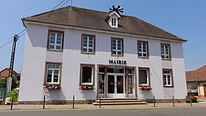
 Mairie Monswiller |
||
Monswiller ( German Monsweiler ) is an Alsatian municipality with 2077 inhabitants (as of January 1, 2017) in the Bas-Rhin department in the Grand Est region (until 2015 Alsace ) in France .
geography
The place is on the Rhine-Marne Canal just three kilometers northeast of Saverne .
Population development
| 1962 | 1968 | 1975 | 1982 | 1990 | 1999 | 2006 | 2017 |
|---|---|---|---|---|---|---|---|
| 1454 | 1506 | 1760 | 1779 | 1757 | 1800 | 2076 | 2077 |
See also
literature
- Le Patrimoine des Communes du Bas-Rhin. Flohic Editions, Volume 2, Charenton-le-Pont 1999, ISBN 2-84234-055-8 , pp. 1122-1125.
Web links
Commons : Monswiller - Collection of images, videos and audio files

