Paulx
|
Paulx Palud |
||
|---|---|---|

|
|
|
| region | Pays de la Loire | |
| Department | Loire-Atlantique | |
| Arrondissement | Nantes | |
| Canton | Machecoul | |
| Community association | Sud Retz Atlantique | |
| Coordinates | 46 ° 58 ′ N , 1 ° 45 ′ W | |
| height | 4–51 m | |
| surface | 35.92 km 2 | |
| Residents | 1,981 (January 1, 2017) | |
| Population density | 55 inhabitants / km 2 | |
| Post Code | 44270 | |
| INSEE code | 44119 | |
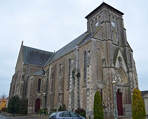
 Saint-Pierre church |
||
Paulx ( Breton : Palud ) is a French municipality with 1,981 inhabitants (as of January 1 2017) in the department of Loire-Atlantique in the Region Pays de la Loire . Paulx belongs to the Arrondissement of Nantes and the Canton of Machecoul . The inhabitants are called Palucéens .
geography
Paulx is located on the border of the Pays de Retz and Pays de Nantais landscapes about 30 kilometers southwest of Nantes . The Tenu River limits the community in the northeast. Paulx is surrounded by the neighboring communities Machecoul-Saint-Même in the north and west, La Marne in the northeast, Saint-Étienne-de-Mer-Morte in the east and southeast, La Garnache in the south and southwest and Bois-de-Céné in the west and Southwest.
Population development
| year | 1946 | 1954 | 1962 | 1968 | 1975 | 1982 | 1990 | 1999 | 2006 | 2012 |
|---|---|---|---|---|---|---|---|---|---|---|
| Residents | 1,521 | 1,540 | 1,574 | 1,516 | 1,382 | 1,348 | 1.311 | 1,355 | 1,779 | 1.938 |
Attractions
- Saint-Pierre church, rebuilt in 1875
- Notre-Dame chapel in Le Pont from the 19th century
- Saint Clair Chapel in La Patelière from the 18th century
- Houses Ilaire, La Patelière (all from the 19th century) and Girairière
- La Choltière castle with chapel from 1749
- Ten mills from the 19th century
literature
- Le Patrimoine des Communes de la Loire-Atlantique . Flohic Editions, Volume 1, Charenton-le-Pont 1999, ISBN 2-84234-040-X , pp. 558-561.
Web links
Commons : Paulx - collection of images, videos and audio files
