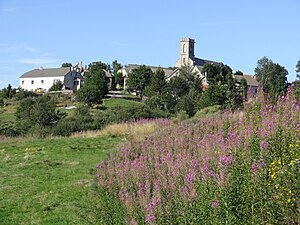
Sagnes-et-Goudoulet
| Sagnes-et-Goudoulet | ||
|---|---|---|
|
|
||
| region | Auvergne-Rhône-Alpes | |
| Department | Ardèche | |
| Arrondissement | Largentière | |
| Canton | Haute-Ardèche | |
| Community association | Montagne d'Ardèche | |
| Coordinates | 44 ° 47 ' N , 4 ° 14' E | |
| height | 1,080-1,527 m | |
| surface | 25.02 km 2 | |
| Residents | 117 (January 1, 2017) | |
| Population density | 5 inhabitants / km 2 | |
| Post Code | 07450 | |
| INSEE code | 07203 | |
 Sagnes-et-Goudoulet |
||
Sagnes-et-Goudoulet is a French commune in Ardèche, in the region of Auvergne Rhône-Alpes . It belongs to the canton of Haute-Ardèche in the Arrondissement Largentière . Sagnes-et-Goudoulet is located 1240 meters above sea level. Neighboring municipalities are Sainte-Eulalie in the northwest, Saint-Martial in the north, Saint-Andéol-de-Fourchades in the northeast, Lachamp-Raphaël in the east, Péreyres in the southeast, Burzet in the south and Usclades-et-Rieutord in the southwest.
Population development
| year | 1962 | 1968 | 1975 | 1982 | 1990 | 1999 | 2008 | 2014 |
|---|---|---|---|---|---|---|---|---|
| Residents | 369 | 322 | 198 | 182 | 146 | 131 | 134 | 125 |
Web links
Commons : Sagnes-et-Goudoulet - collection of images, videos and audio files

