Saint-Pierre-de-Colombier
| Saint-Pierre-de-Colombier | ||
|---|---|---|
|
|
||
| region | Auvergne-Rhône-Alpes | |
| Department | Ardèche | |
| Arrondissement | Largentière | |
| Canton | Haute-Ardèche | |
| Community association | Ardèche des Sources et Volcans | |
| Coordinates | 44 ° 42 ′ N , 4 ° 16 ′ E | |
| height | 360-1,062 m | |
| surface | 9.43 km 2 | |
| Residents | 411 (January 1, 2017) | |
| Population density | 44 inhabitants / km 2 | |
| Post Code | 07450 | |
| INSEE code | 07282 | |
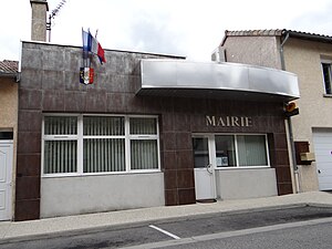
 Mairie Saint-Pierre-de-Colombier |
||
Saint-Pierre-de-Colombier is a French commune in Ardèche, in the region of Auvergne Rhône-Alpes . It belongs to the canton of Haute-Ardèche and the canton of Largentière . The residents call themselves Colombièrois.
geography
The Bourges flows into the Fontolière at Saint-Pierre-de-Colombier as a left tributary . Neighboring municipalities are Burzet in the north, Labastide-sur-Bésorgues in the northeast, Juvinas in the east, Chirols in the southeast, Meyras in the south, Thueyts in the southwest and Montpezat-sous-Bauzon in the west.
Population development
| year | 1962 | 1968 | 1975 | 1982 | 1990 | 1999 | 2008 | 2014 |
|---|---|---|---|---|---|---|---|---|
| Residents | 546 | 454 | 373 | 385 | 388 | 382 | 390 | 411 |
| Source: Cassini and INSEE | ||||||||
Attractions
- 19th century church Saint-Pierre
- Schoolhouse from 1890
Web links
Commons : Saint-Pierre-de-Colombier - Collection of images, videos and audio files
