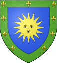
Les Vans
| Les Vans | ||
|---|---|---|

|
|
|
| region | Auvergne-Rhône-Alpes | |
| Department | Ardèche | |
| Arrondissement | Largentière | |
| Canton | Les Cévennes Ardéchoises | |
| Community association | Pays des Vans en Cévennes | |
| Coordinates | 44 ° 24 ' N , 4 ° 8' E | |
| height | 126-948 m | |
| surface | 31.09 km 2 | |
| Residents | 2,672 (January 1, 2017) | |
| Population density | 86 inhabitants / km 2 | |
| Post Code | 07140 | |
| INSEE code | 07334 | |
| Website | www.les-vans.com | |
 Les Vans from the south-west |
||
Les Vans is a French commune with 2,672 inhabitants (as of January 1, 2017) in the Ardèche department . It is located south of the Chassezac river on the edge of the Cevennes . The place is considered the gateway to the Regional Natural Park of Monts d'Ardèche ( Parc naturel régional des Monts d'Ardèche ).
Population development
| 1962 | 1968 | 1975 | 1982 | 1990 | 1999 | 2006 | 2016 |
|---|---|---|---|---|---|---|---|
| 1,692 | 2,034 | 2,325 | 2,570 | 2,668 | 2,664 | 2,827 | 2,679 |
| Source: INSEE | |||||||
Personalities
- Louis (Xavier Edouard) Léopold Ollier (1830–1900), surgeon and orthopedic surgeon, ao descriptor of Ollier's syndrome .
- Bernadette Perrin-Riou (* 1955), French mathematician
Web links
Commons : Les Vans - Collection of images, videos and audio files
- Les Vans en Ardèche, an environnement exceptionnel. Photos of the region
- Les Vans en Ardèche
- Site de l'office de Tourisme du Pays des Vans
- Village des Vans
Individual evidence
- ↑ Les Vans on the Insee website at INSEE , 2006: insee.fr ; only residents with primary residence
- ↑ Barbara I. Tshisuaka: Ollier, Louis Xavier Edouard Léopold. In: Werner E. Gerabek , Bernhard D. Haage, Gundolf Keil , Wolfgang Wegner (eds.): Enzyklopädie Medizingeschichte. De Gruyter, Berlin / New York 2005, ISBN 3-11-015714-4 , p. 1069.
