St. Clair County, Missouri
 St. Clair County Courthouse |
|
| administration | |
|---|---|
| US state : | Missouri |
| Administrative headquarters : | Osceola |
| Address of the administrative headquarters: |
County Courthouse P.O. Box 525 Osceola, MO 64776-0525 |
| Foundation : | 1841 |
| Area code : | 001 417 |
| Demographics | |
| Residents : | 9805 (2010) |
| Population density : | 5.6 inhabitants / km 2 |
| geography | |
| Total area : | 1818 km² |
| Water surface : | 65 km² |
| map | |
| Website : stclaircountymissouri.com | |
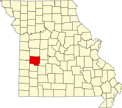
The St. Clair County is a county in the US -amerikanischen State Missouri . In 2010 , the county had 9,805 residents and a population density of 5.6 people per square kilometer. The county seat is Osceola , named after the Seminole chief Osceola .
geography
The county is located in the Northern Ozarks in western Missouri. It is approximately 50 km from Kansas and covers an area of 1,818 square kilometers, of which 65 square kilometers are water.
The county is crossed by the Osage River . In Warsaw in neighboring Benton County , the river is dammed up to form Truman Lake , which extends far into St. Clair County.
The following neighboring counties border St. Clair County:
| Bates County | Henry County | Benton County |

|
Hickory County | |
| Vernon County | Cedar County | Polk County |
history
| Population development | |||
|---|---|---|---|
| Census | Residents | ± in% | |
| 1850 | 3556 | - | |
| 1860 | 6812 | 91.6% | |
| 1870 | 6742 | -1 % | |
| 1880 | 14,125 | 109.5% | |
| 1890 | 16,747 | 18.6% | |
| 1900 | 17,907 | 6.9% | |
| 1910 | 16,412 | -8.3% | |
| 1920 | 15,341 | -6.5% | |
| 1930 | 13,289 | -13.4% | |
| 1940 | 13,146 | -1.1% | |
| 1950 | 10,482 | -20.3% | |
| 1960 | 8421 | -19.7% | |
| 1970 | 7667 | -9% | |
| 1980 | 8622 | 12.5% | |
| 1990 | 8457 | -1.9% | |
| 2000 | 9652 | 14.1% | |
| 2010 | 9805 | 1.6% | |
| Before 1900 1900–1990 2000 2010 | |||
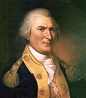
St. Clair County was formed in 1841. It was named after Arthur St. Clair (1736-1818), a general in the Continental Army in the American War of Independence and later the first governor of the Northwest Territory (1788-1802).
Demographic data
According to the 2010 census , St. Clair County had 9,805 people in 4,320 households. The population density was 5.6 inhabitants per square kilometer. Statistically, 2.24 people lived in each of the 4,320 households.
The racial the population was composed of 96.5 percent white, 0.5 percent African American, 0.7 percent Native American, 0.1 percent Asian and other ethnic groups; 1.8 percent were descended from two or more races. Hispanic or Latino of any race was 1.7 percent of the population.
20.0 percent of the population were under 18 years old, 56.6 percent were between 18 and 64 and 23.4 percent were 65 years or older. 49.5 percent of the population was female.
The median income for a household was 32,217 USD . The per capita income was $ 18,309. 16.6 percent of the population lived below the poverty line.
St. Clair County localities
structure
St. Clair County is divided into 16 townships :
|
|
See also
Individual evidence
- ↑ GNIS-ID: 758547. Retrieved on February 22, 2011 (English).
- ↑ a b c U.S. Census Bureau, State & County QuickFacts - St. Clair County, MO. Retrieved November 19, 2012
- ^ A b National Association of Counties.Retrieved November 19, 2012
- ^ US Census Bureau - Census of Population and Housing.Retrieved March 15, 2011
- ^ Extract from Census.gov.Retrieved February 18, 2011
- ↑ Missouri Census Data Center ( page no longer available , search in web archives ) Info: The link was automatically marked as defective. Please check the link according to the instructions and then remove this notice. Retrieved November 19, 2012
Web links
Coordinates: 38 ° 2 ′ N , 93 ° 46 ′ W

