Athies (Pas-de-Calais)
| Athies | ||
|---|---|---|

|
|
|
| region | Hauts-de-France | |
| Department | Pas-de-Calais | |
| Arrondissement | Arras | |
| Canton | Arras-2 | |
| Community association | Arras | |
| Coordinates | 50 ° 18 ′ N , 2 ° 50 ′ E | |
| height | 47-103 m | |
| surface | 4.34 km 2 | |
| Residents | 1,014 (January 1, 2017) | |
| Population density | 234 inhabitants / km 2 | |
| Post Code | 62223 | |
| INSEE code | 62042 | |
| Website | http://www.athies.fr/ | |
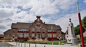
 Town Hall ( Mairie ) of Athies |
||
Athies is a French commune with 1,014 inhabitants (as of January 1 2017) in the department of Pas-de-Calais in the region of Hauts-de-France . The municipality belongs to the Arrondissement Arras and the canton Arras-2 (until 2015: canton Arras-Nord ). The inhabitants are called Athésiens .
geography
Athies is four kilometers east-northeast of the city center of Arras on the canalized Scarpe , which forms the southern municipal boundary. Athies is surrounded by the neighboring communities of Bailleul-Sir-Berthoult in the north, Gavrelle in the northeast, Fampoux in the south and east, Feuchy in the south and Saint-Laurent-Blangy in the west.
Population development
| year | 1962 | 1968 | 1975 | 1982 | 1990 | 1999 | 2006 | 2013 |
|---|---|---|---|---|---|---|---|---|
| Residents | 669 | 695 | 697 | 719 | 969 | 930 | 985 | 986 |
| Source: Cassini and INSEE | ||||||||
Attractions
- Saint-Christophe Church
- Memorial to the dead of wars
Web links
Commons : Athies - collection of images, videos and audio files

