Butler County, Missouri
 Butler County Courthouse |
|
| administration | |
|---|---|
| US state : | Missouri |
| Administrative headquarters : | Poplar Bluff |
| Address of the administrative headquarters: |
County Courthouse 105 Main Street Poplar Bluff, MO 63901-0000 |
| Foundation : | February 27, 1849 |
| Made up from: | Wayne County |
| Area code : | 001 573 |
| Demographics | |
| Residents : | 42,794 (2010) |
| Population density : | 23.7 inhabitants / km 2 |
| geography | |
| Total area : | 1810 km² |
| Water surface : | 4 km² |
| map | |
| Website : butler.countyportal.net | |
The Butler County is a county in the US -amerikanischen State Missouri . In 2010 , the county had 42,794 residents and a population density of 23.7 people per square kilometer. The county seat is Poplar Bluff , named after the poplars that grow here .
geography
The county is located almost in the extreme southeast of Missouri on the western bank of the St. Francis River , a right tributary of the Mississippi . It borders Arkansas to the south and has an area of 1,810 square kilometers, of which four square kilometers are water. The following neighboring counties border Butler County:
| Carter County | Wayne County | |
| Ripley County |

|
Stoddard County |
|
Clay County, Arkansas |
Dunklin County |
history
| Population development | |||
|---|---|---|---|
| Census | Residents | ± in% | |
| 1850 | 1616 | - | |
| 1860 | 2891 | 78.9% | |
| 1870 | 4298 | 48.7% | |
| 1880 | 6011 | 39.9% | |
| 1890 | 10.164 | 69.1% | |
| 1900 | 16,769 | 65% | |
| 1910 | 20,624 | 23% | |
| 1920 | 24.106 | 16.9% | |
| 1930 | 23,697 | -1.7% | |
| 1940 | 34,276 | 44.6% | |
| 1950 | 37,707 | 10% | |
| 1960 | 34,656 | -8.1% | |
| 1970 | 33,529 | -3.3% | |
| 1980 | 37,693 | 12.4% | |
| 1990 | 38,765 | 2.8% | |
| 2000 | 40,867 | 5.4% | |
| 2010 | 42,794 | 4.7% | |
| Before 1900 1900–1990 2000 2010 | |||
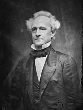
Butler County was formed on February 27, 1849 from parts of Wayne County. It was named after William Orlando Butler , a member of the US Congress and candidate for the office of US Vice President . On June 18, 1849, the district court met for the first time.
23 buildings and sites in the county are listed on the National Register of Historic Places (as of February 5, 2018).
Demographic data
According to the 2010 census , Butler County had 42,794 people in 16,821 households. The population density was 23.7 inhabitants per square kilometer. Statistically, 2.38 people lived in the 16,821 households.
The racial the population was composed of 90.8 percent white, 5.3 percent African American, 0.5 percent Native American, 0.7 percent Asian and other ethnic groups; 2.2 percent were descended from two or more races. Hispanic or Latino of any race was 1.6 percent of the population.
23.3 percent of the population were under 18 years old, 59.7 percent were between 18 and 64 and 17.0 percent were 65 years or older. 51.8 percent of the population was female.
The median income for a household was 31,920 USD . The per capita income was $ 19,039. 23.1 percent of the population lived below the poverty line.
Butler County localities
structure
Butler County is divided into ten townships :
| Township | Population (2010) |
FIPS |
|---|---|---|
| Ash Hill Township | 3349 | 29-02224 |
| Beaver Dam Township | 4473 | 29-03826 |
| Black River Township | 1665 | 29-06076 |
| Cane Creek Township | 468 | 29-11044 |
| Coon Island Township | 187 | 29-16264 |
| Epps Township | 3171 | 29-22492 |
| Gillis Bluff Township | 683 | 29-27046 |
| Neely Township | 1126 | 29-51392 |
| Poplar Bluff Township | 25,878 | 29-59114 |
| St. Francois Township | 1794 | 29-64262 |
See also
Individual evidence
- ↑ GNIS-ID: 758466. Retrieved on February 22, 2011 (English).
- ↑ a b c U.S. Census Bureau, State & County QuickFacts - Butler County, MO. Retrieved October 6, 2012
- ^ A b National Association of Counties.Retrieved October 6, 2012
- ^ US Census Bureau - Census of Population and Housing.Retrieved March 15, 2011
- ^ Extract from Census.gov.Retrieved February 18, 2011
- ↑ Search mask database in the National Register Information System. National Park Service , accessed February 5, 2018.
- ↑ Missouri Census Data Center ( page no longer available , search in web archives ) Info: The link was automatically marked as defective. Please check the link according to the instructions and then remove this notice. Retrieved October 6, 2012
Web links
Coordinates: 36 ° 43 ′ N , 90 ° 24 ′ W

