
Fuchshofen
| coat of arms | Germany map | |
|---|---|---|

|
Coordinates: 50 ° 26 ' N , 6 ° 51' E |
|
| Basic data | ||
| State : | Rhineland-Palatinate | |
| County : | Ahrweiler | |
| Association municipality : | Adenau | |
| Height : | 262 m above sea level NHN | |
| Area : | 2.84 km 2 | |
| Residents: | 94 (Dec. 31, 2019) | |
| Population density : | 33 inhabitants per km 2 | |
| Postal code : | 53533 | |
| Area code : | 02693 | |
| License plate : | AW | |
| Community key : | 07 1 31 022 | |
| Association administration address: | Kirchstrasse 15 53518 Adenau |
|
| Website : | ||
| Local Mayor : | Bernd Schmitz | |
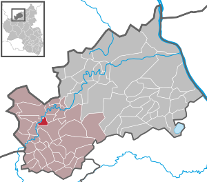
| Location of the local community of Fuchshofen in the Ahrweiler district | ||
  |
||

Fuchshofen is a municipality in the Ahrweiler district in Rhineland-Palatinate . It belongs to the Adenau community .

geography
Fuchshofen is eight kilometers northwest of the city of Adenau on the right side of the Ahr . The village extends over a steeply sloping terrain from south to north and includes altitudes between 265 m above sea level. NHN and 310 m above sea level NHN . Immediately to the northeast rises above the Ahr valley the Schellenberg ( 325 m above sea level ), southeast of the mountain ridge of the Eulenkopf ( 467 m above sea level ). The municipality can naturally be assigned to the Dümpelfelder Ahr valley .
history
Earlier today neighboring community formed Reifferscheid with Fuchshofen own community that until 1794 the Electoral Cologne office Nuerburg belonged. The time when Fuchshofen was first settled is unknown, but it is assumed that it was Roman or Frankish times. The place could not be documented until 1768, when the Reifferscheider miller Johann Michael asked the government in a letter for permission to build a grinding and oil mill in Fuchshofen . The letter shows that the village called “Voishof” consists of seven houses and does not have a grinding mill, which is why the permit to build one was granted immediately.
At the beginning of the 19th century the citizens of Fuchshofen tried to end their affiliation to Reifferscheid when they requested the separation from Reifferscheid and the formation of their own community. At the hearing of deputies from both places in 1839 before the district government in Koblenz , no agreement was reached. After all, it was not until after 1862 that Fuchshofens became a separate municipality, after the dispute over the properties, lands and forests had been settled.
In 1909 the Dümpelfeld – Lissendorf railway line was built, with Fuchshofen also involved and a tunnel being built in the community. Numerous railway workers died in the flood in 1910. The Fuchshofener Brücke partially collapsed when a canteen shattered on it.
During the Second World War , V1 and V2 rockets were deposited in the Fuchshofener tunnel on the railway line and later shot down from Tondorf , Rohr and Lommersdorf . Due to the strategically important location of Fuchhofen during the war, 80% of the houses in the village were destroyed.
- Population development
The development of the population of Fuchshofen, the values up to 1987 are based on censuses:
|
|

politics
Municipal council
The council in Fuchshofen consists of six council members, who in the local elections on May 26, 2019 in a majority vote were elected, and the honorary mayor as chairman.
mayor
Bernd Schmitz became mayor of Fuchshofen on July 8, 2019. Since there was no candidate in the direct election on May 26, 2019, the upcoming election of the mayor was incumbent on the council, which decided in favor of Schmitz.
Schmitz's predecessor as local mayor from 1999 to 2019 was Wolfgang Heinisch.
Attractions

In the 18th century, foundations provided for the establishment of a chapel ; The money was initially used to support a winter teacher. Finally, in 1874, the branch church St. Josef was built .
Web links
- Local community Fuchshofen
- Literature about Fuchshofen in the Rhineland-Palatinate State Bibliography
Individual evidence
- ↑ State Statistical Office of Rhineland-Palatinate - population status 2019, districts, communities, association communities ( help on this ).
- ↑ State Statistical Office Rhineland-Palatinate - regional data
- ^ The Regional Returning Officer Rhineland-Palatinate: Local elections 2019, city and municipal council elections
- ^ The Regional Returning Officer Rhineland-Palatinate: direct elections 2019. see Adenau, Verbandsgemeinde, ninth line of results. Retrieved August 7, 2020 .
- ↑ Administration. Fuchshofen community, accessed on August 7, 2020 .
- ↑ Fear in the VG Adenau: Many mayors no longer continue. Wolfgang Heinisch. In: Rhein-Zeitung. Mittelrhein-Verlag GmbH, Koblenz, March 29, 2019, accessed on August 8, 2020 .

Cities: Adenau | Bad Breisig | Bad Neuenahr-Ahrweiler (seat of the district administration) | Niederzissen | Remagen | Sinzig
Municipalities: Ahrbrück | Altenahr | Antweiler | Aremberg | Barweiler | Bauler | Berg (near Ahrweiler) | Brenk | Brohl-Lützing | Burgbrohl | Dankerath | Dedenbach | Dernau | Dorsel | Dümpelfeld | Eichenbach | Fuchshofen | Galenberg | Glees | Gönnersdorf (near Bad Breisig) | County (Rhineland) | Harscheid (near Adenau) | Heckenbach | Herschbroich | Hoffeld (Eifel) | Hohenleimbach | Honerath | Hönningen | Bumblebee | Insul | Kalenborn (near Altenahr) | Kaltenborn | Kempenich | Kesseling | Kirchsahr | Königsfeld (Eifel) | Kottenborn | Leimbach (near Adenau) | Lind (near Altenahr) | Mayschoss | Meuspath | Müllenbach (near Adenau) | Müsch | Niederduerenbach | Nürburg | Oberduerenbach | Oberzissen | Ohlenhard | Pomster | Quiddelbach | Rech | Reifferscheid | Rodder | Schalkenbach | Guilt (Ahr) | Senscheid | Sierscheid | Spessart (Brohltal) | Trierscheid | Waldorf | Wassenach | Weir | Weibern (Eifel) | Wershofen | Wiesemscheid | Wimbach | Winnerath | Throws