List of states in the United States by height
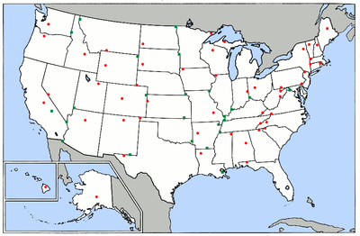
The list of states of the United States by altitude includes the highest and lowest points of the 50 states of the United States and the District of Columbia . It also provides information about their mean heights and the height difference between the highest and lowest point in the state.
5,500 square kilometers of the United States (approximately 0.05% of the national territory) is below sea level . This corresponds to about twice the area of the Saarland. 52,400 square kilometers (approx. 0.5% of the national territory) are located at an altitude of over 3,000 m, which roughly corresponds to the area of North Rhine-Westphalia and Rhineland-Palatinate combined.
Which state is highest and which state is lowest depends on the definition. Alaska , for example, can be considered the highest state, because Alaska's highest mountain, Denali , is the highest mountain in the United States at 6,168 m. Colorado can also be seen as the highest state, as it has the highest mean altitude and the highest lowest point of any US state. The situation is similar when naming the lowest state. In Death Valley in California, the deepest point in the US is 86 m below sea level, while Florida the lowest maximum collection and Delaware has the smallest average height. Florida is also the flattest state, because that's where the difference between the highest and lowest points is the smallest.
list
| State | The highest point | height | Image of the highest point | Lowest point | height | Average height |
Height difference |
|---|---|---|---|---|---|---|---|
|
|
Cheaha Peak | 736 m | Gulf of Mexico | Sea level | 150 m | 736 m | |
|
|
Denali | 6,168 m | Gulf of Alaska , Bering Sea , Arctic Ocean | Sea level | 580 m | 6,168 m | |
|
|
Humphreys Peak | 3,852 m | Colorado River on the Mexican border in San Louis | 22 m | 1,250 m | 3,830 m | |
|
|
Mount Magazine | 839 m | Ouachita River on the Louisiana border | 17 m | 200 m | 822 m | |
|
|
Mount Elbert | 4,401 m | Arikaree River on the Kansas border | 1,011 m | 2,070 m | 3,390 m | |
|
|
Massachusetts border on the southern slopes of Mount Frissell | 725 m | Long Island Sound | Sea level | 150 m | 725 m | |
|
|
Ebright azimuth | 137 m | Atlantic Ocean | Sea level | 20 m | 137 m | |
|
|
Fort Reno Park | 125 m | Potomac River on the eastern border with Maryland | 0.3 m | 50 m | 124 m | |
|
|
Britton Hill | 105 m | Atlantic Ocean and Gulf of Mexico | Sea level | 30 m | 105 m | |
|
|
Brasstown Soon | 1,458 m | Atlantic Ocean | Sea level | 180 m | 1,458 m | |
|
|
Mauna Kea | 4,207 m | Pacific Ocean | Sea level | 920 m | 4,207 m | |
|
|
Borah Peak | 3,861 m | Confluence of the Snake River and Clearwater River | 217 m | 1,520 m | 3,644 m | |
|
|
Charles Mound | 376 m | Confluence of the Mississippi Rivers and Ohio Rivers | 85 m | 180 m | 291 m | |
|
|
Hoosier Hill | 383 m | Confluence of the Ohio River and Wabash River | 97 m | 210 m | 286 m | |
|
|
Hawkeye Point | 509 m | Confluence of the Mississippi River and Des Moines River | 146 m | 340 m | 363 m | |
|
|
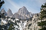
Mount Whitney | 4,421 m | Badwater in Death Valley | −86 m | 880 m | 4,507 m | |
|
|
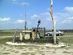
Mount Sunflower | 1,231 m | Verdigris River on the Oklahoma border | 207 m | 610 m | 1,024 m | |
|
|
Black Mountain | 1,263 m | Mississippi River on the Kentucky Bend | 78 m | 230 m | 1,185 m | |
|
|
Mount Driskill | 163 m | New Orleans | −2.4 m | 30 m | 165 m | |
|
|
Mount Katahdin | 1,606 m | Atlantic Ocean | Sea level | 180 m | 1,606 m | |
|
|
Hoye Crest | 1,024 m | Atlantic Ocean | Sea level | 107 m | 1,024 m | |
|
|
Mount Greylock | 1,064 m | Atlantic Ocean | Sea level | 150 m | 1,064 m | |
|
|
Mount Arvon | 603 m | Lake Erie | 174 m | 274 m | 429 m | |
|
|
Eagle Mountain | 701 m | Lake Superior | 183 m | 370 m | 518 m | |
| Mississippi | Woodall Mountain | 246 m | Gulf of Mexico | Sea level | 90 m | 246 m | |
|
|
Taum Sauk Mountain | 540 m | Saint Francis River on the Arkansas border | 70 m | 240 m | 470 m | |
|
|
Granite Peak | 3,904 m | Kootenai River on the Idaho border | 550 m | 1,040 m | 3,354 m | |
|
|
Panorama Point | 1,653 m | Missouri River on the Kansas border | 256 m | 790 m | 1,397 m | |
|
|
Boundary Peak | 4,007 m | Colorado River on the California border | 147 m | 1,680 m | 3,860 m | |
|
|
Mount Washington | 1,917 m | Atlantic Ocean | Sea level | 300 m | 1,917 m | |
|
|
High point | 550 m | Atlantic Ocean | Sea level | 80 m | 550 m | |
|
|
Wheeler Peak | 4,013 m | Red Bluff Reservoir on the Texas border | 867 m | 1,740 m | 3,146 m | |
|
|
Mount Marcy | 1,629 m | Atlantic Ocean | Sea level | 300 m | 1,629 m | |
|
|
Mount Mitchell | 2,037 m | Atlantic Ocean | Sea level | 210 m | 2,037 m | |
|
|
White Butte | 1,069 m | Red River of the North on the Canadian border | 229 m | 580 m | 840 m | |
|
|
Campbell Hill | 472 m | Ohio River on the Indiana border | 139 m | 260 m | 333 m | |
|
|
Black Mesa | 1,516 m | Little River on the Arkansas border | 88 m | 400 m | 1,428 m | |
|
|
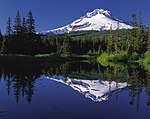
Mount Hood | 3,425 m | Pacific Ocean | Sea level | 1,000 m | 3,425 m | |
|
|
Mount Davis | 979 m | Delaware River on the Delaware border | Sea level | 340 m | 979 m | |
|
|
Jerimoth Hill | 247 m | Atlantic Ocean | Sea level | 60 m | 247 m | |
|
|
Sassafras Mountain | 1,085 m | Atlantic Ocean | Sea level | 110 m | 1,085 m | |
|
|
Harney Peak | 2,208 m | Big Stone Lake on the Minnesota border | 295 m | 670 m | 1,913 m | |
|
|
Clingman's Dome | 2,025 m | Mississippi River on the Mississippi border | 54 m | 270 m | 1,971 m | |
|
|
Guadalupe Peak | 2,667 m | Gulf of Mexico | Sea level | 520 m | 2,667 m | |
|
|
Kings Peak | 4,125 m | Beaver Dam Wash on the Arizona border | 664 m | 1,860 m | 3,461 m | |
|
|
Mount Mansfield | 1,340 m | Lake Champlain | 29 m | 300 m | 1,311 m | |
|
|
Mount Rogers | 1,746 m | Atlantic Ocean | Sea level | 290 m | 1,746 m | |
|
|
Mount Rainier | 4,394 m | Pacific Ocean | Sea level | 520 m | 4,394 m | |
|
|
Spruce Knob | 1,482 m | Potomac River on the Virginia border | 73 m | 460 m | 1,409 m | |
|
|
Timms Hill | 595 m | Lake Michigan | 176 m | 320 m | 419 m | |
|
|
Gannett Peak | 4,209 m | Belle Fourche River on the South Dakota border | 945 m | 2,040 m | 3,264 m | |
|
|
Denali | 6,168 m | Badwater in Death Valley | −86 m | 760 m | 6,254 m |
See also
- List of states in the United States
- List of states in the United States by area
- List of states in the United States by population
- List of mountains or elevations in the United States
- List of the highest elevations of the states of the United States
Individual evidence
- ↑ List of state highest and lowest points ( October 24, 2010 memento on the Internet Archive ) on the US Geological Survey website, accessed from the Internet Archive on May 6, 2015.
- ↑ a b Extreme and Mean Elevations by State and Other Areas (PDF) ( Memento of the original from September 26, 2014 in the Internet Archive ) Info: The archive link was inserted automatically and has not yet been checked. Please check the original and archive link according to the instructions and then remove this notice. from the United States Census Bureau website , accessed May 6, 2015.
- ↑ US State Highpoints , overview of the highest points for all states, accessed May 6, 2015.
- ↑ Peakbagger.com , accessed May 6, 2015.
- ↑ Death Valley geology field trip: Badwater ( Memento of the original from March 21, 2009 in the Internet Archive ) Info: The archive link was inserted automatically and has not yet been checked. Please check the original and archive link according to the instructions and then remove this notice. , accessed on May 6, 2015.
- ↑ a b The Denali is the highest mountain in the United States and North America . The summit of Denali has the third largest prominence worldwide after Mount Everest and Aconcagua .
- ↑ The summit of Mount Elbert is also the highest point of the Rocky Mountains .
- ↑ The lowest point in Colorado is the highest lowest point in any US state.
- ↑ Connecticut is the only state whose highest point is not a summit .
- ↑ The summit of Mauna Kea is also the highest point of Oceania . Mauna Kea is also the highest mountain in the world if you go by the height from the sea floor. Since the Pacific is almost 6000 m deep at this point, the total height of the mountain is over 10,200 m (Mount Everest: 8,848 m).
- ↑ The Mount Whitney is the highest mountain in the Sierra Nevada and the Continental United States , so the United States without Alaska and Hawaii .
- ↑ a b Badwater is the lowest point in the United States and North America .
- ↑ The summit of Mount Washington is the highest point in northeastern North America .
- ↑ The summit of Mount Mitchell is the highest point in eastern North America .
- ↑ The Mount Rainier , the largest has prominence of all mountains of the Continental United States , so the United States without Alaska and Hawaii . It is also the highest mountain in the Cascade Range .
