Pavlovskaya (Krasnodar)
| Staniza
Pawlowskaja
Павловская
|
||||||||||||||||||||||||||||||||||||||||||
|
||||||||||||||||||||||||||||||||||||||||||
|
||||||||||||||||||||||||||||||||||||||||||
| List of large settlements in Russia | ||||||||||||||||||||||||||||||||||||||||||
Pavlovskaja ( Russian Па́вловская ) is a stanitsa in the southern Russian region of Krasnodar with 31,327 inhabitants (as of October 14, 2010).
geography
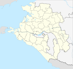
The Stanitsa is located in the north of the Kuban area , about 140 km northeast of the regional capital Krasnodar on the Sossyka , a left tributary of the Jeja . Pavlovskaya is the fourth largest stanitsa ( Cossack settlement ) in the region.
The Stanitsa Pavlovskaya is the administrative center of the Pavlovskaya Rajon (Pavlovsky).
history
The place was founded in 1822 by Cuban Cossacks as Pawlowskoje , named after the apostle Paulus (Russian Pawel ; see coat of arms). Since 1842 it has been known as Staniza under its current name.
In 1875 the main line of the North Caucasus Railway from Rostov to Vladikavkaz was passed east of the Stanitsa; The Sossyka station named after the river was built here . In 1911 it became the starting point for the private Yeisker Railway via the large Stanizi Umanskaya and Starominskaya to the city Yeisk on the coast of the Azov Sea . The new train station, Sossyka-Jeiskaya , was built closer to the Stanitsa ; the old one was renamed Sossyka-Rostovskaya .
Due to the favorable traffic situation of the Stanitsa, its economic importance grew towards the end of the 19th century. During this time she was administratively part of the department (Otdel) Jeisk of the then Kuban Oblast .
During the Second World War , Pavlovskaya was occupied by the German Wehrmacht from summer 1942 to February 1943 .
Population development
| year | Residents |
|---|---|
| 1897 | 8,050 |
| 1939 | 12,279 |
| 1959 | 16,652 |
| 1970 | 23,627 |
| 1979 | 25,846 |
| 1989 | 28,744 |
| 2002 | 30,736 |
| 2010 | 31,327 |
Note: census data
Economy and Infrastructure
The Stanitsa is the center of an important agricultural area . There are a number of companies for the processing of agricultural products ( sugar factory , canning factory "Techada", large slaughterhouse (" meat combinat ") "Pawlowski" , animal feed factory) and more than ten companies in the construction industry.
Pavlovskaya is located on the railway line from Rostov - Mineralnye Vody - Vladikavkaz or - Makhachkala - Baku ( Sossyka-Rostovskaya station , line kilometers 1468 from Moscow ). The route to Yeisk, which previously branched off, has been out of service on the section to Starominskaya since the 1990s.
The place is also an important junction of the road network. The M29 branches off from the M4 Moscow – Rostov – Novorossiysk trunk road (also European route 115 ), which runs east around Pavlovskaya and , like the railway, leads to the Azerbaijani border. A regional road leads towards Yeisk.
Individual evidence
- ↑ a b Itogi Vserossijskoj perepisi naselenija 2010 goda. Tom 1. Čislennostʹ i razmeščenie naselenija (Results of the All-Russian Census 2010. Volume 1. Number and distribution of the population). Tables 5 , pp. 12-209; 11 , pp. 312–979 (download from the website of the Federal Service for State Statistics of the Russian Federation)


