Rombach-le-Franc
| Rombach-le-Franc | ||
|---|---|---|

|
|
|
| region | Grand Est | |
| Department | Haut-Rhin | |
| Arrondissement | Colmar-Ribeauvillé | |
| Canton | Sainte-Marie-aux-Mines | |
| Community association | Val d'Argent | |
| Coordinates | 48 ° 17 ′ N , 7 ° 16 ′ E | |
| height | 290-850 m | |
| surface | 17.87 km 2 | |
| Residents | 780 (January 1, 2017) | |
| Population density | 44 inhabitants / km 2 | |
| Post Code | 68660 | |
| INSEE code | 68283 | |
 Rombach-le-Franc |
||
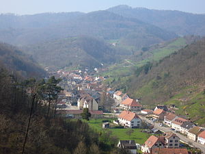
Rombach-le-Franc ( German German Rumbach ) is a municipality in the Haut-Rhin department in the Grand Est region (until 2015 Alsace ) in France . It is a member of the Val d'Argent municipal association and has 780 inhabitants (as of January 1, 2017).
geography
Rombach-le-Franc is the northernmost commune of the Haut-Rhin department. It is located in a side valley of the Lièpvrette , about 15 kilometers west of Sélestat (Schlettstadt). The municipality is part of the Ballons des Vosges Regional Nature Park .

Mairie Rombach-le-Franc
Population development
| year | 1962 | 1968 | 1975 | 1982 | 1990 | 1999 | 2007 | 2017 |
| Residents | 1041 | 870 | 765 | 720 | 764 | 820 | 905 | 780 |
Personalities
- Gert-Rudolf Flick (* 1943), German lawyer, entrepreneur and art collector
literature
- Le Patrimoine des Communes du Haut-Rhin. Flohic Editions, Volume 2, Paris 1998, ISBN 2-84234-036-1 , pp. 1081-1083.
Web links
Commons : Rombach-le-Franc - Collection of images, videos and audio files

