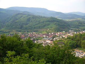
Lièpvre
| Lièpvre | ||
|---|---|---|

|
|
|
| region | Grand Est | |
| Department | Haut-Rhin | |
| Arrondissement | Colmar-Ribeauvillé | |
| Canton | Sainte-Marie-aux-Mines | |
| Community association | Val d'Argent | |
| Coordinates | 48 ° 16 ' N , 7 ° 17' E | |
| height | 234-930 m | |
| surface | 12.55 km 2 | |
| Residents | 1,724 (January 1, 2017) | |
| Population density | 137 inhabitants / km 2 | |
| Post Code | 68660 | |
| INSEE code | 68185 | |
| Website | http://www.liepvre.fr | |

|
||
Lièpvre ( German Leberau , Alsatian Laweröi , Which Co Lieuf ) is a French commune with 1724 inhabitants (as of January 1, 2017) in the Haut-Rhin department in the Grand Est region (until 2015 Alsace ). It belongs to the canton of Sainte-Marie-aux-Mines and is a member of the Val d'Argent municipal association .
geography
The village is located in the Vosges , in the Lièpvrette valley , now also known as the Val d'Argent because of the silver mining in the past . The municipality is part of the Ballons des Vosges Regional Nature Park .
history
Lièpvre developed around a monastery founded by Abbot Fulrad of Saint-Denis in 774 on a site donated by Charlemagne .
From 1871 until the end of the First World War , Lièpvre belonged to the German Empire as part of the realm of Alsace-Lorraine and was assigned to the Rappoltsweiler district in the Upper Alsace district .
| year | 1910 | 1962 | 1968 | 1975 | 1982 | 1990 | 1999 | 2007 | 2017 |
| Residents | 2061 | 1601 | 1639 | 1520 | 1536 | 1558 | 1632 | 1741 | 1724 |
economy
The Schmidt Groupe kitchen construction company is based in Lièpvre ; it employs around 1400 people.
Community partnerships
The French partner municipality of Lièpvre is Saint-Sylvestre-sur-Lot in Aquitaine .
See also
literature
- Le Patrimoine des Communes du Haut-Rhin. Flohic Editions, Volume 2, Paris 1998, ISBN 2-84234-036-1 , pp. 1078-1081.
