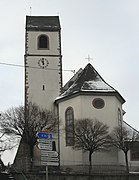
Hirtzfelden
| Hirtzfelden | ||
|---|---|---|

|
|
|
| region | Grand Est | |
| Department | Haut-Rhin | |
| Arrondissement | Colmar-Ribeauvillé | |
| Canton | Ensisheim | |
| Community association | Pays Rhin-Brisach | |
| Coordinates | 47 ° 55 ' N , 7 ° 27' E | |
| height | 206-217 m | |
| surface | 22.10 km 2 | |
| Residents | 1,261 (January 1, 2017) | |
| Population density | 57 inhabitants / km 2 | |
| Post Code | 68740 | |
| INSEE code | 68140 | |
 Mairie Hirtzfelden |
||
Hirtzfelden is a French commune with 1261 inhabitants (as of January 1, 2017) in the Haut-Rhin département in the Grand Est region (until 2015 Alsace ). It belongs to the Arrondissement Colmar-Ribeauvillé , the canton Ensisheim and the municipal association Essor du Rhin, founded in 2000 .
geography
The village is located in the Upper Rhine Valley between the Rhine and Ill , about halfway between Breisach am Rhein and Mulhouse . The 22.1 km² large municipal area is mainly characterized by arable land (Fluren Rufacker Weg, Schlittweg, Rustenharter Bann, Colmarer path, Ensisheimer Strasse, Gemeindeackerweg, Mittelfeld, Mittelzug, Allmend, Kurzerzug, Fessenheimer Strasse, Baseler Weg, Munchhauser Weg, Battenheimer Weg, Krummer Schlittweg, Fahnackerweg, Diebsweg and Neugesetz ).
Almost 30% of the municipality is forested. The communal forest ( Forêt communale d'Hirtzfelden ) consists of two parts: Le Niederwald in the northeast and part of the Bois de Rothleible in the west.
The Rhine-Rhône Canal , which today is only used by pleasure boats, runs through the east of the municipality . At the time of commissioning in the 1830s, a small port was built two kilometers east of the town center, which brought an economic boom.
Neighboring communities are Rustenhart in the north, Balgau in the northeast, Fessenheim in the east, Roggenhouse in the southeast, Munchhouse in the south, Réguisheim and Meyenheim in the west and Oberentzen and Niederentzen in the northwest.
history
The village was first mentioned under the name Hiruzfeld as a gift to Murbach Abbey in the 8th century. The name is derived from the word deer , which is expressed in the municipality's coat of arms . Artifacts from Roman times have been found in burial mounds in the Bois de Rothleible forest . It is believed that the Roman roads Burgundische Pforte - Breisach and Egisheim - Basel crossed here. Hitzfelden belonged to the Habsburgs, later regional rulers from Landser and Ottmarsheim . In 1446, Hirtzfelden was owned by Basel, and in the 18th century it was dependent on the Ensisheim Bailiwick .
From 1871 until the end of the First World War , Hirtzfelden belonged to the German Empire as part of the realm of Alsace-Lorraine and was assigned to the Gebweiler district in the Upper Alsace district .
In 1920 the remains of a cemetery from the Merovingian era were found.
Population development
| 1910 | 1962 | 1968 | 1975 | 1982 | 1990 | 1999 | 2007 | 2017 |
| 669 | 544 | 559 | 561 | 741 | 848 | 981 | 1099 | 1261 |
Around the old village center on the Ensisheim - Rustenhart road , numerous new rows of houses have been built in a star shape since the late 1970s. The population of Hirtzfeld has doubled in the last 45 years.
Administration union
Hirtzfelden is a member of the cross- border local special purpose association Mittelhardt-Oberrhein , which promotes cross-border communal cooperation between communities in Alsace and Baden on the basis of the Karlsruhe Convention .
Attractions
|

Hirtzfelden water tower with the coats of arms of the communities of Hirtzfelden, Roggenhouse and Munchhouse
|
Personalities
- François-Antoine Jecker (1765–1834), French instrument maker
- Laurenz Jecker (1769–1834), French needle manufacturer in Aachen
literature
- Le Patrimoine des Communes du Haut-Rhin. Flohic Editions, Volume 1, Paris 1998, ISBN 2-84234-036-1 , pp. 359-360.
Individual evidence
- ↑ Municipal directory Germany 1900 - Gebweiler district
- ↑ http://www.gemeinde-eschbach.de/wirtschaftsstandort/glct_goez.php
Web links
- Hirtzfelden on cc-essordurhin.fr (French)


