Munchhouse
| Munchhouse | ||
|---|---|---|

|
|
|
| region | Grand Est | |
| Department | Haut-Rhin | |
| Arrondissement | Colmar-Ribeauvillé | |
| Canton | Ensisheim | |
| Community association | Pays Rhin-Brisach | |
| Coordinates | 47 ° 52 ' N , 7 ° 27' E | |
| height | 214-227 m | |
| surface | 24.05 km 2 | |
| Residents | 1,519 (January 1, 2017) | |
| Population density | 63 inhabitants / km 2 | |
| Post Code | 68740 | |
| INSEE code | 68225 | |
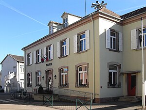
 Mairie Munchhouse |
||
Munchhouse (German Münchhausen ) is a French commune with 1519 inhabitants (as of January 1, 2017) in the Haut-Rhin department in the Grand Est region (until 2015 Alsace ). She is a member of the Essor du Rhin municipal association .
geography
The municipality of Munchhouse is located on the northern edge of the Harthwald , about 15 kilometers northeast of Mulhouse and nine kilometers west of the Rhine , which forms the border with Germany. The old northern section of the Rhine-Rhône Canal runs immediately to the west of the village .
history
From 1871 until the end of the First World War , Munchhouse belonged to the German Empire as part of the realm of Alsace-Lorraine and was assigned to the Gebweiler district in the Upper Alsace district .
Population development
| year | 1910 | 1962 | 1968 | 1975 | 1982 | 1990 | 1999 | 2007 | 2016 |
| Residents | 849 | 802 | 818 | 903 | 937 | 1216 | 1429 | 1569 | 1547 |
Attractions
- Sainte-Agathe Church
- Chapel Reine-du-Monde ([Maria], Queen of the World)
Administration union
Munchhouse is a member of the cross- border local special purpose association Mittelhardt-Oberrhein , which promotes cross-border communal cooperation between municipalities in Alsace and Baden on the basis of the Karlsruhe Convention .
literature
- Le Patrimoine des Communes du Haut-Rhin. Flohic Editions, Volume 1, Paris 1998, ISBN 2-84234-036-1 , pp. 364-3365.
Individual evidence
- ↑ Municipal directory Germany 1900 - Gebweiler district
- ↑ http://www.gemeinde-eschbach.de/wirtschaftsstandort/glct_goez.php


