
Nile
| Nile | ||
 Nile with tributaries and neighboring states |
||
| Data | ||
| location | Northeast Africa: Burundi Rwanda Tanzania Uganda South Sudan Sudan Egypt |
|
| River system | Nile | |
| source |
Luvironza (longest headwaters of the White Nile) 3 ° 54 ′ 47 ″ S , 29 ° 50 ′ 22 ″ E |
|
| Source height | approx. 2700 m (Rwandan spring river) approx. 2050 m (Burundian spring river) |
|
| muzzle | North of Cairo in the Mediterranean Coordinates: 31 ° 28 ′ N , 30 ° 22 ′ E 31 ° 28 ′ N , 30 ° 22 ′ E |
|
| Mouth height | 0 m | |
| Height difference | approx. 2700 m | |
| Bottom slope | approx. 0.41 ‰ | |
| length | Approximately 6650 km | |
| Catchment area | 3,255,000 km² | |
| Outflow at the Wadi Halfa gauge |
MNQ |
2660 m³ / s |
| Discharge at the Dongola A Eo gauge: 2,575,418 km² |
MNQ 1890-1995 MQ 1890-1995 Mq 1890-1995 MHQ 1890-1995 |
837 m³ / s 2700 m³ / s 1 l / (s km²) 7930 m³ / s |
| Left tributaries | Bahr al-Ghazal | |
| Right tributaries | Sobat , Blue Nile (headwaters), Atbara | |
| Flowing lakes | Lake Victoria , Lake Kioga , Lake Albert | |
| Reservoirs flowed through | Merowe Reservoir , Lake Nasser | |
| Big cities | 26 major cities | |
| Medium-sized cities | Bur , Imbaba , Wadi Halfa | |
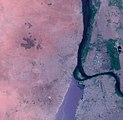
 Satellite image of the Nile |
||
The Nile ( Arabic النيل an-Nīl ; from ancient Greek Νεῖλος Neilos , later Nīlos , before that Latin Nilus , ancient Egyptian ı͗tr.w or * ı͗ắtraw "river", Coptic ⲫⲓⲁⲣⲱ piaro or phiaro ) is a river in Africa , which is the longest river on earth with a total length of about 6650 kmapplies. The discussion about whether it shouldbe classified as the second longest riverafter the Amazon (see below) continues. It rises in the mountains of Rwanda and Burundi , then flows through Tanzania , Uganda , South Sudan and Sudan beforeflowinginto the Mediterranean in Egypt . The Nile receives most of its water from the humid tropics of East Africa and to a lesser extent from the humid tropics of Central Africa . As the only river on earth, it then completely crosses one of the two subtropical dry belts , which has also produced the largest dry desert on earth, the Sahara . The special characteristics of the river gaverise toone of the earliest advanced civilizations on its banks, the ancient Egyptian pharaonic empire . Even today, the Nile is of vital economic importance to Egypt.
Water data
length
The information on the total length of the Nile ranges from 5,499 km to 7,088 km and depends, among other things, on the chosen measuring path (e.g. from the source areas or from the outflow of Lake Victoria). The Encyclopædia Britannica puts the total length at around 6650 kilometers, measured by the United States Geological Survey . An unpublished Brazilian study from 2008 comes to a total length of 6,852 kilometers measured from the sources of the Kagera-Nile , according to other sources it reaches a length of 6,671 kilometers from there. Chinese scientists, on the other hand, came in a study published in 2009 by including the Rukarara source river to a length of 7088 kilometers. Since there are similarly large differences in the length data for the Amazon (values range from 6,275 km to 7,025 km), the exact length of both rivers and thus the question of the longest river on earth is still uncertain at the beginning of the 2020s. Works like the Encyclopædia Britannica classify the Nile as the longest river, but still consider the results and thus the competition to be open and dependent on interpretation and discourse.
After leaving Lake Victoria , a flow path of around 5500 kilometers remains, during which the river changes its name several times. The approximately 480 km long section from Lake Victoria to Lake Albert is called the Victoria Nile. The subsequent 210 km long section from Lake Albert to the city of Nimule is called the Albert Nil. From Nimule to the confluence of the left tributary Bahr al-Ghazal in Lake No , the river is called Bahr al-Jabal over a length of about 800 km . The next approx. 1000 km from the No-See to the Sudanese capital Khartoum , or to the confluence of the Blue Nile , the river bears the name White Nile . Only for the last 3000 km is the river actually called the Nile. He covers a distance of about 2800 km between Khartoum and Cairo (beginning of the Nile Delta ). In the Nile Delta, the river splits into 2 estuary arms of approximately the same length, the western Rosette arm with a length of approx. 239 km and the eastern Damietta arm with a length of approx. 230 km.
Catchment area
The catchment area of the Nile extends over 11 countries. In addition, there are a few square kilometers of Chad that drains into the Nile catchment area via Wadi Howar .
Depending on the source and measurement method, the catchment area is given with values between 3.108 and 3.255 million km². The catchment area of the Nile is divided as follows (based on 3.177 million km²):
| States | Catchment area of the state in [km²] | Percent of the area of the catchment area | Percent of the country's area |
|---|---|---|---|
| Burundi | 13,860 | 0.44 | 49.39 |
| Democratic Republic of Congo | 21,796 | 0.69 | 0.91 |
| Eritrea | 25,697 | 0.81 | 21.11 |
| Egypt | 302.452 | 9.52 | 30.34 |
| Ethiopia | 365.318 | 11.50 | 31.93 |
| Kenya | 51,363 | 1.62 | 8.66 |
| Rwanda | 20,625 | 0.65 | 84.01 |
| South Sudan | 620.626 | 19.54 | 97.71 |
| Sudan | 1,396,230 | 43.95 | 74.90 |
| Tanzania | 118.507 | 3.73 | 12.69 |
| Uganda | 240.067 | 7.56 | 99.51 |
| total | 3,176,541 | 100 |
Water flow
Of the mean water flow of 2770 m³ / s below the confluence of the Atbara in the middle reaches, under natural conditions, only about 1250 m³ / s reach the estuary not far from Cairo; in terms of water flow, the Nile is thus far surpassed by numerous rivers of shorter lengths. Due to the large amount of water withdrawn for irrigation purposes, only around 140 m³ / s reach the Mediterranean today.
The water flow of the Nile fluctuates strongly, so in Aswan only 50 billion m³ / year were measured in the period 1971/72, but 100 billion m³ / year in the period 1975/76. The effect of the fluctuations is intensified by the fact that often several arid years follow one another and also several watery years. The Nile carried a lot of water in the 1960s, while the water levels were low in the 1980s. The two source rivers also rarely balance the water flow of the Nile. They can both carry a lot of water or, as in the 1980s, both have little water, which was almost catastrophic for Egypt.
The flow rates of the Nile were measured over long periods of time at different levels. Here graphically the discharge at the Dongola gauge , after the confluence of all water-bearing tributaries and about 350 km before the confluence with the Nasser Reservoir, measured over a period of 105 years (1890–1995) in m³ / s.

geography
source
The Nile has two source rivers: the shorter, but richer Blue Nile and the much longer White Nile. The latter forms the main axis of the catchment area, which at around 3,255,000 km² is only slightly smaller than that of the Congo (3,731,000 km²).
Blue Nile
The Blue Nile drains large parts of the high- precipitation highlands of Abyssinia . Its source rivers gather in the large Tana lake . Soon after leaving the lake, the Blue Nile forms the Tis Issat waterfall and flows through long canyons up to 1,500 m deep . Due to international restrictions, it could only be used to a limited extent in Ethiopia for a long time. In the meantime, the Grand Ethiopian Renaissance dam is under construction, which will at least be able to influence the water flow of the Blue Nile. In Sudan , the Blue Nile is dammed by the Roseires Dam and the Sennar Dam for irrigation, especially for the Gezira project, and for energy generation. After a run of 1,783 km, it flows together near Khartoum with the White Nile, which on average has about a quarter less water.
The Blue Nile is rich in sediment and therefore used to be the main supplier of the Nile flood , which is important for the deposition of the fertile Nile mud in Egypt , but which has lost its importance since the construction of the Aswan Dam . It took place in the months of July to October, depending on the course of the rainy season in the Ethiopian highlands. During this time, the Blue Nile has an average of five times as much water as the White Nile, which has a much more even water flow. Conversely, the White Nile leads almost 1.8 times that of the Blue Nile on average over the remaining eight months.
White Nile

The White Nile is mostly viewed as the actual Nile, despite the lower water flow. Compared to the Blue Nile, it has a catchment area that is more than five times the size and, at around 3800 kilometers, more than 2.5 times the length.
The White Nile arises in the high hill countries of Burundi , Rwanda and Tanzania from the Burundian source river Luvironza - Ruvuvu and the Rwandan source river Rukarara-Nyabarongo , which flow into the Kagera (in the upper reaches also Akagera ).
The Kagera, which reaches the west bank of Lake Victoria in northern Tanzania , is its largest tributary. It has a catchment area of approximately 60,000 km² and drains most of Rwanda, half of Burundi and small parts of northwestern Tanzania. In the past, the Kagera was often not considered part of the Nile, despite its length of well over 900 kilometers and a water flow of over 230 m³ / s.
The Victoria Nile leaves Lake Victoria in the north of Uganda. Shortly below the former Owen Falls and Ripon Falls , it is dammed so high that the lake level of Lake Victoria can be raised by up to three meters. Below the Bujagali rapids and Lake Kyoga , it is called the Kyoga Nile and flows into Lake Albert via the Karuma Falls and the Murchison Falls . As the Albert Nile, it flows from the lake to the border with South Sudan. From there the course of the river is called Bahr al-Jabal ( Arabic : mountain river ; also Bahr al-Jabal , Bahr el-Jebel ). At the city of Juba it leaves the highlands and enters the swamp area of the Sudd at the city of Bur , which extends for almost 400 kilometers to the north. Here, 51 percent of the Nile water evaporates, with the water flow decreasing from 1048 m³ / s to 510 m³ / s.
Shortly before leaving the Sudd, the Bahr al-Jabal meets the long but arid river Bahr al-Ghazāl (2 m³ / s) coming from the left in the No Lake and is from there on as Bahr al-Abiad ( White Nile ), which now initially flows eastwards. At the town of Malakal , the unfinished Jonglei Canal and the strong, clay-colored Sobat (412 m³ / s) flow to the right . Then it flows northwards towards Khartoum and Omdurman , where it meets the Blue Nile , which comes from the right (south-east) from Ethiopia .

Dominance of the White Nile (below) over the Blue Nile (right) in the dry season (April)
Dominance of the Blue Nile over the dammed White Nile in the rainy season (August)

Nile near Khartoum, around 1910
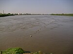
Confluence of the White and Blue Nile, 2010


From Khartoum to Cairo
From Khartoum downstream, the Nile flows as a so-called alien river through vast desert landscapes in an S-shape further north, enclosing the Bayuda desert . The Libyan Desert begins in the west, and the Nubian Desert , known as the Arabian Desert in Egypt , lies to the east as far as the Red Sea . In the northern Sudanese and Egyptian desert regions, the Nile forms a 5 to 20 kilometer wide depression ; it is a vital river oasis and the agricultural basis of Egypt. The calm and wide course of the Nile is disturbed in the six cataracts by narrow passages and rocks, three of which have now disappeared in reservoirs.
About 300 km below Khartoum flows into the Atbara , a sediment-rich mountain river coming from the Ethiopian highlands , which during the three-month flood period supplies the Nile with a considerable part of its water, but almost completely dries up in the dry season. It is the last tributary of the Nile before it flows into the Mediterranean.
The fourth cataract, about 400 kilometers north of Khartoum, was flooded by the new Merowe reservoir , which was flooded in 2009. At Al Dabba at the southern end of the Nile arch, the no longer water-bearing Wadi Howar , the former Yellow Nile, flows from the west .
Shortly before Wadi Halfa , the Nile reaches Lake Nubia, the section of Lake Nasser in Sudan , which is dammed up by the Aswan Dam built between 1960 and 1971 . In the Egyptian part of the reservoir north of Abu Simbel there is a large pumping station that supplies the Toshka project with water.
On the nearly 1,000 km route from the Aswan Dam to Cairo, the Nile is a huge irrigation canal has become, since Muhammad Ali Pasha (1805-1848 Viceroy of Egypt), the Delta Barrage was built and began the irrigation methods on the Nile from the Date the pharaohs practiced seasonal irrigation in flood basins to switch to year-round canal irrigation. The next big step was the 350 km long Ibrahimiyya Canal , which was completed in 1873 and also supplies the Fayyum Basin in the west of the Nile via the Bahr Yusuf Canal . Starting with the old Aswan dam , the Asyut weir and the Zifta weir , a number of weirs and thousands of kilometers of canals have been built since the beginning of the 20th century, which are largely evenly supplied with water. Even after the Aswan Dam, more dams were and will be built: cf. see the list of dams on the Nile .

Nile near Aswan 2002

Aswan High Dam

Nile near El-Minija

Nile river oasis near Luxor


delta

Below Cairo, the Nile fans out into the approximately 24,000 km² Nile Delta , over which it flows into the Mediterranean in two main branches . Since the construction of the Aswan Dam in the 1960s and the resulting lack of flooding in the Nile, the river delta has not grown any further into the sea, but has been partially carried away by the surf . Only the left arm, the Rosetta arm , still constantly reaches the sea; the Damietta arm is dammed shortly before the mouth so that its water often only reaches the open sea through irrigation canals. The main reasons for the reduction in the flow rate of the Nile are the more intensive irrigation of significantly enlarged agricultural areas and the evaporation losses over Lake Nasser.
Tributaries
|
Left (here western) tributaries:
|
Right (here eastern) tributaries: |
Cataracts and waterfalls
White Nile
The upper reaches of the White Nile runs in a tectonically turbulent area and has been subject to many changes in the recent geological past. This is reflected in the unbalanced longitudinal profile of the river with numerous smaller and larger waterfalls and rapids . This includes:
- Rusumo Falls on the border of Rwanda and Tanzania
- Kuruma Rapids in Tanzania - east of the north knee of the Kagera
- Ripon Falls in Uganda - ( flooded by Lake Victoria by the Owen Falls Dam )
- Owen Falls in Uganda - (flooded by Lake Victoria by the Owen Falls Dam)
- Bujagali Falls in Uganda - below the Owen Falls Dam (flooding dam under construction)
- Karuma Falls in Uganda - about 60 km above Murchison Falls
- Murchison Falls (also called Kabelega Falls ) in Uganda
Blue Nile
The Blue Nile flows through plateau landscapes with many horizontal layers, in whose deeply cut valleys it forms numerous rapids. The only large waterfall is probably the best known in the river system of the Nile, the Tis Issat .
Cataracts on the middle course

In the central reaches of the Nile, below the confluence of the Blue Nile and White Nile, the river bed is characterized by six natural granite barriers , which are much harder than the surrounding sedimentary rock and the Nile sediments. In ancient Egypt, the dreaded cataracts formed the borders between the kingdoms. Even if some of them have meanwhile been dammed, they are still an obstacle for navigation, at low tide because of hidden cliffs and narrow rock gullies that are difficult to see and at high tide because of the rapid current.

The cataracts have simply been numbered upstream (from north to south) since ancient times. The first cataract is in what is now Egypt ; the second through sixth cataracts are in Sudan .
- The first cataract is near Aswan ( 24 ° 5 ′ 0.4 ″ N , 32 ° 52 ′ 54.3 ″ E ), the only one in present-day Egypt. Much of it was flooded by the construction of the old Aswan dam.
- The second cataract (or large cataract) is located in Nubia above the Nasser reservoir ( 21 ° 28 ′ 46.5 ″ N , 30 ° 57 ′ 41.5 ″ E ).
- The third cataract is located near Tombos / Hannek ( 19 ° 48 '41.2 " N , 30 ° 18' 38.9" O ).
- The fourth cataract is located at Dar al-Manasir and has been flooded by the Merowe Dam since 2008 ( 18 ° 59 ′ 44.1 ″ N , 32 ° 23 ′ 55.3 ″ E ).
- The fifth cataract is located at the confluence of the Nile and Atbara Rivers ( 18 ° 24 ′ 43.9 ″ N , 33 ° 45 ′ 43.9 ″ E ).
- The sixth cataract is located in a mountain breakthrough, the Sabaluka Intrusion, near Meroe ( 16 ° 20 ′ 59.7 ″ N , 32 ° 42 ′ 26.2 ″ E ).
The location of the six cataracts ( map with all coordinates of the cataracts section on the middle reaches : OSM ).
![]()
1. Cataract around 1870
1. Cataract, date unknown

3rd cataract 2010

The 4th cataract expired in 2010

6. Cataract around 1908


Cities on the banks of the Nile
The megacities of Cairo, Giza (both Egypt) and Khartoum (Sudan) are the largest cities.
The ancient Egyptians often built their cities on the fertile plains of the sacred river . Many cataracts and dams were built, among other things for the settlement.
- Rwanda
- Uganda
- South Sudan
- Sudan
- Kusti
- Rabak
- Khartoum (al-Chartūm)
- Omdurman (Umm Durmān)
- al-Chartum Bahri
- Atbara
- Wadi Halfa
- Egypt
- Places in or on the Nile Delta
- Cairo (al-Qāhira)
- Giza (al-Jīza)
- Heliopolis (Misr al-Jadīda)
- Imbaba (Imbābā)
- Banha (Banhā)
- Shibin al-Hardly
- Ismailia (al-Isma'īliyya, on the Suez Canal , connected to the Nile Delta via a side canal)
- Zagazig (az-Zaqāzīq)
- Tanta (Tantā)
- Mahalla al-Kubra (al-Mahallāt al-Kubrā)
- Mansura (al-Mansura)
- Naukratis (Nebireh)
- Damanhur (Damanhūr)
- Kafr el-Sheikh
- Alexandria (al-Iskandariyya)
- Port Said (Būr Sa'īd)
- Damietta (Dumyāt)
fauna

The Nile is inhabited by over 120 species of fish, which are not many for a river of this length. Endemic about a quarter of the species, an endemic genus does not exist. The Nile valley does not form a zoogeographical unit, around 75 species are also found in the Niger river basin and most of these species are also found in other West African rivers. More than 20 species of fish living in the Nile are also at home in the Congo Basin . One of the great living in the Nile fish species are plankton -eating African arowana ( Heterotis niloticus ) and the predators gymnarchus ( Gymnarchus niloticus ) and Nile perch ( Lates niloticus ). The jitter catfish are represented by two species Malapterurus electricus and Malapterurus minjiriya . The most species-rich fish family are the carp fish (Cyprinidae) with 18 species and the Nilhechte (Mormyridae) with 16 species.
Many other animal species got their names after the river, such as the Nile crocodile , the Egyptian goose , the Nile grass rat , the Nile monitor and also the hippopotamus or hippopotamus , which is no longer found in the lower reaches today . Many animals served the Egyptians as pets or are role models for gods.
Economic use: hydraulic structures
overview
The hydraulic engineering interventions on the Nile were caused by the change in irrigation methods on the Nile in Egypt from the flooding of flood basins to permanent canal irrigation. In recent times, hydroelectric power plants have also been built (see list of dams on the Nile ).
Flood basins
The natural water flow of the Nile was characterized by the change between the floods in August, September and October and the subsequent drop in the water level to a seventh of the maximum. Even when comparing the years, there were strong fluctuations in both the height of the floods and the low water. For the irrigation of agricultural fields, the flood was directed into large flood basins, which were emptied again after the soil was moistened and the Nile mud settled . The sowing took place immediately afterwards on the soaked soil, the harvest could and had to be done after around three months, before the summer heat dried out the soil and agricultural cultivation was no longer possible.
Permanent canal irrigation
Muhammad Ali Pascha (1805–1848 Viceroy of Egypt) had the Delta Barrages built, which in the low water period increased the Nile by max. four meters dammed up, which was enough to alternately water part of the Nile Delta . This opened up additional cultivation areas in the Nile Delta and for the first time cotton could be cultivated, which requires long-term and evenly irrigated fields. In addition, two harvests became possible.
Ismail Pasha (1863–1879 viceroy) extended the method to Upper Egypt and had the Ibrahimiyya Canal built, which was completed in 1873. The 320 km long canal in Asyut was diverted from the Nile without any special structures in order to irrigate the viceroy's sugar cane fields. A branch fills the Bahr Yusuf Canal to the Fayyum Basin .
Bridging the low water period
The Delta Barrages proved to be very successful after their rehabilitation by the British at the end of the 19th century. That is why the Aswan dam , the Asyut dam and the Zifta dam were built in 1902 . The dam in Aswan was supposed to hold up enough water during the flood so that all of the downstream irrigation channels could be adequately supplied in the subsequent low water period. The Asyut weir served to control the inflow to the Ibrahimiyya Canal.
As a result of the progressive conversion of flood basins into permanently irrigated fields, the storage volume of the Aswan dam was soon no longer sufficient, so that it had to be increased in 1912 and again in 1934. The first hydropower plant was also installed on the Nile.
For the inflow to the other canals, the Esna weir was built in 1906 and the Naga-Hammadi barrage in 1930 .
In 1937 the Jebel Aulia Dam in the White Nile above Khartoum was also built for the purpose of damming water and releasing it during the low water period.
In the Nile Delta, the Zifta Dam improved the water distribution in the area of the Damietta Arm, and in 1938 the Muhammad Ali Barrages replaced the old Delta Barrages.
With these extensive construction measures consisting of weirs in the Nile and irrigation canals on both sides, the greater part of the agricultural areas of Egypt was converted to permanent canal irrigation.
The previously fundamental importance of the Nile mud became secondary. Although all weirs and even the Aswan dam still had gates to allow part of the flood to pass, it was important to have enough water for the summer months and to ensure that the canals were evenly supplied. The Nile mud was sometimes a hindrance when it clogged the canals and had to be laboriously cleared.
Bridging several years of drought
As early as 1900 the British were considering how low water levels could be compensated for and additional water supplied to the fields in Egypt. Already at that time, a damming of Lake Tana and Lake Victoria, a canal along the Sudds and a reservoir in the White Nile above Khartoum were considered.
The volume dammed up by the Aswan Dam was not sufficient, even after it had been raised, to cover a whole year with extremely low water levels or for two consecutive periods with low water levels and thus prevent Egyptian agriculture from withering. To avert such a catastrophic development for Egypt was in the years 1960-1971 Aswan Dam ( Aswan High Dam ) built. In return, it was accepted that the Nile flood would finally end in Lake Nasser and the Nile mud could no longer reach Egypt. In the meantime, the flood has already ended in Sudan in the reservoir of the Merowe Dam .
Extra water
In the Sudd , the huge swamp area in South Sudan, 53% of the water of the White Nile evaporates. To reduce this loss and to channel more water through the White Nile to Egypt, construction of the Jonglei Canal began in 1974 , through which the water of the White Nile should flow past the Sudd. Construction was interrupted in 1984 by the civil war in Sudan and has not been started since then.
Conflicts of use
Since only a good five percent of the discharge below the Atbara estuary reaches the Mediterranean Sea on average over the year, an intensification of the conflicts over water distribution is foreseeable. Egypt and Sudan determined in bilateral negotiations in 1959 that the total annual amount of available water from the Nile averages 84 billion m³, of which an average of 10 billion m³ would be lost through evaporation and seepage. The water throughput (around 2660 m³ / s) was measured at the height of the old Aswan Dam . Egypt approved 55.5 billion m³ annually and granted Sudan 18.5 billion m³. However, since the Nile has ten riparian states, most of which were not mentioned in the agreement of 1959, there is an undersupply for the majority of the approximately 300 million river residents, as Egypt wants to enforce its water claims by force if necessary. The Nile Basin Initiative , which has existed since 1999 , attempts to establish partnership arrangements, but the existing imbalance, in which Egypt and Sudan reserve around 88% of water use, whereas Ethiopia, from whose national territory around 90% of the runoff originate, is only minimal Use is now expressed in a separate framework agreement of the upstream states from 2010 with the aim of greater personal use ( Entebbe Agreement ). The Ugandan hydropower plant under construction below the Bujagali rapids of the Victoria Nile is also one such increased use.
history
| Nile in hieroglyphics | ||||||||||
|---|---|---|---|---|---|---|---|---|---|---|
Iteru Jtrw Nile, stream |
||||||||||
Gery Gry Strom / The Meandering One |
||||||||||
Hapi Ḥˁpj Flooded Nile |
||||||||||
Old Egypt
The Nile was only called the “great river” or “stream” by the ancient Egyptians. The term "Nile" was first introduced through the Greek "Neilos".
The Nile favored the emergence of a culture on the banks of the Nile in ancient Egypt . Without him the country would be a desert today. You can see it from the fact that it is bordered in the west by the Libyan desert and in the east by the Nubian desert and the Arabian desert , where apart from a few oases there is no water and thus agriculture and culture were or are impossible. It was only through the fertile mud that the Nile spreads over the country during its floods that crops could be grown and agriculture could be practiced. In addition, the very clayey mud brought by the Nile flood was used to build houses.
Once a year the Nile flooded the country and covered a strip of land up to several kilometers wide (so-called Nile threshold). When the water flowed away and evaporated, it left behind fertile, dark mud (this would still be the case today if the Aswan Dam did not exist), which gave ancient Egypt its name (Kemet - "The Black Land"). In order to be able to fully use this cultivation area for grain, the Egyptians mostly settled directly along the Nile, but also a little away from the river in the desert. In order to be able to store water for the desert settlements and for dry seasons , they had to create canals and artificial lakes. Since the individual Egyptian peasant could not build this, the inhabitants of a region united and formed districts that were administered by district princes .
The water level of the Nile fluctuated by up to eight meters at the time of the flood. He was measured in miles , for example Per Hapi . Since some areas were not flooded when the level was low and the farmers living there starved, taxes were set according to the level of the Nile. However, if the Nile rose too high, dams could break and houses would be destroyed. As a result, geometers were needed early on to re-measure the land and redefine the field boundaries.
The Nile was Egypt's main trade route. For example, wood was transported across the river. It was imported from Syria and Palestine . In addition, blocks of stone for building pyramids were transported on ships. The shipping traffic was limited to the day, as there was a risk of running on sandbanks at night. When the water level was very low, the ships were pulled over land over short distances. The sail was only used in 3350 BC. Introduced.
Roman times

The ancient Romans were already looking for the sources of the huge river ("caput Nili quaerere", ambiguous in Vulgar Latin, since it can also be translated as "looking for the head of nothing"). In the second century after the turn of the times, Claudius Ptolemy wrote on the basis of travel reports that the Nile flows out of two large inland lakes near the equator. The Montes Lunae rise near the lakes. This statement and his world map were followed by Arabic and European representations of the Middle Ages. Due to the great importance for the fertility of Egypt and the grain deliveries for the supply of Rome, the personified Nile was often depicted as the god Nilus on coins during the Roman period.
From the 17th century
The Portuguese Jesuit missionary Father Pedro Páez (1564–1622) discovered the source of the Blue Nile in 1613. The Scottish Africa explorer James Bruce (1730–1794) rediscovered the source on November 4, 1770 and claimed the fame (in vain) for himself.
Many African researchers have tried to find the real source of the White Nile.
- During an expedition that lasted from 1821 to 1822, the Frenchman Frédéric Cailliaud reached the confluence of the Blue and White Nile.
- In 1857 the British John Hanning Speke and Richard Francis Burton went on a joint exploration of Lake Victoria: John Speke saw it as the source, Richard Burton saw it in Lake Tanganyika to the south .
- In 1858 John Speke, now accompanied by James Augustus Grant , went on an expedition again, and in 1862 they discovered the Ripon Falls in the north of Lake Victoria, which was wrongly regarded as the source of the Nile.
- In 1861 the Dutch African explorer Alexandrine Tinné put together an expedition in Cairo , but had to break it off after a few months for logistical reasons.
- In 1866 the British explorer David Livingstone set out on expeditions to the sources of the Nile and the Congo . He thought he found it in Lake Bangweul , much further south, but never reached the actual source.
- The source of the Kagera Nile on the Luvironza, which corresponds to the most distant Nile source, was discovered jointly by Oskar Baumann and Oskar Lenz in 1893 , but was not precisely determined.
- In 1898 Richard Kandt discovered the Rukarara spring (Rwandan spring river) in the Nyungwe forest .
- It was not until 1937 that Burkhart Waldecker (1902–1964) determined the exact geographic location of the Luvironza spring .
The Briton Samuel White Baker and the Italian Romolo Gessi , who also went on the search, have also undertaken successful expeditions.
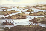
In the meantime, on the occasion of the inauguration of the Suez Canal in 1869, the Parisian family company Léon & Lévy , which specializes in stereoscopy , financed the photographer Auguste-Rosalie Bisson's “journey on the Nile”, of which around 300 images were reproduced.
The British began hydrological exploration and documentation of the Nile soon after taking control of Egypt. In this context, William Willcocks , the builder of the first Aswan dam, and in particular Harold Edwin Hurst , who, during his 62 years in the service of the Egyptian government, researched, collected and documented the largest amount of data ever about a river, became known was collected. When determining the storage volume required for Century Storage , Hurst discovered the phenomenon of the Hurst exponent , which was later named after him , according to which his empirical data clearly resulted in a larger volume than would have been expected from the theoretical calculation methods used at the time.

"The Nile" - Roman work from the 1st century AD in the Vatican Museum

Arab world map, 12th century (south is above): Two source rivers are fed from a mountain range (above), flow through two lakes and unite in a third lake to form the Nile.

European map "Abyssinia", 16th century: The Nile and its upper tributaries flow away from inland lakes.


traffic
channels
Man-made canals that accompany or branch off the Nile include:
bridges
Numerous other bridges have been built in the Nile Delta since the railroad from Alexandria to Cairo built by Robert Stephenson between 1852 and 1856 and the two sections of the Delta Barrages over the Rosetta and Damietta arms, completed in 1862 .
In Cairo, the Kobri el Gezira, opened in 1871, was the first bridge to the island of al-Gezira . In the meantime, several bridges of up to ten lanes connect the center with the island and the opposite bank of the river.
For a long time there were only weirs between Cairo and Khartoum, completed in 1902 in Asyut and Aswan, over which a road ran. In Sudan, a few years later, the railway from Port Sudan to Khartoum and Wadi Halfa and the branch from Khartoum via Sannar and Kusti to El Obeid with the An-Nil-al-azraq bridge over the Blue Nile in Khartoum and the Kusti railway bridge built over the White Nile.
In the last few decades in particular, Egypt has built numerous road bridges below Aswan, so that there is a fixed crossing every 50 to 100 km.
In Sudan, bridges were built in Khartoum and a few in the sparsely populated section above Lake Nasser. In addition, above Khartoum there are now three road bridges each over the White and Blue Nile.
South of Sudan there are only five fixed crossings over the Blue and White Nile, including the two Portuguese bridges below Lake Tana from the 17th century in Ethiopia, which are by far the oldest Nile bridges.
See also
literature
(sorted chronologically)
- Adolf Erman : What is the name of the Nile . In: Adolf Erman, Georg Steindorff (Hrsg.): Journal for Egyptian language and antiquity . Forty-fourth volume. Hinrichs'sche Buchhandlung, Leipzig 1907, p. 114 ( archive.org [accessed April 12, 2016]).
- Georg Brunold: Nile fever. The race to the sources. Eichborn, Frankfurt am Main 1993, ISBN 3-8218-4107-9 .
- Lutz Knörnschild: On the history of the Nile water use in Egyptian agriculture from the beginnings to the present (= Leipzig contributions to orient research. Volume 1). Frankfurt am Main / Berlin a. a. 1993, ISBN 3-631-44755-8 , p. 284.
- Karl W. Butzer: Nile, modern hydrology. In: Kathryn A. Bard (Ed.): Encyclopedia of the Archeology of Ancient Egypt. Routledge, London 1999, ISBN 0-415-18589-0 , pp. 570-571.
- Karl W. Butzer: Nile Valley, geological evolution. In: Kathryn A. Bard (Ed.): Encyclopedia of the Archeology of Ancient Egypt. Routledge, London 1999, ISBN 0-415-18589-0 , pp. 571-573.
- Wolfgang Helck , Eberhard Otto : Nile. In: Small Lexicon of Egyptology. 4th edition. Harrassowitz, Wiesbaden 1999, ISBN 3-447-04027-0 , p. 203.
- Hans Bonnet: Nile. In: Real Lexicon of Egyptian Religious History. Nikol, Hamburg 2000, ISBN 3-937872-08-6 , pp. 525-528.
- Christine Strauss-Seeber: The Nile. Lifeline of ancient Egypt. Hirmer, Munich 2007, ISBN 978-3-7774-3715-6 .
- Gabriele Höber-Kamel (ed.): Egypt, a gift from the Nile (= Kemet issue 1/2009 ). Kemet-Verlag, Berlin 2009, ISSN 0943-5972 .
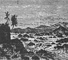
- The discovery of the source of the Nile . In: The Gazebo . Issue 24, 1863, pp. 383 ( full text [ Wikisource ]).
Web links
- Nile Basin Water Resources Atlas
- Friedhelm Hoffmann : Nile. In: Michaela Bauks, Klaus Koenen, Stefan Alkier (eds.): The scientific biblical lexicon on the Internet (WiBiLex), Stuttgart 2006 ff., Accessed on May 26, 2012.
- Sofian Philip Naceur: Who Owns the Nile? In: Telepolis , June 28, 2013.
- Flow diagram El Ekhsase ( Memento from September 4, 2004 in the Internet Archive )
- Hermann Henze: The Nile, a representation of its hydrography and its economic importance based on more recent sources. Gebauer-Schwetschke, Halle a. S. 1903, ( digitized version of the yellowed and therefore difficult to read original - Internet Archive and reprint books.google.de ) Unikum Verlag, Barsinghausen 2012.
- William Willcocks, James Ireland Craig: Egyptian Irrigation. 3. Edition. Spon, London / New York 1913 ( archive.org Volume I; archive.org Volume II).
- Sandra Postel: Egypt's Nile Valley Basin Irrigation . Excerpt from Sandra Postel: Pillar of Sand: Can the Irrigation Miracle Last? WW Norton Company, New York 1999.
- Nile, Irrigation along the Nile. On: Infoplease.com ; last accessed on March 24, 2014.
- Greg Shapland: Rivers of Discord: International Water Disputes in the Middle East. C. Hurst & Co., London 1997, ISBN 1-85065-214-7 , pp. 57 f. (Reading sample: [1] ).
- John V. Sutcliffe, Yvonne P. Parks: The Hydrology of the Nile. International Association of Hydrological Sciences, Wallingford 1999, ISBN 978-1-901502-75-6 , p. 151 f .; hydrosciences.fr (PDF).
Individual evidence
- ↑ a b The total length of the Nile is often given as around 6,650 km (Magdi M. El-Kammash, Harold Edwin Hurst , Charles Gordon Smith: Nile River . Status: July 21, 2017, accessed August 2017.), but is below Other factors depend on the chosen measuring path and the information varies between 5,499 km and 7,088 km ( Shaochuang Liu, P Lu, D Liu, P Jin, W Wang: Pinpointing the sources and measuring the lengths of the principal rivers of the world . In: Int. J . Digital Earth . 2, March 1, 2009, pp 80-87. doi : 10.1080 / 17538940902746082 . ). For details, see the length section .
- ↑ Nile Basin Initiative (NBI)
- ↑ rounded converted from 84 billion km³ / a from SENE et al. 2001 (see quotation ( Memento from April 20, 2006 in the Internet Archive ) PDF); this value is also the arithmetic basis of the 1959 Nile Water Agreement between Egypt and Sudan. The natural discharge is slightly higher further up, about half as large at the mouth.
- ^ Information Products for Nile Basin Water Resources Management
- ^ A b The Hydrology of the Nile
- ↑ Wolfgang Schenkel: Tübingen Introduction to the Classical Egyptian Language and Script . Tübingen: 1991, p. 275.
- ^ A b c Magdi M. El-Kammash, Harold Edwin Hurst , Charles Gordon Smith: Nile River . Status: July 21, 2017 (accessed August 2017)
- ↑ a b How Long Is the Amazon River? Accessed December 31, 2018 .
- ↑ a b c Shaochuang Liu, P Lu, D Liu, P Jin, W Wang: Pinpointing the sources and measuring the lengths of the principal rivers of the world . In: Int. J. Digital Earth . 2, March 1, 2009, pp. 80-87. doi : 10.1080 / 17538940902746082 .
- ^ Estudo do INPE indica que o rio Amazonas é 140 km mais extenso do que o Nilo. INPE press release of July 1, 2008, accessed July 2017.
- ↑ Lothar Nickels: Nilquellen , Planet Wissen , as of March 1, 2016, accessed on July 1, 2017.
- ↑ Günter Paul: The Amazon is longer than the Nile . In: FAZ , July 4, 2007, accessed July 2017.
- ↑ See also article on the Amazon , where this is explained in detail.
- ↑ Victoria Nile (Britannica.com).
- ^ Albert-Nil (Britannica.com).
- ↑ Including about 900 km from Asuan to Cairo
- ^ Potentialities of Water Resources Pollution of the Nile River Delta, Egypt
- ^ University of Texas Libraries - Abeche Sheet ND 34, AMS 2, First Edition, 1943
- ^ Nile Basin Initiative
- ↑ Balázs M. Fekete, Charles J. Vörösmarty, Wolfgang Grabs: UNH-GRDC Composite Runoff Fields V1.0 (example: Station El Ekhsase )
- ↑ See table of the longest rivers on earth , last column: Average. Discharge (m³ / s). If you sort this column in descending order (double click on the column header), the Nile appears far below with 2660 m³ / s.
- ^ Greg Shapland: Rivers of Discord: International Water Disputes in the Middle East. C. Hurst & Co., London 1997, ISBN 1-85065-214-7 , p. 7.
- ↑ Based on data from the stations Mogren (White Nile) and Khartoum (Blue Nile) located shortly before the confluence of the two rivers
- ↑ FAO page on the catchment area of the Kagera
- ^ Mamdouh Shahin: Hydrology and Water Resources of Africa (= Water science and technology library. Vol. 41). Kluwer Academic, Dordrecht / Boston 2002, online on Google Books
- ↑ nest.su.se
- ↑ Fishbase Species in Nile ( page no longer available , search in web archives ) Info: The link was automatically marked as defective. Please check the link according to the instructions and then remove this notice.
- ^ Petru Bănărescu: Zoogeography of Fresh Waters. Aüla-Verlag, Wiesbaden 1990, ISBN 3-89104-480-1 , p. 1137.
- ↑ Basin irrigation and perennial irrigation are the keywords used in the English specialist literature for the two methods.
- ^ William Willcocks, James Ireland Craig: Egyptian Irrigation. 3. Edition. Spon, London / New York 1913 ( archive.org Volume I; archive.org Volume II).
- ↑ a b Century storage was the catchphrase for the considerations and concepts for bridging a period of low water, as it is likely to occur on a statistical average once every hundred years.
- ↑ Geof Magga: Uganda: Ethiopian led river Nile agreement signed without Egypt and Sudan. In: afrik-news.com , May 14, 2010 (English).
- ↑ a b A. Wiese, Y. Müller: The symbolic meaning of Egyptian plants. In: André Wiese, Christiane Jacquat u. a .: flower kingdom. Rebirth in the tombs of the pharaohs. Antique Museum and Collection Ludwig, Basel 2014, ISBN 978-3-905057-32-4 , p. 122.
- ↑ Annie Francé-Harrar : The last chance for a future without need , Munich 1950, according to reprint 2007 on page 320
- ↑ Kampmann / Ganschow: The coins of the Roman mint in Alexandria , Battenberg Verlag Regenstauf 1st edition 2008, p. 18
- ↑ Michel Mégnin: LEON & LEVY, puis LEVY & FILS ("LL") (in French) on the page dictionnairedesorientalistes.ehess.fr of the Dictionnaire des orientalistes de langue française , last accessed on December 26, 2013
- ↑ The Nile Basin. 11 volumes (numerous articles together with P. Phillips, later with RP Black, finally with RP Black and YM Simaika), Government Press, Cairo 1931 to 1978. (quoted from John V. Sutcliffe, Yvonne P. Parks: The Hydrology of the Nile, International Association of Hydrological Sciences, Wallingford 1999, ISBN 978-1-901502-75-6 , p. 175).