Boudes
| Boudes | ||
|---|---|---|

|
|
|
| region | Auvergne-Rhône-Alpes | |
| Department | Puy-de-Dôme | |
| Arrondissement | Issoire | |
| Canton | Brassac-les-Mines | |
| Community association | Agglo Pays d'Issoire | |
| Coordinates | 45 ° 28 ' N , 3 ° 11' E | |
| height | 437-726 m | |
| surface | 7.92 km 2 | |
| Residents | 287 (January 1, 2017) | |
| Population density | 36 inhabitants / km 2 | |
| Post Code | 63340 | |
| INSEE code | 63046 | |
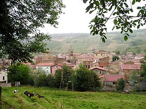
 View of Boudes |
||
Boudes is in France a commune in the region of Auvergne Rhône-Alpes in the Puy-de-Dôme in the Arrondissement Issoire and in Brassac-les-Mines . The relatively small community of 7.92 square kilometers is located at 437 to 726 m above sea level . The wine village on the D 48 has 287 inhabitants (as of January 1, 2017). With 45 hectares, Boudes belongs to the Côtes d'Auvergne wine-growing region . From Saint-Germain-Lembron the place is 4 km away; On the D 909 you turn shortly after this place to Boudes.
history
The place is first mentioned in writing in the 9th century. It belonged to the Lords of Chalus at the neighboring Chalus Castle. The present day townscape still gives an idea of the Middle Ages.
Attractions
- Saint Loup Church, Romanesque (11th century), modified in the 19th and 20th centuries; inside supported by a girder structure due to the risk of collapse; spire formed from iron rods
- Romanesque donjon
- Near the village in a south-easterly direction the “Vallée des Saitns” (Valley of the Saints) with the geological peculiarity of the 10 to 30 m high “cheminées de fées” (chimneys of the fairies), ferruginous and therefore red-colored rock formations created by erosion in the Tertiary
Web links
Commons : Boudes - collection of images, videos and audio files


