
Greene County, Illinois
 Greene County Courthouse |
|
| administration | |
|---|---|
| US state : | Illinois |
| Administrative headquarters : | Carrollton |
| Address of the administrative headquarters: |
County Courthouse 519 North Main Street Carrollton, IL 62016-1033 |
| Foundation : | January 20, 1821 |
| Made up from: | Madison County |
| Area code : | 001 217 |
| Demographics | |
| Residents : | 13,886 (2010) |
| Population density : | 9.9 inhabitants / km 2 |
| geography | |
| Total area : | 1415 km² |
| Water surface : | 8 km² |
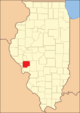
| map | |
 |
|
The Greene County is a county in the US -amerikanischen State Illinois . In 2010 , the county had 13,886 residents and a population density of 9.9 people per square kilometer. The county seat is Carrollton .
geography
The county is located in central southwest Illinois and is bounded to the west by the Illinois River . It has an area of 1415 square kilometers, of which eight square kilometers are water. The following neighboring counties border Greene County:
| Pike County | Scott County | Morgan County |
.svg)
|
Macoupin County | |
| Calhoun County | Jersey County |
history

| Population development | |||
|---|---|---|---|
| Census | Residents | ± in% | |
| 1830 | 7674 | - | |
| 1840 | 11,951 | 55.7% | |
| 1850 | 12,420 | 3.9% | |
| 1860 | 16.093 | 29.6% | |
| 1870 | 20,277 | 26% | |
| 1880 | 23,010 | 13.5% | |
| 1890 | 23,791 | 3.4% | |
| 1900 | 23,402 | -1.6% | |
| 1910 | 22,363 | -4.4% | |
| 1920 | 22,883 | 2.3% | |
| 1930 | 20,417 | -10.8% | |
| 1940 | 20,292 | -0.6% | |
| 1950 | 18,852 | -7.1% | |
| 1960 | 17,460 | -7.4% | |
| 1970 | 17,014 | -2.6% | |
| 1980 | 16,661 | -2.1% | |
| 1990 | 15,317 | -8.1% | |
| 2000 | 14,761 | -3.6% | |
| 2010 | 13,886 | -5.9% | |
| Before 1900 1900–1990 2000–2010 | |||
The country used to be the home of the warring Kickapoo and Pottawatamie Indians. It was later captured by the French first. As a result, war broke out between the French and British, who won the Battle of Quebec .
Greene County was formed on January 20, 1821 from parts of Madison County. It was named after Nathanael Greene (1742–1786), a general in the Continental Army in the American War of Independence . At that time the areas of the later Jersey, Macoupin, Morgan and Scott Counties were still part of Greene County and Edwardsville was the only city.
Territorial development

Greene County from its founding 1821 to 1823

1823 to 1825

1825 to 1829

1829 to 1839
1839 until today


Demographic data
As of the 2010 census , Greene County had 13,886 people in 5749 households. The population density was 9.9 inhabitants per square kilometer. Statistically, 2.35 people lived in each of the 5749 households.
The racial the population was composed of 97.9 percent white, 0.9 percent African American, 0.2 percent Native American, 0.1 percent Asian and other ethnic groups; 0.7 percent were descended from two or more races. Hispanic or Latino of any race was 0.8 percent of the population.
23.6 percent of the population were under 18 years old, 59.0 percent were between 18 and 64 and 17.4 percent were 65 years or older. 51.0 percent of the population was female.
The median income for a household was 39,226 USD . The per capita income was $ 21,883. 14.3 percent of the population lived below the poverty line.
Greene County localities
structure
Greene County is divided into 13 townships :
|
|
See also
Individual evidence
- ↑ GNIS-ID: 424232. Retrieved on February 22, 2011 (English).
- ↑ a b c U.S. Census Bureau, State & County QuickFacts - Greene County, IL ( Memento of the original from July 11, 2011 on WebCite ) Info: The archive link was automatically inserted and not yet checked. Please check the original and archive link according to the instructions and then remove this notice. Retrieved December 5, 2012
- ^ National Association of Counties.Retrieved December 5, 2012
- ^ US Census Bureau - Census of Population and Housing.Retrieved March 15, 2011
- ^ Extract from Census.gov.Retrieved February 15, 2011
- ↑ Jesse White, Origin and Evolution of Illinois Counties (PDF; 5.3 MB). Retrieved December 5, 2012
- ↑ Missouri Census Data Center - Illinois ( page no longer available , search in web archives ) Info: The link was automatically marked as defective. Please check the link according to the instructions and then remove this notice. Retrieved December 5, 2012
Web links
List of counties in Illinois
Adams |
Alexander |
Bond |
Boone |
Brown |
Bureau |
Calhoun |
Carroll |
Cass |
Champaign |
Christian |
Clark |
Clay |
Clinton |
Coles |
Cook |
Crawford |
Cumberland |
DeKalb |
DeWitt |
Douglas |
DuPage |
Edgar |
Edwards |
Effingham |
Fayette |
Ford |
Franklin |
Fulton |
Gallatin |
Greene |
Grundy |
Hamilton |
Hancock |
Hardin |
Henderson |
Henry |
Iroquois |
Jackson |
Jasper |
Jefferson |
Jersey |
Jo Daviess |
Johnson |
Kane |
Kankakee |
Kendall |
Knox |
LaSalle |
Lake |
Lawrence |
Lee |
Livingston |
Logan |
Macon |
Macoupin |
Madison |
Marion |
Marshall |
Mason |
Massac |
McDonough |
McHenry |
McLean |
Menard |
Mercer |
Monroe |
Montgomery |
Morgan |
Moultrie |
Ogle |
Peoria |
Perry |
Piatt |
Pike |
Pope |
Pulaski |
Putnam |
Randolph |
Richland |
Rock Island |
Saline |
Sangamon |
Schuyler |
Scott |
Shelby |
St. Clair |
Strong |
Stephenson |
Tazewell |
Union |
Vermilion |
Wabash |
Warren |
Washington |
Wayne |
White |
Whiteside |
Will |
Williamson |
Winnebago |
Woodford
Coordinates: 39 ° 21 ′ N , 90 ° 23 ′ W