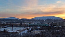
Murmansk Oblast
|
Subject of the Russian Federation
Murmansk Oblast
Мурманская область
|
||||||||||||||||||||||||||||||||||||
Coordinates: 68 ° 0 ' N , 35 ° 0' E
The Murmansk Oblast ( Russian Мурманская область / Murmanskaja oblast ) is an oblast in northwestern Russia .
The oblast is located in northeastern Europe and also includes the Kola peninsula . In the north is the Barents Sea , in the east the White Sea . It is bordered by the Autonomous Republic of Karelia to the south and Finland and Norway to the west .
The surface of the oblast is mostly hilly, the highest mountains are the Chibinen . The climate is tempered by the proximity to the sea and the Gulf Stream.
The Sami , who are only a small minority today, are the indigenous people of the entire area. As early as the 12th century, the Russians began to explore the coasts of the White Sea. The area remained backward for a long time, Murmansk was only founded in 1916. In the 20th century, Russia began to see the Kola Peninsula as a strategically important region and established the Northern Fleet .
The most important industry is mining, in the oblast apatite , nickel , iron ore , copper and other mineral resources are extracted. In addition, fishing (the port city of Murmansk is ice-free due to the Gulf Stream ) and the timber industry are important.
population
In the last censuses in 2002 and 2010, the population was 892,534 and 795,409, respectively. The number of inhabitants thus fell by 97,125 people (−10.88%) in these eight years. 738,382 people lived in cities in 2010. This corresponds to 92.83% of the population (in Russia 73%). By January 1, 2014, the population decreased further to 771,058 people. The distribution of the different ethnic groups was as follows:
| nationality | VZ 1989 | percent | VZ 2002 | percent | VZ 2010 | percent |
|---|---|---|---|---|---|---|
| Russians | 965.727 | 84.21 | 760.862 | 85.25 | 642.310 | 80.75 |
| Ukrainians | 105.079 | 9.16 | 56,845 | 6.37 | 34,268 | 4.31 |
| Belarusians | 38,794 | 3.38 | 20,335 | 2.28 | 12,050 | 1.51 |
| Tatars | 11,459 | 1.00 | 7,944 | 0.89 | 5,624 | 0.71 |
| Azerbaijanis | 2,695 | 0.24 | 4,614 | 0.52 | 3,841 | 0.48 |
| Tschuwaschen | 3,865 | 0.34 | 2,759 | 0.31 | 1,782 | 0.22 |
| Komi | 2.167 | 0.19 | 2,177 | 0.24 | 1,649 | 0.21 |
| Mordwinen | 4.214 | 0.37 | 2,479 | 0.28 | 1,625 | 0.20 |
| Armenians | 1,521 | 0.13 | 1,954 | 0.22 | 1,618 | 0.20 |
| Seeds | 1,615 | 0.14 | 1,769 | 0.20 | 1,599 | 0.20 |
| Karelians | 3,505 | 0.31 | 2,203 | 0.25 | 1,376 | 0.17 |
| German | 1,454 | 0.13 | 1,211 | 0.14 | 725 | 0.09 |
| Finns | 590 | 0.05 | 426 | 0.05 | 273 | 0.03 |
| Residents | 1,146,757 | 100.00 | 892.534 | 100.00 | 795,409 | 100.00 |
Note: the proportions refer to the total number of inhabitants. Including the group of people who did not provide any information about their ethnic affiliation (2002 10,679 and 2010 73,484 people)
The majority of the area's population is Russian . The Ukrainians and Belarusians are the only significant ethnic minorities in Murmansk Oblast. Their number has fallen sharply.
Administrative divisions and cities
The main cities are Murmansk and Apatity . The population lives mainly on the Murman Railway , which connects Murmansk with the southern parts of the country. Murmansk Oblast is divided into five Rajons and twelve urban districts . The administrative center of Murmansk is the only big city . There are a total of 16 cities and 12 urban-type settlements in the oblast , of which six cities and two settlements have the status of "Closed Administrative-Territorial Entities" (SATO).

| Surname | Russian | Residents (October 14, 2010) |
|---|---|---|
| Murmansk | Мурманск | 307.257 |
| Apatity | Апатиты | 59,672 |
| Severomorsk | Североморск | 50,060 |
| Montchegorsk | Мончегорск | 45,361 |
| Kandalaksha | Кандалакша | 35,654 |
| Kirovsk | Кировск | 28,625 |
| Olenegorsk | Оленегорск | 23,072 |
politics
Governor of the oblast has been Andrei Tschibis since September 27, 2019 , who temporarily took over this post on March 21, 2019 from Marina Kowtun, who had resigned early and had held the post since 2012.
Web links
- Murmansk Oblast website (Russian, English )
Individual evidence
- ↑ Administrativno-territorialʹnoe delenie po subʺektam Rossijskoj Federacii na 1 janvarja 2010 goda (administrative-territorial division according to subjects of the Russian Federation as of January 1, 2010). ( Download from the website of the Federal Service for State Statistics of the Russian Federation)
- ↑ a b Itogi Vserossijskoj perepisi naselenija 2010 goda. Tom 1. Čislennostʹ i razmeščenie naselenija (Results of the All-Russian Census 2010. Volume 1. Number and distribution of the population). Tables 5 , pp. 12-209; 11 , pp. 312–979 (download from the website of the Federal Service for State Statistics of the Russian Federation)


