Noble County, Oklahoma
![The Noble County Courthouse in Perry, listed on the NRHP since 1984 [1]](https://upload.wikimedia.org/wikipedia/commons/thumb/3/3f/NobleCountyCourthousPerry.jpg/298px-NobleCountyCourthousPerry.jpg) The Noble County Courthouse in Perry, listed on the NRHP since 1984 |
|
| administration | |
|---|---|
| US state : | Oklahoma |
| Administrative headquarters : | Perry |
| Address of the administrative headquarters: |
County Courthouse 300 Courthouse Drive Perry, OK 73077-6649 |
| Foundation : | 1893 |
| Made up from: | Cherokee country |
| Area code : | 001 580 |
| Demographics | |
| Residents : | 11,561 (2010) |
| Population density : | 6.1 inhabitants / km 2 |
| geography | |
| Total area : | 1923 km² |
| Water surface : | 27 km² |
| map | |
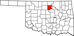
The Noble County is a county in the US -amerikanischen State Oklahoma . In 2010 , the county had 11,561 residents and a population density of 6.1 people per square kilometer. By 2013 the population had decreased to 11,446. The county seat is Perry .
geography
The county is located in north-central Oklahoma and is approximately 50 km from Kansas . In the extreme northeast, Noble County is bounded by the Arkansas River . It has an area of 1923 square kilometers, of which 27 square kilometers are water. The following neighboring counties border Noble County:
| Grant County | Kay County | Osage County |
| Garfield County |

|
Pawnee County |
| Logan County | Payne County |
history
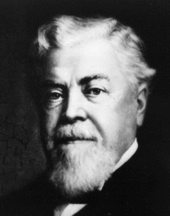
Noble County was formed on August 21, 1893 as the original county from Cherokee Country. It received its current name on November 6, 1894. It was named after John Willock Noble , a lawyer and US Secretary of the Interior. The county was settled by white settlers during the fourth official land occupation ( Oklahoma Land Run ) on September 16, 1893.
Historical objects
In addition to the Noble County Courthouse in Perry and a number of other historic buildings in Noble County, Morrison is home to the historic, abandoned Sumner School . The school is located on County Road N3300 , approximately two miles north of US Highway 64 . The former school, which includes two buildings, was listed on April 26, 1996 by the National Register of Historic Places as a historic monument with the number 96000492.
Other objects:
| Population development | |||
|---|---|---|---|
| Census | Residents | ± in% | |
| 1900 | 11,798 | - | |
| 1910 | 14,945 | 26.7% | |
| 1920 | 13,560 | -9.3% | |
| 1930 | 15,139 | 11.6% | |
| 1940 | 14,826 | -2.1% | |
| 1950 | 12,156 | -18% | |
| 1960 | 10,376 | -14.6% | |
| 1970 | 10,043 | -3.2% | |
| 1980 | 11,573 | 15.2% | |
| 1990 | 11,045 | -4.6% | |
| 2000 | 11,411 | 3.3% | |
| 2010 | 11,561 | 1.3% | |
| 2013 estimate | 11,446 | -1 % | |
| 1900–1990 2000 2010–2013 | |||
population
As of the 2010 census , Noble County had 11,561 people in 4,531 households. The population density was 6.1 people per square kilometer. In the 4531 households there were statistically 2.49 people each.
The racial the population was composed of 84.5 percent white, 2.1 percent African American, 8.8 percent Native American, 0.4 percent Asian, 0.1 percent Polynesian and other ethnic groups; 4.2 percent were descended from two or more races. Hispanic or Latino of any race was 2.7 percent of the population.
24.4 percent of the population were under 18 years old, 58.7 percent were between 18 and 64 and 16.9 percent were 65 years or older. 50.4 percent of the population was female.
The median income for a household was 43,324 USD . The per capita income was $ 21,262. 13.7 percent of the population lived below the poverty line.
Localities in Noble County
Other Unincorporated Community
structure
Noble County is divided into three Census County Divisions (CCD):
| CCD | Population (2010) | FIPS |
|---|---|---|
| Billings CCD | 724 | 40-90234 |
| East Noble CCD | 3084 | 40-90975 |
| Perry CCD | 7753 | 40-92522 |
Individual evidence
- ↑ Extract from the National Register of Historic Places - No. 84003361.Retrieved June 16, 2011
- ^ Noble County in the United States Geological Survey's Geographic Names Information System.Retrieved February 22, 2011
- ↑ a b c U.S. Census Bureau, State & County QuickFacts - Noble County, OK ( Memento of the original from July 15, 2011 on WebCite ) Info: The archive link was automatically inserted and not yet checked. Please check the original and archive link according to the instructions and then remove this notice. Retrieved January 18, 2015
- ↑ a b National Association of Counties.Retrieved January 18, 2015
- ↑ Charles Curry Aiken, Joseph Nathan Kane: The American Counties: Origins of County Names, Dates of Creation, Area, and Population Data, 1950-2010 . 6th edition. Scarecrow Press, Lanham 2013, ISBN 978-0-8108-8762-6 , p. 224 .
- ↑ Oklahoma National Register Properties ( Memento of the original from June 22, 2010 in the Internet Archive ) Info: The archive link was inserted automatically and has not yet been checked. Please check the original and archive link according to the instructions and then remove this notice.
- ^ Extract from Census.gov.Retrieved February 28, 2011
- ↑ Missouri Census Data Center - Oklahoma ( page no longer available , search in web archives ) Info: The link was automatically marked as defective. Please check the link according to the instructions and then remove this notice. Retrieved May 19, 2013
Web links
Coordinates: 36 ° 23 ′ N , 97 ° 14 ′ W


