
milestone


,_R%C3%B6mischer_Meilenstein.jpg)


A milestone , also a post mile pillar (also a half mile stone or post half mile pillar ), is a distance indicator that is set up at regular intervals on the road. Milestones, like crossroads or wayside shrines, belong to the small monuments and, among them, to the distance stones .
General
Milestones are stone distance indicators. For millennia, they were part of the basic equipment of numerous types of streets, but especially the Chausseen (also called artificial streets ). They are spread across Europe for the first time through the Roman Empire, and later worldwide through the British Empire . In Germany they were set up in large quantities in the 18th and 19th centuries and were particularly widespread due to expanding Prussia. The milestones of the 18th century were mostly postal milestones that were used by the post office to calculate postage and for travel, while those of the 19th century are often called highway milestones for easier differentiation.
Due to the numerous small territories, a certain variety of shapes arose in Germany, but different shapes, sizes and types of lettering are also known within the larger systems of Saxony and Prussia . There are milestones in Austria-Hungary as well as in England, the USA and Australia. Milestones were also set up in many countries as direct successors to the milestones. But there are also numerous countries and states that never had milestones. For the small state of Saxony-Meiningen, it is assumed that stones were only set along the streets with the introduction of the kilometer. There are also no known milestones for Württemberg.
In the course of time, the shape of the stones became simpler, as they initially had a high representative value, but would later have resulted in too high costs due to the quantity. This often enables an approximate chronological classification of the stones and there are, for example, strong differences between milestones of the 18th and 19th centuries in Saxony. In Prussia, they sometimes even differ within a region, such as the Duchy of Magdeburg, after decades.
Distance stones in antiquity
Assyrian Empire
Already the Assyrian King Sargon II had between 721 and 705 BC. BC erect stones with distance information on the streets of his empire.
Ancient Greece
In ancient Greece , pillars with distances and popular sayings stood on the streets between Athens and the Demen (the smallest administrative districts).
Roman Empire
For the milestones of this empire see: Miliarium .
The Roman Empire had a very well developed road system, the "Roman roads" . After 123 BC So-called miliaria were built on these streets . In certain formerly Celtic areas of the northern provinces , the stones stood at a distance of one league and were therefore called " league stones " . The stadiasmus patarensis was found in 1993 .

Roman milestone from the year 201, found near Sankt Margarethen in Lungau

Roman Leugenstein from Friedberg , Hessen, on display in the Wetterau Museum

Roman milestone near Jülich , Voreifel

Roman milestone in the Corbières (France)


China
For the time of the Tang Dynasty (618–907), milestones that marked the way along the streets have been handed down.
Modern times: Germany
Bavaria
Similar to Baden-Württemberg, there were hour columns in Bavaria instead of milestones. However, it is assumed that milestones were set in the principalities of Bayreuth and Ansbach, which fell to Prussia in 1792 . The obelisks that can be found there today, however, have hours and kilometers and both belonged to Prussia as Ansbach-Bayreuth until 1805.
- Sandstone hourly pillar, 2nd half of the 18th century in Eckersdorf , Bayreuth district

10 hours to Bamberg

17 hours to Erlangen


Brandenburg
The Thirty Years War brought economy and trade in the Lubusz region to a standstill. The roads fell into disrepair and grew, so the Elector Friedrich Wilhelm von Brandenburg had a new post and trade line set up in 1646. Its course already largely corresponded to the course of today's federal highway 1 in Brandenburg. It led from Kleve in the Rhineland (from 1614 part of Brandenburg), via Berlin , through the Lebuser Land, to Küstrin , through the then Kingdom of Poland to Königsberg (Prussia) in the then Duchy of Prussia (1618 to Brandenburg), today Kaliningrad , Russia . Another post line from Berlin through the Lebuser Land via Frankfurt (Oder) to the Austrian part of Silesia was available from around 1660. It was later largely followed by Reichsstraße 5, today with some changes the Bundesstraße 5 . The old trade route to Küstrin from Frankfurt (Oder) via Lebus was probably a cross-connection around 1670. The first signposts at the crossroads were placed for these unpaved routes on the orders of Elector Friedrich III, later Frederick I , King of Prussia around 1698 built. You should be delicate, like the pointing bare arm of a Roman warrior, cut from wood and attached to an oak pole. This post was painted yellow, from 1704 blue-white-orange, after the Seven Years' War in the Prussian state colors black and white, in addition it was provided with distance information.
The first mileage pillars on the road between Berlin and the two residences Oranienburg and Potsdam are also known from this period. On a drawing by the architect Christian Eltester (1671–1700) from 1699, you can see a stone with the Latin inscription: "ab urbe lapis II M passus distat" , in German roughly: "The stone is two miles away from the city" . Above is a crown with the initials "F3" for "Friedrich III." The "II M" (rush) therefore refer to a stone near Zehlendorf . Another stone is also described for Potsdam in 1798: “Next to the new obelisk in front of the long bridge stands that of Elector Friedrich III. Set smaller milestone: on which is the fourth stone four miles from Berlin 1700, on the morning and evening side you can see the name, and above it the Churhuth ” .
"The Schöneberg milestone that stood on the corner of Wieland-Strasse in the Friedenau district of Schöneberg had to be removed when the old Provinzial-Chaussee was regulated. On this occasion it was totally destroyed because nobody thought of its historical value. This milestone is from King Friedrich Wilhelm III. been erected. The king, who made his journeys from Berlin to Potsdam by car and still did so when the Potsdamer Bahn was in operation in 1837, had three milestones built on Potsdamer Chaussee. The first was the one that has now been demolished, the second is still in Zehlendorf today, while the third, also still there, is behind Wannsee. These milestones rise on a granite base in the shape of a tall column topped by a metal ball with a flashing tip. On the front is in Latin numerals and letters 1, II, resp. III miles from Berlin. The distance of the number of miles has been measured from Dönhoffplatz, where a large obelisk used to mark the starting milestone at the point where the stone monument stands today. "
In the course of the expansion of the transport network and the paving of the roads, the post roads were measured and laid out according to plan from 1800 to better calculate the charges. The paved roads, known as “artificial roads”, “stone roads” or “ Chausseen ”, which now run in a straight line over longer stretches , have been given appropriate markings in the form of milestones for orientation about the distances and compliance with the specified travel times for riding and driving mail. The Prussian mile was 7.532 km long. The zero point of the measurement of all Prussian post roads in Berlin was at the old Leipziger Tor near Dönhoffplatz . In 1979 the semicircular Spittelkolonnaden was restored on Dönhoffplatz in Leipziger Straße and a replica of a post mile column was erected in its center, which in 1730 marked the beginning of the distance to Potsdam as a stone obelisk ( “mile pointer”) , here the “mile zero” “Of Reichsstraße 1. The location is a few meters from the original installation site. Other city gates, the castle (or the eagle column in front of the castle) and the flagpole at the town hall are also assumed to be the location of the zero point of the measurement of all Prussian post roads in Berlin .
While the Saxon post mile pillars and stones are almost the same apart from slight deviations, there have been a wide variety of shapes in Prussia over the years. There are two variants in the Lebuser Land:
At the Kunststrasse Berlin - Müncheberg - Frankfurt (Oder) around 1802 round base stones of about 0.85 m height were set up at a distance of one mile with the chiseled distance "... MEILEN BIS BERLIN". Received is z. B. the milestone in Georgenthal (Falkenhagen (Mark)) . It says IX miles to Berlin. In between were 1 ⁄ 2 milestones and rectangular 1 ⁄ 4 milestones. Received is z. B. the 1 ⁄ 4 milestone near Arensdorf (Steinhöfel) . The Chaussee Müncheberg - Seelow - Kietz - Küstrin was expanded in the years 1817 to 1819 and received cast-iron mile oblisks. The first mileage pillar was located in Müncheberg at the junction of today's B 1 and B 5. The multi-tiered approximately 2.80 m high mileage pillar showed the relief of a post horn hanging on a bow and ribbon on the surfaces facing the direction of travel. The 1 ⁄ 4 and 1 ⁄ 2 milestones were bell-shaped, with an elliptical cross-section and were made of sandstone . The 1 ⁄ 2 milestones were about 1.22 m high, the 1 ⁄ 4 milestones about 0.92 m. The designation was chiseled in the upper area, with a four-leaf rosette below as a relief .
In the areas of the current districts of Potsdam-Mittelmark and Elbe-Elster , which belonged to Saxony before 1815 , there are also Saxon post mile pillars in the cities of Bad Belzig , Niemegk , Brück , Uebigau , Wahrenbrück , Bad Liebenwerda and Elsterwerda .
After the introduction of the metric system in 1873, many milestones were implemented on kilometer distances and are therefore no longer in their original location.
Lower Saxony
The construction of highways and the setting of milestones were regulated differently in the individual territories. The road construction with milestones in Lower Saxony extends to the time between the years 1764 and 1874. In the Braunschweig territories from the 1770s road lakes were built with state funds, after the unification to the new Duchy of Brunswick there was still a phase of expansion, but soon the focus was on maintaining the built roads. State road construction in the Principality of Schaumburg-Lippe was limited to the period between 1782 and 1804.
Electorate of Hanover
In 1764 the English King George III. Funds were made available and with this, highways were built from Hanover in quick succession, around 1764 Hanover – Hameln, 1765 Hanover – Göttingen and Hanover – Kassel or 1769 Hanover – Nienburg. Quarter, half and full milestones were set up along these roads.
After the Congress of Vienna , the Hanover Mile was now measured at 7.420 kilometers instead of 9.347, which resulted in the implementation of the existing milestones. In addition, the road network was systematically expanded, creating new milestones. Satisfying the demand ended almost at the same time as the advent of rail traffic. Priority was given to this in the 1840s and 1850s, and in the road area mainly feeder roads and municipal roads were created. Milestones were rarely erected on such roads and their era ended with the introduction of the kilometer in 1874.
There are three types of whole milestones: the high columns of the 18th century, the shortened obelisks from 1822, which were part of the plan to convert the stones to the new milestone from 1818, and the so-called standardized obelisks, which are a pattern from the 1850 follow. Although these were only set at full mile intervals, it is assumed that around 150 stones were set up. The extent to which membership of Prussia still had an impact from 1866 onwards is not entirely clear. On October 7, 1870, the order was made to move the stones to the new mile, which corresponded to 7,500 kilometers. In addition, 159 new full milestones should be set. Zero points were set in Hanover, Osnabrück, Hildesheim and Göttingen.
Ostfriesland
East Frisia belonged to the Kingdom of Hanover from 1815 to 1866 . During this time, plans for the erection of wooden pillars were made . These are verifiable for the roads from Aurich to Emden, from Aurich to Leer, from Hesel to Moorburg and from Utwerdum to the north. A distinction was made between whole and half mileage pillars, as well as number posts. The zero point of these rankings were post houses and a city gate of Aurich. Until 1836 the mile was 7,420.439 meters, then 7,419.205 meters. Today there are no more milestones. Milestones set up later look similar to the historical ones, but they are not former milestones.
Grand Duchy of Oldenburg
In 1821 there was an order to set up milestones on all post roads here in the country . The distance between the stones corresponded to the geographical mile (7420.5 meters). The first road was built between Oldenburg and Bremen between 1822 and 1829. By 1855, 14 artificial roads had been built, which were 376 kilometers long. The milestones were reused as five-kilometer stones from 1874. A distinction between these and new milestones requires precise measurement of the stones, as they look very similar to one another.
Rhineland
After the Rhineland became the Prussian Rhine Province in 1815 , the Prussian milestones for distance display were created along the Middle Rhine Valley between Cologne and Mainz .
Saxony
In the Electorate of Saxony , under August the Strong and his son, a nationwide network of milestones was set up in the 18th century, the Saxon postal milestones.

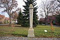
Saxon postal milestone (distance column) and royal Saxon milestone (whole milestone) at the Untertor in Geithain

Saxon postal mileage column (distance column) in Bad Liebenwerda , Brandenburg

Saxon post mile pillar (full mile pillar) in Altzella near Nossen, Saxony
Ihlow, district Illmersdorf, Brandenburg, Kursächsische Postmeile column (half mile column)

Saxon post milestone (quarter milestone) in the Harte from 1732, near Liebenau , Saxony

Saxon postal mileage column (distance column) in Leisnig


.jpg)

- Royal Saxon milestones
After the conversion to a new length of the mile, namely 7.5 km, in the Kingdom of Saxony in 1840 , it was not until 1858 that the remeasuring of the roads and the erection of new distance stones, called royal Saxon milestones , began. Station stones mark the starting point of a survey. Milestones and half-milestones were set up along the road at the indicated distances. A branch stone was set up at the branching off of a side road on which a postal route ran from a main road . Border crossing stones marked the end of Saxony. After only about 15 years these stones lost their importance, because from 1875 onwards the metric system was in force in the German Empire. The milestones were history. This change to the metric system often led to the redesign of the milestones and changes to the information on the milestones. Compared to the Saxon post mile pillars, the stones from the mid-19th century are rather unadorned. This is one of the reasons why they were not viewed, preserved and cared for as monuments everywhere. After 1990, the Saxon road construction administration restored many of the milestones that had been preserved and, as far as possible, returned them to their original locations.
Saxony-Anhalt
Due to the small German states, there are three independent milestone systems in Saxony-Anhalt: the Prussian, the Anhalt and the Electoral Saxon. The Saxon post mile pillars are the oldest, date from the 1730s and can be found in the southeast of the state. The few remaining examples include the quarter milestone in Bad Lauchstädt , the post mile column in Brehna or the post mile column in Landsberg . The Anhalt milestones are in the central part (see separate section) and the Prussian milestones are in the rest of the country. Most of them were erected in the first half of the 19th century. Counts by the Milestones research group identified 329 milestones in Saxony-Anhalt (status: end of 2002). These are under monument protection, but their existence is constantly threatened. Milestones were accidentally destroyed again and again, for example in Merseburg-Nord (1998) or Halle-Trotha (1999).
Due to the large number of milestones, there is also a greater variety of shapes. There are numerous Prussian and Anhalt round base stones, for example at Morsleben , at Frößnitz (both Prussian), in Görzig or at Münchenhof (both from Anhalt). There are also cubes with an obelis attachment (for example near Nauendorf , in Grube Ferdinande or near Magdeburg ) as well as red all-mile obelisks that are up to four meters high (e.g. in Halle-Ammendorf , in Weißenfels or also in Merseburg ), and hexagonal whole milestones ( for example near Landsberg , near Roitzsch or in Bitterfeld ). There are also bell-shaped half and quarter milestones made of red sandstone, for example in Schkopau , near Seeburg (both half milestones), near Emseloh or at Kernersee (each quarter milestones) and cube-shaped stones, for which it is not entirely clear whether they were also obelisks. Occasionally stones also deviate from these shapes, such as the whole milestone in Langenbogen .
Duchy of Anhalt
There is no precise information about the start of the road survey and the associated establishment of the milestones. The first clue from old documents is a report from the police: "... on Sunday, November 13th, 1853, the milestone between Bobbau and Heidekrug, which was only set a few weeks ago, passed." Files from 1858 show that “paths with station and milestones are marked”.

At the beginning of 1871, the remeasurement of the streets remaining in the state administration of Anhalt began in accordance with the measures and weights for the North German Confederation from 1868. On May 18, 1871, the ducal building administration reported to the secret building councilor of Vieth: “The measurement and division of the road from Dessau to Cöthen according to the meter and the corresponding installation of the station stones has now been carried out in the Dessau district.” The report also goes out shows that the statue of Prince Leopold on the large market in Dessau served as the starting point for the measurement. This was stated in the “Comments on the Decree of the Prussian Minister of Commerce on the Numbering of State Roads from September 7, 1870” with the words: “For the Duchy of Anhalt, the zero point for the dimensions and for the numbering of the main roads is in the city of Dessau Seats of the government ... “again clearly defined.

During the survey, so-called stations were set as dividing units every 75 meters. The station stones were numbered according to their location, the number in front of the comma indicated the mile from Dessau and the number after the comma indicated the number of stations of the respective mile.
The measurement was carried out with the help of measuring chains (also called field chains). A cost estimate from the Schmidt workshop for mathematical and optical instruments from Halle is known from the state main archive Saxony-Anhalt , Dessau department, in which chains were offered that were 20 meters long, the individual links could be disassembled into 5 and 10 meter pieces with ½ meter length and 10 cm graduation. The ducal building authorities bought such chains at a unit price of 5 thalers 15 silver groschen. The total cost of the survey was estimated at 1,529 talers and 27 silver groschen. The survey was started in the Dessau building district and completed in April 1872. The only exception was Selketalstrasse, which, according to the order of October 26, 1872, should not be measured, since after the end of the North German Confederation it became apparent that new regulations would be enacted through new imperial laws. On August 17, 1868, the North German Reichstag decided to introduce a new measure and weight system , which was to come into force on January 1, 1872. In it, the distance for a mile was set at 7,500 meters and the rod size was accordingly shortened to 3.7500 meters. As early as December 7, 1873, this order of weight and measure of the North German Confederation was repealed by a Reich law. From then on, the new division into meters, kilometers and myriameters applied, with 1 myriameter corresponding to a distance of 10 kilometers. All of these specifications had an impact on the measurement of the roads and thus also on the construction of the milestones.
Mecklenburg-Western Pomerania
Similar to Saxony-Anhalt, in Mecklenburg-Western Pomerania there are both round columns (especially in the historic Mecklenburg-Strelitz ) and square obelisks (in the territories of Western Pomerania and Mecklenburg-Schwerin ). The counting of the Milestones research group in 2003 resulted in 446 received milestones for today's Mecklenburg-Western Pomerania, of which 239 were whole milestones (including 61 round pillars; status: end of 2002). Their origin could not always be clarified, but more than half were built in Mecklenburg-Schwerin (224), 93 could be assigned to Prussia and 31 to Mecklenburg-Strelitz.
The greatest variety of forms exists in Mecklenburg-Schwerin, as it was often left to stock corporations here to build the roads. These were then allowed to introduce individual shapes for their respective street. In Mecklenburg-Strelitz, however, the round base stone was introduced as the standard shape in 1834. Along the road from Neubrandenburg via Teterow and Güstrow to Rostock there is the special feature that when the kilometer was converted, the new five-kilometer stones were placed on the northern side of the street, whereas the milestones were on the southern side. But wherever there was a 2 mile point, i.e. every 15 kilometers, the milestone was set on the north side and made a 5 kilometer stone. In Western Pomerania, all milestones were probably implemented in the kilometer system after 1874. There are special forms of stones in Western Pomerania on Rügen and in the Damgarten area . The Prussian stones are mainly found on the streets in the east of Western Pomerania that start from Stettin . The last remaining round base stone in Western Pomerania disappeared in the early 1990s.
Hamburg
The Free Hanseatic City of Hamburg set its own milestones, the number of which was given as 693 copies in 1843. This is explained by the fact that the stones were not set up at the usual intervals of quarter miles, but at intervals of hundredths of a mile. With the changeover to the new mile, which was 7.5 kilometers long, the decision was made in 1870 to move the zero point of the streets from the respective city gates to the city center and chose the stock exchange as the starting point for mileage counting.
Schleswig-Holstein
The construction of the older art roads in Holstein was ordered by the Danish king / the Danish administration. This is why there are Danish milestones along the Altona-Kiel , Altona-Lübeck and Altona-Neustadt roads . However, it has meanwhile also been proven that further milestones were set up in Holstein in the Prussian period from 1867. In addition, there was an effort to set its own milestones in the free Hanseatic city of Lübeck, which can be specifically proven in a letter from 1844. As early as 1817, it can be proven that Lübeck tried to build roads. The milestones set up to 1870 had to be implemented with the conversion to the new mile, but it seems that new stones have been placed on the other side of the street, whose whereabouts and appearance are not yet known.

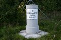
Danish milestone near Herweg, Schleswig-Holstein

Historic milestone in Bielefeld-Ummeln

Prussian milestone in the Middle Rhine Valley near Brey

Anhalt round base stone (2 miles from Dessau) near Wörlitz in Saxony-Anhalt
Myriameterstein on the A9 exit Köselitz in Saxony-Anhalt

Milestone in Hartmannsdorf near Gera in Thuringia

Hexagonal, Prussian milestone near Landsberg in Saxony-Anhalt

Bell-shaped, Prussian milestone in Seeburg in Saxony-Anhalt

Main milestone in Ludwigslust in Mecklenburg-Western Pomerania


Modern times: rest of Europe

England
In England there are, for understandable reasons, many more preserved milestones than in Germany, because the mile is still a valid measure of length there and thus the preservation of the stones was necessary for a much longer time than elsewhere in Europe. While milestones became superfluous in Germany from the 1870s onwards, as kilometers were introduced as a measure of length, the particularly widespread use of milestones in England only began with the advent of the automobile, as numerous new roads were now being built.
However, only very few milestones have survived from the Roman period in England. At least ten are known, most of which are set up in museums. Only two stones on Hadrian's Wall and one in Temple Sowerby are in their original locations. On the road between London and Oxford there were also distance columns, the Lapides . Similar to the Roman miliaria, the distance measured from the capital was given in Roman numerals.
The year 1697 is seen as a new beginning, in which King William III. initiated the list of the Moorland Guide Stones and Mark Stones . These were used for orientation in the moor and peat areas. These gained further importance through the advent of the royal mail. Today's B 1368 was one of the first roads to be marked with milestones. The stones preserved in the 15 English mile stretch between Cambridge and Barkway are known as the Trinity Hall series . When the engineer Thomas Telford was finally commissioned to build a road network in 1802, 1,500 kilometers of highways were built by 1830 alone. In addition, toll roads developed during this time, which also received milestones, which meant that there was no uniform form, because the customs associations often used regional materials.
In England, milestones were sometimes made in the form of small stairs and thus served as an aid to getting on horses.
Poland
In Poland, Prussian milestones in particular have survived. These can be found both in museums and on the roadsides. Systematic collection is ongoing. Zbigniew Czarnuch made a special contribution here with his Park of Signposts and Milestones of Cultures ( Park Drogowskazów i Słupów Milowych Cywilizacji ), which he founded in Witnica in 1994 and in which he saved several milestones. However, there were also historical Polish “milestones”, as evidenced by the milestone in Konin (Greater Poland Voivodeship) from 1151 as the oldest surviving specimen. By definition, however, this is not a milestone, as it only contains distance information, but a distance stone . Today it is considered an important cultural heritage of Poland and stood halfway between Kalisz and Kruszwica, exactly 52 kilometers from both places. The Romanesque column is one of the city's landmarks today. In addition, stories have been spun in Poland about the bell-shaped Prussian milestones that want to see the headgear of Slavic deities in them. The Saxon post mile pillars in Poland are also being researched and documented.

Prussian milestone in the "Park of Signposts and Milestones of Cultures" in Witnica (Vietz), Lebus Voivodeship, Poland

Prussian milestones in the "Museum for Roads and Paths" in Skwierzyna (Schwerin an der Warthe), Lebus Voivodeship, Poland
Prussian quarter milestone in Bogdaniec, Lubusz Voivodeship, Poland

Saxon post mile pillar in Lubań, Lower Silesian Voivodeship, Poland
.jpg)


.jpg)
There have been milestones in Denmark since the 17th century. They bear the royal initials and differ in seven different shapes: stele, stele with base, obelisk, three types of truncated cones (Keglestub) and truncated pyramids (Pyramidestub). In Sweden, the wooden mileage indicators were replaced by milestones from around 1750. In the middle of the 19th century, iron mileage indicators were made because they were cheaper to manufacture. A total of 8,000 mileage indicators are assumed. In Norway, milestones were made out of granite, and there are also cast iron milestones.
Modern times: rest of the world
Milestones can be found almost everywhere where the mile was used as a measure. This applies in particular to all regions in which the British Empire had influence.
North America
There are several types of milestones in the United States, especially in Massachusetts and Rhode Island. A certain number of milestones of the 18th century have been preserved here. These include the 1767 milestones along Boston Post Road , the oldest of which dates back to 1729, and the stones along the Great Road . In addition, a number of zero point stones have been preserved in Canada and the USA, such as the mile zero of Highway 101 in Lund, the Alaska Highway in Dawson Creek or the Trans-Canada Highway in Victoria (all British Columbia, Canada) or the zero in the USA milestones in Memphis, Tennessee, Richmond, Virginia, or Charleston, West Virginia.
India
During the Mughal period , numerous 6 to 8 m high towers ( Kos minars ) were placed along the main traffic connections (e.g. the Grand Trunk Road ) in northern India at a distance of about 2 Indian miles ( kos ) , of which still around 150 have been preserved.
today
After the introduction of the metric system were held milestones milestones and signs, tags placed. In some cases, the old milestones have also been implemented and converted into milestones.
In some German countries, the kilometer signs have again been replaced by station signs .
literature
- Eberhard Brumm: State routes in the Oldenburger Land - Chausseen, routes, dimensions, markings , in: Das Meilenstein-Journal 28 (2008) 56, pp. 7-12.
- Eberhard Brumm: Milestones & Co. between the North and Baltic Seas, Denmark and Mecklenburg , 2nd edition, Oldenburg 2017.
- Eberhard Brumm / Olaf Grell: Milestones and Kilometers in East Friesland , in: The Milestone Journal 32 (2012) 64, pp. 30–34.
- Olaf Grell: Milestones in Mecklenburg-Western Pomerania , in: Das Meilenstein-Journal 22 (2002) 44, pp. 9-13.
- Katrin Körner: The era of the royal Saxon milestones from 1858 to 1873 , 1st edition, self-published, Chemnitz 2017.
- Herbert Liman: Milestones in Lower Saxony , in: Das Meilenstein-Journal 28 (2008) 55, pp. 9-10.
- Werner Michalsky: On the history of the Lebuser country, trade routes and post roads. Council of the Seelow District Dept. Culture, Seelow 1985.
- Post pillars and milestones . Published by the research group Kursächsische Postmeilensäulen e. V. Dresden / Grillenburg (City of Tharandt). 3rd revised edition, Schütze-Engler-Weber Verlag GbR, Dresden 2007, ISBN 978-3-936203-09-7 .
- Collective of authors (head of Eberhard Stimmel): Lexicon Kursächsische Postmeilensäulen , Transpress VEB Verlag for Transport, Berlin 1989, ISBN 3-344-00264-3 .
- Maxi Zimmermann: Milestones in England and Scotland , in: Das Meilenstein-Journal 30 (2010) 59, pp. 16–22.
Web links
- Research group Kursächsische Postmeilensäulen eV
- Research group Milestones eV
- Saxon post mile pillars
Individual evidence
- ↑ Margareta Baum: Historical milestones in the Duchy of Saxony-Meiningen , in: Das Meilenstein-Journal 30 (2010) 60, pp. 41–42, here p. 42.
- ^ Herbert Liman: On the development of the roads in Württemberg - A book review , in: Das Meilenstein-Journal 24 (2004) 47, p. 45.
- ^ Herbert Liman / Olaf Grell: Prussian milestones in Bavaria? , in: Das Meilenstein-Journal 38 (2018) 76, pp. 38–42. This applies, for example, to the Kulmbach post column from 1791, which is mentioned in the list of monuments as a milestone.
- ↑ Otto Sann: The postal course Berlin-Breslau in its beginnings. In: Märkische Blätter. Local history supplement to the Oder newspaper. No. 19, of January 23, 1937, ZDB -ID 2179640-3 .
- ↑ Carl Christian Horvath (Ed.): Potsdam's oddities described, and through plans and prospectuses. explained. Carl Christian Horvath, Potsdam 1798, p. 116 .
- ↑ Milestone at Arendorf .
- ↑ Milestones in the Steinhöfel community
- ↑ a b c d Liman, p. 9.
- ↑ Liman, p. 10.
- ^ Eberhard Brumm: Historic Chausseen in Ostfriesland * 1851 *. 360-270.de, accessed on October 19, 2019 .
- ^ Eberhard Brumm: Milestones in East Friesland. 360-270.de, accessed on October 19, 2019 .
- ↑ Brumm / Grell, 2012, pp. 31, 33.
- ↑ Eberhard Brumm: Everything is history. 360-270.de, accessed on October 19, 2019 .
- ↑ Eberhard Brumm: Kilometrage in the Oldenburger Land. 360-270.de, accessed on October 19, 2019 .
- ↑ Up to 2018, 20 parts of the series Milestones in Lower Saxony by Eberhard Brumm and Olaf Grell had been published in the magazine Das Meilenstein-Journal .
- ^ Collective of authors (head of Eberhard Stimmel): Lexicon Kursächsische Postmeilensäulen , VEB Verlag for Transport, Berlin 1989, p. 143
- ↑ A selection of Prussian and Anhalt milestones from Saxony-Anhalt is shown on the homepage of the Milestones research group , accessed on November 28, 2018.
- ↑ Milestone Journal 46 (2003), p. 42.
- ↑ Arbeitsmaterial 36 (1998), ed. v. Research Group Prussian, Mecklenburg and Anhalt Milestones, p. 34 and Fred Sawusch's homepage , accessed on November 28, 2018.
- ↑ Illustrated article on the milestone Grube Ferdinande , Saalekreis im Bild, accessed on November 28, 2018.
- ↑ Representations of these milestones can be found on different pages: Merseburg im Bild , Halle im Bild (each article with photos), Mitteldeutsche Zeitung , all accessed on November 28, 2018. Another example of the Altweidenbach all-mile obelisk , Saalekreis im Bild, accessed on November 28 2018.
- ↑ Illustrated articles on these spacer stones can be found here, for example: Halbmeilenstein Schkopau , Viertelmeilenstein bei Höhnstedt , there also other examples e.g. B. the half milestone in the courtyard of Moritzburg , all accessed on November 28, 2018.
- ↑ An illustrated documentation of a complete section of road between Magdeburg and Halle with the milestones of various sizes can be found on the homepage of Fred Sawusch The Prussian milestones along the B 71 / B 6 between Magdeburg and Halle / S. - An inventory , accessed on November 28, 2018. You often have a specialization at the top that suggests an essay. The variety of forms of the Prussian milestones is documented for the Halle area, for example by Wernfried Fieber: Prussian milestones in the Saalkreis and the city of Halle , in: Heimatblätter Halle-Saalkreis 2004, pp. 12-19.
- ↑ See Wikisource (Federal Law Gazette of the North German Federation Volume 1868, No. 28, Pages 473-478; Law No. 156 of 1868).
- ↑ Dirk Schröter: Milestones in Anhalt-Dessau ( Memento from November 21, 2013 in the Internet Archive ). Illustrated documentation on milestones in Anhalt can be found on Fred Sawusch's homepage . A map with 15 locations (each with photo) in the southeastern Harz can be found on the homepage of the Milestones Research Group , all accessed on November 28, 2018.
- ↑ Grell, 2002, pp. 9-11. See also: Galleries of the Milestones Research Group on Mecklenburg-Strelitz , Western Pomerania and Mecklenburg-Schwerin , as well as the Heimat Mecklenburgische Seenplatte page, accessed on March 6, 2016.
- ↑ Milestone Journal 45 (2003), p. 13.
- ↑ Grell, 2002, pp. 10-11.
- ^ Brumm, Meilensteine & Co , pp. 15–27.
- ↑ Brumm, Meilensteine & Co , pp. 3–14, 27–36. - Internet documentation: Distance information on the road , State Office for Road Construction and Traffic Schleswig-Holstein; The milestones of the Chaussee Schnelsen to Lübeck from 1840 , The milestones of the Altona-Kieler Chaussee from 1832 , each Schelsen archive; The Altona-Kieler Chaussee , private homepage of Jan Willamowius, all accessed on October 29, 2018.
- ↑ Zimmermann, p. 16.
- ↑ Zimmermann, pp. 18-19.
- ↑ In the publications of the Milestones research group , more than ten articles on milestones in Poland appeared, some of which were authored by Carnuch. About the park: Park Drogowskazów , witnica.pl, and Witnica - Park Drogowskazów i Słupów Milowych Cywilizacji , polskaniezwykla.pl, each accessed on December 14, 2018.
- ↑ The Konin Pillar , Wielkopolska region, accessed on December 14, 2018.
- ↑ Milestenstyper (Danish-language website of Dansk Vejhistorisk Selskab ), accessed on October 28, 2018.
- ↑ Swedish Milestones (Danish-language page of Dansk Vejhistorisk Selskab ), accessed on October 28, 2018. Some stone specimens can be found on the Bygdeband and DigitaltMuseum pages , accessed on October 28, 2018.
- ↑ Norwegian Milestones (Danish-language page of Dansk Vejhistorisk Selskab ), accessed on October 28, 2018. The DigitaltMuseum is showing some copies , accessed on October 28, 2018.
- ↑ What are milestones and what do they look like? , Milestones Research Group, accessed on May 9, 2020.