Ussel (Corrèze)
|
Ussel Ussèl |
||
|---|---|---|

|
|
|
| region | Nouvelle-Aquitaine | |
| Department | Corrèze | |
| Arrondissement | Ussel | |
| Canton | Ussel (main town) | |
| Community association | Haute-Corrèze Communauté | |
| Coordinates | 45 ° 33 ' N , 2 ° 19' E | |
| height | 588-781 m | |
| surface | 50.37 km 2 | |
| Residents | 9,736 (January 1, 2017) | |
| Population density | 193 inhabitants / km 2 | |
| Post Code | 19200 | |
| INSEE code | 19275 | |
| Website | www.ussel19.fr | |
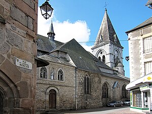
 Ussel: church square |
||
Ussel ( Occitan Ussel [ ysel, Vyse ]) is a French municipality with 9736 inhabitants (as of January 1 2017) in the department of Corrèze in the region Nouvelle-Aquitaine ; it is the administrative seat of the arrondissement of Ussel and the canton of Ussel (until 2015 of the two cantons of Ussel-Est and Ussel-Ouest ).
geography
Ussel is located in the Massif Central on one of the outermost foothills of the Plateau de Millevaches on the Diège and Sarsonne rivers . The city is on the RN 89 that connects Bordeaux to Lyon via Clermont-Ferrand . Through traffic was removed from the city with the construction of the A89 autoroute .
The municipality is associated with the Millevaches en Limousin Regional Nature Park .
coat of arms
Description : In blue a right golden door with black fittings accompanied by three five-pointed golden stars .
Population development
- 1962: 7994
- 1968: 8464
- 1975: 10.664
- 1982: 11,765
- 1990: 11,448
- 1999: 10,753
- 2016: 9782
Attractions
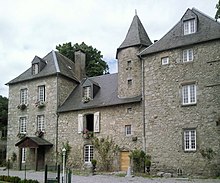
- Château de Diège (castle)
- Maison de l'Enfant
Personalities
sons and daughters of the town
- François Chassagnite (1955–2011), jazz trumpeter and singer
- Jean-Pierre Cottanceau (* 1953), Roman Catholic religious, Archbishop of Papeete in Tahiti
Connected to the city
- Jacques Chirac as MP for Ussel
- François Hollande as a member of the local council from 1983 to 1989
- Marcel Treich-Laplène (1860–1890), explorer
Web links
- The city on the Internet
- Office de tourisme (French, English)

