
Sarran
|
Sarran Serran |
||
|---|---|---|
.svg)
|
|
|
| region | Nouvelle-Aquitaine | |
| Department | Corrèze | |
| Arrondissement | Ussel | |
| Canton | Égletons | |
| Community association | Ventadour-Égletons-Monédières | |
| Coordinates | 45 ° 25 ′ N , 1 ° 56 ′ E | |
| height | 500-819 m | |
| surface | 26.09 km 2 | |
| Residents | 275 (January 1, 2017) | |
| Population density | 11 inhabitants / km 2 | |
| Post Code | 19800 | |
| INSEE code | 19251 | |
.jpg) Sarran |
||

Sarran ( Serran in Occitan ) is a French municipality with 275 inhabitants (at January 1, 2017) in the Correze in the region Nouvelle-Aquitaine . The inhabitants call themselves Sarranais (es).
geography
The municipality is located in the Massif Central in the southern part of the Plateau de Millevaches and therefore also in the Regional Nature Park Millevaches en Limousin . Only one kilometer northeast of the community center is the highest point in the area, the Puy de Sarran, at 819 meters . Two large valleys characterize the municipality, that of the Corrèze and that of the Montane .
The prefecture of the Tulle department is located about 23 kilometers southwest and Égletons about 10 kilometers east. Exit 22 of the A89 autoroute is about nine kilometers east.
The neighboring municipalities of Sarran are Saint-Yrieix-le-Déjalat in the northeast, Rosiers-d'Égletons in the east, Vitrac-sur-Montane in the south, Corrèze in the southwest, Meyrignac-l'Église in the west and Chaumeil in the northwest.
coat of arms
Description : Set in red with a golden bevel and blue with a golden lion .
Population development
| year | 1962 | 1968 | 1975 | 1982 | 1990 | 1999 | 2007 | 2016 |
| Residents | 381 | 367 | 321 | 293 | 275 | 289 | 273 | 275 |
Personalities
- Jacques Chirac (1932–2019), former President of France
- Bernadette Chirac (* 1933), wife of Jacques Chirac and member of the Conseil général of Corrèze
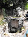
Attractions
- Saint-Pierre-ès-Liens church from the 15th century with a remarkable altarpiece
- Castle of Bity, owned by the Chirac family
- Museum of President Jacques Chirac
Oratory near the museum

Saint-Pierre-ès-Liens church

Altarpiece

town hall
.jpg)
.jpg)
.jpg)
.jpg)
Web links
Individual evidence