
Bernstorf
| coat of arms | Germany map | |
|---|---|---|

|
Coordinates: 53 ° 50 ' N , 11 ° 7' E |
|
| Basic data | ||
| State : | Mecklenburg-Western Pomerania | |
| County : | Northwest Mecklenburg | |
| Office : | Grevesmühlen-Land | |
| Height : | 22 m above sea level NHN | |
| Area : | 17.56 km 2 | |
| Residents: | 337 (Dec. 31, 2019) | |
| Population density : | 19 inhabitants per km 2 | |
| Postal code : | 23936 | |
| Area code : | 03881 | |
| License plate : | NWM, GDB, GVM, WIS | |
| Community key : | 13 0 74 005 | |
| Office administration address: | Rathausplatz 1 23936 Grevesmühlen |
|
| Website : | ||
| Mayor : | Mirko Timm | |
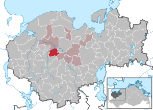
| Location of the municipality Bernstorf in the district of Northwest Mecklenburg | ||
  |
||

Bernstorf is a municipality in the district of Northwest Mecklenburg in Mecklenburg-Western Pomerania, Germany. It is administered by the Grevesmühlen-Land office based in the city of Grevesmühlen , which forms an administrative partnership with the office.
geography
The municipality of Bernstorf is located seven kilometers southwest of the city of Grevesmühlen and is about 30 kilometers from Wismar . The Stepenitz and Radegast rivers enclose the slightly hilly municipality in the north and west. The municipality is characterized by agriculture.
Bernstorf is surrounded by the neighboring communities Stepenitztal in the north, Grevesmühlen in the northeast, Upahl in the east and Rehna in the south and west.
Bernstorf includes the districts of Bernstorf-Expansion, Jeese, Pieverstorf, Strohkirchen, Wilkenhagen and Wölschendorf.
history
The name of the community goes back to the Bernstorff family, who owned the Bernardestorp estate from the 13th century until 1945 .
politics
Coat of arms, flag, official seal
The municipality has no officially approved national emblem, neither a coat of arms nor a flag. The official seal is the small state seal with the coat of arms of the state of Mecklenburg. It shows a looking bull's head with torn off the neck fur and crown and the inscription "GEMEINDE BERNSTORF • LANDKREIS NORDWESTMECKLENBURG".
Attractions

- The manor house in Bernstorf is an elaborate two-storey neo-renaissance building, which was built from 1877 to 1880 according to plans by Georg Daniel in the form of the Dutch renaissance , one could also say Weser renaissance. Brick for the foundation and sandstone for all architectural details ensure a highly varied appearance. On the south side there are two side wings and a flat central projectile with volute gables and on the east side an octagonal tower. The structure was made with yellow bricks and sandstone. The last owner of the estate was Hermann Graf von Bernstorff (1867–1946) until 1945. After the renovation, a cancer hospice was opened in the building on April 14, 2014.
- A stone of atonement for Werner Bernstorp from 1359 is located away from the manor house in the palace gardens.
traffic
The Ostseautobahn A 20 divides the municipality into a north and a south half; the Grevesmühlen motorway junction is around eleven kilometers away. There is a connection to the federal highway 105 (Grevesmühlen– Lübeck ) via the neighboring municipality of Stepenitztal . In Grieben, four kilometers away, there is a stop on the Lübeck – Bad Kleinen railway line .
Personalities
- Paul Brockmüller (1864–1925), a painter and illustrator, was born in Wölschendorf .
Web links
- Information about Bernstorff at grevesmuehlen.de
Individual evidence
- ↑ Statistisches Amt MV - population status of the districts, offices and municipalities 2019 (XLS file) (official population figures in the update of the 2011 census) ( help ).
- ↑ Main statute, § 1, paragraph 1
- ^ Horst Ende : Georg Daniel as an architect and preservationist in Mecklenburg. Lecture on February 11, 2004 on his 175th birthday at the State Office for Monument Preservation in Schwerin.
- ^ Georg Dehio : Handbook of German Art Monuments. Mecklenburg-Western Pomerania , Deutscher Kunstverlag, revision, Munich / Berlin 2000, ISBN 3-422-03081-6 , p. 66 f.
- ^ History of the house. (No longer available online.) In: Website of Schloss Bernstorf gGmbH. Archived from the original on May 9, 2015 ; accessed on July 28, 2015 . Info: The archive link was inserted automatically and has not yet been checked. Please check the original and archive link according to the instructions and then remove this notice.
- ^ Manor house (castle) Bernstorf. In: gutshaeuser.de. Retrieved July 28, 2015 .
- ↑ Volker Bohlmann: Manor opened as a biohospice. In: Schweriner People's Newspaper . April 4, 2014, archived from the original on April 7, 2014 ; accessed on July 28, 2015 .

Alt Meteln | Bad little ones | Barnekov | Benz | Bernstorf | Bibow | Blowatz | Bobitz | Boiensdorf | Boltenhagen | Brüsewitz | Carlow | Cramonshagen | Dalberg-Wendelstorf | Damshagen | Dassow | Dechow | Mecklenburg village | Dragun | Gadebusch | Gägelow | Glasin | God's gift | Grambov | Grevesmühlen | Greaves | Large Molzahn | Big Stieten | Hohenkirchen | Tall beasts | Holdorf | Hornstorf | Poel Island | Jesendorf | Kalkhorst | Klein Trebbow | Klütz | Kneese | Koenigsfeld | Krembz | Krusenhagen | Lübberstorf | Luebow | Lübstorf | Lüdersdorf | Lützow | Menzendorf | Metelsdorf | Mills Eichsen | Neuburg | Neukloster | Passee | Perlin | Pingelshagen | Pokrent | Rehna | Rieps | Roduchelstorf | Roggendorf | Rye peat | Rögnitz | Rüting | Schildenal | Schlagsdorf | Schoenberg | Seehof | Selmsdorf | Siemz-Niendorf | Stepenitztal | Testorf-Steinfort | Thandorf | Upahl | Utecht | Veelböken | Ventschow | Warin | Warnow | Wedendorfersee | Wismar | Zickhusen | Zierow | Zurow | Züsow