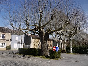
Pineapple (Haute-Garonne)
| Anan | ||
|---|---|---|
|
|
||
| region | Occitania | |
| Department | Haute-Garonne | |
| Arrondissement | Saint-Gaudens | |
| Canton | Cazères | |
| Community association | Coeur et Coteaux du Comminges | |
| Coordinates | 43 ° 21 ′ N , 0 ° 49 ′ E | |
| height | 199-327 m | |
| surface | 13.43 km 2 | |
| Residents | 243 (January 1, 2017) | |
| Population density | 18 inhabitants / km 2 | |
| Post Code | 31230 | |
| INSEE code | 31008 | |
| Website | http://www.mairie-anan.fr/ | |
 Anan |
||
Anan ( identical in Occitan ) is a French commune with 243 inhabitants (as of January 1, 2017) in the Haute-Garonne department in the Occitanie region (before 2016 Midi-Pyrénées ). The municipality belongs to the arrondissement of Saint-Gaudens and is part of the canton of Cazères (until 2015 L'Isle-en-Dodon ). The inhabitants call themselves ananois .
geography
Anan lies in the Comminges landscape and in the Lannemezan plain on the Save . Anan is surrounded by the neighboring communities of L'Isle-en-Dodon in the north and north-west, Saint-Frajou in the east and south-east, Saint-Laurent in the south, Montesquieu-Guittaut in the south-west and Puymaurin in the west and north-west.
Population development
| 1962 | 1968 | 1975 | 1982 | 1990 | 1999 | 2006 | 2013 |
|---|---|---|---|---|---|---|---|
| 308 | 270 | 261 | 244 | 238 | 230 | 217 | 228 |
| Source: Cassini and INSEE | |||||||
Attractions
- Saint-Jean church
literature
- Le Patrimoine des Communes de la Haute-Garonne. Flohic Editions, Volume 1, Paris 2000, ISBN 2-84234-081-7 , pp. 771-773.
Web links
Commons : Anan - collection of images, videos and audio files
