Boutx
|
Boutx bots |
||
|---|---|---|
|
|
||
| region | Occitania | |
| Department | Haute-Garonne | |
| Arrondissement | Saint-Gaudens | |
| Canton | Bagneres-de-Luchon | |
| Community association | Pyrénées Haut Garonnaises | |
| Coordinates | 42 ° 55 ' N , 0 ° 43' E | |
| height | 560-1,869 m | |
| surface | 47.28 km 2 | |
| Residents | 244 (January 1, 2017) | |
| Population density | 5 inhabitants / km 2 | |
| Post Code | 31160 and 31440 | |
| INSEE code | 31085 | |
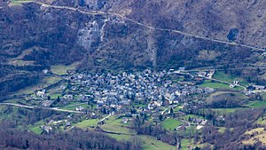
 View of Boutx |
||
Boutx ( Occitan : Bots ) is a French commune with 244 inhabitants (as of January 1, 2017) in the Haute-Garonne department in the Occitanie region ; it belongs to the arrondissement of Saint-Gaudens and the association of communes Pyrénées Haut Garonnaises founded in 2016 . The inhabitants are called Boutxois .
geography
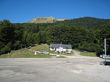
Boutx is located in the Pyrenees in the south of the historic province of Comminges , about 30 kilometers south of Saint-Gaudens and about eight kilometers north of the border with Spain . The mountainous and very wooded municipal area has an east-west extension of 20 kilometers. With an area of 47.28 km², Boutx is the seventh largest of the 587 communes in the Haute-Garonne department. The numerous mountain streams in the municipal area drain over the Ger or directly to the upper Garonne . Approximately in the middle of the municipality is the 1343 m high Col de Menté, a road pass that leads from the Garonne valley in the west to the Gertal and on to the Col de Portet-d'Aspet in the west. Both passes were often involved in Tour de France stages in the past . The municipality of Boutx includes the villages of Boutx, L'Artigue, Ger de Boutx, Coulédoux, Le Couéu, Lacus and Argut dessus as well as the hamlets of Carrère, Plandan, Bienne, Mascarole, Rouge, Les Mentesses, Le Boutas, Courraou, Cabane d'Escales , Berdulet, Le Bourrut, Cubouch, Sahorgue, Soulan, Couret de Bon. Cote de la Mole, Peyras, L'Esponille, Chapitre, Mothe, Chourique, Coume de Bugat, Plan du Rey, Cap de Tire, Goutasson, Cuchere, Coulomé, Sarrat, Souleilla, Tournerisse, Penot, Touront, Le Sourd, Portillon, Magine, Lascomères, Megnagne, Mussau, Auirondes, Pierre Blanche, Le Brocaillon, L'Artigue and the Station du Mourtis ski resort . Boutx is surrounded by the neighboring communities of Sengouagnet in the north, Razecueillé and Portet-d'Aspet in the northeast, Saint-Lary in the east, Melles in the south, Argut-Dessous , Fos and Saint-Béat-Lez in the southwest, Eup (point of contact) in the west as well as Bezins-Garraux and Arguenos in the northwest.
The highest peaks in the municipality of Boutx are:
|
|
|
history
In 1930 Argut-Dessus was incorporated into Boutx. In 1974 the previously independent municipality of Coulédoux merged with Boutx.
Population development
| year | 1962 | 1968 | 1975 | 1982 | 1990 | 1999 | 2007 | 2017 |
| Residents | 250 | 251 | 304 | 362 | 324 | 259 | 269 | 244 |
| Source: Cassini and INSEE | ||||||||
Attractions
- Saint-Georges church
- Notre-Dame-du-Lac chapel
- Church of the Birth of Our Lady ( Église de la Nativité-de-la-Sainte-Vierge ) in the Ger de Boutx district
- Church in the Argut-Dessus district
- Church in the district of Coulédoux
- numerous hall crosses
Economy and Infrastructure
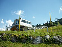
Tourism dominates in Boutx. Many hotels, guesthouses and holiday homes take in large numbers of holidaymakers, especially in winter. In 1965, the Station du Mourtis ski area was created with a few ski lifts. There are still 17 farms in the municipality, which mainly breed cattle (horses, dairy cows, goats, sheep).
Route nationale 125 runs three kilometers west of Boutx from the Autoroute A645 motorway slip road to Vielha in Spain.
literature
- Le Patrimoine des Communes de la Haute-Garonne. Flohic Editions, Volume 2, Paris 2000, ISBN 2-84234-081-7 , pp. 1297-1300.
supporting documents
- ↑ Histoire de la commune on annuaire-mairie.fr
- ↑ Boutx on cassini.ehess.fr
- ↑ Boutx on insee.fr
- ↑ Farms on annuaire-mairie.fr


