
Les Tourreilles
|
Les Tourreilles Eras Torrelhas |
||
|---|---|---|
|
||
| region | Occitania | |
| Department | Haute-Garonne | |
| Arrondissement | Saint-Gaudens | |
| Canton | Saint-Gaudens | |
| Community association | Coeur et Coteaux du Comminges | |
| Coordinates | 43 ° 7 ' N , 0 ° 33' E | |
| height | 413-553 m | |
| surface | 12.33 km 2 | |
| Residents | 384 (January 1, 2017) | |
| Population density | 31 inhabitants / km 2 | |
| Post Code | 31210 | |
| INSEE code | 31556 | |
 Mairie Les Toureilles |
||

Les Tourreilles ( Occitan Eras Torrelhas ) is a French commune with 384 inhabitants (as of January 1, 2017) in the Haute-Garonne department in the Occitania region (before 2016 Midi-Pyrénées ); it is part of the arrondissement of Saint-Gaudens and the canton of Saint-Gaudens (until 2015 Montréjeau ). The inhabitants are called Tourreillais .
geography
Les Tourreilles is located in the historic province of Comminges at the foot of the Pyrenees , about 80 kilometers southwest of Toulouse . Les Tourreilles is surrounded by the neighboring communities of Franquevielle in the north, Ponlat-Taillebourg in the east, Ausson in the southeast, Montréjeau in the south and Cuguron in the south and west.
Population development
| year | 1962 | 1968 | 1975 | 1982 | 1990 | 1999 | 2006 | 2017 |
|---|---|---|---|---|---|---|---|---|
| Residents | 300 | 291 | 305 | 283 | 305 | 358 | 382 | 384 |
| Source: Cassini and INSEE | ||||||||
Attractions
- Church of Sainte-Anne

Church of Sainte-Anne

Water tower
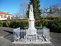
Fallen memorial

Community festival hall


literature
- Le Patrimoine des Communes de la Haute-Garonne. Flohic Editions, Volume 2, Paris 2000, ISBN 2-84234-081-7 , p. 1068.