
Heathland (Thuringia)
| coat of arms | Germany map | |
|---|---|---|
 Help on coat of arms |
Coordinates: 51 ° 0 ' N , 11 ° 55' E |
|
| Basic data | ||
| State : | Thuringia | |
| County : | Saale-Holzland district | |
| Management Community : | Heideland-Elstertal-Schkölen | |
| Height : | 302 m above sea level NHN | |
| Area : | 37.56 km 2 | |
| Residents: | 1776 (Dec. 31, 2019) | |
| Population density : | 47 inhabitants per km 2 | |
| Postal code : | 07613 | |
| Area code : | 036691 | |
| License plate : | SHK, EIS, SRO | |
| Community key : | 16 0 74 039 | |
| Community structure: | 7 districts | |
| Address of the municipal administration: |
Pillingsgasse 2 07613 OT Königshofen, municipality of Heideland |
|
| Mayor : | Heiko Baumann | |
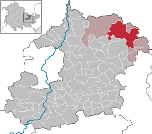
| Location of the municipality of Heideland in the Saale-Holzland district | ||
  |
||

Heideland is a municipality in the northeast of the Saale-Holzland district near Eisenberg and part of the Heideland-Elstertal-Schkölen administrative community . There is a branch of the VG administration in Heideland.
geography
Neighboring communities
Neighboring communities are Walpernhain , Crossen an der Elster , Hartmannsdorf , Rauda , the city of Eisenberg , Gösen , Petersberg and Schkölen in the Saale-Holzland district and Osterfeld , Droy says and Wetterzeube in the Saxony-Anhalt Burgenland district .
Community structure
Heideland consists of the districts of Buchheim , Etzdorf , Großhelmsdorf , Königshofen , Lindau / Rudelsdorf , Thiemendorf and Tbodla . The community was formed on April 9, 1994 as part of a regional reform.
history
The places Buchheim (documentary first mention: 1196), Etzdorf (1219), Thiemendorf (6 May 1296) and Törpla (27 November 1341) belonged to the founding of the State of Thuringia in 1920 the duchy of Saxe-Altenburg on, which until the mid-19 Century to the Wettin district office in Eisenberg .
Großhelmsdorf (September 11, 1223), Lindau (September 13, 1303) and Rudelsdorf (1350) again belonged to the Weißenfels office , which in the course of its existence belonged to the Electorate of Saxony , to the Principality of Saxony-Weißenfels and from 1806 to the Kingdom of Saxony . Through the Congress of Vienna in 1815 they came to the Kingdom of Prussia and were annexed to the Province of Saxony .
Königshofen (1256) was part of the Electoral Saxon area, then Prussian and Altenburg until 1868, and only then came completely to Saxony-Altenburg, which in return gave its share in Willschütz (approx. 1145) to Prussia.
The mountain tongue at the northeast end of the village of Thiemendorf between the Schindegraben and the side gorge was built with the "Timo" castle. It came from the 12th century. During renovation work in 1972/73, the basement was uncovered and today's surroundings were designed. A street in the village is reminiscent of the castle site.
Of the 16 burial mounds "Am Nassen Wald" in the Etzdorf district, three each were opened and documented in 1924 and 1956. They had grave fixtures and stone settings that were well preserved - like a house of the dead. Amphoras, beakers, flint knives and arrowheads were found.
On the south-western outskirts of Königshofen on the road towards Gosen there is a clearly visible stone cross in a garden next to a striking oak. The original location is not recorded. The stone was probably moved during the construction of the motorway.
The stone cross, which stands 1.5 km southeast of the village of Königshofen in the direction of Eisenberg, in a fenced area of the water supply association, has an eventful history. It was repositioned and damaged several times. The original location is said to have been the hill, which is also the watershed. During a storm, monks are said to have been struck by lightning at this point. Later attempts were made to drive away storms at this location by singing and cannon shots. This led to the naming "Weather Cross". In 1945 it was destroyed. In 1959 it was professionally reassembled and set up at its current location.
Heiko Baumann was elected as the new mayor on June 6, 2010.
Population development
Development of the population (December 31) :
|
|
|
|
|
- Data source: Thuringian State Office for Statistics
Personalities
- August Friedrich von Etzdorff (1739–1792), born in Etzdorf, Prussian major general
Web links
Individual evidence
- ^ Population of the municipalities from the Thuringian State Office for Statistics ( help on this ).
- ^ Wolfgang Kahl : First mention of Thuringian towns and villages. Verlag Rockstuhl, Bad-Langensalza 2010, ISBN 978-3-86777-202-0 , pp. 44, 73, 285, 287, 102, 166, 241, 150 and. 315
- ^ OV Archaeological Hiking Guide Thuringia. Issue 9: Saale-Holzland-Kreis, East. Commission publisher Beier & Beran, 2007, p. 53.
- ↑ Castle Timo
- ^ OV Archaeological Hiking Guide Thuringia. Issue 9: Saale-Holzland-Kreis, East. Weimar 2007, ISBN 978-3-937517-51-3 , p. 54.
- ^ OV: Archaeological hiking guide Thuringia. Issue 9: Saale-Holzland-Kreis, East. Weimar 2007, ISBN 978-3-937517-51-3 , p. 50.
- ^ OV: Archaeological hiking guide Thuringia. Issue 9: Saale-Holzland-Kreis, East. 2007, ISBN 978-3-937517-51-3 , pp. 51-52.
Albersdorf | Altenberga | Bad Klosterlausnitz | Bibra | Bobeck | Bremsnitz | Bucha | Bürgel | Crossing the Elster | Dornburg-Camburg | Eichenberg | Eineborn | Eisenberg | Frauenprießnitz | Outdoor orla | Geisenhain | Gneus | Golmsdorf | Gosen | Graitschen at Bürgel | Greater buckedra | Grosseutersdorf | Großlöbichau | Großpürschütz | Gumperda | Hainichen | Hainspitz | Hartmannsdorf | Heathland | Hermsdorf | Hummelshain | Jenalöbnitz | Kahla | Karlsdorf | Little buckedra | Kleinebersdorf | Kleineutersdorf | Laasdorf | Lehesten | Lindig | Lippersdorf-Erdmannsdorf | Löberschütz | Mertendorf | Meusebach | Milda | Möckern | Mörsdorf | Nausnitz | Neuengönna | Oberbodnitz | Orlamünde | Ottendorf | Petersberg | Poxdorf | Rattelsdorf | Rauda | Rauschwitz | Rausdorf | Reichenbach | Reinstädt | Renthendorf | Rothenstein | Ruttersdorf-Lotschen | Scheiditz | Schkölen | Grinding trips | Schlöben | Schöngleina | Schöps | Side rod | Serba | Silbitz | Stadtroda | St. Gangloff | Sulza | Tautenburg | Tautendorf | Tautenhain | Animal snail | Tissa | Trobnitz | Trockenborn-Wolfersdorf | Unterbodnitz | Waldeck | Walpernhain | Waltersdorf | Weissbach | Weißenborn | Wichmar | Rooms | Zollnitz