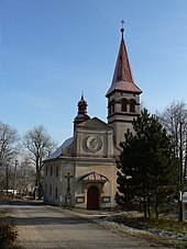
Štíty
| Štíty | ||||
|---|---|---|---|---|
|
||||
| Basic data | ||||
| State : |
|
|||
| Region : | Olomoucký kraj | |||
| District : | Šumperk | |||
| Area : | 2993 ha | |||
| Geographic location : | 49 ° 58 ' N , 16 ° 46' E | |||
| Height: | 443 m nm | |||
| Residents : | 2,021 (Jan 1, 2019) | |||
| Postal code : | 789 91 | |||
| traffic | ||||
| Street: | Lanškroun - Šumperk | |||
| Railway connection: | Dolní Lipka – Štíty | |||
| structure | ||||
| Status: | city | |||
| Districts: | 4th | |||
| administration | ||||
| Mayor : | Jiří Vogel (as of 2007) | |||
| Address: | náměstí Míru 55 789 91 Štíty |
|||
| Municipality number: | 541168 | |||
| Website : | www.stity.cz | |||
Štíty , until 1949 Šilperk ( German Mährisch Schildberg ) is a city in the Czech Republic .
geography
The city located 14 kilometers west of Šumperk ( Šumperk ) to the SS 43 according to Lanškroun ( Landskron ) in the valley of Březná ( Friese ) between the Eagle mountains , Hanušovická Vrchovina ( Hanušovická vrchovina ) and High dwellers Mountains ( Zábřežská highlands ).
Neighboring towns are Březná, Heroltice and Bukovice in the north, Horní Studénky in the east, Jedlí in the southeast, Crhov in the south, Cotkytle in the southwest, Polsko and Horní Heřmanice in the west and Rýdrovice in the northwest.
history
Schildberg was founded under German law in the first half of the 13th century and first mentioned in a document in 1248. In a document from January 26, 1312 a Johannes von Schildberg is mentioned. It belonged to the Hohenstadt rulership and was owned by the von Sternbergs until 1480 . After numerous other changes of ownership, it was bought by Jan Odkolek of Újezd in 1602. Because of his participation in the Bohemian uprising , he was expropriated after the Battle of White Mountain . In 1624 Schildberg was handed over to the loyal governor Karl I of Liechtenstein , from whom his son Karl Eusebius of Liechtenstein inherited it in 1627 . In the Thirty Years War , Schildberg was sacked by the Swedes in 1646 and by the Prussian army in the Second Silesian War in 1744. In the years 1681, 1799 and 1802 it was destroyed by city fires. During the rule of the Liechtensteiners , the Counter Reformation was carried out and Schildberg was incorporated into the Eisenberg rule .
On December 30, 1899, Mährisch Schildberg received a railway connection to the local railway Mährisch Schildberg – Grulich .
- Historical cityscapes
After the establishment of Czechoslovakia in 1918, Schildberg belonged to the political district of Zábřeh . In 1922 it was given the official Czech place name Šilperk . In 1790 there were 1720 inhabitants, and in 1980 there were 2002 inhabitants. In the 1930 census there were 1567 inhabitants ( 489 of them Czechs ).
As a result of the Munich Agreement in 1938 it became part of the German Empire and belonged until 1945 to the district chief town , Region of Opava , in the Reich District of Sudetenland . After the Second World War it came back to Czechoslovakia and initially received the place name Šilperk again . In 1945/46 the German population was expelled . In 1949 the name was changed to Štíty .
Demographics
| year | Residents | Remarks |
|---|---|---|
| 1900 | 1,858 | German residents |
| 1930 | 1,567 | |
| 1939 | 1,366 |
Local division
The districts belong to Štíty:
- Březná ( Friesendorf )
- Crhov ( Cerhof ) and
- Heroltice ( Herautz )
- and the localities of Březenský Dvůr ( Nieder Lenzdorf ), Březná II ( Friesehof ), Na Hutích ( Hammerfeld ) and Štíty Hamerské ( hammer mill ).
sons and daughters of the town
- Anton Schmidt (1797–1866), businessman and member of the Frankfurt National Assembly
Attractions
- The parish church of the Assumption of Mary was built in 1755 instead of the wooden church in the baroque style that burned down in 1744
- Marian column on the town square, erected in 1716
- Statue of St. John of Nepomuk, erected in 1732
- Town hall, the original Renaissance building was redesigned in baroque style in 1734
- Maritime fossils from the Mesozoic era in the clay pit at the brickworks
See also
literature
- Joachim Bahlcke , Winfried Eberhard, Miloslav Polívka (eds.): Handbook of historical places . Volume: Bohemia and Moravia (= Kröner's pocket edition . Volume 329). Kröner, Stuttgart 1998, ISBN 3-520-32901-8 , p. 546.
Web links
Individual evidence
- ↑ Český statistický úřad - The population of the Czech municipalities as of January 1, 2019 (PDF; 7.4 MiB)
- ^ Meyer's Large Conversational Lexicon . 6th edition, Volume 17, Leipzig and Vienna 1909, p. 789.
- ↑ a b Michael Rademacher: German administrative history from the unification of the empire in 1871 to the reunification in 1990. Hohenstadt district. (Online material for the dissertation, Osnabrück 2006).


