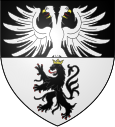
Siltzheim
| Siltzheim | ||
|---|---|---|

|
|
|
| region | Grand Est | |
| Department | Bas-Rhin | |
| Arrondissement | Saverne | |
| Canton | Ingwiller | |
| Community association | Sarreguemines Confluences | |
| Coordinates | 49 ° 4 ′ N , 7 ° 6 ′ E | |
| height | 200-287 m | |
| surface | 6.96 km 2 | |
| Residents | 636 (January 1, 2017) | |
| Population density | 91 inhabitants / km 2 | |
| Post Code | 67260 | |
| INSEE code | 67468 | |
Siltzheim (German Silzheim ) is a French commune with 636 inhabitants (as of January 1, 2017) in the Bas-Rhin department in the Grand Est region (until 2015 Alsace ).
location
Siltzheim is the northernmost municipality in Crooked Alsace and is six kilometers south of Sarreguemines .
The neighboring municipality to the south is Herbitzheim . To the north, east and west, Siltzheim borders the Sarreguemines arrondissement , Moselle department .
Siltzheim is the only municipality in the Communauté d'agglomération Sarreguemines Confluences , which is located in the Bas-Rhin department.
history
Siltzheim belonged to the county of Saar Werden .
Population development
| year | 1962 | 1968 | 1975 | 1982 | 1990 | 1999 | 2007 | 2012 | 2014 |
| Residents | 459 | 481 | 505 | 538 | 551 | 582 | 621 | 650 | 648 |
literature
- Le Patrimoine des Communes du Bas-Rhin. Flohic Editions, Volume 2, Charenton-le-Pont 1999, ISBN 2-84234-055-8 , p. 1098.
Web links
Commons : Siltzheim - Collection of pictures, videos and audio files
