
Big Timber Creek and Taipei: Difference between pages
m →Geography: dab relief |
|||
| Line 1: | Line 1: | ||
{{ |
{{refimprove|date=July 2008}} |
||
{{two other uses|the city|the county|Taipei County}} |
|||
{{Infobox Settlement |
|||
<!--See the Table at Infobox Settlement for all fields and descriptions of usage--> |
|||
<!-- Basic info ----------------> |
|||
|official_name = Taipei City |
|||
|other_name = |
|||
|native_name = 臺北市 |
|||
|Capital = 臺灣的首都 Capital of Taiwan |
|||
|nickname = the City of [[Azaleas]] (杜鵑花之城) |
|||
|settlement_type = <!--For Town or Village (Leave blank for the default City)--> |
|||
|motto = |
|||
<!-- images and maps -----------> |
|||
|image_skyline = Taipei_night_view_from_Xiangshan.jpg |
|||
|imagesize = 280px |
|||
|image_caption = Taipei City |
|||
|image_flag = Flag of Taipei City.svg |
|||
|flag_size = |
|||
|image_seal = Biglogo 02.gif |
|||
|seal_size = |
|||
|image_shield = |
|||
|shield_size = |
|||
|city_logo = |
|||
|citylogo_size = |
|||
|image_map = Taiwan ROC political division map Taipei City.svg |
|||
|mapsize = |
|||
|map_caption = |
|||
|image_map1 = Space Radar Image of Taiwan.jpg |
|||
|mapsize1 = |
|||
|map_caption1 = Satellite image of Taipei City |
|||
|image_dot_map = |
|||
|dot_mapsize = |
|||
|dot_map_caption = |
|||
|dot_x = |dot_y = |
|||
|pushpin_map = <!-- the name of a location map as per http://en.wikipedia.org/wiki/Template:Location_map --> |
|||
|pushpin_label_position = <!-- the position of the pushpin label: left, right, top, bottom, none --> |
|||
|pushpin_map_caption = |
|||
|pushpin_mapsize = |
|||
<!-- Location ------------------> |
|||
|subdivision_type = Country |
|||
|subdivision_name = {{ROC}} ([[Taiwan]]) |
|||
|subdivision_type1 = Region |
|||
|subdivision_name1 = Northern Taiwan |
|||
|subdivision_type2 = City seat |
|||
|subdivision_name2 = [[Xinyi, Taipei|Xinyi District]] |
|||
|subdivision_type3 = |
|||
|subdivision_name3 = |
|||
|subdivision_type4 = |
|||
|subdivision_name4 = |
|||
<!-- Politics -----------------> |
|||
|government_footnotes = |
|||
|government_type = |
|||
|leader_title = [[Mayor of Taipei|Mayor]] |
|||
|leader_name = [[Hau Lung-bin]] ([[Kuomintang|KMT]]) |
|||
|leader_title1 = <!-- for places with, say, both a mayor and a city manager --> |
|||
|leader_name1 = |
|||
|leader_title2 = |
|||
|leader_name2 = |
|||
|leader_title3 = |
|||
|leader_name3 = |
|||
|leader_title4 = |
|||
|leader_name4 = |
|||
|established_title = <!-- Settled --> |
|||
|established_date = |
|||
|established_title2 = <!-- Incorporated (town) --> |
|||
|established_date2 = |
|||
|established_title3 = <!-- Incorporated (city) --> |
|||
|established_date3 = |
|||
<!-- Area ---------------------> |
|||
|area_magnitude = 1 E9 |
|||
|unit_pref = <!--Enter: Imperial, if Imperial (metric) is desired--> |
|||
|area_footnotes = |
|||
|area_total_km2 = 271.7997<!-- ALL fields dealing with a measurements are subject to automatic unit conversion--> |
|||
|area_land_km2 = <!--See table @ Template:Infobox Settlement for details on automatic unit conversion--> |
|||
|area_water_km2 = 2.7 |
|||
|area_total_sq_mi = 104.9 |
|||
|area_land_sq_mi = |
|||
|area_water_sq_mi = 1.0 |
|||
|area_water_percent = 1.0 |
|||
|area_urban_km2 = 2457 |
|||
|area_urban_sq_mi = |
|||
|area_metro_km2 = |
|||
|area_metro_sq_mi = |
|||
|area_blank1_title = |
|||
|area_blank1_km2 = |
|||
|area_blank1_sq_mi = |
|||
<!-- Population -----------------------> |
|||
|population_as_of = June 2008 |
|||
|population_footnotes = |
|||
|population_note = [[List of Taiwanese counties and cities by population|Population Ranked 2 of 25]] |
|||
|population_total = 2,630,191 |
|||
|population_density_km2 = 9678.14 |
|||
|population_density_sq_mi = 25031 |
|||
|population_metro = 10,072,918 |
|||
|population_density_metro_km2 = |
|||
|population_density_metro_sq_mi = |
|||
|population_urban = 6,752,826 |
|||
|population_density_urban_km2 = |
|||
|population_density_urban_sq_mi = |
|||
|population_blank1_title = |
|||
|population_blank1 = |
|||
|population_density_blank1_km2 = |
|||
|population_density_blank1_sq_mi = |
|||
<!-- General information ---------------> |
|||
|timezone = [[Chungyuan Standard Time|CST]] |
|||
|utc_offset = +8 |
|||
|timezone_DST = |
|||
|utc_offset_DST = |
|||
|latd=25 |latm=2 |lats= |latNS=N |
|||
|longd=121 |longm=38 |longs= |longEW=E |
|||
|elevation_footnotes = <!--for references: use<ref> </ref> tags--> |
|||
|elevation_m = |
|||
|elevation_ft = |
|||
<!-- Area/postal codes & others --------> |
|||
|postal_code_type = <!-- enter ZIP code, Postcode, Post code, Postal code... --> |
|||
|postal_code = |
|||
|area_code = |
|||
|blank_name = |
|||
|blank_info = |
|||
|blank1_name = |
|||
|blank1_info = |
|||
|website = http://english.taipei.gov.tw/ |
|||
|footnotes = The city has 12 districts. The metropolitan area of Taipei includes [[Taipei City]], [[Taipei County]], [[Keelung City]], [[Taoyuan County]], [[Hsinchu City]], [[Hsinchu County]], and [[Yilan County]].<br/>'''City flower''': [[Azalea]] (''Rhododendron nudiflorum'')<br/>'''City tree''': [[Banyan]] (India laurel fig, ''Ficus microcarpa'')<br/>'''City bird''': [[Formosan Blue Magpie]] (Urocissa caerulea) |
|||
}} |
|||
'''Taipei''' ({{zh-tsht|t=臺北市 or 台北市|s=台北市|tp=Táiběi Shìh|hp=Táiběi Shì}}, [[Taiwanese language|Taiwanese]] {{Unicode|[[Pe̍h-ōe-jī]]}}: Tâi-pak-chhī; [[Jhuyin Fuhao]]: ㄊㄞˊ ㄅㄟˇ ㄕˋ; [[Hakka]]: Thòi-pet-sṳ) has been the capital of the '''[[Republic of China|Republic of China (ROC)]] ''' on Taiwan since 1949. It is situated on the [[Danshui River]], almost at the northern tip of the country, about 25 km southwest of [[Keelung]], which is its port on the [[Pacific Ocean]]. Another coastal city, [[Tamsui, Taipei|Danshui]], is about 20 km northwest at the river's mouth on the [[Taiwan Strait]]. |
|||
{{Geobox River |
|||
<!-- *** Name section *** --> |
|||
| name =Big Timber Creek |
|||
| native_name = |
|||
| other_name = |
|||
| other_name1 = |
|||
<!-- *** Image *** ---> |
|||
| image =Big_Timber_Creek.JPG |
|||
| image_size = |
|||
| image_caption =Main stem, looking upstream (2007) |
|||
<!-- *** Etymology *** ---> |
|||
| etymology =Dutch, ''Timmer Kill'' |
|||
<!-- *** Country etc. *** --> |
|||
| country =USA |
|||
| country1 = |
|||
| state =New Jersey |
|||
| state1 = |
|||
| region = |
|||
| region1 = |
|||
| district = |
|||
| district1 = |
|||
| city = |
|||
| city1 = |
|||
| landmark = |
|||
| landmark1 = |
|||
<!-- *** Geography *** --> |
|||
| length_imperial =16 |
|||
| watershed_imperial =63 |
|||
| discharge_location =Delaware River |
|||
| discharge_imperial = |
|||
| discharge_max_imperial = |
|||
| discharge_min_imperial = |
|||
| discharge1_location = |
|||
| discharge1_imperial = |
|||
<!-- *** Source *** --> |
|||
| source_name =Big Lebanon Branch |
|||
| source_location =Cross Keys |
|||
| source_district = |
|||
| source_region = |
|||
| source_state =New Jersey |
|||
| source_country = |
|||
| source_lat_d =39 |
|||
| source_lat_m =43 |
|||
| source_lat_s =38 |
|||
| source_lat_NS =N |
|||
| source_long_d =75 |
|||
| source_long_m =01 |
|||
| source_long_s =28 |
|||
| source_long_EW =W |
|||
| source_elevation_imperial =158 |
|||
| source_length_imperial = |
|||
<!-- *** Mouth *** --> |
|||
| mouth_name = |
|||
| mouth_location =Westville |
|||
| mouth_district = |
|||
| mouth_region = |
|||
| mouth_state =New Jersey |
|||
| mouth_country = |
|||
| mouth_lat_d =39 |
|||
| mouth_lat_m =52 |
|||
| mouth_lat_s =42 |
|||
| mouth_lat_NS =N |
|||
| mouth_long_d =75 |
|||
| mouth_long_m =05 |
|||
| mouth_long_s =07 |
|||
| mouth_long_EW =W |
|||
| mouth_elevation_imperial =0 |
|||
<!-- *** Tributaries *** --> |
|||
| tributary_left = |
|||
| tributary_left1 = |
|||
| tributary_right = |
|||
| tributary_right1 = |
|||
<!-- *** Free fields *** --> |
|||
| free_name = |
|||
| free_value = |
|||
<!-- *** Map section *** --> |
|||
| map =Big_Timber_Creek_course.jpg |
|||
| map_size = |
|||
| map_caption = |
|||
}} |
|||
'''Big Timber Creek''' is a stream in southwestern [[New Jersey]], [[USA]], and is also known by the name 'Tetamekanchz Kyl' by the [[Lenape]] tribes. It comprises about {{convert|25|mi|km|1}} of stream and drains {{convert|63|sqmi|km2|1}}. A tributary of the [[Delaware River]], it enters the Delaware between the boroughs of [[Brooklawn, New Jersey|Brooklawn]] and [[Westville, New Jersey|Westville]], just south of [[Philadelphia]], [[Pennsylvania]]. The main stream and South Branch form about half of the border between [[Camden County, New Jersey|Camden]] and [[Gloucester County, New Jersey|Gloucester]] counties. |
|||
Taipei lies in the relatively narrow, bowl-shaped valley of the Danshui and two of its main tributaries, the Jilong (Keelung) and Xindian (Sindian) rivers. The generally low-lying terrain of the central areas on the western side of the municipality slopes upward to the south and east and especially to the north, where it reaches 1,120 metres at Mount Qixing (七星山). The climate is humid subtropical, with hot, muggy, rainy summers and cool, damp winters. It is also the political, economic, and cultural center of the country. |
|||
Pre-Columbian Big Timber Creek was home to numerous villages of the [[Lenape|Lenni Lenape]]<!--, notably at the site of present-day Westville-->. In Colonial times, the creek was a commercial waterway, and it powered a multitude of mills up through the 1950s<!--, carrying among other things timber and agricultural products to Philadelphia, and ash and manure back to the farmlands-->. In the second half of 20th century it suffered the ill effects of the rapid post–World War II development that plagued many of America's waterways. As of 2007, it had recovered somewhat thanks to pollution controls and improvements in sewage treatment. |
|||
Taipei City, [[Taipei County]], and [[Keelung City]] together form the [[Taipei-Keelung metropolitan area|Taipei metropolitan area]] but are administered under different local government bodies. Taipei City is a special [[municipality (China)|municipality]] administered directly under the [[Executive Yuan]], while Taipei County and Keelung City are administered as part of [[Taiwan Province]]. ''Taipei'' commonly refers to the whole metropolitan area, while ''Taipei City'' refers to the city proper. Taipei's city government is headed by a mayor who is elected by direct popular vote. A secretary-general assists the mayor. |
|||
==The name== |
|||
First named 'Tetamekanchz' by the local [[Lenape]] tribe, with the North Branch named Tetamekanchz, the Chew's Landing section named Arwames, Beaver Branch is called Tekoke, and Little Timber Creek is named Sassackon<ref>Mickle, Isaac[http://www.rootsweb.com/~njgchs/Mickle.pdf], 1845. Accessed [[January 4]], [[2008]].</ref>. The earliest recorded use of the current name is by an early Dutch explorer, [[Zwaanendael Museum|David P. DeVries]], who refers to a ''Timmer Kill'', "Timber Creek" in Dutch, in his memoirs of his journey of 1630–1633, after the construction of [[Fort Nassau]] at its mouth.<ref>Cleary, William E. [http://gloucestercitynews.typepad.com/clearysnotebook/2007/02/history_of_fort.html History of Fort Nassau], [[February 18]], [[2007]]. Accessed [[September 5]], [[2007]].</ref> This name became anglicized when the [[Religious Society of Friends|Quakers]] arrived. In 1697, the [[West Jersey]] [[Lords Proprietor|Proprietors]], in creating the town of [[Gloucester City, New Jersey|Gloucester]], decreed that the name be the "Gloucester River", and although that name did appear in documents for several years, it faded away. A much smaller creek lying to the north, [[Little Timber Creek]], finds the Delaware at the same place as its larger namesake. To differentiate between the two, the latter came to be known as "Great Timber Creek", which soon became "Big Timber Creek." Even so, at the end of the 20th century it was still usually referred to in speech as simply "Timber Creek." |
|||
Taipei is part of a major industrial area. Most of Taiwan's [[textile]] factories are here, and other products include electronics, electrical machinery and appliances, wires and cables, and refrigeration equipment. Shipbuilding, including yachts and other pleasure craft, is done in the port of [[Keelung]] east of the city. Railways and bus lines connect Taipei with all parts of the island. The city is served by the [[Taiwan Taoyuan International Airport]] west of the city in Taoyuan. The freeway system is excellent. |
|||
==Description== |
|||
===Course=== |
|||
(Note: All course mileage figures are approximate [[river mile]]s, not as the crow flies.) |
|||
Taipei was founded in the early 18th century and became an important center for overseas trade in the 19th century. The [[Japan]]ese acquired the island in 1895 after the [[Sino-Japanese War]] and made Taipei the capital. The [[Republic of China]] took over the island in 1945 after Japan's defeat in [[World War II]]. The city became the provisional capital of the [[Kuomintang]] (KMT) government in December 1949 after the [[Chinese Communist Party|Communist]] government was formally installed in [[mainland China]]. The arrival of [[democracy]] in the 1990s has made it simply the seat of Taiwan's government, regardless of the party in power. |
|||
Big Timber Creek flows roughly to the northwest. Two streams, the North Branch and the South Branch, join {{convert|4.8|mi|km|1}} above its mouth to form the main stream. The South Branch is considered the source stream. Both branches are dammed at several points to form impoundments—no natural lakes occur along either branch. |
|||
==Romanization== |
|||
====South Branch==== |
|||
{{Seealso|Romanization of Chinese in Taiwan}} |
|||
[[Image:South Branch Big Timber Creek.jpg|thumb|right|200px|South Branch, just below Blackwood Lake, looking downstream]] |
|||
The spelling ''Taipei'' derives from the [[Wade-Giles]] romanization ''T'ai-pei'', which is pronounced {{IPAEng|'taɪ'peɪ}} by English speakers. |
|||
Two streams join to form the South Branch of Big Timber Creek, the Big Lebanon Branch and the Little Lebanon Branch. |
|||
[[Hanyu Pinyin]], which is mandated by the city government, and [[Tongyong Pinyin]], which is still in use (until january 2009, when the only official romanization system natiowide will be [[Hanyu Pinyin]]<ref name="pinyin_tt">{{cite news |publisher=Taipei Times |date=[[2008-09-18]] |title=Hanyu Pinyin to be standard system in 2009 |url=http://www.taipeitimes.com/News/taiwan/archives/2008/09/18/2003423528 |accessdate=2008-09-20}}</ref><ref name="pinyin_cp">{{cite news |publisher=The China Post |date=[[2008-09-18]] |title=Gov't to improve English-friendly environment |url=http://www.chinapost.com.tw/taiwan/national/national%20news/2008/09/18/175155/Gov%27t-to.htm |accessdate=2008-09-20}}</ref>), both reflect this pronunciation, romanizing ''Taipei'' as ''Taibei'', a spelling that is closer to the [[Standard Mandarin]] pronunciation of {{IPAEng|'tʰaɪ'peɪ}}. However, this romanization is very rarely seen. |
|||
Big Lebanon is considered the source stream, as it is the longer. Indeed, it appears on some maps as "Big Timber Creek". It rises near [[Cross Keys]] in Gloucester County (under a housing development) at an elevation of about {{convert|160|ft|m|1}} and flows nothwesterly {{convert|2.5|mi|km|1}}, fed by several streams from the east along the way, to its confluence with the Little Lebanon Branch just above Nash's Lake in Turnersville. About a mile (1.6 km) north of its source, at the head of Jones Lake, Big Lebanon receives Long Hollow Branch. Jones Lake is formed by a dam about a quarter mile (0.4 km) on and lies at an elevation of about {{convert|110|ft|m|1}}. Just beyond the dam, Chestnut Branch comes in, and Big Lebanon veers northwest to run along the south side of the [[Atlantic City Expressway]]. A half mile (0.8 km) beyond Chestnut Branch it receives Slab Bridge Branch, and after another half mile, Jeremys Field Branch about {{convert|0.3|mi|km|1}} above its confluence with Little Lebanon. |
|||
Taipei City has converted many of its street signs to Hanyu Pinyin, but it has retained the original spelling of "Taipei" as an exception, since this form has been well-known and heavily used. |
|||
Little Lebanon lies within Gloucester County. It begins at Baum Pond (in 2007, dry) at an elevation of about {{convert|135|ft|m|1}} near the intersection of Stagecoach Road and the Black Horse Pike. It flows roughly north for {{convert|1.6|mi|km|1}} to meet the Big Lebanon and with it form the South Branch of Big Timber Creek. Little Lebanon has no significant tributaries. |
|||
==Geography== |
|||
The South Branch proper begins just above Nash's Lake in [[Washington Township, Gloucester County, New Jersey|Washington Township]] and runs northward for {{convert|9|mi|km|1}} to the point where it joins the North Branch. It forms several impoundments and receives a number of smaller streams over its course. Just below its head, the South Branch passes under the Atlantic City Expressway to be dammed about a third of a mile down to form Nash's Lake at an elevation of {{convert|79|ft|m|1}}. After weaving once under the highway for about two-thirds of a mile (1 km), it receives Stone Bridge Branch and Toms Branch from the east in quick succession and, passing under the highway (now [[New Jersey Route 42|Route 42]]) to the west, it flows north for a mile to Grenloch Lake in [[Turnersville, New Jersey|Turnersville]]. Grenloch Lake lies at an elevation of {{convert|44|ft|m|1}} and extends for a half mile (0.8 km) above its dam. The lake receives Holly Run from the northeast before passing under the [[New Jersey Route 168|Black Horse Pike]], whereupon Bells Lake Branch enters from the south. Below Grenloch Lake's dam, the South Branch wanders northwest for a mile (1.6 km) to Blackwood Lake in [[Blackwood, New Jersey|Blackwood]], having picked up Gardner's Run from the southwest about halfway along. At an elevation of {{convert|18|ft|m|1}}, Blackwood Lake snakes almost a mile along the foot of an [[escarpment]] to its west. Farrows Run enters from the east about at the midpoint. About a quarter mile below the dam, two streams join the South Branch, Bull Run from the west and Minqus Run from the east. About a mile farther on, the stream grows sluggish and tidal. Another mile, and Pines Run enters from the east just after the South Branch passes under Route 42 south-to-north. Its final mile lies among wetlands and mudflats. |
|||
[[Image:TaipeiViewFromMaokong.jpg|thumb|left|The city of Taipei, as seen from [[Maokong]].]] |
|||
[[Image:DSCF0550.jpg|thumb|right|Xìnyì District]] |
|||
Taipei City is located in the [[Taipei Basin]] in northern [[Taiwan]]. It is bordered by the [[Xindian River]] on the south, and the [[Danshui River|Danshui (Tamsui) River]] on the west. The northern districts of [[Shilin]] and [[Beitou]] extend north of the [[Keelung River]] and are bordered by [[Yangmingshan National Park]]. The Taipei city limits cover an area ranked sixteenth of twenty-five among [[List of Taiwanese counties and cities by area|all counties and cities in Taiwan]]. |
|||
[[Cising Mountain]] is located on the Datun Volcano Group and the tallest Mountain at the rim of the Taipei Basin. Its main peak is 1,120 m tall (above elevation). |
|||
====North Branch==== |
|||
[[Image:North Branch Big Timber Creek.jpg|thumb|left|200px|North Branch, Stratford, looking downstream]]The North Branch of Big Timber Creek rises near [[Albion, New Jersey|Albion]] at an elevation of about {{convert|135|ft|m|1}}, about {{convert|2.5|mi|km|1}} from Pine Hill (the hill, not [[Pine Hill, New Jersey|the town]], which is nearer), the highest point in southern New Jersey at about {{convert|200|ft|m|1}}. The North Branch flows northwestward {{convert|10|mi|km|1}} through several impoundments to Chews Landing and thence to its confluence with the South Branch. |
|||
From its origin, the North Branch skirts the northern edge of the world-renowned [[Pine Valley Golf Club]] and enters Lekau Lake a mile down.<ref>Lekau Lake lies within a [[Boy Scouts of America|Boy Scout]] reservation, and it was renamed from "Irelands Lake" after the [[Lenape language|Lenape]] word for "sand" or "gravel," apparently translated "sandpiper" by the [[Order of the Arrow]].</ref> A teardrop-shaped impoundment about third of a mile (0.5 km) long, Lekau Lake lies at an elevation of {{convert|76|ft|m|1}} in a hollow of the hills. Leaving the lake, the North Branch twines its way a mile northwest, down to {{convert|51|ft|m|1}}, and enters [[Clementon Amusement Park|Clementon Lake]] in [[Clementon, New Jersey|Clementon]], long a recreational mecca for the region. A quarter mile (0.4 km) below the lake Trout Run enters from the east, and a half mile farther on, Gravelly Run. The North Branch then runs more to the west for a mile to Laurel Lake, a sinuous half-mile-long (0.8 km) impoundment which lies at an elevation of about {{convert|30|ft|m|1}}. The North Branch continues its westerly course for three-quarters of a mile (1.2 km) below Laurel Lake, turning northward where Mason Run enters from the south. It turns to the westward again after another three-quarters of a mile, immediately after which it receives Signey Run from the north. The North Branch then tends northwestward, widening and slowing a mile along, and, turning west upon receiving Otter Branch from the north a half mile farther down, enters an impoundment at [[Chew's Landing, New Jersey|Chew's Landing]]. This impoundment is a consequence of the constriction at the point about a third of a mile (0.5 km) down where the North Branch passes under the Black Horse Pike. The North Branch is now tidal and runs westward through wetlands another mile to its confluence with the South Branch. |
|||
Mt. Datun's main peak is 1092 m tall. It is defined as an area in the western section of Yangmingshan National Park, extending from Mt. Datun northward to Mt. Caigongkeng (菜公坑山). Located on a broad saddle between two mountains, the area contains the marshy Datun Pond. |
|||
====Main stream==== |
|||
[[Image:Main Stream Big Timber Creek.jpg|thumb|right|200px|Main stream, Bellmawr, looking downstream]]The main stream of Big Timber Creek begins in [[Glendora, New Jersey|Glendora]], just upstream from Clement's Bridge, at the confluence of the North and South branches. It meanders northwest for {{convert|4.8|mi|km|1}} to empty into the Delaware River between Westville and Brooklawn. Over much of its length it is hemmed in by roads, old dumps, and fill. It opens out into wetlands here and there. The main stream is tidal throughout. |
|||
The first mile (1.6 km) of the main stream is essentially a ditch between a housing development and a trash dump. Three-quarters of a mile (1.2 km) downstream from its head, the main stream receives from the north the waters of Hirsch Lake in [[Runnemede, New Jersey|Runnemede]], a smallish impoundment fed by an unnamed stream. A quarter mile (0.4 km) on, the left bank recedes into wetlands, and Almonesson Creek enters on the left another quarter mile down. A further half mile (0.8 km) sees Beaver Brook enter on the right, and the stream narrows again as it passes under Route 42 and the [[New Jersey Turnpike]]. It remains confined for the next mile and a half (2.4 km), receiving Ladd's Branch on the left at one mile and flowing another half mile to pass under [[Interstate 295 (Delaware-New Jersey)|Route 295]], shortly after which it opens out into three-quarters of a mile of wetlands. The stream forms three channels here, the main one hugging the left bank by Westville. The last three-quarters of a mile are confined. |
|||
=== Administrative divisions === |
|||
===The land=== |
|||
Taipei City administers twelve districts (區): |
|||
====Geology==== |
|||
{| class="wikitable" align="right" style="float" |
|||
Big Timber Creek lies wholly within in the [[Coastal Plain]] [[Geology of the United States of America#Geologic provinces|Physiographic Province]], specifically that portion known as the Inner Coastal Plain. The coastal plain is a wedge-shaped mass of [[sediments]], mostly unconsolidated, lying upon [[Pre-Cambrian]] [[basement rock]]. It extends from the [[fall line]] out onto the [[continental shelf]], thickening as it goes at the rate of 80 to 100 feet per mile (15–19m/km). |
|||
|- |
|||
! [[Hanyu Pinyin]] |
|||
![[Chinese character]]s ([[Hanzi]]) |
|||
![[Wade-Giles]] |
|||
![[Postcode]] |
|||
|---------- |
|||
|[[Zhongzheng|Zhōngzhèng]] |
|||
|中正區 |
|||
|Chung-cheng |
|||
|100 |
|||
|---------- |
|||
|[[Datong, Taipei|Dàtóng]] |
|||
|大同區 |
|||
|Ta-t'ung |
|||
|103 |
|||
|---------- |
|||
|[[Zhongshan, Taipei|Zhōngshān]] |
|||
|中山區 |
|||
|Chung-shan |
|||
|104 |
|||
|---------- |
|||
|[[Songshan District, Taipei|Sōngshān]] |
|||
|松山區 |
|||
|Sung-shan |
|||
|105 |
|||
|---------- |
|||
|[[Daan|Dà'ān]] |
|||
|大安區 |
|||
|Ta-an |
|||
|106 |
|||
|---------- |
|||
|[[Wanhua|Wànhuá]] |
|||
|萬華區 |
|||
|Wan-hua |
|||
|108 |
|||
|---------- |
|||
|[[Xinyi, Taipei|Xìnyì]] |
|||
|信義區 |
|||
|Hsin-yi |
|||
|110 |
|||
|---------- |
|||
|[[Shilin|Shìlín]] |
|||
|士林區 |
|||
|Shih-lin |
|||
|111 |
|||
|---------- |
|||
|[[Beitou|Běitóu]] |
|||
|北投區 |
|||
|Pei-t'ou |
|||
|112 |
|||
|---------- |
|||
|[[Neihu|Nèihú]] |
|||
|內湖區 |
|||
|Nei-hu |
|||
|114 |
|||
|---------- |
|||
|[[Nangang District, Taipei|Nángǎng]] |
|||
|南港區 |
|||
|Nan-kang |
|||
|115 |
|||
|---------- |
|||
|[[Wenshan District|Wénshān]] |
|||
|文山區 |
|||
|Wen-shan |
|||
|116 |
|||
|---------- |
|||
|} |
|||
<div style="position: relative; font-size:85%"> |
|||
[[Image:BlankTaipeiMap.png]] |
|||
{{Image label|x=82|y=124|text=[[Beitou District|Beitou]]}} |
|||
{{Image label|x=180|y=149|text=[[Shilin District|Shilin]]}} |
|||
{{Image label|x=229|y=233|text=[[Neihu District|Neihu]]}} |
|||
{{Image label|x=85|y=270|text=[[Datong District, Taipei|Datong]]}} |
|||
{{Image label|x=121|y=246|text=[[Zhongshan District, Taipei|Zhongshan]]}} |
|||
{{Image label|x=156|y=279|text=[[Songshan District, Taipei|Songshan]]}} |
|||
{{Image label|x=44|y=337|text=[[Wanhua District|Wanhua]]}} |
|||
{{Image label|x=80|y=313|text=[[Zhongzheng District|Zhongzheng]]}} |
|||
{{Image label|x=135|y=336|text=[[Daan District|Daan]]}} |
|||
{{Image label|x=185|y=332|text=[[Xinyi District|Xinyi]]}} |
|||
{{Image label|x=244|y=323|text=[[Nangang District, Taipei|Nangang]]}} |
|||
{{Image label|x=180|y=410|text=[[Wenshan District|Wenshan]]}} |
|||
</div> |
|||
===Climate=== |
|||
New Jersey's inner coastal plain is defined by a [[cuesta]] that runs through the coastal plain roughly northeast to southwest across the middle and southern parts of the state. This cuesta marks the transition between the underlying [[Cretaceous]] sediments toward the [[piedmont]] and the more recent [[Miocene]] sediments seaward and is itself Cretaceous in origin. In its southern reaches, where Big Timber Creek lies, it runs roughly parallel to the Delaware River at a distance of about {{convert|20|mi|km|0}} and delineates the left edge of the Delaware River [[drainage basin|watershed]] in southern New Jersey. |
|||
[[Image:Pacific typhoon tracks 1980-2005.jpg|thumb|200px|Tracks of all [[Pacific typhoon]]s between 1980 and 2005.]] |
|||
Taipei has a [[humid subtropical climate]]. The average annual temperature is 23.6 °C (74.5 °F), with a summer average of 29.4 °C (84.9 °F) and a winter average of 11.0 °C (51.8 °F). |
|||
The [[Pacific typhoon]] season occurs between June and October. |
|||
{{-}} |
|||
The surficial [[geology]] of the New Jersey inner coastal plain is among the most complex in the world. At least eight of the 14 or 15 sedimentary strata, or [[Geologic formation|''formations'']], laid down since the Cretaceous [[Geologic time scale#Terminology|period]] appear at the surface in the Big Timber Creek [[Drainage basin|basin]]. Each formation is itself made up of many layers, some the result of irregular interglacial stream deposition. The situation is further complicated by the appearance of fragments of older formations at a shallower level than more recent ones, owing to cycles of [[Deposition (sediment)|deposition]] and [[erosion]]; in fact, the so-called ''Bridgeton'' formation, the oldest, containing iron-indurated [[sand]], forms the summits of the few prominences on the landscape. Generally speaking, the surface of the area is weathered Cretaceous coastal plain consisting of [[quartz]] sand, with patches where [[gravel]] or [[clay]] are found. [[Glauconite]] occurs in varying concentrations in the younger formations, and some [[bog iron]] is seen. There is no [[Rock (geology)|rock]], though some iron-bearing sand has become concreted and rock-like. |
|||
{| class="wikitable" style="font-size:90%;width:100%;border:0px;text-align:center;line-height:120%;" |
|||
! style="background: #FFFFFF; color: #000080" height="17" | Month |
|||
! style="background: #FFFFFF; color:#000080;" | Jan |
|||
! style="background: #FFFFFF; color:#000080;" | Feb |
|||
! style="background: #FFFFFF; color:#000080;" | Mar |
|||
! style="background: #FFFFFF; color:#000050;" | Apr |
|||
! style="background: #FFFFFF; color:#000080;" | May |
|||
! style="background: #FFFFFF; color:#000080;" | Jun |
|||
! style="background: #FFFFFF; color:#000080;" | Jul |
|||
! style="background: #FFFFFF; color:#000080;" | Aug |
|||
! style="background: #FFFFFF; color:#000080;" | Sep |
|||
! style="background: #FFFFFF; color:#000080;" | Oct |
|||
! style="background: #FFFFFF; color:#000080;" | Nov |
|||
! style="background: #FFFFFF; color:#000080;" | Dec |
|||
! style="background: #FFFFFF; color:#000080;" | Year |
|||
|- |
|||
! style="background: #FFFFFF; color:#000080;" | Record High (°C)<br/> |
|||
| style="background: #FF8000; color:#000000;" | 30<br/> |
|||
| style="background: #FF8000; color:#000000;" | 31<br/> |
|||
| style="background: #FF8000; color:#000000;" | 33<br/> |
|||
| style="background: #FF8000; color:#000000;" | 35<br/> |
|||
| style="background: #FF8000; color:#000000;" | 37<br/> |
|||
| style="background: #FF8000; color:#000000;" | 37<br/> |
|||
| style="background: #FF8000; color:#000000;" | 38<br/> |
|||
| style="background: #FF8000; color:#000000;" | 38<br/> |
|||
| style="background: #FF8000; color:#000000;" | 36<br/> |
|||
| style="background: #FF8000; color:#000000;" | 35<br/> |
|||
| style="background: #FF8000; color:#000000;" | 33<br/> |
|||
| style="background: #FF8000; color:#000000;" | 31<br/> |
|||
| style="background: #FFFFFF; color:#000000;" |<center>'''-'''<br/></center> |
|||
|- |
|||
! style="background: #FFFFFF; color:#000080;" | Average High (°C)<br/> |
|||
| style="background: #FFFFCC; color:#000000;" | 19<br/> |
|||
| style="background: #FFFFCC; color:#000000;" | 18<br/> |
|||
| style="background: #FFFF99; color:#000000;" | 21<br/> |
|||
| style="background: #FFFF99; color:#000000;" | 25<br/> |
|||
| style="background: #FFFF99; color:#000000;" | 28<br/> |
|||
| style="background: #FF8000; color:#000000;" | 32<br/> |
|||
| style="background: #FF8000; color:#000000;" | 34<br/> |
|||
| style="background: #FF8000; color:#000000;" | 33<br/> |
|||
| style="background: #FF8000; color:#000000;" | 31<br/> |
|||
| style="background: #FFFF99; color:#000000;" | 27<br/> |
|||
| style="background: #FFFF99; color:#000000;" | 24<br/> |
|||
| style="background: #FFFF99; color:#000000;" | 21<br/> |
|||
| style="background: #FFFFFF; color:#000000;" |<center>'''-'''<br/></center> |
|||
|- |
|||
! style="background: #FFFFFF; color:#000080;" height="16;" | Average Low (°C)<br/> |
|||
| style="background: #FFFFCC; color: black;" | 12<br/> |
|||
| style="background: #FFFFCC; color: black;" | 12<br/> |
|||
| style="background: #FFFFCC; color: black;" | 14<br/> |
|||
| style="background: #FFFFCC; color: black;" | 17<br/> |
|||
| style="background: #FFFF99; color: black;" | 21<br/> |
|||
| style="background: #FFFF99; color: black;" | 23<br/> |
|||
| style="background: #FFFF99; color: black;" | 26<br/> |
|||
| style="background: #FFFF99; color: black;" | 24<br/> |
|||
| style="background: #FFFF99; color: black;" | 23<br/> |
|||
| style="background: #FFFFCC; color: black;" | 19<br/> |
|||
| style="background: #FFFFCC; color: black;" | 17<br/> |
|||
| style="background: #FFFFCC; color: black;" | 14<br/> |
|||
| style="background: #FFFFFF; color: black;" | <center>'''-''' |
|||
</center> |
|||
|- |
|||
! style="background: #FFFFFF; color:#000080;" height="16;" | Record Low (°C) <br> |
|||
| style="background: #DDDDDD; color: black;" | 3<br/> |
|||
| style="background: #DDDDDD; color: black;" | 0<br/> |
|||
| style="background: #DDDDDD; color: black;" | 2<br/> |
|||
| style="background: #DDDDDD; color: black;" | 8<br/> |
|||
| style="background: #FFFFCC; color: black;" | 10<br/> |
|||
| style="background: #FFFFCC; color: black;" | 16<br/> |
|||
| style="background: #FFFFCC; color: black;" | 19<br/> |
|||
| style="background: #FFFFCC; color: black;" | 19<br/> |
|||
| style="background: #FFFFCC; color: black;" | 13<br/> |
|||
| style="background: #FFFFCC; color: black;" | 11<br/> |
|||
| style="background: #DDDDDD; color: black;" | 1<br/> |
|||
| style="background: #DDDDDD; color: black;" | 2<br/> |
|||
| style="background: #DDDDDD; color: black;" | <center>'''-'''<br/></center> |
|||
|- |
|||
! style="background: #FFFFFF; color:#000080;" | Average Rainfall (mm) |
|||
| style="background: #1E90FF;" | 86 |
|||
| style="background: #6495ED;" | 135 |
|||
| style="background: #6495ED;" | 178 |
|||
| style="background: #6495ED;" | 170 |
|||
| style="background: #4169E1;" | 231 |
|||
| style="background: #4169E1;" | 290 |
|||
| style="background: #4169E1;" | 248 |
|||
| style="background: #4169E1;" | 305 |
|||
| style="background: #4169E1;" | 244 |
|||
| style="background: #6495ED;" | 122 |
|||
| style="background: #1E90FF;" | 66 |
|||
| style="background: #1E90FF;" | 71 |
|||
| style="background: #4169E1;" | <center>'''2129'''</center> |
|||
|- |
|||
|} |
|||
=== |
===Air quality=== |
||
Motor vehicle engine exhaust, particularly from motor scooters, is a source of [[air pollution]] in Taipei. The levels of fine [[particulate]] matter, including [[polycyclic aromatic hydrocarbons|PAHs]], are consistently more serious in the mornings as there is less air movement; sunlight helps clear up some pollutants, which tend to be trapped close to the ground.<ref> {{cite news |
|||
Big Timber Creek dissects the inner coastal plain in the [[Drainage system#Dendritic drainage system|dendritic pattern]] characteristic of streams flowing over soft materials. It has been cutting down through sand, clay, and gravel since the retreat of the last of the [[Pleistocene]] [[Sea level rise|marine inundations]] which deposited fresh layers of sediment. Big Timber Creek's [[Drainage basin|watershed]] encompasses 63 square miles (163.2 km²), including Little Timber Creek, a small creek that shares its mouth. The sides of the basin are defined by the patchy remains of relatively erosion-resistant formations. Nowhere in its basin does the [[terrain|relief]] exceed {{convert|200|ft|m|0}}, and much lies below {{convert|50|ft|m|0}}. What relief there is is entirely due to erosion, mostly by Big Timber Creek and its [[tributaries]]. |
|||
|last=Oung |
|||
|first=Angelica |
|||
|url= http://www.taipeitimes.com/News/taiwan/archives/2007/05/04/2003359365 |
|||
|title= Taipei air pollution alarming: scientists |
|||
|publisher=[[The Taipei Times]] |
|||
|date=May 04, 2007 |
|||
}} </ref> |
|||
==History== |
|||
The terrain consists mainly of a jumble of the low, flattened ridges typical of mature sandy basins. The scattered prominences of 100 feet (30m) or more, some quite steep, owe their existence to caps of iron-rich sand. A cuesta forms escarpments beyond the headwaters of the Creek and along some of its southerly tributaries. There is a small, marshy [[floodplain]] in the lower reaches. |
|||
{{main|History of Taipei}} |
|||
[[Image:Old Taipei revealing the original city wall and gates.jpg|thumb|left|Diagram of Old Taipei revealing the original city wall and gates. Important buildings are highlighted.]] |
|||
The region known as the Taipei basin was home to [[Ketagalan]] tribes before the eighteenth century. [[Han Chinese]] mainly from [[Fujian]] province of China began to settle in the [[Taipei Basin]] in 1709. In the late 19th century, the Taipei area, where the major Han Chinese settlements in northern Taiwan and one of the designated overseas trade port, [[Tamsui]], were located, gained economic importance due to the booming overseas trade, especially that of [[tea]] exportation. In 1875, the northern part of Taiwan was separated from Taiwan Prefecture (臺灣府) and incorporated into the new Taipei Prefecture as a new administrative entity of the Chinese government ([[Qing Dynasty]]). Having been established adjoining the flourishing townships of [[Wanhua|Bangkah]] and [[Dadaocheng|Twatutia]], the new prefectural capital was known as [[Chengnei]] (城內), "the inner city", and government buildings were erected there. From 1875 (during the Qing Dynasty) until the beginning of Japanese rule in 1895, Taipei was part of Danshui County of Taipei Prefecture and the prefectural capital. In 1886, when Taiwan was proclaimed a [[province of China]], Taipei city was made the provincial capital. Taipei remained a temporary provincial capital before it officially became the capital of Taiwan in 1894. All that remains from the old Qing Dynasty city is the north gate. The west gate and city walls were demolished by the Japanese while the south gate, little south gate and east gate were extensively modified by the Kuomintang and have lost much of their original character. |
|||
As settlement for losing the [[First Sino-Japanese War]], China ceded the island of Taiwan to the [[Empire of Japan]] in 1895 as part of the peace agreement. After the Japanese take-over, Taipei, called [[Taihoku Prefecture|'''Taihoku''']] in Japanese, was retained as the capital and emerged as the political center of the Japanese Colonial Government. During that time the city acquired the characteristics of an administrative center, including many new public buildings and housing for [[civil servants]]. Much of the architecture of Taipei dates from the period of [[Taiwan under Japanese rule|Japanese rule]], including the Presidential Building which was the Office of the Taiwan Governor-General. |
|||
During the Japanese rule, Taihoku was incorporated in 1920 as part of Taihoku Prefecture (台北縣). It included [[Wanhua|Bangka]], [[Dadaocheng]], and [[Chengnei]] among other small settlements. The eastern village [[Songshan District, Taipei|Matsuyama]] (松山區) was annexed into Taihoku City in 1938. Upon the Japanese defeat in the [[Pacific War]] and its consequent surrender in August 1945, the [[Kuomintang|Chinese Nationalist]] assumed control of Taiwan. Subsequently, a temporary Office of the Taiwan Province Administrative Governor was established in Taipei City. |
|||
On [[December 7]] [[1949]], the [[Kuomintang]] (KMT) government under Generalissimo [[Chiang Kai-shek]] established Taipei as the capital of the ROC after the [[Communist Party of China|Communists]] forced them to flee mainland China after the [[Chinese Civil War|Civil War]]. |
|||
Taipei expanded greatly in the decades after 1949, and as approved on [[December 30]], [[1966]] by the [[Executive Yuan]], Taipei was declared a special [[municipality (China)|centrally administered municipality]] on [[July 1]], [[1967]] and given the administrative status of a province. In the following year, Taipei City expanded again by annexing [[Shilin]], [[Beitou]], [[Neihu]], [[Nangang District, Taipei|Nangang]], [[Jingmei]], and [[Muzha]]. At that time, the city's total area increased fourfold through absorbing several outlying towns and villages. |
|||
The city's population, which had reached one million in the early 1960s, also expanded rapidly after 1967, exceeding two million by the mid-1970s. Although growth within the city itself gradually slowed thereafter — its population had become relatively stable by the mid-1990s — Taipei remained one of the world's most densely populated urban areas, and the population continued to increase in the region surrounding the city, notably along the corridor between Taipei and [[Keelung]]. In 1990, 16 districts in Taipei City were consolidated into the current 12 districts. |
|||
==Economy== |
|||
{{seealso|Economy of Taiwan}} |
|||
As the capital of the Republic of China, Taipei has been at the centre of rapid economic development in the country and has now become one of the global cities in the production of high technology and its components. This is part of the so called [[Taiwan Miracle]] which has seen dramatic growth in the city following foreign direct investment in the 1960s. Taiwan is now a creditor economy, holding one of the world's largest foreign exchange reserves of more than $500 billion (100 G$) in 1999. Despite the Asian financial crisis, the economy continues to expand at about 5% per year, with virtually full employment and low inflation. |
|||
Taipei and its environs have long been the foremost industrial area of Taiwan. Most of the country's important factories producing textiles and wearing apparel are located there; other industries include the manufacture of electronic products and components, electrical machinery and equipment, printed materials, precision equipment, and foods and beverages. Services, including those related to commerce, transportation, and banking, have become increasingly important. Tourism is a small but significant component of the local economy. |
|||
Beginning in the 1960s, many older, low wooden buildings in Taipei began to be replaced with high-rise apartment houses and office buildings. Because of the population influx and the priority given to office and industrial construction, an acute shortage of housing developed in the city. The government has taken steps since the late 1960s to build affordable public housing, but overall real-estate costs have remained high. Much new construction has occurred in the city center, particularly in the area of the Presidential Building and the Nationalist Party headquarters, and broad boulevards now radiate from there to all parts of the city. Among the more notable commercial projects was the [[Taipei 101]] (Taipei Financial Center) building which, when its framework was completed in 2003, became the world's tallest building, reaching 508 m. |
|||
In the 1960s, foreign investment in Taiwan helped introduce modern, labor-intensive technology to the island, and Taiwan became a major exporter of labor-intensive products. |
|||
On [[July 1]],[[1970]], to further develop [[Taiwan]] international trade activities, [[Taiwan External Trade Development Council]] (TAITRA) were established as economic growth was accelerating. The [[Taipei World Trade Center]] was completed in 1985. |
|||
In the 1980s, production in Taiwan shifted toward increasingly sophisticated, capital-intensive and technology-intensive products for export and toward developing the service sector. At the same time, the appreciation of the New Taiwan dollar (TWD), rising labor costs, and increasing environmental consciousness in Taiwan caused many labor-intensive industries, such as shoe manufacturing, to move to mainland China. Taiwan has also invested heavily in mainland China estimated to total more than $100 billion. |
|||
However the [[Taiwan External Trade Development Council]] (TAITRA), was established in 1986 to provide a single, modern venue that would combine [[Trade fair|exhibition]] space, [[Business conference|conference]] facilities, [[office]]s, and [[hotel]] accommodation for [[international business]]. It is located in the city's [[Xinyi, Taipei|Xinyi District]], TWTC combines every possible service that brings together a vast consulting service on trade-related issues, trading partners, [[supplier]]s, and [[market]]s. |
|||
The International Trade Building was completed in 1988 and the International Convention Center completed in 1989. |
|||
==Government== |
|||
{{seealso|Politics of the Republic of China}} |
|||
[[Image:Presidential Building, Taiwan (0750).JPG|thumb|left| Republic of China's [[Presidential Office Building (Taiwan)|Presidential Office Building]]]] |
|||
The current mayor of Taipei City is [[Hau Lung-bin]] who won the 2006 mayoral election on [[December 9]] [[2006]]. |
|||
The mayor of Taipei City had been an appointed position since Taipei's conversion to a centrally-administered municipality in 1967 until the first public election was held in 1994. The position has a four-year term. The first elected mayor was [[Chen Shui-bian]] of the [[Democratic Progressive Party]]. [[Ma Ying-Jeou]] took office in 1998 for two terms, before handing over to [[Hau Lung-bin]]. Both Chen Shui-bian and Ma Ying-Jeou went on to become [[President of Republic of China]]. |
|||
Based on the outcomes of previous elections in the past decade, the vote of the overall constituency of Taipei City shows a slight inclination towards the pro-KMT camp (the [[Pan-Blue Coalition]]); however, the pro-DPP camp (the [[Pan-Green Coalition]]) also has considerable support. |
|||
[[Ketagalan Boulevard]], where Republic of China's [[Presidential Office Building (Taiwan)|Presidential Office Building]] and other government structures are situated, is often the site of mass gatherings such as inauguration and national holiday parades, receptions for visiting dignitaries, political demonstrations and public festivals. |
|||
==Culture== |
|||
===Tourism=== |
|||
{{seealso|List of tourist attractions in Taipei}} |
|||
[[Image:Taipei 101 at night.jpg|thumb|left|125px|Taipei 101 at night]] |
|||
Most areas of interest are easily accessible from the transit system. The [[Taipei Rapid Transit System|MRT]] (Taipei's Metro Rapid Transit System) has well-marked signs, in both English and Chinese, throughout the stations to get you to your destination quickly. They have above and below ground lines. The above ground lines are particularly good, and cheap, for sightseeing. An automated system tells you each station's name when approached in Mandarin, [[Taiwanese (linguistics)|Taiwanese]], [[Hakka]], and English. The city has the highest wireless penetration in the world, with the [[internet]] being accessible through a city wide [[Wi-Fi]] network consisting of over 20,000 access points.<ref>{{cite web |title=The 10 Most Connected Cities in the World |url=http://www.dailywireless.com/features/most-connected-cities-030607/ |accessdate=2007-08-18}}</ref> |
|||
A popular recreation area is nearby Yangmingshan (陽明山). Both the mountain and the town of [[Beitou]] at its base are known for their [[hot springs]]. The Maokong area of Taipei's mountains has since 2007 been served by a gondola that takes visitors to mountaintop tea houses. Bitan (Green Water) in Taipei County is a popular location for boating and water sports. |
|||
====Taipei 101==== |
|||
{{main|Taipei 101}} |
|||
[[Taipei 101]] is a 101-floor [[landmark]] [[skyscraper]] that claimed the title of [[World's tallest structures|world's tallest building]] when it opened in 2004. Designed by [[C.Y. Lee & Partners]] and constructed by [[KTRT Joint Venture]], Taipei 101 remains the [[World's tallest structures|tallest completed skyscraper in the world]], measuring 449 m (1,474 ft) from ground to roof. (The tallest incomplete skyscraper is the [[Burj Dubai]] now under [[construction]] in [[Dubai]], [[United Arab Emirates|UAE]]). Taipei 101 also set new records for ascending elevator speed. The landmark has won numerous international awards for its innovations. Its Indoor and Outdoor Observatories draw visitors from all over the world and its New Year's Eve fireworks display is a regular feature of international broadcasts. |
|||
==== Memorial halls and museums ==== |
|||
[[Image:CKS Memorial Hall.jpg|thumb|245px|The [[National Chiang Kai-shek Memorial Hall]]]] |
|||
{{seealso|National Chiang Kai-shek Memorial Hall}} |
|||
{{seealso|List of museums in Taipei}} |
|||
The [[National Chiang Kai-shek Memorial Hall]] is a monument that was erected in memory of [[Chiang Kai-shek]], former [[President of the Republic of China]]. The monument, surrounded by a park and a large square incorporating the [[National Concert Hall (Taiwan)|National Concert Hall]] and [[National Theatre (Taiwan)|National Theater]], stands within sight of Republic of China's [[Presidential Building (Taipei)|Presidential Building]] in Taipei's [[Zhongzheng District]]. |
|||
The [[Sun Yat-sen Memorial Hall|National Sun Yat-sen Memorial Hall]] is a memorial to one of the most recognizable founding fathers of the [[Republic of China]], [[Sun Yat-sen]], and was completed on [[May 16]], [[1972]]. From the opening of the hall, majority of the exhibits displayed were revolutionary events of the national founding fathers at the end of the [[Qing Dynasty]]. However, recently its function moved toward a multi-purpose [[social]], [[educational]] and [[cultural]] center for the Taiwanese public. The Memorial Hall is within walking distance to Taipei 101. |
|||
[[Image:National Palace Museum view.jpg|thumb|left|The National Palace Museum]] |
|||
The [[National Palace Museum]] is an [[art gallery]] and [[museum]] built around a permanent collection centered on [[ancient China|ancient Chinese artifacts]]. It should not be confused with the [[Palace Museum]] in [[Beijing]] (which it is named after). Both institutions trace their origins to the same institution. The collections were divided in the 1940s as a result of the [[Chinese Civil War]]. The National Palace Museum in Taipei, now boasting a much more international collection, still remains most famous for housing one of the world's largest collections of artifacts from ancient China. The museum reopened in December 2006 after several years of extensive renovations. |
|||
The [[Taipei Fine Arts Museum]] was established in [[December 24]], [[1983]]. It is also the first [[modern art]] museum. The artworks in the museum are mostly done by [[Taiwanese people|Taiwanese]] artists. There are more than 3,000 artworks in the museum. Most of them are done after 1940 by Taiwanese artist, and are organized into 13 groups. In 2000, there were exhibitions of digital technology arts in the museum. In 2001, Museum of Contemporary Art Taipei (台北當代藝術館;MOCA Taipei) was established in the Taipei City government old building. |
|||
The [[National Taiwan Museum]] is the oldest museum in [[Taiwan]]. It was set up by the colonial government of [[Japan]] on October 24, 1908 to commemorate the inauguration of the North-South Railway during the [[Taiwan under Japanese rule|Japanese rule in Taiwan]]. The colonial government of Japan set up the Taiwan Governor Museum . The museum had a collection of over 10,000 items in its initial stages. In 1915, the new building of the museum in Taipei New Park was inaugurated and became one of the major public buildings during [[Taiwan under Japanese rule|Japanese rule]]. |
|||
The Armed Forces Museum [http://museum.mnd.gov.tw//English/index.aspx] is the only military styled museum in Taiwan. |
|||
====Visual and Performing Arts==== |
|||
The [[National Palace Museum]] is a leading [[art gallery]] and cultural [[landmark]]. The museum hosts a number of international exhibits as well as hosting its own historically unique collection (see discussion above). |
|||
The [[Taipei Fine Arts Museum]] was established in [[1983]] as Taiwan's first museum of [[modern art]]. The collection features over 3,000 works, mainly by [[Taiwanese people|Taiwanese]] artists since the 1940s. The collection is organized into 13 groups. In 2000, there were exhibitions of digital technology arts in the museum. |
|||
The [[Museum of Contemporary Art Taipei]] (台北當代藝術館;MOCA Taipei) opened in 2001. Its building originally housed offices for the Taipei City government. |
|||
The [[National Theater and Concert Hall]] stand at Taipei's Liberty Square and host a non-stop series of events by performers from Taiwan and every region of the world. Other leading concert venues include the historic [[Zhongshan Hall]] at [[Ximen]] and the [[Sun Yat-sen Memorial Hall]] near [[Taipei 101]]. |
|||
A new cultural landmark, the [[Taipei Performing Arts Center]], is slated to open in 2013. The venue will stand near the [[Shilin Night Market]] across from the Jingtian MRT station. The Performing Arts Center will house three theatres for events with multi-week runs. The architectural design will be determined in 2009 as the result of an international competition. Construction is expected to take place from 2010 to 2013. The same design process is also in place for a new [[Taipei Center for Popular Music]] and [[Taipei City Museum]].<ref>[http://www.taipeitimes.com/News/taiwan/archives/2008/07/25/2003418450 Taipei invites architects | Taipei Times, 2008.07.25]</ref> |
|||
==== Recreation ==== |
|||
{{main|Shopping in Taipei}} |
|||
Taipei has many night markets, most famous of which is the [[Shilin Night Market]] in the [[Shilin District]] of the city. The surrounding streets by Shilin Market get extremely crowded during the evening. Most night markets in Taiwan open around 4 [[p.m.]] as students begin returning home from school, crowds reach their peak between 8 and 11 p.m. Businesses continue operating well past [[midnight]] and close around 1 to 2 [[a.m.]] |
|||
[[Ximending]] has been a famous area for shopping and entertainment since the 1930s. Historic structures include a concert hall and a historic cinema. Modern structures house karaoke businesses, art film cinemas, wide-release movie cinemas, electronic stores, and a wide variety of restaurants and fashion clothing stores. The pedestrian area is especially popular with teens. |
|||
The Xinyi District is popular with tourists and locals alike for its many entertainment and shopping venues, as well as being the home of the [[Taipei 101]] building, a prime tourist attraction famous for being the world's tallest building. Malls in the area include the sprawling Shin Kong [[Mitsukoshi]] complex, [[Taipei 101]] mall, [[Eslite Bookstore]]'s flagship store (which includes a boutique mall), The Living Mall, New York New York shopping mall, and the [[Vieshow Cinema]] (formerly known as Warner Village). |
|||
The thriving shopping area around Taipei Main Station includes the [[Taipei Underground Market]] and the original Shin Kong [[Mitsukoshi]] department store at [[Shin Kong Life Tower]]. Other popular shopping destinations include the [[Zhongshan Metro Mall]], [[Dihua Street]], the [[Guanghua Bazaar]] (electronics and comics market), and the [[Core Pacific City]]. The [[Miramar Entertainment Park]] is famous for its large ferris wheel and [[Imax]] theater. |
|||
Taipei maintains an extensive system of parks, green spaces, and nature preserves. Parks and forestry areas of note in and around the city include [[Yangmingshan National Park]], [[Taipei Zoo]] and [[Da-an Forest Park]]. |
|||
[[Yangmingshan]] (only 10 km north of the central city), famous for its cherry blossoms, [[hot springs]], sulfur deposits is the home of famous writer [[Lin Yutang]], the summer residence of [[Chiang Kai-shek]], residences of foreign diplomats, the [[Chinese Culture University]], the meeting place of the now defunct [[National Assembly of the Republic of China]], and the [[Kuomintang]] Party Archives. The Taipei Zoo was founded in 1914 and covers an area of 165 hectares for animal sanctuary. |
|||
[[Bitan]] has boating and water sports. [[Danshui]] is a popular resort town. Ocean beaches are accessible in several directions from Taipei. |
|||
==== Temples ==== |
|||
[[Image:Lung-shan temple-Taipei-Taiwan-P1010110.JPG|thumb|300px| The Longshan Temple]] |
|||
Taipei is rich in beautiful, ornate temples housing Buddhist, Taoist, and Chinese folk religion deities. The [[Longshan Temple]], located in the [[Wanhua District]] demonstrates an example of architecture with southern Chinese influences commonly seen in older buildings in Taiwan. |
|||
Xinsheng South Road is known as the road to heaven because of its high concentration of churches as well as a mosque (literally called “Pure Truth Temple” in Chinese). Several blocks away from Xinsheng South Road is the beautiful, pristine Mormon Temple as well as the Vatican’s representative office. |
|||
Besides large temples, small outdoor shrines to local deities are very common, and can be spotted on road sides, parks, and neighborhoods. Many homes and businesses may also set up small shrines of candles, figurines, and offerings. Some restaurants, for example, may set up a small shrine to the Kitchen god for success in a restaurant business. [http://wikimania2007.wikimedia.org/wiki/About_Taipei_5:_Religions] |
|||
===Festivities and events=== |
|||
Many yearly festivals are held in Taipei, including the Taipei [[Lantern Festival]] and [[Double Tenth Day|Double Ten Day]]. Common locations for festival celebrations include [[Chiang Kai-shek Memorial Hall|Memorial Square]], [[Taipei 101]], and the Zhongshan plaza in [[Xinmending]]. In recent years some festivals traditionally held in Taipei, such as the Double Ten Day fireworks and concerts, have increasingly been hosted by other cities in Taiwan. |
|||
===Taipei in film=== |
|||
*[[Te-sheng Wei]]'s ''[[Cape No. 7]]'' (drama/comedy) |
|||
*[[Leste Chen]]'s ''[[Eternal Summer]]'' (drama) |
|||
*[[Edward Yang]]'s ''[[Yi Yi: A One and a Two]]'' (drama) |
|||
*[[Edward Yang]]'s ''[[Mahjong (1996 film)|Mahjong]]'' (drama) |
|||
*[[Edward Yang]]'s ''[[A Brighter Summer Day]]'' (drama) |
|||
*[[Tsai Ming-liang]]'s ''[[Vive L'Amour]]'' (drama) |
|||
*[[Tsai Ming-liang]]'s ''[[What Time Is It There?]]'' (drama) |
|||
*[[Tsai Ming-liang]]'s ''[[Goodbye, Dragon Inn]]'' (drama) |
|||
*[[Tsai Ming-liang]]'s ''[[Rebels of the Neon God]]'' (drama) |
|||
*[[Hou Hsiao-hsien]]'s ''[[Three Times]]'' (drama) |
|||
*[[Ang Lee]]'s ''[[Eat Drink Man Woman]]'' (drama) |
|||
*[[John Woo]]'s ''[[A Better Tomorrow]]'' (action) |
|||
*[[Chen Yin-jung]]'s ''[[Formula 17]]'' (gay/comedy) |
|||
*[[Zero Chou]]'s ''[[Spider Lilies (film)|Spider Lilies]]'' (lesbian/drama) |
|||
*[[Sylvia Chang]]'s ''[[20 30 40]]'' (romance) |
|||
*[[Hsiao-ming Hsu]]'s ''[[Love of May]]'' (romance) |
|||
*[[Yee Chin-yen]]'s ''[[Blue Gate Crossing]]'' (romance) |
|||
*[[Jay Chou]]'s ''[[Secret (2007 film)|Secret]]'' (romance) |
|||
*[[Chen Kuo-Fu]]'s ''[[Double Vision]]'' (horror/suspense) |
|||
*[[Chao-Bin Su]]'s ''[[Silk (2006 film)|Silk]]'' (horror/suspense) |
|||
*[[Ye-ming Wang]]'s ''[[Tea Fight (film)|Tea Fight]]'' (drama/comedy) |
|||
*[[Mamoru Oshii]]'s ''[[StrayDog: Kerberos Panzer Cops]]'' (science fiction/drama) |
|||
*[[Andrew Lau]] 's ''[[Young and Dangerous 2]]'' ([[Hong-Kong]] studio, filmed on location in Taipei) |
|||
*''[[Turn Left, Turn Right]]'' ([[Hong-Kong]] studio, filmed on location in Taipei) |
|||
*''[[One Missed Call 2]]'' (Japanese studio, filmed in Taipei and [[Jinguashi]]) |
|||
*''[[About Love]]'' (Japanese studio, filmed on three cities in Asia: Taipei, [[Tokyo]], [[Shanghai]]) |
|||
*[[Takashi Miike]]'s ''[[Rainy Dog]]'' (Japanese studio, filmed on location in Taipei) (drama) |
|||
*[[Takahisa Zeze]]'s ''[[Moon Child (2003 film)|Moon Child]]'' (Japanese studio, filmed in Taipei, as the futuristic city of Mallepa) (drama) |
|||
==Transportation== |
|||
[[Image:Taipei MRT Shimen station.jpg|thumb|Ximen station]] |
|||
[[Image:Taipei.shinkong01.altonthompson.jpg|right|thumb|The [[Shin Kong Life Tower]] adjoins Taipei Main Station]] |
|||
All scheduled international flights are served by [[Taiwan Taoyuan International Airport]] in nearby [[Taoyuan County (Taiwan)|Taoyuan County]]. [[Taipei Songshan Airport|Songshan Airport]] at the heart of the city serves mostly domestic flights, with the exception of some charter flights. |
|||
Taipei's public transport system, the [[Taipei Rapid Transit System|Taipei Metro]] (commonly referred to as the MRT), incorporates a [[rapid transit|metro]] and [[light rail]] system based on advanced [[VAL]] technology. In addition to the rapid transit system itself, the Taipei Metro also includes several public facilities such as the [[Maokong Gondola]], underground shopping malls, parks, and public squares. Modifications to existing [[Taiwan Railway Administration|railway]] lines to integrate them into the Metro system are underway, as well as a rapid transit line to connect the city with Taiwan Taoyuan International Airport. Customer satisfaction with the Taipei Metro, at over 94% in 2008, ranks it as possibly the best public transport system worldwide.<ref>[http://blog.wired.com/cars/2008/05/taipei-metro-re.html All Subways Should be Like Taipei's Marvel of Mass Transit, Wired News]</ref> |
|||
[[Taipei Main Station]] serves as the comprehensive hub for bus transportation, the Metro, Taiwan Rail, and Taiwan High Speed Rail. |
|||
The [[Taiwan High Speed Rail]] system opened in 2007. The bullet trains connect Taipei with the west coast cities of [[Banciao]], [[Taoyuan]], [[Hsinchu City|Hsinchu]], [[Taichung City|Taichung]], [[Tainan City|Tainan]] and [[Zuoying]] ([[Kaohsiung]]) at speeds that cut travel times by 60% or more from what they normally are on a bus or conventional train. |
|||
An extensive city bus system serves metropolitan areas not covered by the metro. Sometimes buses require payment upon boarding, sometimes upon exiting. Many routes, due to length, require payment upon both boarding and exiting. Riders of the city MRT system are able to use their MRT passes on buses. The pass, known as Easy Card, contain credits that are deducted each time a ride is taken. The Easy Card, Taipei's equivalent to [[Hong Kong]]'s [[Octopus Card]], is read via proximity sensory panels on buses and in MRT stations, and need not be removed from wallet or purse. |
|||
[[Scooter (motorcycle)|Motor-scooter]]s are ubiquitous in Taipei (and much of Taiwan). Motor-scooters often weave between cars and occasionally through oncoming traffic. While there is little respect for traffic laws there are increasing numbers of police roadblocks checking riders for alcohol consumption and other offenses. |
|||
== Education == |
|||
[[Image:NTU Hospital.JPG|thumb|''West Site'' of [[National Taiwan University Hospital]]]] |
|||
19 universities have campuses located in Taipei: |
|||
*[[National Taiwan University]] (1928) |
|||
*[[National Chengchi University]] (1927) |
|||
*[[National Taipei University]] |
|||
*[[National Taipei University of Education]] |
|||
*[[National Taiwan University of Science and Technology]] |
|||
*[[National Taipei University of Technology]] |
|||
*[[National Taiwan Normal University]] (1946) |
|||
*[[National Yang Ming University]] |
|||
*[[Taipei National University of the Arts]] |
|||
*[[Taipei Municipal University of Education]] |
|||
*[[China University of Technology]] |
|||
*[[Chinese Culture University]] |
|||
*[[Ming Chuan University]] |
|||
*[[Shih Chien University]] |
|||
*[[Shih Hsin University]] |
|||
*[[Soochow University (Taiwan)|Soochow University]] |
|||
*[[Taipei Medical University]] |
|||
*[[Tatung University]] |
|||
The [[National Taiwan University]] was established in 1928 during the period of Japanese colonial rule. NTU has produced many political and social leaders in Taiwan. Both [[pan-blue coalition|pan-blue]] and [[pan-green coalition|pan-green]] movements in Taiwan are rooted on the NTU campus. The university has six campuses in the greater Taipei region (including [[Taipei County]]) and two additional campuses in [[Nantou County]]. The University governs farms, forests, and hospitals for educational and research purposes. The main campus is in Taipei's Da-An district, where most department buildings and all the administrative buildings are located. The College of Law and the College of Medicine are located near the [[Presidential Building (Taiwan)]]. The [[National Taiwan University Hospital]] is a leading international center of medical research. <ref>http://www.ntu.edu.tw/english/about%20ntu/location/ntumap.htm]</ref> |
|||
[[National Taiwan Normal University]] (NTNU or ''Shida'') likewise traces its origins to the Japanese colonial period. Originally a teacher training institution, NTNU has developed into a comprehensive international university with demanding entrance requirements. The university boasts especially strong programs in the humanities and international education. Worldwide it is perhaps best known as home of the [[Mandarin Training Center]], a program that offers Mandarin language training each year to over a thousand students from dozens of countries throughout the world. The main campus in Taipei's Guting district is known for its historic architecture and giving its name to the Shida Night Market, one of the most popular of the many night markets in Taipei. |
|||
===Chinese as a foreign language=== |
|||
*[[International Chinese Language Program]] (國際華語研習所) of National Taiwan University |
|||
*[[Mandarin Training Center]] (國語教學中心) of National Taiwan Normal University |
|||
==Sports== |
|||
[[Image:Taipei municipal baseball stadium 001.jpg|thumb|right|The former [[Taipei Municipal Baseball Stadium]]]] |
|||
Due to Taiwan being under American and Japanese influence over the years, the sports of [[baseball]] in particular and [[basketball]] have become popular in the city. Taipei, like the rest of the country, has featured most prominently in baseball and has often been the venue for the [[Asian Baseball Championship]] since the 1960s. |
|||
=== Major sporting events === |
|||
* 1962: Taipei - [[Asian Baseball Championship]] |
|||
* 1969: Taipei- [[Asian Baseball Championship]] |
|||
* 1997: Taipei - [[Asian Baseball Championship]] |
|||
* 2001: Taipei - [[Asian Baseball Championship]] |
|||
* 2001: [[Baseball World Cup]] |
|||
* 2009: Taipei - 21st Summer [[Deaflympics]] in 2009 |
|||
[[Image:Taipei Arena at night.jpg|thumb|right|[[Taipei Arena]]]] |
|||
The [[Taipei Arena]] is located in the city home to baseball with a capacity of some 15,000. It is located at the site of the former [[Taipei Municipal Baseball Stadium]] (built in 1958, opened 1959, demolished 2000). It was designed by Archasia, an architectural firm established in Taipei. The arena was opened on December 1st, 2005. It is currently operated by the Eastern Media Group (東森集團), which won the bid to operate the arena for 9 years. |
|||
The main arena has an adjustable floor space: its minimum floor space is 60 m x 30 m, and can be extended to 80 m x 40 m. |
|||
The Chinese Taipei Ice Hockey League (CTIHL) plays out of the auxiliary arena, which is a 60 m x 30 m ice skating rink. |
|||
Since opening in 2005, the arena has held more art and cultural activities (such as live concerts) than sporting events, which it was originally designed and built for. |
|||
Taipei has the only [[football (soccer)|football]]-[[soccer-specific stadium|specific stadium]] in Taiwan, [[Chungshan Soccer Stadium]], which hosts the [[Chinese Taipei national football team|national football team]]. It hosts qualifiers for the [[FIFA World Cup|FIFA World]] and [[Asian Football Confederation|AFC]] regional cups, and finals of school football tournaments. As there is no professional football league in Taiwan, no other sporting events are held there. |
|||
==Media== |
|||
[[Image:Taiwan TVBS Nangang Building.JPG|left|thumb|TVBS-G produces programs mainly from their [[Nangang District, Taipei|Nangang]] building in [[Taipei City]].]] |
|||
As the capital, Taipei City is the headquarters for many television and radio stations in Taiwan and the centre of some of the country's largest newspapers. |
|||
===Television=== |
|||
Television stations centred in Taipei include the [[CTS Education and Culture]], [[CTS Recreation]], [[CTV MyLife]], [[CTV News Channel]], [[China Television]], [[Chinese Television System]], [[Chung T'ien Television]], [[Dimo TV]], [[Eastern Television]], [[Era Television]], [[FTV News]], [[Follow Me TV]], [[Formosa TV]], [[Gala Television]], [[Public Television Service]], [[SET Metro]], [[SET News]], [[SET Taiwan]], [[Sanlih E-Television]], [[Shuang Xing]], [[TTV Family]], [[TTV Finance]], [[TTV World]], [[TVBS]], [[TVBS-G]], [[TVBS-NEWS]], [[Taiwan Broadcasting System]], [[Videoland Television Network]] and [[Taiwan Television]]. |
|||
===Newspapers=== |
|||
Newspapers include [[Apple Daily (Taiwan)|Apple Daily]], [[Central Daily News]], [[The China Post]], [[China Times]], [[Kinmen Daily News]], [[Liberty Times]], [[Mandarin Daily News]], [[Matsu Daily]], [[Min Sheng Bao]], [[Sharp Daily]], [[Taipei Times]], [[Taiwan Daily]], [[Taiwan News]], [[Taiwan Times]] |
|||
and [[United Daily News]]. |
|||
<center><gallery> |
|||
Image:Taipei night view from Xiangshan.jpg|Taipei City |
|||
Image:BMAnniversary_ROC_Taipei_101.jpg|Taipei City |
|||
Image:CKS_Memorial_Hall.jpg|National Chiang Kai-shek Memorial Hall |
|||
Image:EntranceChiangKaiShek.JPG|Entrance of National Chiang Kai-shek Memorial Hall |
|||
Image:101.tall.altonthompson.jpg|Taipei 101 |
|||
Image:101.love-indiana.altonthompson.jpg|''Love'' in Taipei |
|||
Image:DSCF0365.jpg|Taipei 101 from National Sun Yat-sen Memorial Hall Station |
|||
Image:ghotel.jpg|Grand Hotel |
|||
Image:GrandHotelTaipei_v1.jpg|Grand Hotel Taipei |
|||
Image:DaZhiBridge2_byJaojao.JPG|Dazhi Bridge |
|||
Image:dansui.jpg|Dadaocheng Wharf, Taipei |
|||
Image:baoan2.jpg|Baoan Temple |
|||
Image:指南宮凌霄寶殿.jpg|Zhinan Temple |
|||
Image:101.typhoon.altonthompson.jpg|A typhoon makes landfall in Taipei |
|||
Image:ChiangKai-shek_MemorialHall_PeripheralParks.jpg|Pond by National Chiang Kai-shek Memorial Hall |
|||
Image:-thumb-250px-Ximending_at_night.jpg|Ximending at Night |
|||
</gallery></center> |
|||
==Sister Cities== |
|||
{{mainarticle|Sister cities of Taipei}} |
|||
Taipei has the following [[sister cities]]:<ref>[http://www.edunet.taipei.gov.tw/attach/The%2045%20Sister%20Cities%20list.doc Sister city list] (.DOC)</ref> |
|||
{{col-begin}} |
|||
{{col-2}} |
|||
*{{flagicon|US}} [[Houston, Texas|Houston]], [[USA]] (1961) |
|||
*{{flagicon|TGO}} [[Lome]], [[Togo]] (1966) |
|||
*{{flagicon|PHL}} [[Quezon City]], [[Philippines]] (1968) |
|||
*{{flagicon|PHL}} [[Manila]], [[Philippines]] (1966) |
|||
*{{flagicon|BEN}} [[Cotonou]], [[Benin]] (1967) |
|||
*{{flagicon|KOR}} [[Seoul]], [[South Korea]] (1968) |
|||
*{{flagicon|DOM}} [[Santo Domingo]], [[Dominican Republic]] (1970) |
|||
*{{flagicon|VNM}} [[Ho Chi Minh City]], [[Vietnam]] (1968) |
|||
*{{flagicon|US}} [[San Francisco, California|San Francisco]], [[USA]] (1970) |
|||
*{{flagicon|GUM}} [[Guam]], [[USA]] (1973) |
|||
*{{flagicon|SAU}} [[Jeddah]], [[Saudi Arabia]] (1978) |
|||
*{{flagicon|US}} [[Cleveland, Ohio|Cleveland]], [[USA]] (1970) |
|||
*{{flagicon|US}} [[Cincinnati, Ohio|Cincinnati]], [[USA]] |
|||
*{{flagicon|US}} [[Indianapolis, Indiana|Indianapolis]], [[USA]] (1978) |
|||
*{{flagicon|US}} [[Marshall, Texas|Marshall]], [[USA]] (1978) |
|||
*{{flagicon|US}} [[Phoenix, Arizona|Phoenix]], [[USA]] (1979) |
|||
*{{flagicon|US}} [[Los Angeles, California|Los Angeles]], [[USA]] (1979) |
|||
*{{flagicon|US}} [[Atlanta, Georgia|Atlanta]], [[USA]] (1979) |
|||
*{{flagicon|US}} [[Oklahoma City, Oklahoma|Oklahoma City]], [[USA]] (1981) |
|||
*{{flagicon|ZAF}} [[Johannesburg]], [[South Africa]] (1982) |
|||
*{{flagicon|AUS}} [[Gold Coast, Queensland|Gold Coast]], [[Australia]] (1982) |
|||
*{{flagicon|ZAF}} [[Pretoria]], [[South Africa]] (1983) |
|||
*{{flagicon|HND}} [[Tegucigalpa]], [[Honduras]] (1975) |
|||
*{{flagicon|CRC}} [[San José, Costa Rica|San José]], [[Costa Rica]] (1984) |
|||
*{{flagicon|MWI}} [[Lilongwe]], [[Malawi]] (1984) |
|||
{{col-2}} |
|||
*{{flagicon|FRA}} [[Versailles]], [[France]] (1986) |
|||
*{{flagicon|PRY}} [[Asunción]], [[Paraguay]] (1987) |
|||
*{{flagicon|PAN}} [[Panama City]], [[Panama]] (1989) |
|||
*{{flagicon|NIC}} [[Managua]], [[Nicaragua]] (1992) |
|||
*{{flagicon|SLV}} [[San Salvador]], [[El Salvador]] (1993) |
|||
*{{flagicon|CZE}} [[Prague]], [[Czech Republic]] (1994) |
|||
*{{flagicon|POL}} [[Warsaw]], [[Poland]] (1995) |
|||
*{{flagicon|RUS}} [[Ulan-Ude]], [[Russia]] (1996) |
|||
*{{flagicon|US}} [[Boston, Massachusetts|Boston]], [[USA]] (1997) |
|||
*{{flagicon|US}} [[Dallas, Texas|Dallas]], [[USA]] (1997) |
|||
*{{flagicon|SEN}} [[Dakar]], [[Senegal]] (1997) |
|||
*{{flagicon|GMB}} [[Banjul]], [[Gambia]] (1997) |
|||
*{{flagicon|GNB}} [[Bissau]], [[Guinea-Bissau]] (1997) |
|||
*{{flagicon|SWZ}} [[Mbabane]], [[Swaziland]] (1997) |
|||
*{{flagicon|MNG}} [[Ulaanbaatar]], [[Mongolia]] (1997) |
|||
*{{flagicon|MEX}} [[Monterrey]], [[Mexico]] (1997) |
|||
*{{flagicon|BOL}} [[La Paz, Bolivia|La Paz]], [[Bolivia]] (1997) |
|||
*{{flagicon|GTM}} [[Guatemala City]], [[Guatemala]] (1998) |
|||
*{{flagicon|LBR}} [[Monrovia]], [[Liberia]] (1998) |
|||
*{{flagicon|LTU}} [[Vilnius]], [[Lithuania]] (1998) |
|||
*{{flagicon|MHL}} [[Majuro]], [[Marshall Islands]] (1998) |
|||
*{{Flagicon|Australia}} [[Perth, Western Australia|Perth]], [[Australia]] (1999) |
|||
*{{flagicon|India}} [[Hyderabad, India|Hyderabad]],[[India]] (2000) |
|||
*{{flagicon|LVA}} [[Riga]], [[Latvia]] (2001) |
|||
*{{flagicon|ITA}} [[Paola, Italy|Paola]], [[Italy]] (prospective) |
|||
{{col-end}} |
|||
==References== |
==References== |
||
{{reflist|2}} |
{{reflist|2}} |
||
{{Refimprove|date=July 2008}} |
|||
==See also== |
==See also== |
||
{{contains Chinese text}} |
|||
* [[List of New Jersey rivers]] |
|||
*[[Chinese Taipei]] |
|||
*[[List of districts of Taipei by area]] |
|||
*[[List of districts of Taipei by population]] |
|||
*[[List of districts of Taipei by population density]] |
|||
*[[List of schools in Taipei]] |
|||
*[[List of most expensive cities for expatriate employees]] (#48 in the world) |
|||
*[[Kaohsiung City]] |
|||
*[[Administrative divisions of the Republic of China]] |
|||
*[[List of Chinese language schools in Taiwan]] |
|||
==External links== |
==External links== |
||
{{sisterlinks|Taipei}} |
|||
* [http://www.delawareriverkeeper.org/factsheets/big_timber.html Delaware Riverkeeper's page on Big Timber Creek] |
|||
*{{wikitravel}} |
|||
* [http://www.njconservation.org/html/gfa-timber.htm New Jersey Conservation Foundation's page on Big Timber Creek] |
|||
*[http://album.ioi.tw/taipeinightview/ Taipei Night View] |
|||
* [http://www.bigtimbercreek.org/ The Old Pine Farm Natural Lands Trust - a land trust along the creek, much information on area wildlife] |
|||
*[http://english.taipei.gov.tw/ Taipei City Government Official Website] |
|||
*[http://www.taipeitravel.net/en/default.asp?pcode=2 Taipei Travel Net] |
|||
*[http://its.taipei.gov.tw/atis/web/index.aspx Taipei Atis Web] |
|||
*[http://www.e-services.taipei.gov.tw/?HYPAGE=index.htm Taipei e-services] |
|||
*[http://www.discovery.tcg.gov.tw/english/index.htm Discovery Taipei] |
|||
*[http://healthycity.taipei.gov.tw/Eng/index.asp Healthy Taipei City] |
|||
*[http://www.protocol.taipei.gov.tw/sister/esister.htm List of Sister Cities from the official site] |
|||
*[http://www.tcc.gov.tw/eng/index.htm Taipei City Council] |
|||
{{s-start}} |
|||
{{s-bef|before=[[Nanjing]]}} |
|||
{{s-ttl|title=[[Historical capitals of China|Capital of the Republic of China]] |
|||
|years=1949-present}} |
|||
{{s-aft|after=present capital}} |
|||
{{end}} |
|||
{{Administrative divisions of the Republic of China}} |
|||
{{TaipeiDistricts}} |
|||
{{Major cities of Greater China}} |
|||
{{List of Asian capitals by region}} |
|||
{{World's most populated urban areas}} |
|||
[[Category:Settlements established in 1884]] |
|||
[[Category:Capitals in Asia]] |
|||
[[Category:Administrative divisions of the Republic of China]] |
|||
[[Category:Taipei City| ]] |
|||
[[af:Taipei]] |
|||
[[Category:Camden County, New Jersey]] |
|||
[[am:ታይፔ]] |
|||
[[Category:Gloucester County, New Jersey]] |
|||
[[ar:تايبيه]] |
|||
[[Category:Rivers of New Jersey]] |
|||
[[frp:Tayipèh]] |
|||
[[Category:Tributaries of the Delaware River]] |
|||
[[bn:তাইপে]] |
|||
[[zh-min-nan:Tâi-pak-chhī]] |
|||
[[be-x-old:Тайбэй]] |
|||
[[bo:ཐའེ་པེ]] |
|||
[[bg:Тайпей]] |
|||
[[ca:Taipei]] |
|||
[[cs:Tchaj-pej]] |
|||
[[da:Taipei]] |
|||
[[de:Taipeh]] |
|||
[[et:Taibei]] |
|||
[[el:Ταϊπέι]] |
|||
[[es:Taipéi]] |
|||
[[eo:Tajpeo]] |
|||
[[eu:Taipei]] |
|||
[[fa:تایپه]] |
|||
[[fr:Taipei]] |
|||
[[gd:Taipei]] |
|||
[[gl:Taibei - 台北市]] |
|||
[[zh-classical:臺北市]] |
|||
[[hak:Thòi-pet-sṳ]] |
|||
[[ko:타이베이 시]] |
|||
[[hi:ताइपे]] |
|||
[[hr:Taipei]] |
|||
[[io:Taipei]] |
|||
[[id:Kota Taipei]] |
|||
[[is:Taípei]] |
|||
[[it:Taipei]] |
|||
[[he:טאיפיי]] |
|||
[[pam:Taipei]] |
|||
[[ka:ტაიბეი]] |
|||
[[sw:Taipei]] |
|||
[[ht:Taypè]] |
|||
[[la:Taipeium]] |
|||
[[lt:Taipėjus]] |
|||
[[lij:Taipei]] |
|||
[[hu:Tajpej]] |
|||
[[cdo:Dài-báe̤k]] |
|||
[[nl:Taipei]] |
|||
[[ja:台北市]] |
|||
[[no:Taipei]] |
|||
[[nn:Taipei]] |
|||
[[nov:Taipei]] |
|||
[[oc:Taipei]] |
|||
[[pms:Taipei]] |
|||
[[pl:Tajpej]] |
|||
[[pt:Taipé]] |
|||
[[ro:Taipei]] |
|||
[[ru:Тайбэй]] |
|||
[[simple:Taipei City]] |
|||
[[sk:Tchaj-pej]] |
|||
[[sr:Тајпеј]] |
|||
[[fi:Taipei]] |
|||
[[sv:Taipei]] |
|||
[[tl:Taipei]] |
|||
[[ta:தாய்பெய்]] |
|||
[[th:ไทเป]] |
|||
[[vi:Đài Bắc]] |
|||
[[tg:Тайбэй]] |
|||
[[tpi:Taipei]] |
|||
[[tr:Taipei]] |
|||
[[uk:Тайбей]] |
|||
[[vec:Taipei]] |
|||
[[zh-yue:台北市]] |
|||
[[zh:台北市]] |
|||
Revision as of 13:40, 11 October 2008
This article needs additional citations for verification. (July 2008) |
Taipei City
臺北市 | |
|---|---|
| Taipei City Taipei City | |
 Flag | |
| Nickname: the City of Azaleas (杜鵑花之城) | |
 | |
 Satellite image of Taipei City | |
| Country | |
| Region | Northern Taiwan |
| City seat | Xinyi District |
| Government | |
| • Mayor | Hau Lung-bin (KMT) |
| Area | |
| • City | 271.7997 km2 (104.9 sq mi) |
| • Water | 2.7 km2 (1.0 sq mi) 1.0% |
| • Urban | 2,457 km2 (949 sq mi) |
| Population (June 2008) | |
| • City | 2,630,191 |
| • Density | 9,665/km2 (25,031/sq mi) |
| • Urban | 6,752,826 |
| • Metro | 10,072,918 |
| Population Ranked 2 of 25 | |
| Time zone | UTC+8 (CST) |
| Website | http://english.taipei.gov.tw/ |
| The city has 12 districts. The metropolitan area of Taipei includes Taipei City, Taipei County, Keelung City, Taoyuan County, Hsinchu City, Hsinchu County, and Yilan County. City flower: Azalea (Rhododendron nudiflorum) City tree: Banyan (India laurel fig, Ficus microcarpa) City bird: Formosan Blue Magpie (Urocissa caerulea) | |
Taipei (simplified Chinese: 台北市; traditional Chinese: 臺北市 or 台北市; Hanyu Pinyin: Táiběi Shì; Tongyong Pinyin: Táiběi Shìh, Taiwanese
Pe̍h-ōe-jī: Tâi-pak-chhī; Jhuyin Fuhao: ㄊㄞˊ ㄅㄟˇ ㄕˋ; Hakka: Thòi-pet-sṳ) has been the capital of the Republic of China (ROC) on Taiwan since 1949. It is situated on the Danshui River, almost at the northern tip of the country, about 25 km southwest of Keelung, which is its port on the Pacific Ocean. Another coastal city, Danshui, is about 20 km northwest at the river's mouth on the Taiwan Strait.
Taipei lies in the relatively narrow, bowl-shaped valley of the Danshui and two of its main tributaries, the Jilong (Keelung) and Xindian (Sindian) rivers. The generally low-lying terrain of the central areas on the western side of the municipality slopes upward to the south and east and especially to the north, where it reaches 1,120 metres at Mount Qixing (七星山). The climate is humid subtropical, with hot, muggy, rainy summers and cool, damp winters. It is also the political, economic, and cultural center of the country.
Taipei City, Taipei County, and Keelung City together form the Taipei metropolitan area but are administered under different local government bodies. Taipei City is a special municipality administered directly under the Executive Yuan, while Taipei County and Keelung City are administered as part of Taiwan Province. Taipei commonly refers to the whole metropolitan area, while Taipei City refers to the city proper. Taipei's city government is headed by a mayor who is elected by direct popular vote. A secretary-general assists the mayor.
Taipei is part of a major industrial area. Most of Taiwan's textile factories are here, and other products include electronics, electrical machinery and appliances, wires and cables, and refrigeration equipment. Shipbuilding, including yachts and other pleasure craft, is done in the port of Keelung east of the city. Railways and bus lines connect Taipei with all parts of the island. The city is served by the Taiwan Taoyuan International Airport west of the city in Taoyuan. The freeway system is excellent.
Taipei was founded in the early 18th century and became an important center for overseas trade in the 19th century. The Japanese acquired the island in 1895 after the Sino-Japanese War and made Taipei the capital. The Republic of China took over the island in 1945 after Japan's defeat in World War II. The city became the provisional capital of the Kuomintang (KMT) government in December 1949 after the Communist government was formally installed in mainland China. The arrival of democracy in the 1990s has made it simply the seat of Taiwan's government, regardless of the party in power.
Romanization
The spelling Taipei derives from the Wade-Giles romanization T'ai-pei, which is pronounced /'taɪ'peɪ/ by English speakers.
Hanyu Pinyin, which is mandated by the city government, and Tongyong Pinyin, which is still in use (until january 2009, when the only official romanization system natiowide will be Hanyu Pinyin[1][2]), both reflect this pronunciation, romanizing Taipei as Taibei, a spelling that is closer to the Standard Mandarin pronunciation of /'tʰaɪ'peɪ/. However, this romanization is very rarely seen.
Taipei City has converted many of its street signs to Hanyu Pinyin, but it has retained the original spelling of "Taipei" as an exception, since this form has been well-known and heavily used.
Geography

Taipei City is located in the Taipei Basin in northern Taiwan. It is bordered by the Xindian River on the south, and the Danshui (Tamsui) River on the west. The northern districts of Shilin and Beitou extend north of the Keelung River and are bordered by Yangmingshan National Park. The Taipei city limits cover an area ranked sixteenth of twenty-five among all counties and cities in Taiwan.
Cising Mountain is located on the Datun Volcano Group and the tallest Mountain at the rim of the Taipei Basin. Its main peak is 1,120 m tall (above elevation).
Mt. Datun's main peak is 1092 m tall. It is defined as an area in the western section of Yangmingshan National Park, extending from Mt. Datun northward to Mt. Caigongkeng (菜公坑山). Located on a broad saddle between two mountains, the area contains the marshy Datun Pond.
Administrative divisions
Taipei City administers twelve districts (區):
| Hanyu Pinyin | Chinese characters (Hanzi) | Wade-Giles | Postcode |
|---|---|---|---|
| Zhōngzhèng | 中正區 | Chung-cheng | 100 |
| Dàtóng | 大同區 | Ta-t'ung | 103 |
| Zhōngshān | 中山區 | Chung-shan | 104 |
| Sōngshān | 松山區 | Sung-shan | 105 |
| Dà'ān | 大安區 | Ta-an | 106 |
| Wànhuá | 萬華區 | Wan-hua | 108 |
| Xìnyì | 信義區 | Hsin-yi | 110 |
| Shìlín | 士林區 | Shih-lin | 111 |
| Běitóu | 北投區 | Pei-t'ou | 112 |
| Nèihú | 內湖區 | Nei-hu | 114 |
| Nángǎng | 南港區 | Nan-kang | 115 |
| Wénshān | 文山區 | Wen-shan | 116 |
Climate

Taipei has a humid subtropical climate. The average annual temperature is 23.6 °C (74.5 °F), with a summer average of 29.4 °C (84.9 °F) and a winter average of 11.0 °C (51.8 °F). The Pacific typhoon season occurs between June and October.
| Month | Jan | Feb | Mar | Apr | May | Jun | Jul | Aug | Sep | Oct | Nov | Dec | Year |
|---|---|---|---|---|---|---|---|---|---|---|---|---|---|
| Record High (°C) |
30 |
31 |
33 |
35 |
37 |
37 |
38 |
38 |
36 |
35 |
33 |
31 |
|
| Average High (°C) |
19 |
18 |
21 |
25 |
28 |
32 |
34 |
33 |
31 |
27 |
24 |
21 |
|
| Average Low (°C) |
12 |
12 |
14 |
17 |
21 |
23 |
26 |
24 |
23 |
19 |
17 |
14 |
|
| Record Low (°C) |
3 |
0 |
2 |
8 |
10 |
16 |
19 |
19 |
13 |
11 |
1 |
2 |
|
| Average Rainfall (mm) | 86 | 135 | 178 | 170 | 231 | 290 | 248 | 305 | 244 | 122 | 66 | 71 |
Air quality
Motor vehicle engine exhaust, particularly from motor scooters, is a source of air pollution in Taipei. The levels of fine particulate matter, including PAHs, are consistently more serious in the mornings as there is less air movement; sunlight helps clear up some pollutants, which tend to be trapped close to the ground.[3]
History

The region known as the Taipei basin was home to Ketagalan tribes before the eighteenth century. Han Chinese mainly from Fujian province of China began to settle in the Taipei Basin in 1709. In the late 19th century, the Taipei area, where the major Han Chinese settlements in northern Taiwan and one of the designated overseas trade port, Tamsui, were located, gained economic importance due to the booming overseas trade, especially that of tea exportation. In 1875, the northern part of Taiwan was separated from Taiwan Prefecture (臺灣府) and incorporated into the new Taipei Prefecture as a new administrative entity of the Chinese government (Qing Dynasty). Having been established adjoining the flourishing townships of Bangkah and Twatutia, the new prefectural capital was known as Chengnei (城內), "the inner city", and government buildings were erected there. From 1875 (during the Qing Dynasty) until the beginning of Japanese rule in 1895, Taipei was part of Danshui County of Taipei Prefecture and the prefectural capital. In 1886, when Taiwan was proclaimed a province of China, Taipei city was made the provincial capital. Taipei remained a temporary provincial capital before it officially became the capital of Taiwan in 1894. All that remains from the old Qing Dynasty city is the north gate. The west gate and city walls were demolished by the Japanese while the south gate, little south gate and east gate were extensively modified by the Kuomintang and have lost much of their original character.
As settlement for losing the First Sino-Japanese War, China ceded the island of Taiwan to the Empire of Japan in 1895 as part of the peace agreement. After the Japanese take-over, Taipei, called Taihoku in Japanese, was retained as the capital and emerged as the political center of the Japanese Colonial Government. During that time the city acquired the characteristics of an administrative center, including many new public buildings and housing for civil servants. Much of the architecture of Taipei dates from the period of Japanese rule, including the Presidential Building which was the Office of the Taiwan Governor-General.
During the Japanese rule, Taihoku was incorporated in 1920 as part of Taihoku Prefecture (台北縣). It included Bangka, Dadaocheng, and Chengnei among other small settlements. The eastern village Matsuyama (松山區) was annexed into Taihoku City in 1938. Upon the Japanese defeat in the Pacific War and its consequent surrender in August 1945, the Chinese Nationalist assumed control of Taiwan. Subsequently, a temporary Office of the Taiwan Province Administrative Governor was established in Taipei City.
On December 7 1949, the Kuomintang (KMT) government under Generalissimo Chiang Kai-shek established Taipei as the capital of the ROC after the Communists forced them to flee mainland China after the Civil War.
Taipei expanded greatly in the decades after 1949, and as approved on December 30, 1966 by the Executive Yuan, Taipei was declared a special centrally administered municipality on July 1, 1967 and given the administrative status of a province. In the following year, Taipei City expanded again by annexing Shilin, Beitou, Neihu, Nangang, Jingmei, and Muzha. At that time, the city's total area increased fourfold through absorbing several outlying towns and villages.
The city's population, which had reached one million in the early 1960s, also expanded rapidly after 1967, exceeding two million by the mid-1970s. Although growth within the city itself gradually slowed thereafter — its population had become relatively stable by the mid-1990s — Taipei remained one of the world's most densely populated urban areas, and the population continued to increase in the region surrounding the city, notably along the corridor between Taipei and Keelung. In 1990, 16 districts in Taipei City were consolidated into the current 12 districts.
Economy
As the capital of the Republic of China, Taipei has been at the centre of rapid economic development in the country and has now become one of the global cities in the production of high technology and its components. This is part of the so called Taiwan Miracle which has seen dramatic growth in the city following foreign direct investment in the 1960s. Taiwan is now a creditor economy, holding one of the world's largest foreign exchange reserves of more than $500 billion (100 G$) in 1999. Despite the Asian financial crisis, the economy continues to expand at about 5% per year, with virtually full employment and low inflation.
Taipei and its environs have long been the foremost industrial area of Taiwan. Most of the country's important factories producing textiles and wearing apparel are located there; other industries include the manufacture of electronic products and components, electrical machinery and equipment, printed materials, precision equipment, and foods and beverages. Services, including those related to commerce, transportation, and banking, have become increasingly important. Tourism is a small but significant component of the local economy.
Beginning in the 1960s, many older, low wooden buildings in Taipei began to be replaced with high-rise apartment houses and office buildings. Because of the population influx and the priority given to office and industrial construction, an acute shortage of housing developed in the city. The government has taken steps since the late 1960s to build affordable public housing, but overall real-estate costs have remained high. Much new construction has occurred in the city center, particularly in the area of the Presidential Building and the Nationalist Party headquarters, and broad boulevards now radiate from there to all parts of the city. Among the more notable commercial projects was the Taipei 101 (Taipei Financial Center) building which, when its framework was completed in 2003, became the world's tallest building, reaching 508 m.
In the 1960s, foreign investment in Taiwan helped introduce modern, labor-intensive technology to the island, and Taiwan became a major exporter of labor-intensive products.
On July 1,1970, to further develop Taiwan international trade activities, Taiwan External Trade Development Council (TAITRA) were established as economic growth was accelerating. The Taipei World Trade Center was completed in 1985.
In the 1980s, production in Taiwan shifted toward increasingly sophisticated, capital-intensive and technology-intensive products for export and toward developing the service sector. At the same time, the appreciation of the New Taiwan dollar (TWD), rising labor costs, and increasing environmental consciousness in Taiwan caused many labor-intensive industries, such as shoe manufacturing, to move to mainland China. Taiwan has also invested heavily in mainland China estimated to total more than $100 billion.
However the Taiwan External Trade Development Council (TAITRA), was established in 1986 to provide a single, modern venue that would combine exhibition space, conference facilities, offices, and hotel accommodation for international business. It is located in the city's Xinyi District, TWTC combines every possible service that brings together a vast consulting service on trade-related issues, trading partners, suppliers, and markets.
The International Trade Building was completed in 1988 and the International Convention Center completed in 1989.
Government
.JPG)
The current mayor of Taipei City is Hau Lung-bin who won the 2006 mayoral election on December 9 2006.
The mayor of Taipei City had been an appointed position since Taipei's conversion to a centrally-administered municipality in 1967 until the first public election was held in 1994. The position has a four-year term. The first elected mayor was Chen Shui-bian of the Democratic Progressive Party. Ma Ying-Jeou took office in 1998 for two terms, before handing over to Hau Lung-bin. Both Chen Shui-bian and Ma Ying-Jeou went on to become President of Republic of China.
Based on the outcomes of previous elections in the past decade, the vote of the overall constituency of Taipei City shows a slight inclination towards the pro-KMT camp (the Pan-Blue Coalition); however, the pro-DPP camp (the Pan-Green Coalition) also has considerable support.
Ketagalan Boulevard, where Republic of China's Presidential Office Building and other government structures are situated, is often the site of mass gatherings such as inauguration and national holiday parades, receptions for visiting dignitaries, political demonstrations and public festivals.
Culture
Tourism

Most areas of interest are easily accessible from the transit system. The MRT (Taipei's Metro Rapid Transit System) has well-marked signs, in both English and Chinese, throughout the stations to get you to your destination quickly. They have above and below ground lines. The above ground lines are particularly good, and cheap, for sightseeing. An automated system tells you each station's name when approached in Mandarin, Taiwanese, Hakka, and English. The city has the highest wireless penetration in the world, with the internet being accessible through a city wide Wi-Fi network consisting of over 20,000 access points.[4]
A popular recreation area is nearby Yangmingshan (陽明山). Both the mountain and the town of Beitou at its base are known for their hot springs. The Maokong area of Taipei's mountains has since 2007 been served by a gondola that takes visitors to mountaintop tea houses. Bitan (Green Water) in Taipei County is a popular location for boating and water sports.
Taipei 101
Taipei 101 is a 101-floor landmark skyscraper that claimed the title of world's tallest building when it opened in 2004. Designed by C.Y. Lee & Partners and constructed by KTRT Joint Venture, Taipei 101 remains the tallest completed skyscraper in the world, measuring 449 m (1,474 ft) from ground to roof. (The tallest incomplete skyscraper is the Burj Dubai now under construction in Dubai, UAE). Taipei 101 also set new records for ascending elevator speed. The landmark has won numerous international awards for its innovations. Its Indoor and Outdoor Observatories draw visitors from all over the world and its New Year's Eve fireworks display is a regular feature of international broadcasts.
Memorial halls and museums

The National Chiang Kai-shek Memorial Hall is a monument that was erected in memory of Chiang Kai-shek, former President of the Republic of China. The monument, surrounded by a park and a large square incorporating the National Concert Hall and National Theater, stands within sight of Republic of China's Presidential Building in Taipei's Zhongzheng District.
The National Sun Yat-sen Memorial Hall is a memorial to one of the most recognizable founding fathers of the Republic of China, Sun Yat-sen, and was completed on May 16, 1972. From the opening of the hall, majority of the exhibits displayed were revolutionary events of the national founding fathers at the end of the Qing Dynasty. However, recently its function moved toward a multi-purpose social, educational and cultural center for the Taiwanese public. The Memorial Hall is within walking distance to Taipei 101.
The National Palace Museum is an art gallery and museum built around a permanent collection centered on ancient Chinese artifacts. It should not be confused with the Palace Museum in Beijing (which it is named after). Both institutions trace their origins to the same institution. The collections were divided in the 1940s as a result of the Chinese Civil War. The National Palace Museum in Taipei, now boasting a much more international collection, still remains most famous for housing one of the world's largest collections of artifacts from ancient China. The museum reopened in December 2006 after several years of extensive renovations.
The Taipei Fine Arts Museum was established in December 24, 1983. It is also the first modern art museum. The artworks in the museum are mostly done by Taiwanese artists. There are more than 3,000 artworks in the museum. Most of them are done after 1940 by Taiwanese artist, and are organized into 13 groups. In 2000, there were exhibitions of digital technology arts in the museum. In 2001, Museum of Contemporary Art Taipei (台北當代藝術館;MOCA Taipei) was established in the Taipei City government old building.
The National Taiwan Museum is the oldest museum in Taiwan. It was set up by the colonial government of Japan on October 24, 1908 to commemorate the inauguration of the North-South Railway during the Japanese rule in Taiwan. The colonial government of Japan set up the Taiwan Governor Museum . The museum had a collection of over 10,000 items in its initial stages. In 1915, the new building of the museum in Taipei New Park was inaugurated and became one of the major public buildings during Japanese rule.
The Armed Forces Museum [1] is the only military styled museum in Taiwan.
Visual and Performing Arts
The National Palace Museum is a leading art gallery and cultural landmark. The museum hosts a number of international exhibits as well as hosting its own historically unique collection (see discussion above).
The Taipei Fine Arts Museum was established in 1983 as Taiwan's first museum of modern art. The collection features over 3,000 works, mainly by Taiwanese artists since the 1940s. The collection is organized into 13 groups. In 2000, there were exhibitions of digital technology arts in the museum.
The Museum of Contemporary Art Taipei (台北當代藝術館;MOCA Taipei) opened in 2001. Its building originally housed offices for the Taipei City government.
The National Theater and Concert Hall stand at Taipei's Liberty Square and host a non-stop series of events by performers from Taiwan and every region of the world. Other leading concert venues include the historic Zhongshan Hall at Ximen and the Sun Yat-sen Memorial Hall near Taipei 101.
A new cultural landmark, the Taipei Performing Arts Center, is slated to open in 2013. The venue will stand near the Shilin Night Market across from the Jingtian MRT station. The Performing Arts Center will house three theatres for events with multi-week runs. The architectural design will be determined in 2009 as the result of an international competition. Construction is expected to take place from 2010 to 2013. The same design process is also in place for a new Taipei Center for Popular Music and Taipei City Museum.[5]
Recreation
Taipei has many night markets, most famous of which is the Shilin Night Market in the Shilin District of the city. The surrounding streets by Shilin Market get extremely crowded during the evening. Most night markets in Taiwan open around 4 p.m. as students begin returning home from school, crowds reach their peak between 8 and 11 p.m. Businesses continue operating well past midnight and close around 1 to 2 a.m.
Ximending has been a famous area for shopping and entertainment since the 1930s. Historic structures include a concert hall and a historic cinema. Modern structures house karaoke businesses, art film cinemas, wide-release movie cinemas, electronic stores, and a wide variety of restaurants and fashion clothing stores. The pedestrian area is especially popular with teens.
The Xinyi District is popular with tourists and locals alike for its many entertainment and shopping venues, as well as being the home of the Taipei 101 building, a prime tourist attraction famous for being the world's tallest building. Malls in the area include the sprawling Shin Kong Mitsukoshi complex, Taipei 101 mall, Eslite Bookstore's flagship store (which includes a boutique mall), The Living Mall, New York New York shopping mall, and the Vieshow Cinema (formerly known as Warner Village).
The thriving shopping area around Taipei Main Station includes the Taipei Underground Market and the original Shin Kong Mitsukoshi department store at Shin Kong Life Tower. Other popular shopping destinations include the Zhongshan Metro Mall, Dihua Street, the Guanghua Bazaar (electronics and comics market), and the Core Pacific City. The Miramar Entertainment Park is famous for its large ferris wheel and Imax theater.
Taipei maintains an extensive system of parks, green spaces, and nature preserves. Parks and forestry areas of note in and around the city include Yangmingshan National Park, Taipei Zoo and Da-an Forest Park.
Yangmingshan (only 10 km north of the central city), famous for its cherry blossoms, hot springs, sulfur deposits is the home of famous writer Lin Yutang, the summer residence of Chiang Kai-shek, residences of foreign diplomats, the Chinese Culture University, the meeting place of the now defunct National Assembly of the Republic of China, and the Kuomintang Party Archives. The Taipei Zoo was founded in 1914 and covers an area of 165 hectares for animal sanctuary.
Bitan has boating and water sports. Danshui is a popular resort town. Ocean beaches are accessible in several directions from Taipei.
Temples

Taipei is rich in beautiful, ornate temples housing Buddhist, Taoist, and Chinese folk religion deities. The Longshan Temple, located in the Wanhua District demonstrates an example of architecture with southern Chinese influences commonly seen in older buildings in Taiwan.
Xinsheng South Road is known as the road to heaven because of its high concentration of churches as well as a mosque (literally called “Pure Truth Temple” in Chinese). Several blocks away from Xinsheng South Road is the beautiful, pristine Mormon Temple as well as the Vatican’s representative office.
Besides large temples, small outdoor shrines to local deities are very common, and can be spotted on road sides, parks, and neighborhoods. Many homes and businesses may also set up small shrines of candles, figurines, and offerings. Some restaurants, for example, may set up a small shrine to the Kitchen god for success in a restaurant business. [2]
Festivities and events
Many yearly festivals are held in Taipei, including the Taipei Lantern Festival and Double Ten Day. Common locations for festival celebrations include Memorial Square, Taipei 101, and the Zhongshan plaza in Xinmending. In recent years some festivals traditionally held in Taipei, such as the Double Ten Day fireworks and concerts, have increasingly been hosted by other cities in Taiwan.
Taipei in film
- Te-sheng Wei's Cape No. 7 (drama/comedy)
- Leste Chen's Eternal Summer (drama)
- Edward Yang's Yi Yi: A One and a Two (drama)
- Edward Yang's Mahjong (drama)
- Edward Yang's A Brighter Summer Day (drama)
- Tsai Ming-liang's Vive L'Amour (drama)
- Tsai Ming-liang's What Time Is It There? (drama)
- Tsai Ming-liang's Goodbye, Dragon Inn (drama)
- Tsai Ming-liang's Rebels of the Neon God (drama)
- Hou Hsiao-hsien's Three Times (drama)
- Ang Lee's Eat Drink Man Woman (drama)
- John Woo's A Better Tomorrow (action)
- Chen Yin-jung's Formula 17 (gay/comedy)
- Zero Chou's Spider Lilies (lesbian/drama)
- Sylvia Chang's 20 30 40 (romance)
- Hsiao-ming Hsu's Love of May (romance)
- Yee Chin-yen's Blue Gate Crossing (romance)
- Jay Chou's Secret (romance)
- Chen Kuo-Fu's Double Vision (horror/suspense)
- Chao-Bin Su's Silk (horror/suspense)
- Ye-ming Wang's Tea Fight (drama/comedy)
- Mamoru Oshii's StrayDog: Kerberos Panzer Cops (science fiction/drama)
- Andrew Lau 's Young and Dangerous 2 (Hong-Kong studio, filmed on location in Taipei)
- Turn Left, Turn Right (Hong-Kong studio, filmed on location in Taipei)
- One Missed Call 2 (Japanese studio, filmed in Taipei and Jinguashi)
- About Love (Japanese studio, filmed on three cities in Asia: Taipei, Tokyo, Shanghai)
- Takashi Miike's Rainy Dog (Japanese studio, filmed on location in Taipei) (drama)
- Takahisa Zeze's Moon Child (Japanese studio, filmed in Taipei, as the futuristic city of Mallepa) (drama)
Transportation


All scheduled international flights are served by Taiwan Taoyuan International Airport in nearby Taoyuan County. Songshan Airport at the heart of the city serves mostly domestic flights, with the exception of some charter flights.
Taipei's public transport system, the Taipei Metro (commonly referred to as the MRT), incorporates a metro and light rail system based on advanced VAL technology. In addition to the rapid transit system itself, the Taipei Metro also includes several public facilities such as the Maokong Gondola, underground shopping malls, parks, and public squares. Modifications to existing railway lines to integrate them into the Metro system are underway, as well as a rapid transit line to connect the city with Taiwan Taoyuan International Airport. Customer satisfaction with the Taipei Metro, at over 94% in 2008, ranks it as possibly the best public transport system worldwide.[6]
Taipei Main Station serves as the comprehensive hub for bus transportation, the Metro, Taiwan Rail, and Taiwan High Speed Rail.
The Taiwan High Speed Rail system opened in 2007. The bullet trains connect Taipei with the west coast cities of Banciao, Taoyuan, Hsinchu, Taichung, Tainan and Zuoying (Kaohsiung) at speeds that cut travel times by 60% or more from what they normally are on a bus or conventional train.
An extensive city bus system serves metropolitan areas not covered by the metro. Sometimes buses require payment upon boarding, sometimes upon exiting. Many routes, due to length, require payment upon both boarding and exiting. Riders of the city MRT system are able to use their MRT passes on buses. The pass, known as Easy Card, contain credits that are deducted each time a ride is taken. The Easy Card, Taipei's equivalent to Hong Kong's Octopus Card, is read via proximity sensory panels on buses and in MRT stations, and need not be removed from wallet or purse.
Motor-scooters are ubiquitous in Taipei (and much of Taiwan). Motor-scooters often weave between cars and occasionally through oncoming traffic. While there is little respect for traffic laws there are increasing numbers of police roadblocks checking riders for alcohol consumption and other offenses.
Education

19 universities have campuses located in Taipei:
- National Taiwan University (1928)
- National Chengchi University (1927)
- National Taipei University
- National Taipei University of Education
- National Taiwan University of Science and Technology
- National Taipei University of Technology
- National Taiwan Normal University (1946)
- National Yang Ming University
- Taipei National University of the Arts
- Taipei Municipal University of Education
- China University of Technology
- Chinese Culture University
- Ming Chuan University
- Shih Chien University
- Shih Hsin University
- Soochow University
- Taipei Medical University
- Tatung University
The National Taiwan University was established in 1928 during the period of Japanese colonial rule. NTU has produced many political and social leaders in Taiwan. Both pan-blue and pan-green movements in Taiwan are rooted on the NTU campus. The university has six campuses in the greater Taipei region (including Taipei County) and two additional campuses in Nantou County. The University governs farms, forests, and hospitals for educational and research purposes. The main campus is in Taipei's Da-An district, where most department buildings and all the administrative buildings are located. The College of Law and the College of Medicine are located near the Presidential Building (Taiwan). The National Taiwan University Hospital is a leading international center of medical research. [7]
National Taiwan Normal University (NTNU or Shida) likewise traces its origins to the Japanese colonial period. Originally a teacher training institution, NTNU has developed into a comprehensive international university with demanding entrance requirements. The university boasts especially strong programs in the humanities and international education. Worldwide it is perhaps best known as home of the Mandarin Training Center, a program that offers Mandarin language training each year to over a thousand students from dozens of countries throughout the world. The main campus in Taipei's Guting district is known for its historic architecture and giving its name to the Shida Night Market, one of the most popular of the many night markets in Taipei.
Chinese as a foreign language
- International Chinese Language Program (國際華語研習所) of National Taiwan University
- Mandarin Training Center (國語教學中心) of National Taiwan Normal University
Sports
Due to Taiwan being under American and Japanese influence over the years, the sports of baseball in particular and basketball have become popular in the city. Taipei, like the rest of the country, has featured most prominently in baseball and has often been the venue for the Asian Baseball Championship since the 1960s.
Major sporting events
- 1962: Taipei - Asian Baseball Championship
- 1969: Taipei- Asian Baseball Championship
- 1997: Taipei - Asian Baseball Championship
- 2001: Taipei - Asian Baseball Championship
- 2001: Baseball World Cup
- 2009: Taipei - 21st Summer Deaflympics in 2009
The Taipei Arena is located in the city home to baseball with a capacity of some 15,000. It is located at the site of the former Taipei Municipal Baseball Stadium (built in 1958, opened 1959, demolished 2000). It was designed by Archasia, an architectural firm established in Taipei. The arena was opened on December 1st, 2005. It is currently operated by the Eastern Media Group (東森集團), which won the bid to operate the arena for 9 years.
The main arena has an adjustable floor space: its minimum floor space is 60 m x 30 m, and can be extended to 80 m x 40 m.
The Chinese Taipei Ice Hockey League (CTIHL) plays out of the auxiliary arena, which is a 60 m x 30 m ice skating rink.
Since opening in 2005, the arena has held more art and cultural activities (such as live concerts) than sporting events, which it was originally designed and built for.
Taipei has the only football-specific stadium in Taiwan, Chungshan Soccer Stadium, which hosts the national football team. It hosts qualifiers for the FIFA World and AFC regional cups, and finals of school football tournaments. As there is no professional football league in Taiwan, no other sporting events are held there.
Media

As the capital, Taipei City is the headquarters for many television and radio stations in Taiwan and the centre of some of the country's largest newspapers.
Television
Television stations centred in Taipei include the CTS Education and Culture, CTS Recreation, CTV MyLife, CTV News Channel, China Television, Chinese Television System, Chung T'ien Television, Dimo TV, Eastern Television, Era Television, FTV News, Follow Me TV, Formosa TV, Gala Television, Public Television Service, SET Metro, SET News, SET Taiwan, Sanlih E-Television, Shuang Xing, TTV Family, TTV Finance, TTV World, TVBS, TVBS-G, TVBS-NEWS, Taiwan Broadcasting System, Videoland Television Network and Taiwan Television.
Newspapers
Newspapers include Apple Daily, Central Daily News, The China Post, China Times, Kinmen Daily News, Liberty Times, Mandarin Daily News, Matsu Daily, Min Sheng Bao, Sharp Daily, Taipei Times, Taiwan Daily, Taiwan News, Taiwan Times and United Daily News.
-
Taipei City
-
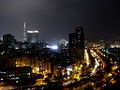 Taipei City
 -
 National Chiang Kai-shek Memorial Hall
 -
 Entrance of National Chiang Kai-shek Memorial Hall
 -
 Taipei 101
 -
Love in Taipei
-
Taipei 101 from National Sun Yat-sen Memorial Hall Station
-
 Grand Hotel
 -
 Grand Hotel Taipei
 -
 Dazhi Bridge
 -
 Dadaocheng Wharf, Taipei
 -
Baoan Temple
-
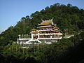 Zhinan Temple
 -
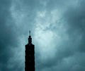 A typhoon makes landfall in Taipei
 -
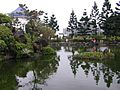 Pond by National Chiang Kai-shek Memorial Hall
 -
Ximending at Night


Sister Cities
Taipei has the following sister cities:[8]
References
- ^ "Hanyu Pinyin to be standard system in 2009". Taipei Times. 2008-09-18. Retrieved 2008-09-20.
{{cite news}}: Check date values in:|date=(help) - ^ "Gov't to improve English-friendly environment". The China Post. 2008-09-18. Retrieved 2008-09-20.
{{cite news}}: Check date values in:|date=(help) - ^ Oung, Angelica (May 04, 2007). "Taipei air pollution alarming: scientists". The Taipei Times.
{{cite news}}: Check date values in:|date=(help) - ^ "The 10 Most Connected Cities in the World". Retrieved 2007-08-18.
- ^ Taipei invites architects | Taipei Times, 2008.07.25
- ^ All Subways Should be Like Taipei's Marvel of Mass Transit, Wired News
- ^ http://www.ntu.edu.tw/english/about%20ntu/location/ntumap.htm]
- ^ Sister city list (.DOC)
This article needs additional citations for verification. (July 2008) |
See also
Template:Contains Chinese text
- Chinese Taipei
- List of districts of Taipei by area
- List of districts of Taipei by population
- List of districts of Taipei by population density
- List of schools in Taipei
- List of most expensive cities for expatriate employees (#48 in the world)
- Kaohsiung City
- Administrative divisions of the Republic of China
- List of Chinese language schools in Taiwan
External links
 Definitions from Wiktionary
 Media from Commons
 News from Wikinews
 Quotations from Wikiquote
 Texts from Wikisource
 Textbooks from Wikibooks
 Resources from Wikiversity