
Altenpleen
| coat of arms | Germany map | |
|---|---|---|

|
Coordinates: 54 ° 21 ' N , 12 ° 57' E |
|
| Basic data | ||
| State : | Mecklenburg-Western Pomerania | |
| County : | Western Pomerania-Ruegen | |
| Office : | Altenpleen | |
| Height : | 3 m above sea level NHN | |
| Area : | 20.06 km 2 | |
| Residents: | 992 (Dec. 31, 2019) | |
| Population density : | 49 inhabitants per km 2 | |
| Postal code : | 18445 | |
| Area code : | 038323 | |
| License plate : | VR, GMN, NVP, RDG, RÜG | |
| Community key : | 13 0 73 005 | |
| LOCODE : | DE 9AI | |
| Office administration address: | Parkstrasse 2 18445 Altenpleen |
|
| Website : | ||
| Mayor : | Rainer Behrndt | |
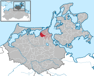
| Location of the municipality Altenpleen in the district of Vorpommern-Rügen | ||
  |
||

Altenpleen is a municipality north-west of Stralsund in the district of Vorpommern-Rügen . The municipality is administered by the Altenpleen office based in the Altenpleen municipality.
Geography and traffic
Altenpleen is located about 14 km northwest of Stralsund and about 16 km east of Barth . The district of Nisdorf is located on Grabow . The community is located in the northernmost corner of the mainland in Mecklenburg-Western Pomerania. The municipality is flat without any significant elevations. To the west of Altenpleen, near the district of Günz, lies Günzer See .
Districts
history
The first settlements existed in the Neolithic Age (3300 BC). Germanic tribes lived here until the Great Migration and left the area again in the 5th and 6th centuries. From the 7th century the area was settled by Slavs . The area belonged to the Principality of Rügen until the 14th century and then to the city of Stralsund. After the Thirty Years War until 1815, the area belonged to Sweden and then to Prussia .
The community was then part of the Franzburg-Barth district until 1952 and then belonged to the Stralsund district in the Rostock district until 1994 . Altenpleen has been part of the state of Mecklenburg-Western Pomerania since 1990.
Altenpleen and Neuenpleen were first mentioned in a document in 1312. The name Altenpleen comes from the Slavic Polene and means something like inhabitant of an open field, field .
Nisdorf was first mentioned in a document in 1302. Knight Johannes von Nisdorf ( Johannes de Ost de Neslestorp ) gave away some land to a monastery. The landowners were the councilor Sabel Segefried (from 1439), the Junge family (from 1455), the Neuenkamp monastery (from 1512), the von Rammin families (16th / 17th century), von Hertell (around 1695), Rewoldt and von Zansen-Osten (from 1858–1945). The two-storey, renovated manor house was rebuilt in its current form in 1898 after a fire.
Coat of arms, flag, official seal
The municipality has no officially approved national emblem, neither a coat of arms nor a flag . The official seal is the small state seal with the coat of arms of the region of Western Pomerania . It shows an upright griffin with a raised tail and the inscription "* GEMEINDE ALTENPLEEN * LANDKREIS VORPOMMERN-RÜGEN".
Attractions
→ See also the list of architectural monuments in Altenpleen
- Altenpleen manor house (castle) from the 2nd half of the 19th century
- Manor Günz from the 19th century from the former monastery estate of St. Annen and Brigitten in Stralsund
- Neuenpleen manor from around 1880
- Two-storey manor house Nisdorf from the 19th century; today hotel.
Personalities
- Walter Krüger (born April 11, 1930 in Altenpleen; † October 28, 2018 in Prohn ), javelin thrower, silver medal winner, 1960 Olympics
Web links
Individual evidence
- ↑ Statistisches Amt MV - population status of the districts, offices and municipalities 2019 (XLS file) (official population figures in the update of the 2011 census) ( help ).
- ↑ Main Statute, Section 2, Section 1 (PDF).

Ahrenshagen-Daskow | Ahrenshoop | Altefähr | Altenkirchen | Altenpleen | Baabe | Bad Sülze | Barth | Mountains on Rügen | Binz | Born a. Darß | Breege | Buschvitz | Dettmannsdorf | Deyelsdorf | Dierhagen | Divitz-Spoldershagen | Dranske | Drechow | Dreschvitz | Eixen | Elmenhorst | Franzburg | Fuhlendorf | Garz / Rügen | Went | Glewitz | Glowe | Goehren | Grammendorf | Gransgebieth | Gremersdorf-Buchholz | Grim | Groß Kordshagen | Gross Mohrdorf | Gustow | Hugoldsdorf | Hiddensee Island | Jakobsdorf | Karnin | Kenz-Küstrow | Klausdorf | Kluis | Kramerhof | Lancken-Granitz | Lietzow | Lime wood | Löbnitz | Lohme | Lüdershagen | Lüssow | Marlow | Millienhagen-Oebelitz | Mönchgut | Neuenkirchen | Niepars | Pantelitz | Papenhagen | Parchtitz | Patzig | Poseritz | Preetz | Prerow | Prohn | Pruchten | Putbus | Putgarten | Ralswiek | Rambin | Rappin | Ribnitz-Damgarten | Richtenberg | Hall | Sagard | Velvet | Sassnitz | Schaprode | Schlemmin | Sehlen | Sellin | Semlow | Splietsdorf | Steinhagen | Stralsund | Süderholz | Sundhagen | Trent | Tribsees | Trinwillershagen | Ummanz | Velgast | Weitenhagen | Wendisch Baggendorf | Wendorf | Wieck a. Darß | Wiek | Wittenhagen | Wustrow | Zarrendorf | Zingst | Zirkow