Velgast
| coat of arms | Germany map | |
|---|---|---|

|
Coordinates: 54 ° 16 ' N , 12 ° 49' E |
|
| Basic data | ||
| State : | Mecklenburg-Western Pomerania | |
| County : | Western Pomerania-Ruegen | |
| Office : | Franzburg-Richtenberg | |
| Height : | 3 m above sea level NHN | |
| Area : | 71.43 km 2 | |
| Residents: | 1708 (Dec. 31, 2019) | |
| Population density : | 24 inhabitants per km 2 | |
| Postal code : | 18469 | |
| Area code : | 038324 | |
| License plate : | VR, GMN, NVP, RDG, RÜG | |
| Community key : | 13 0 73 096 | |
| Office administration address: | Ernst-Thälmann-Str. 71 18461 Franzburg |
|
| Website : | ||
| Mayor : | Christian Griwahn | |
| Location of the municipality of Velgast in the district of Vorpommern-Rügen | ||
Velgast is a municipality west of Stralsund in the Vorpommern-Rügen district . The municipality is administered by the Franzburg-Richtenberg Office , based in the city of Franzburg . The municipality is the largest municipality in terms of area and population in the office.
geography
Velgast is located about 25 kilometers west of the Hanseatic city of Stralsund on a ridge . The Barthe River flows through the south of the municipality.
Districts
|
|
The community was then part of the Franzburg-Barth district until 1952 and then belonged to the Stralsund district in the Rostock district until 1994 . Velgast has been part of the state of Mecklenburg-Western Pomerania since 1990.
history
Starkow : The Gothic St. Jürgen Church was built from the 13th century (until 1250 nave , around 1300 the choir ) and renovated around 1820 and later.
Velgast was first mentioned in a document in 1242. The place is one of the oldest in Western Pomerania . He was mentioned as Vilegust in a deed by Rüganer Wizlaw I. 1305 was the community Velegost , 1312 Velegast and 1314 for the first time Velgast . The place name is derived from the Old Slavic velki gast and means roughly large grove . Velgast was part of the Principality of Rügen until 1326 and then the Duchy of Pomerania .
The Gothic Christ Church dates from the 13th century, the belfry from 1828.
With the Peace of Westphalia of 1648, Vorpommern and thus Velgast came under Swedish rule, after the place previously belonged to the Duchy of Pomerania . In 1815 the municipality and Western Pomerania became part of the Prussian province of Pomerania .

The Stralsund – Rostock railway has touched the community since 1888 . The Velgast station dates from 1889. The Darßbahn is a branch line that has been running to Barth since 1910 and to Prerow until 1997.
coat of arms
The coat of arms was approved by the Ministry of the Interior on May 29, 2006 and registered under no.
Blazon : “ Slanted left split; above in blue on a golden plow rail 3 golden ploughshares in bars, below in silver a green pedunculate oak leaf placed on the left. "
The coat of arms was designed by Bernd Tscheuschner from Velgaster.
Others
In Velgast there were probably remains of a Wendish cult site. In documents in the church archives, there is talk of a "fallen sacrificial stone". It was almost four meters long, two meters wide, protruding about four feet from the earth and had other stones arranged around it. The stone was blown up in 1824.
Attractions
→ See also the list of monuments in Velgast
- Christ Church : brick church from the 14th century in Velgast
- Schuenhagen Forestry Office
- Brick church St. Jürgen in Starkow
- Parish garden in Starkow
- Nature trail in the Barthe landscape protection area
- Manor house in Altenhagen
- Starkow Tower Hill
Transport links
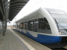
The B 105 runs north of the municipality . The Stralsund – Rostock railway runs through the town. In addition to the Rostock – Sassnitz regional express trains, the Intercity trains that connect southern Germany via Hamburg with Binz on Rügen also stop here . By UBB web (UBB), on a part section of the former Darßbahn wrong is Barth connected. The Velgast – Tribsees / Franzburg railway line , which was discontinued in 1995, began in the village.
Web links
- Municipality of Velgast on the website of the Franzburg-Richtenberg office
Individual evidence
- ↑ Statistisches Amt MV - population status of the districts, offices and municipalities 2019 (XLS file) (official population figures in the update of the 2011 census) ( help ).
- ↑ a b Velgast's story on the website of the Franzburg-Richtenberg district.
- ↑ Angela Pfennig: The parish garden in Starkow. In: Pomerania. Journal of Culture and History. Issue 1/2008, ISSN 0032-4167 , pp. 24-29.


