Rappin
| coat of arms | Germany map | |
|---|---|---|

|
Coordinates: 54 ° 30 ' N , 13 ° 23' E |
|
| Basic data | ||
| State : | Mecklenburg-Western Pomerania | |
| County : | Western Pomerania-Ruegen | |
| Office : | Mountains on Rügen | |
| Height : | 3 m above sea level NHN | |
| Area : | 29.07 km 2 | |
| Residents: | 295 (Dec. 31, 2019) | |
| Population density : | 10 inhabitants per km 2 | |
| Postal code : | 18528 | |
| Area code : | 03838 | |
| License plate : | VR, GMN, NVP, RDG, RÜG | |
| Community key : | 13 0 73 074 | |
| Office administration address: | Markt 5–6 18528 Bergen on Rügen |
|
| Website : | ||
| Mayor : | Thomas Geetz | |
| Location of the municipality of Rappin in the district of Vorpommern-Rügen | ||
Rappin is a municipality in the district of Vorpommern-Rügen on the island of Rügen in Mecklenburg-Western Pomerania. The municipality is administered by the Bergen auf Rügen office based in the city of the same name .
geography
Geographical location
Rappin is located about 15 kilometers northwest of Bergen on Rügen. The community is located south of the Great Jasmunder Bodden and the Tetztitz Lake, a bulge of the Bodden. In the municipality are the Banzelvitzer Mountains , the western edge of a terminal moraine that runs right through the middle of Rügen . The Tetztitz lake and the Banzelvitz mountains together form the nature reserve Tetzitz lake with the Liddow peninsula and the Banzelvitz mountains .
Between Rappin and the Bodden coast there was the "Rappiner See" with an area of 40.6 hectares until after 1920 (according to MTB). Extensive dyke and drainage work drained it.
Community structure
|
|
history
local community
The community was part of the Principality of Rügen until 1326 and then the Duchy of Pomerania . With the Peace of Westphalia of 1648, Rügen and thus also the area of Rappin became part of Swedish Pomerania . In 1815 it came to the Prussian province of Pomerania as part of New Western Pomerania .
Since 1818 the community has belonged to the district of Rügen . Only from 1952 to 1955 it was part of the Bergen district. It then belonged to the Rügen district in the Rostock district until 1990 . The district of Rügen, which has been called this again since 1990, was merged in 2011 in the district of Vorpommern-Rügen.
Rappin

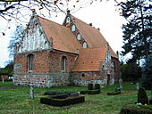
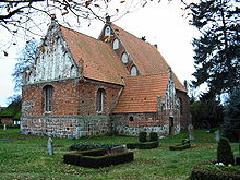
The place was first mentioned in 1305 as Repin . In 1319, Prince Wizlaw III. his debts with Johann von Kiel with the income of the "taberna in villa Reppyn". The St. Andreas Church dates from around 1300 to around 1400. The wooden bell tower collapsed in 1626; he was replaced in 1635.
Bright
Helle was probably named after the first owners, the von der Helle family, who owned an estate. In 1379 the von Normann family bought the estate. The manor burned down in 1842 and was rebuilt. Only fragments of the single-storey manor house, which was converted in 1903, have survived.
Kartzitz
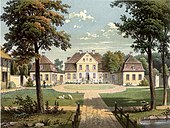
The place was an ancestral seat of the old Rügen noble family of Usedom . The property has been occupied since 1249. Karl Bogislaw von Usedom had a new manor house built on the old foundation walls in the middle of the 18th century. Kartzitz was sold in 1890 in favor of the other goods of the family. It remained a rolling stock until 1945, most recently owned by the von Schinckel family of Hamburg merchants , who bought it back after 1990. The manor park, originally laid out as a baroque park, was converted into an English landscape park at the end of the 18th century in the style of the time.
Moisselbritz
The estate was shown on the Swedish matriculation card in 1694. In 1820 the estate was a four-sided courtyard . The old manor house burned down in part in 1952 and the remainder of the renovated but reformed structure has been preserved.
Tetzitz
Tetzitz was first mentioned in a document in 1314. Landowners were u. a. the families von Gagern (15th and 16th centuries), von Usedom (briefly from 1792), then frequent changes of ownership and Richard Helmrich (1916–1945). The dilapidated manor house dates from 1746, was expanded in 1863, was a residential building after 1945 and has been empty since the 1970s. Up until the 1990s, there were still details from the building period, such as remains of textile wall coverings, wood paneling, floorboards and stucco. Today only the outer walls exist, without a roof. Construction work that had been started came to a standstill (status: 2019). On the red list of ailing monuments.
politics
coat of arms
The coat of arms was approved by the Ministry of the Interior on May 21, 2007 and registered under the number 312 of the coat of arms of Mecklenburg-Western Pomerania.
Blazon : “In silver over a lowered, curved blue tip, inside a silver sea leaf; on the right a beetroot with green cabbage, on the left a red gemshorn bent with the end to the left. "
The coat of arms was designed by the heraldist Gerhard Koggelmann.
flag
The flag of the municipality of Rappin is evenly striped lengthways in red - white - blue. In the middle of the white stripe, at half the height of the red and blue stripes, is the municipal coat of arms. The relation of the height of the flag cloth to the length is like 3: 5.
Culture and sights
Buildings
- Kartzitz manor house and park
- Gothic St. Andrew's Church : brick Gothic from around 1300, restored in 1996
- Göpelhaus in Tetzitz: octagonal half-timbered building
Green spaces and recreation
- Lagoon coast
Economy and Infrastructure
traffic
The B 96 runs east of the community.
literature
- Johannes Hinz : Pomerania. Guide through an unforgettable land. Bechtermünz Verlag, Augsburg 1966, ISBN 3-86047-181-3 , p. 287.
Individual evidence
- ↑ Statistisches Amt MV - population status of the districts, offices and municipalities 2019 (XLS file) (official population figures in the update of the 2011 census) ( help ).
- ^ Hubertus Neuschäffer: Western Pomerania's castles and mansions. Husum Druck- und Verlagsgesellschaft, Husum 1993, ISBN 3-88042-636-8 , p. 94.
- ↑ Guthaeuser.de , Manor Tetzitz
- ^ Foundation for Cultural Heritage


