
Papenhagen
| coat of arms | Germany map | |
|---|---|---|

|
Coordinates: 54 ° 9 ′ N , 12 ° 59 ′ E |
|
| Basic data | ||
| State : | Mecklenburg-Western Pomerania | |
| County : | Western Pomerania-Ruegen | |
| Office : | Franzburg-Richtenberg | |
| Height : | 14 m above sea level NHN | |
| Area : | 20.84 km 2 | |
| Residents: | 567 (Dec. 31, 2019) | |
| Population density : | 27 inhabitants per km 2 | |
| Postal code : | 18510 | |
| Area code : | 038325 | |
| License plate : | VR, GMN, NVP, RDG, RÜG | |
| Community key : | 13 0 73 062 | |
| Office administration address: | Ernst-Thälmann-Str. 71 18461 Franzburg |
|
| Website : | ||
| Mayoress : | Ilona Kindler | |
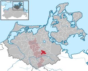
| Location of the municipality Papenhagen in the district of Vorpommern-Rügen | ||
  |
||

Papenhagen is a municipality in the district of Vorpommern-Rügen and belongs to the Franzburg-Richtenberg district with its seat in the city of Franzburg . Until January 1, 2004 Papenburg was part of the dissolved office of Kronskamp .
Papenhagen is about five kilometers northwest of Grimmen .
Federal motorway 20 runs south of the municipality . This can be reached via the Grimmen-Ost connection (approx. Eight kilometers).
Districts
Before 1648 Papenhagen belonged to the Duchy of Pomerania . After the Thirty Years' War until 1815, the area belonged to Swedish Pomerania and then to the Prussian province of Pomerania . Papenhagen was part of the Grimmen district until 1952 and belonged to the Grimmen district in the Rostock district until 1990 . Since 1990 the community has belonged to the district of Grimmen and from 1994 to the district of North Western Pomerania in the state of Mecklenburg-Western Pomerania.
|
|
history
Papenhagen
Papenhagen is named after an early German foundation, which probably goes back to the Neuenkamp monastery (Franzburg). Papenhagen has been a farming village since at least the beginning of the 19th century, and the structures of the village with the separate farmsteads still show this today. In the middle of the village was the restaurant, which had since been demolished. Papenhagen had two windmills that were still in operation in the 20th century. The community poorhouse was in the meadows between Papenhagen and Rolofshagen. The village school was on the outskirts in the direction of Hoikenhagen.
On July 1, 1950, the previously independent municipality of Sievertshagen was incorporated.
Rolofshagen
Rolofshagen was also a German clearing settlement, but was an estate village and the parish of the community. A tower hill with a moat, which is well worth seeing, still bears witness to the early German founding.
Coat of arms, flag, official seal
The municipality has no officially approved national emblem, neither a coat of arms nor a flag . The official seal is the small state seal with the coat of arms of the region of Western Pomerania . It shows an erect griffin with a raised tail and the inscription "GEMEINDE PAPENHAGEN * LANDKREIS VORPOMMERN-RÜGEN".
Attractions
.JPG)
- There is a small two-wheel museum in Sievershagen.
- The ruins of the Rolofshagen village church are located in Rolofshagen .
- In Rolofshagen there is a well-preserved tower hill with a moat.
Individual evidence
- ↑ Statistisches Amt MV - population status of the districts, offices and municipalities 2019 (XLS file) (official population figures in the update of the 2011 census) ( help ).
- ↑ Main Statute, Section 1, Paragraph 3 (PDF).
Web links

Ahrenshagen-Daskow | Ahrenshoop | Altefähr | Altenkirchen | Altenpleen | Baabe | Bad Sülze | Barth | Mountains on Rügen | Binz | Born a. Darß | Breege | Buschvitz | Dettmannsdorf | Deyelsdorf | Dierhagen | Divitz-Spoldershagen | Dranske | Drechow | Dreschvitz | Eixen | Elmenhorst | Franzburg | Fuhlendorf | Garz / Rügen | Went | Glewitz | Glowe | Goehren | Grammendorf | Gransgebieth | Gremersdorf-Buchholz | Grim | Groß Kordshagen | Gross Mohrdorf | Gustow | Hugoldsdorf | Hiddensee Island | Jakobsdorf | Karnin | Kenz-Küstrow | Klausdorf | Kluis | Kramerhof | Lancken-Granitz | Lietzow | Lime wood | Löbnitz | Lohme | Lüdershagen | Lüssow | Marlow | Millienhagen-Oebelitz | Mönchgut | Neuenkirchen | Niepars | Pantelitz | Papenhagen | Parchtitz | Patzig | Poseritz | Preetz | Prerow | Prohn | Pruchten | Putbus | Putgarten | Ralswiek | Rambin | Rappin | Ribnitz-Damgarten | Richtenberg | Hall | Sagard | Velvet | Sassnitz | Schaprode | Schlemmin | Sehlen | Sellin | Semlow | Splietsdorf | Steinhagen | Stralsund | Süderholz | Sundhagen | Trent | Tribsees | Trinwillershagen | Ummanz | Velgast | Weitenhagen | Wendisch Baggendorf | Wendorf | Wieck a. Darß | Wiek | Wittenhagen | Wustrow | Zarrendorf | Zingst | Zirkow